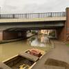
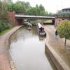
Cherwell Street Bridge No 165A
is a minor waterways place
on the Oxford Canal (Southern Section - Main Line) between
Somerton Bridge No 196 (9 miles and 1¼ furlongs
and 5 locks
to the southeast) and
Concorde Avenue Bridge No 165 (¼ furlongs
to the west).
The nearest place in the direction of Somerton Bridge No 196 is Bridge Street Park Visitor Moorings (180' length of 48hr moorings);
a few yards
away.
The nearest place in the direction of Concorde Avenue Bridge No 165 is Cherwell Street Facilities;
a few yards
away.
There is no access to the towpath here.
Mooring here is ok (a perfectly adequate mooring).
There is a bridge here which takes a major road over the canal.
Site of Swingbridge No 167 | 2 furlongs | |
Cherwell Wharf | 1½ furlongs | |
Bridge Wharf (Banbury) | ¾ furlongs | |
Bridge Street Bridge No 166 | ½ furlongs | |
Bridge Street Park Visitor Moorings | a few yards | |
Cherwell Street Bridge No 165A | ||
Cherwell Street Facilities | a few yards | |
Concorde Avenue Bridge No 165 | ¼ furlongs | |
Banbury Lock No 29 | ¼ furlongs | |
Site of Banbury Wharf | ½ furlongs | |
Lift Bridge No 164 (Oxford Canal) | ¾ furlongs |
Amenities in Banbury
Amenities at other places in Banbury
at
at
at
at
at
at
at
at
at
at
at
at
at
at
at
at
at
at
at
at
at
at
at
at
at
at
at
at
at
at
at
at
at
at
at
at
at
at
at
at
at
at
at
at
at
at
at
at
at
at
at
at
at
at
at
at
at
at
at
at
at
at
at
at
at
at
C&RT sanitary station and rubbish disposal by bridge. but a bit rough.
- Oxford Canal Walk - Part One - Oxford to Thrupp - YouTube — associated with Oxford Canal
- A walk along the Oxford Canal (Southern Section) from Oxford to Thrupp Wide
Mouseover for more information or show routes to facility
Nearest water point
In the direction of Napton Junction
Cherwell Street Facilities — a few yards away
On this waterway in the direction of Napton Junction
Banbury Lock No 29 — ¼ furlongs away
On this waterway in the direction of Napton Junction
Sovereign Wharf — 2½ furlongs and 1 lock away
On this waterway in the direction of Napton Junction
Cropredy Services — 4 miles, 4¼ furlongs and 4 locks away
On this waterway in the direction of Napton Junction
Cropredy Marina (southern basin) — 5 miles, ¾ furlongs and 5 locks away
On this waterway in the direction of Napton Junction
Cropredy Marina (northern basins) — 5 miles, 1 furlong and 5 locks away
On this waterway in the direction of Napton Junction
Fenny Compton Wharf — 10 miles, 6¾ furlongs and 13 locks away
On this waterway in the direction of Napton Junction
Marston Doles Water Point — 18 miles, 2½ furlongs and 13 locks away
On this waterway in the direction of Napton Junction
In the direction of End of Hythe Bridge Arm
Aynho Wharf — 6 miles, 5½ furlongs and 4 locks away
On this waterway in the direction of End of Hythe Bridge Arm
Heyford Wharf — 12 miles, 5¾ furlongs and 7 locks away
On this waterway in the direction of End of Hythe Bridge Arm
Heyford Wharf Bridge No 206 — 12 miles, 6 furlongs and 7 locks away
On this waterway in the direction of End of Hythe Bridge ArmNearest rubbish disposal
In the direction of Napton Junction
Cherwell Street Facilities — a few yards away
On this waterway in the direction of Napton Junction
Sovereign Wharf — 2½ furlongs and 1 lock away
On this waterway in the direction of Napton Junction
Cropredy Services — 4 miles, 4¼ furlongs and 4 locks away
On this waterway in the direction of Napton Junction
Cropredy Marina (southern basin) — 5 miles, ¾ furlongs and 5 locks away
On this waterway in the direction of Napton Junction
Cropredy Marina (northern basins) — 5 miles, 1 furlong and 5 locks away
On this waterway in the direction of Napton Junction
Fenny Compton Marina — 10 miles, 4 furlongs and 13 locks away
On this waterway in the direction of Napton Junction
In the direction of End of Hythe Bridge Arm
Aynho Wharf — 6 miles, 5½ furlongs and 4 locks away
On this waterway in the direction of End of Hythe Bridge Arm
Heyford Wharf — 12 miles, 5¾ furlongs and 7 locks away
On this waterway in the direction of End of Hythe Bridge Arm
Heyford Wharf Bridge No 206 — 12 miles, 6 furlongs and 7 locks away
On this waterway in the direction of End of Hythe Bridge ArmNearest chemical toilet disposal
In the direction of Napton Junction
Cherwell Street Facilities — a few yards away
On this waterway in the direction of Napton Junction
Sovereign Wharf — 2½ furlongs and 1 lock away
On this waterway in the direction of Napton Junction
Cropredy Services — 4 miles, 4¼ furlongs and 4 locks away
On this waterway in the direction of Napton Junction
Cropredy Marina (southern basin) — 5 miles, ¾ furlongs and 5 locks away
On this waterway in the direction of Napton JunctionNearest place to turn
In the direction of Napton Junction
Grimsbury Wharf — 5¾ furlongs and 1 lock away
On this waterway in the direction of Napton Junction
Southam Road Winding Hole — 7 furlongs and 1 lock away
On this waterway in the direction of Napton Junction
Southam Road Footbridge Arm — 1 mile, 1½ furlongs and 1 lock away
On this waterway in the direction of Napton Junction
Cropredy Services — 4 miles, 4¼ furlongs and 4 locks away
On this waterway in the direction of Napton Junction
Cropredy Marina (southern basin) — 5 miles, ¾ furlongs and 5 locks away
On this waterway in the direction of Napton Junction
Cropredy Marina (northern basins) — 5 miles, 1 furlong and 5 locks away
On this waterway in the direction of Napton Junction
Clattercote Bridge Winding Hole — 6 miles, 4 furlongs and 8 locks away
On this waterway in the direction of Napton Junction
Fenny Compton Marina — 10 miles, 4 furlongs and 13 locks away
On this waterway in the direction of Napton Junction
Fenny Compton Wharf — 10 miles, 6¾ furlongs and 13 locks away
On this waterway in the direction of Napton Junction
In the direction of End of Hythe Bridge Arm
Calthorpe Winding Hole — 5¼ furlongs away
On this waterway in the direction of End of Hythe Bridge Arm
Twyford Wharf Winding Hole — 2 miles, 6 furlongs and 1 lock away
On this waterway in the direction of End of Hythe Bridge Arm
Winding Hole above Nell Bridge Lock — 5 miles, 3 furlongs and 2 locks away
On this waterway in the direction of End of Hythe Bridge Arm
Aynho Wharf — 6 miles, 5½ furlongs and 4 locks away
On this waterway in the direction of End of Hythe Bridge Arm
Somerton Deep Lock Winding Hole — 8 miles, 3¾ furlongs and 4 locks away
On this waterway in the direction of End of Hythe Bridge Arm
Heyford Wharf Winding Hole — 12 miles, 5¾ furlongs and 7 locks away
On this waterway in the direction of End of Hythe Bridge Arm
Heyford Wharf — 12 miles, 5¾ furlongs and 7 locks away
On this waterway in the direction of End of Hythe Bridge Arm
The Cleeves Winding Hole — 13 miles, 1¾ furlongs and 7 locks away
On this waterway in the direction of End of Hythe Bridge Arm
Kirtlington Winding Hole — 16 miles, ¼ furlongs and 9 locks away
On this waterway in the direction of End of Hythe Bridge Arm
Enslow Winding Hole — 17 miles, 5¾ furlongs and 10 locks away
On this waterway in the direction of End of Hythe Bridge Arm
Shipton Weir Junction — 19 miles, 1¾ furlongs and 11 locks away
On this waterway in the direction of End of Hythe Bridge ArmNearest self-operated pump-out
In the direction of Napton Junction
Cropredy Marina (southern basin) — 5 miles, ¾ furlongs and 5 locks away
On this waterway in the direction of Napton JunctionNearest boatyard pump-out
In the direction of Napton Junction
Sovereign Wharf — 2½ furlongs and 1 lock away
On this waterway in the direction of Napton Junction
Cropredy Marina (southern basin) — 5 miles, ¾ furlongs and 5 locks away
On this waterway in the direction of Napton Junction
In the direction of End of Hythe Bridge Arm
Twyford Wharf — 2 miles, 6¼ furlongs and 1 lock away
On this waterway in the direction of End of Hythe Bridge Arm
Aynho Wharf — 6 miles, 5½ furlongs and 4 locks away
On this waterway in the direction of End of Hythe Bridge Arm
Heyford Wharf — 12 miles, 5¾ furlongs and 7 locks away
On this waterway in the direction of End of Hythe Bridge Arm
Enslow Wharf — 17 miles, 6¾ furlongs and 10 locks away
On this waterway in the direction of End of Hythe Bridge ArmDirection of TV transmitter (From Wolfbane Cybernetic)
There is no page on Wikipedia called “Cherwell Street Bridge No 165A”
Wikipedia pages that might relate to Cherwell Street Bridge No 165A
[Cherwell Valley line]
line follows the River Cherwell for much of its route between Banbury and Oxford. Banbury, formerly called Banbury Bridge Street Kings Sutton Former station
[Calthorpe, Oxfordshire]
town of Banbury, Oxfordshire. It contains the modern housing estates of Cherwell Heights and Calthorpe. Calthorpe was anciently a manor, held until the
[Punt (boat)]
vicinity of Magdalen Bridge, punting in Oxford is a surprisingly quiet and rural experience. Most of the punting is done on the River Cherwell, which flows through
[Oxford Canal]
through a bridge under Hythe Bridge Street to a turning basin and goods wharf south of Hythe Bridge Street. It then continued via a bridge under Worcester
[Oxford]
of the borough were extended to include a small area east of the River Cherwell. The boundaries were further extended in 1889 to add the areas of Grandpont
[Oxford railway station]
Railways trains. Immediately to the north is Sheepwash Channel Railway Bridge over the Sheepwash Channel. The Great Western Railway (GWR) opened to Oxford
[List of railway bridges and viaducts in the United Kingdom]
significant bridges of the United Kingdom's railways, past and present. Contents: Top 0–9 A B C D E F G H I J K L M N O P Q R S T U V W X Y Z List of bridges in
[Chiltern Main Line]
options included the Banbury – Birmingham section of the line, plus the Cherwell Valley Line and the Coventry to Leamington line. Under the 1979–90 Conservative
[Great Western main line]
Slough (June 1879), Slough to east side of Maidenhead Bridge (September 1884), Maidenhead Bridge to Reading (June 1893), Reading station (1899), Reading
[Chiltern Railways]
parliamentary train services: Cherwell Valley line: there is a single daily parliamentary service operating on the Cherwell Valley Line from Oxford to Banbury
Results of Google Search
Kwik Fit - Banbury. View branch opening times, address, phone number, and services available. ... Cherwell Street, Bridge Street, Banbury, OX16 2BB
The Chiltern Main Line is an inter-urban, regional and commuter railway, part of the British ... It links London (Marylebone) and Birmingham (Moor Street and Snow Hill), the United ... The line is not electrified, although electrification is an aspiration. ... The Cherwell Valley line between Banbury and Leamington Spa was ...
4) The River Cherwell formed the boundary from Magdalen Bridge to King's Mill. ... to Oxford converged in the main street of St. Clement's parish, carrying not only ... 165) In 1823 another day school was started and by 1833 the number of day ...
Hawkesbury Stop Lock No.1 ... 164, Tom Rolt Bridge (Cherwell Drive) ... 165A, Bluebird Bridge (Concorde Avenue, A4260 ) ...
Dec 10, 2018 ... Get a peek inside Cherwell's global offices in the United States, the United ... town with a view of the mountains, it's hard not to love our first office. ... With a prime location close to 16th Street Mall and to Union station, there is ...
May 17, 2016 ... No reproduction or further use of such Data is to be made without the prior ... Spiceball Park Cherwell Street Banbury Oxfordshire Ox16 2bb Ox16 2bb ... (SW). A13SW. (SW). 33. 53. 115. 115. 146. 150. 183. 197. 165. 166. 180 ... Unit 5, Bridge Wharf, Lower Cherwell Street, Banbury, Oxfordshire, OX16 5AY.
close to the Plain has not been compromised. 12. ... Clement's Street to the River Cherwell and Marston ... Road was now accessed directly from the bridge and a ... 165 to 215 Iffley Road. The four storey narrow town houses benefit from a ...