Kiln Bridge
is a minor waterways place
on the Basingstoke Canal between
Woodham Junction (Junction of Basingstoke Canal with River Wey) (5 miles and 6¼ furlongs
and 11 locks
to the east) and
Odiham Castle Stop (End of Navigation) (24 miles and 6¾ furlongs
and 18 locks
to the west).
The nearest place in the direction of Woodham Junction is Goldsworth Top Lock No 11;
½ furlongs
away.
The nearest place in the direction of Odiham Castle Stop is St John's Lye Footbridge;
3¼ furlongs
away.
There may be access to the towpath here.
Mooring here is unrated.
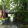
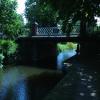
There is a bridge here which takes a minor road over the canal.
| Goldsworth Lock No 8 | 3½ furlongs | |
| Goldsworth Lock No 9 | 2¼ furlongs | |
| St. John's Road Bridge | 1¾ furlongs | |
| Goldsworth Lock No 10 | 1¼ furlongs | |
| Goldsworth Top Lock No 11 | ½ furlongs | |
| Kiln Bridge | ||
| St John's Lye Footbridge | 3¼ furlongs | |
| Blackhorse Road Winding Hole | 7½ furlongs | |
| Hermitage Bridge | 1 mile, ¼ furlongs | |
| Hermitage Bridge Winding Hole | 1 mile, ¾ furlongs | |
| Brookwood Bridge | 1 mile, 6 furlongs | |
Amenities here
Amenities nearby at Goldsworth Top Lock No 11
Amenities nearby at St John's Lye Footbridge
There are no links to external websites from here.
Why not log in and add some (select "External websites" from the menu (sometimes this is under "Edit"))?
Mouseover for more information or show routes to facility
Nearest water point
In the direction of Odiham Castle Stop
Canal Centre Swing Bridge — 7 miles, 1½ furlongs and 17 locks away
On this waterway in the direction of Odiham Castle Stop
Mytchett Bridge — 7 miles, 2½ furlongs and 17 locks away
On this waterway in the direction of Odiham Castle Stop
Ash Lock Canal Depot — 10 miles, 5 furlongs and 18 locks away
On this waterway in the direction of Odiham Castle Stop
The Fox and Hounds (Crookham) — 16 miles, 3¼ furlongs and 18 locks away
On this waterway in the direction of Odiham Castle Stop
In the direction of Woodham Junction
Arthur's Bridge — 1 mile, ¾ furlongs and 5 locks away
On this waterway in the direction of Woodham Junction
Pyrford Lock No 12 — 7 miles, 5½ furlongs and 11 locks away
Travel to Woodham Junction, then on the River Wey Wey Navigation to Pyrford Lock No 12
Thames Lock No 16 — 8 miles, 3¾ furlongs and 14 locks away
Travel to Woodham Junction, then on the River Wey Wey Navigation to Thames Lock No 16
Cartbridge Wharf — 11 miles, 3½ furlongs and 15 locks away
Travel to Woodham Junction, then on the River Wey Wey Navigation to Cartbridge Wharf
Chertsey Lock — 10 miles, 6¾ furlongs and 16 locks away
Travel to Woodham Junction, then on the River Wey Wey Navigation to Thames - Wey Junction, then on the River Thames (below Oxford) to Chertsey Lock
Molesey Lock — 14 miles, 1¾ furlongs and 16 locks away
Travel to Woodham Junction, then on the River Wey Wey Navigation to Thames - Wey Junction, then on the River Thames (below Oxford) to West End of Desborough Cut, then on the River Thames (Desborough Cut) to Thames Meadow, then on the River Thames (below Oxford) to Molesey Lock
Stoke Lock No 5 — 15 miles, 5¾ furlongs and 18 locks away
Travel to Woodham Junction, then on the River Wey Wey Navigation to Stoke Lock No 5
Guildford Waterside Centre — 16 miles, 2¼ furlongs and 19 locks away
Travel to Woodham Junction, then on the River Wey Wey Navigation to Guildford Waterside Centre
Dapdune Wharf — 17 miles, 2 furlongs and 19 locks away
Travel to Woodham Junction, then on the River Wey Wey Navigation to Dapdune Wharf
Teddington Lock Weir Exit — 18 miles, 7 furlongs and 18 locks away
Travel to Woodham Junction, then on the River Wey Wey Navigation to Thames - Wey Junction, then on the River Thames (below Oxford) to West End of Desborough Cut, then on the River Thames (Desborough Cut) to Thames Meadow, then on the River Thames (below Oxford) to Teddington Lock Weir ExitNearest rubbish disposal
In the direction of Odiham Castle Stop
Canal Centre Swing Bridge — 7 miles, 1½ furlongs and 17 locks away
On this waterway in the direction of Odiham Castle Stop
Mytchett Bridge — 7 miles, 2½ furlongs and 17 locks away
On this waterway in the direction of Odiham Castle Stop
Ash Lock Canal Depot — 10 miles, 5 furlongs and 18 locks away
On this waterway in the direction of Odiham Castle Stop
In the direction of Woodham Junction
Arthur's Bridge — 1 mile, ¾ furlongs and 5 locks away
On this waterway in the direction of Woodham Junction
Pyrford Lock No 12 — 7 miles, 5½ furlongs and 11 locks away
Travel to Woodham Junction, then on the River Wey Wey Navigation to Pyrford Lock No 12
Shepperton Lock — 8 miles, 7 furlongs and 15 locks away
Travel to Woodham Junction, then on the River Wey Wey Navigation to Thames - Wey Junction, then on the River Thames (below Oxford) to Shepperton Lock
Penton Hook Lock — 12 miles, 5¾ furlongs and 17 locks away
Travel to Woodham Junction, then on the River Wey Wey Navigation to Thames - Wey Junction, then on the River Thames (below Oxford) to Penton Hook Lock
Molesey Lock — 14 miles, 1¾ furlongs and 16 locks away
Travel to Woodham Junction, then on the River Wey Wey Navigation to Thames - Wey Junction, then on the River Thames (below Oxford) to West End of Desborough Cut, then on the River Thames (Desborough Cut) to Thames Meadow, then on the River Thames (below Oxford) to Molesey Lock
Bell Weir Lock — 15 miles, 4¼ furlongs and 18 locks away
Travel to Woodham Junction, then on the River Wey Wey Navigation to Thames - Wey Junction, then on the River Thames (below Oxford) to Bell Weir Lock
Guildford Waterside Centre — 16 miles, 2¼ furlongs and 19 locks away
Travel to Woodham Junction, then on the River Wey Wey Navigation to Guildford Waterside Centre
Dapdune Wharf — 17 miles, 2 furlongs and 19 locks away
Travel to Woodham Junction, then on the River Wey Wey Navigation to Dapdune Wharf
Teddington Lock Weir Exit — 18 miles, 7 furlongs and 18 locks away
Travel to Woodham Junction, then on the River Wey Wey Navigation to Thames - Wey Junction, then on the River Thames (below Oxford) to West End of Desborough Cut, then on the River Thames (Desborough Cut) to Thames Meadow, then on the River Thames (below Oxford) to Teddington Lock Weir ExitNearest chemical toilet disposal
In the direction of Odiham Castle Stop
Canal Centre Swing Bridge — 7 miles, 1½ furlongs and 17 locks away
On this waterway in the direction of Odiham Castle Stop
In the direction of Woodham Junction
Arthur's Bridge — 1 mile, ¾ furlongs and 5 locks away
On this waterway in the direction of Woodham Junction
Pyrford Lock No 12 — 7 miles, 5½ furlongs and 11 locks away
Travel to Woodham Junction, then on the River Wey Wey Navigation to Pyrford Lock No 12
Shepperton Lock — 8 miles, 7 furlongs and 15 locks away
Travel to Woodham Junction, then on the River Wey Wey Navigation to Thames - Wey Junction, then on the River Thames (below Oxford) to Shepperton Lock
Molesey Lock — 14 miles, 1¾ furlongs and 16 locks away
Travel to Woodham Junction, then on the River Wey Wey Navigation to Thames - Wey Junction, then on the River Thames (below Oxford) to West End of Desborough Cut, then on the River Thames (Desborough Cut) to Thames Meadow, then on the River Thames (below Oxford) to Molesey Lock
Guildford Waterside Centre — 16 miles, 2¼ furlongs and 19 locks away
Travel to Woodham Junction, then on the River Wey Wey Navigation to Guildford Waterside CentreNearest place to turn
In the direction of Odiham Castle Stop
Blackhorse Road Winding Hole — 7½ furlongs away
On this waterway in the direction of Odiham Castle Stop
Hermitage Bridge Winding Hole — 1 mile, ¾ furlongs away
On this waterway in the direction of Odiham Castle Stop
Connaught Crescent Winding Hole — 2 miles, 4 furlongs and 3 locks away
On this waterway in the direction of Odiham Castle Stop
Frimley Bottom Lock Winding Hole — 2 miles, 6¾ furlongs and 4 locks away
On this waterway in the direction of Odiham Castle Stop
Frimley Lock Winding Hole — 3 miles, 5½ furlongs and 8 locks away
On this waterway in the direction of Odiham Castle Stop
Lock No 26 Winding Hole — 4 miles, 4½ furlongs and 14 locks away
On this waterway in the direction of Odiham Castle Stop
Potter's Wharf — 7 miles, 3¼ furlongs and 17 locks away
On this waterway in the direction of Odiham Castle Stop
Anglers' Flash — 7 miles, 7¾ furlongs and 17 locks away
On this waterway in the direction of Odiham Castle Stop
Winter's Close Winding Hole — 8 miles, 1 furlong and 17 locks away
On this waterway in the direction of Odiham Castle Stop
Great Bottom Flash — 8 miles, 4¼ furlongs and 17 locks away
On this waterway in the direction of Odiham Castle Stop
Ash Wharf Bridge Winding Hole — 9 miles, 4¾ furlongs and 17 locks away
On this waterway in the direction of Odiham Castle Stop
In the direction of Woodham Junction
Arthurs Bridge Winding Hole — 1 mile, 1 furlong and 5 locks away
On this waterway in the direction of Woodham Junction
Paxton Gardens Winding Hole — 4 miles and 5 locks away
On this waterway in the direction of Woodham Junction
Woodham Junction — 5 miles, 6¼ furlongs and 11 locks away
On this waterway in the direction of Woodham Junction
Coxes Railway Bridge Winding Hole — 7 miles, 2 furlongs and 13 locks away
Travel to Woodham Junction, then on the River Wey Wey Navigation to Coxes Railway Bridge Winding Hole
Newark Lock Weir Exit No 2 — 9 miles, 1¼ furlongs and 13 locks away
Travel to Woodham Junction, then on the River Wey Wey Navigation to Newark Lock Weir Exit No 2
Newark Lock Weir Exit No 1 — 9 miles, 1¾ furlongs and 13 locks away
Travel to Woodham Junction, then on the River Wey Wey Navigation to Newark Lock Weir Exit No 1
Newark Lock Weir Entrance — 9 miles, 4¼ furlongs and 14 locks away
Travel to Woodham Junction, then on the River Wey Wey Navigation to Newark Lock Weir Entrance
Five Ways Junction — 8 miles, 5 furlongs and 15 locks away
Travel to Woodham Junction, then on the River Wey Wey Navigation to Five Ways Junction
Papercourt Lock Weir Exit — 9 miles, 7¼ furlongs and 14 locks away
Travel to Woodham Junction, then on the River Wey Wey Navigation to Papercourt Lock Weir ExitNearest self-operated pump-out
In the direction of Odiham Castle Stop
Canal Centre Swing Bridge — 7 miles, 1½ furlongs and 17 locks away
On this waterway in the direction of Odiham Castle Stop
Mytchett Bridge — 7 miles, 2½ furlongs and 17 locks away
On this waterway in the direction of Odiham Castle Stop
In the direction of Woodham Junction
Molesey Lock — 14 miles, 1¾ furlongs and 16 locks away
Travel to Woodham Junction, then on the River Wey Wey Navigation to Thames - Wey Junction, then on the River Thames (below Oxford) to West End of Desborough Cut, then on the River Thames (Desborough Cut) to Thames Meadow, then on the River Thames (below Oxford) to Molesey LockNo information
CanalPlan has no information on any of the following facilities within range:boatyard pump-out
Direction of TV transmitter (From Wolfbane Cybernetic)
There is no page on Wikipedia called “Kiln Bridge”
Wikipedia pages that might relate to Kiln Bridge
[Lime kiln]
A lime kiln is a kiln used for the calcination of limestone (calcium carbonate) to produce the form of lime called quicklime (calcium oxide). The chemical
[Basingstoke Canal]
Greywell and Brookwood Lye and a short stretch between Monument Bridge and Scotland Bridge in Woking. It is the most botanically rich aquatic area in England
[Nonbuilding structure]
supply) Avalanche dam Barriers Blast furnaces Boat lifts Brick kilns Bridges and bridge-like structures (aqueducts, overpasses, trestles, viaducts, etc
[Up Nately]
former Penny Bridge (on the Greywell Road) in the west, under Brick Kiln Bridge (Blackstocks Lane), Slades Bridge (Heather Lane) and Eastrop Bridge (Heather
[List of lime kilns in the United States]
This is a list of lime kilns in the United States. A number of historic lime kilns are individually listed on the National Register of Historic Places
[Otteri]
a part of Purasaiwalkam. Cooks road Ayanavaram road Strahans road Brick kiln road Perambur Barracks road Purasawalkam High road DeMellows road Perambur
[Coplay Cement Company Kilns]
Kilns, also known as the Saylor Park Industrial Museum, is an open-air historic site located at Coplay, Lehigh County, Pennsylvania. The nine kilns were
[Expanded clay aggregate]
aggregate made by heating clay to around 1,200 °C (2,190 °F) in a rotary kiln. The yielding gases expand the clay by thousands of small bubbles forming
[Lovelace Bridges]
pits in Kiln Field Coppice. The saw mill was near Brockhole Cross, near the junction with Outdowns on the Epsom Road. There is a Lovelace Bridges Trail
[Annery kiln]
Annery kiln is a former limekiln of the estate of Annery, in the parish of Monkleigh, North Devon. It is situated on the left bank of the River Torridge
Results of Google Search
Kilnbridge: Construction, Concrete Cutting, Demolition, Fabrication ...We have developed a reputation for providing engineered solutions for the successful delivery of complex construction and civil engineering projects in very  ...
This project will replace the existing aging northbound bridge on Route 134 ( Hampton Highway/Magruder Boulevard) over Brick Kiln Creek, located at the ...
Lime Kiln Bridge Park. Hours of Operation. Unless otherwise authorized, the park is opened May 1 thru October 31, ...
Open-spandrel arch bridge over Winooski River & NECR on Lime Kiln Road.
Lime Kiln Bridge. This open-spandrel concrete arch is the only highway bridge of its kind in Vermont. The bridge has precast/prestressed concrete box beam ...
Title: Lime Kiln Road Bridge, Spanning Shoal Creek, Neosho, Newton County, MO; Contributor Names: Historic American Engineering Record, creator: King ...
FOUND: A pair of prescription glasses was found at Lime Kiln Bridge Park yesterday by one of our Public Works employees. Call or message us if they might be ...
Oct 11, 2019 ... The Virginia Department of Transportation is replacing the Route 134 bridge over Brick Kiln Creek on Monday. The entire project is expected to ...
Dec 2, 2019 ... The corporation responsible for the bridge and a neighboring one, known as Jacques Cartier and Champlain Bridges Incorporated, had to take ...
Lime Kiln Bridge. Winooski gorge. ... Share. More. About. BRIDGE. Winooski gorge. CommunitySee All. Highlights info row image. 6 check-ins.