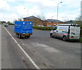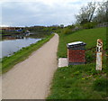
Sims Bridge
is a minor waterways place
on the Gloucester and Sharpness Canal between
Saul Junction (Junction of the Gloucester and Sharpness Canal with the Stroudwater Navigation) (5 miles and 4½ furlongs
to the southwest) and
Gloucester Docks (Waterways Office (South Wales and Severn Waterways) - Canal & River Trust (Water area of 14 acres)) (2 miles and 1¼ furlongs
to the northeast).
The nearest place in the direction of Saul Junction is Rea Bridge;
3 furlongs
away.
The nearest place in the direction of Gloucester Docks is Two Mile Bend (west arm) (Old section of Two Mile Bend);
1 furlong
away.
Mooring here is unrated.
There is a swing bridge here.
| Site of Hardwicke Bridge | 2 miles, 3½ furlongs | |
| Sellars Bridge | 1 mile, 6½ furlongs | |
| Quedgeley Oil Depot | 1 mile, 5 furlongs | |
| Quedgeley Wharf Visitor Mooring | 1 mile, 4½ furlongs | |
| Rea Bridge | 3 furlongs | |
| Sims Bridge | ||
| Two Mile Bend (west arm) | 1 furlong | |
| Netheridge Bridge | 2¼ furlongs | |
| Two Mile Bend (east arm) | 2¾ furlongs | |
| Gloucester Rowing Club | 4¾ furlongs | |
| Hempsted Historic Dry Dock | 5½ furlongs | |
There are no links to external websites from here.
Why not log in and add some (select "External websites" from the menu (sometimes this is under "Edit"))?
Why not log in and add some (select "External websites" from the menu (sometimes this is under "Edit"))?
Mouseover for more information or show routes to facility
Nearest water point
In the direction of Sharpness Junction
Sellars Bridge — 1 mile, 6½ furlongs away
On this waterway in the direction of Sharpness Junction
Saul Junction Winding Hole — 5 miles, 4¾ furlongs away
On this waterway in the direction of Sharpness Junction
Saul Junction Marina — 5 miles, 5½ furlongs away
Travel to Saul Junction, then on the Cotswold Canals (Stroudwater Navigation - Navigable Section) to Saul Junction Marina
Cotswold Canals Trust Visitor Centre - Saul Junction — 5 miles, 5½ furlongs away
On this waterway in the direction of Sharpness Junction
Fretherne Bridge — 6 miles, 2¾ furlongs away
On this waterway in the direction of Sharpness Junction
Splatt Bridge — 7 miles, 3½ furlongs away
On this waterway in the direction of Sharpness Junction
Patch Bridge — 9 miles, 2¼ furlongs away
On this waterway in the direction of Sharpness Junction
Purton Lower Bridge — 11 miles, 6 furlongs away
On this waterway in the direction of Sharpness Junction
In the direction of Gloucester / Sharpness - Severn Junction
Llanthony Pontoons — 1 mile, 7½ furlongs away
On this waterway in the direction of Gloucester / Sharpness - Severn Junction
Llanthony Road Bridge — 2 miles, ½ furlongs away
On this waterway in the direction of Gloucester / Sharpness - Severn Junction
Gloucester Waterways Museum Arm — 2 miles, ¾ furlongs away
On this waterway in the direction of Gloucester / Sharpness - Severn Junction
Gloucester Dock Lock — 2 miles, 1¾ furlongs away
On this waterway in the direction of Gloucester / Sharpness - Severn Junction
Tewkesbury Lower Lode — 13 miles, 7½ furlongs and 1 lock away
Travel to Gloucester / Sharpness - Severn Junction, then on the River Severn (main river - Worcester to Gloucester) to Tewkesbury Lower Lode
Upper Lode Lock No 5 — 14 miles, 5¾ furlongs and 1 lock away
Travel to Gloucester / Sharpness - Severn Junction, then on the River Severn (main river - Worcester to Gloucester) to Upper Lode Lock No 5
Tewkesbury Services — 15 miles, 3¾ furlongs and 3 locks away
Travel to Gloucester / Sharpness - Severn Junction, then on the River Severn (main river - Worcester to Gloucester) to Tewkesbury Junction, then on the River Avon - Warwickshire (Lower Avon Navigation) to Tewkesbury Services
Bredon — 18 miles, 7½ furlongs and 3 locks away
Travel to Gloucester / Sharpness - Severn Junction, then on the River Severn (main river - Worcester to Gloucester) to Tewkesbury Junction, then on the River Avon - Warwickshire (Lower Avon Navigation) to BredonNearest rubbish disposal
In the direction of Sharpness Junction
Sellars Bridge — 1 mile, 6½ furlongs away
On this waterway in the direction of Sharpness Junction
Parkend Bridge — 3 miles, 7¾ furlongs away
On this waterway in the direction of Sharpness Junction
Saul Junction Winding Hole — 5 miles, 4¾ furlongs away
On this waterway in the direction of Sharpness Junction
Saul Junction Marina — 5 miles, 5½ furlongs away
Travel to Saul Junction, then on the Cotswold Canals (Stroudwater Navigation - Navigable Section) to Saul Junction Marina
Fretherne Bridge — 6 miles, 2¾ furlongs away
On this waterway in the direction of Sharpness Junction
Splatt Bridge — 7 miles, 3½ furlongs away
On this waterway in the direction of Sharpness Junction
Patch Bridge — 9 miles, 2¼ furlongs away
On this waterway in the direction of Sharpness Junction
Purton Lower Bridge — 11 miles, 6 furlongs away
On this waterway in the direction of Sharpness Junction
Sharpness Barge Arm — 13 miles, 1¼ furlongs away
On this waterway in the direction of Sharpness Junction
In the direction of Gloucester / Sharpness - Severn Junction
Llanthony Road Bridge — 2 miles, ½ furlongs away
On this waterway in the direction of Gloucester / Sharpness - Severn Junction
Tewkesbury Services — 15 miles, 3¾ furlongs and 3 locks away
Travel to Gloucester / Sharpness - Severn Junction, then on the River Severn (main river - Worcester to Gloucester) to Tewkesbury Junction, then on the River Avon - Warwickshire (Lower Avon Navigation) to Tewkesbury ServicesNearest chemical toilet disposal
In the direction of Gloucester / Sharpness - Severn Junction
Llanthony Road Bridge — 2 miles, ½ furlongs away
On this waterway in the direction of Gloucester / Sharpness - Severn Junction
In the direction of Sharpness Junction
Saul Junction Marina — 5 miles, 5½ furlongs away
Travel to Saul Junction, then on the Cotswold Canals (Stroudwater Navigation - Navigable Section) to Saul Junction Marina
Cotswold Canals Trust Visitor Centre - Saul Junction — 5 miles, 5½ furlongs away
On this waterway in the direction of Sharpness Junction
Sharpness Barge Arm — 13 miles, 1¼ furlongs away
On this waterway in the direction of Sharpness JunctionNearest place to turn
In the direction of Sharpness Junction
Quedgeley Oil Depot — 1 mile, 5 furlongs away
On this waterway in the direction of Sharpness Junction
Pegthorne Bridge Winding Hole — 4 miles, 7½ furlongs away
On this waterway in the direction of Sharpness Junction
Saul Junction Winding Hole — 5 miles, 4¾ furlongs away
On this waterway in the direction of Sharpness Junction
Sharpness Barge Arm — 13 miles, 1¼ furlongs away
On this waterway in the direction of Sharpness Junction
The Ocean — 9 miles, 3 furlongs and 8 locks away
Travel to Saul Junction, then on the Cotswold Canals (Stroudwater Navigation - Navigable Section) to Walk Bridge, then on the Cotswold Canals (Stroudwater Navigation - Un-navigable Section) to The Ocean
Ryeford Winding Hole — 10 miles, 2¾ furlongs and 8 locks away
Travel to Saul Junction, then on the Cotswold Canals (Stroudwater Navigation - Navigable Section) to Walk Bridge, then on the Cotswold Canals (Stroudwater Navigation - Un-navigable Section) to Ryeford Winding Hole
Brimscombe Port — 15 miles, 1¼ furlongs and 19 locks away
Travel to Saul Junction, then on the Cotswold Canals (Stroudwater Navigation - Navigable Section) to Walk Bridge, then on the Cotswold Canals (Stroudwater Navigation - Un-navigable Section) to Site of Entrance to Wallbridge Basin, then on the Cotswold Canals (Thames and Severn Canal - Wide section) to Brimscombe Port
In the direction of Gloucester / Sharpness - Severn Junction
Monk Meadow Dock — 1 mile, 5¼ furlongs away
On this waterway in the direction of Gloucester / Sharpness - Severn Junction
Gloucester Docks — 2 miles, 1¼ furlongs away
On this waterway in the direction of Gloucester / Sharpness - Severn Junction
Waterways Office (South Wales and Severn Waterways) - Canal & River Trust — 2 miles, 1½ furlongs away
On this waterway in the direction of Gloucester / Sharpness - Severn Junction
Gloucester / Sharpness - Severn Junction — 2 miles, 2 furlongs and 1 lock away
On this waterway in the direction of Gloucester / Sharpness - Severn Junction
Upper Parting Junction — 4 miles, 6¾ furlongs and 1 lock away
Travel to Gloucester / Sharpness - Severn Junction, then on the River Severn (main river - Worcester to Gloucester) to Upper Parting Junction
Over Winding Hole — 4 miles, 1¾ furlongs and 2 locks away
Travel to Gloucester / Sharpness - Severn Junction, then on the River Severn (old river navigation) to Lower Parting, then on the River Severn (Maisemore Channel - Southern Section) to Over Junction, then on the Hereford and Gloucester Canal to Over Winding Hole
Upper Lode Lock Weir Exit — 14 miles, 3¾ furlongs and 1 lock away
Travel to Gloucester / Sharpness - Severn Junction, then on the River Severn (main river - Worcester to Gloucester) to Upper Lode Lock Weir Exit
Upper Lode Lock Weir Entrance — 14 miles, 6¾ furlongs and 2 locks away
Travel to Gloucester / Sharpness - Severn Junction, then on the River Severn (main river - Worcester to Gloucester) to Upper Lode Lock Weir Entrance
Avon Lock Junction — 15 miles, 3½ furlongs and 3 locks away
Travel to Gloucester / Sharpness - Severn Junction, then on the River Severn (main river - Worcester to Gloucester) to Tewkesbury Junction, then on the River Avon - Warwickshire (Lower Avon Navigation) to Avon Lock Junction
Abbey Mill Tewkesbury — 15 miles, 4½ furlongs and 3 locks away
Travel to Gloucester / Sharpness - Severn Junction, then on the River Severn (main river - Worcester to Gloucester) to Tewkesbury Junction, then on the River Avon - Warwickshire (Lower Avon Navigation) to Avon Lock Junction, then on the River Avon - Warwickshire (Mill Avon) to Abbey Mill Tewkesbury
Tewkesbury Marina Entrance No 2 — 15 miles, 7½ furlongs and 3 locks away
Travel to Gloucester / Sharpness - Severn Junction, then on the River Severn (main river - Worcester to Gloucester) to Tewkesbury Junction, then on the River Avon - Warwickshire (Lower Avon Navigation) to Tewkesbury Marina Entrance No 2Nearest self-operated pump-out
In the direction of Gloucester / Sharpness - Severn Junction
Llanthony Pontoons — 1 mile, 7½ furlongs away
On this waterway in the direction of Gloucester / Sharpness - Severn Junction
In the direction of Sharpness Junction
Cotswold Canals Trust Visitor Centre - Saul Junction — 5 miles, 5½ furlongs away
On this waterway in the direction of Sharpness Junction
Purton Lower Bridge — 11 miles, 6 furlongs away
On this waterway in the direction of Sharpness JunctionNearest boatyard pump-out
In the direction of Sharpness Junction
Saul Junction Marina — 5 miles, 5½ furlongs away
Travel to Saul Junction, then on the Cotswold Canals (Stroudwater Navigation - Navigable Section) to Saul Junction Marina
Patch Bridge — 9 miles, 2¼ furlongs away
On this waterway in the direction of Sharpness JunctionDirection of TV transmitter (From Wolfbane Cybernetic)
There is no page on Wikipedia called “Sims Bridge”
Wikipedia pages that might relate to Sims Bridge
[Sims]
Sims, sims or SIMS may refer to: Single interface to multiple sources, an ontology-based approach to data integration The Sims, a life simulation computer
[SimCity]
populated by "Sims", simulated persons, who live in the city created by the player. The three development zone types are the major areas in which Sims inhabit:
[Dorothy Rice Sims]
Reisinger). Sims and Sims faced Ely and Josephine Culbertson in a long rubber bridge match during March and April 1935 (Culbertson–Sims match). ["The
[The Urbz: Sims in the City]
The Urbz: Sims in the City is a video game for the Game Boy Advance, GameCube, PlayStation 2, Xbox, and Nintendo DS. It is the third Sims game for video
[The Sims 3: Ambitions]
The Sims 3: Ambitions is the second expansion pack for the strategic life simulation computer game The Sims 3. It was released in June 2010. The Sims 3:
[The Sims 2: Castaway]
The Sims 2: Castaway is the third console spin-off of the life simulation video game The Sims 2 for the Wii, Nintendo DS (NDS), PlayStation 2 (PS2) and
[Manhattan Bridge]
York Times. ISSN 0362-4331. Retrieved December 24, 2017. Sims, Calvin (March 1, 1991). "Bridge Troubles Are Linked To a Lack of Coordination". The New
[Sim Smith Covered Bridge]
The Sim Smith Covered Bridge is east of Montezuma, Indiana. The single span Burr Truss covered bridge structure was built by Joseph A. Britton in 1883
[Sheila Sim]
Attenborough, Lady Attenborough (née Sim; 5 June 1922 – 19 January 2016), known professionally by her maiden name Sheila Sim, was an English film and theatre
[Gerald Sim]
The Story of Cinderella (1976) – 1st Lord of the Navy A Bridge Too Far (1977) – Colonel Sims Gandhi (1982) – Magistrate Miss Marple (1985) – Coroner Cry
Results of Google Search
Sims Bridge - Castella CA - Living New DealDec 22, 2011 ... The Civilian Conservation Corps (CCC) built this suspension bridge over the Upper Sacramento River in September 1933, under the ...
Nov 24, 2018 ... In this The Sims 4 tutorial I show you how you can build a bridge over water and customize it to your personal style and preferences. The guide ...
Structure Information Management System (SIMS) and bridge inspection reports.
Nov 22, 2018 ... I hope you like this short video that shows how you can make bridges in The Sims 4 using the new terrain tools features. Check out my content ...
Sims and Sims became famous as bridge partners. They won the second annual (contract bridge) Master Mixed Teams tournament in 1930Â ...
View 25 photos of this 4 bed, 2 bath, 2052 Sq. Ft. mfd/mobile home at 1461 Sims Bridge Rd, Kittrell, NC 27544 on sale now for $149900.
* The EBED Sim Pairs are fundraising events organised by EBED and run by the EBU on its behalf, with the EBU acting as agent for entry fees. Past Events. 2020- Â ...
Sold: 3 beds, 1.5 baths, 1020 sq. ft. mobile/manufactured home located at 1393 Sims Bridge Rd, Kittrell, NC 27544 sold for $60500 on Oct 11, 2019.
Apr 4, 2020 ... View 23 photos for 315 Sims Bridge Rd, Commerce, GA 30530 a 4 bed, 3 bath, 4382 Sq. Ft. single family home built in 2002 that sold on ...
Structure Information Management System (SIMS) ... to the basic inventory for each in-service bridge as well as the inventorying of each new structure built.

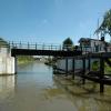
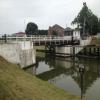
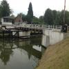


![Gloucester & Sharpness Canal. The towpath approaching the stretch of the ship canal which was realigned a few years ago - see [[115170]] - to accommodate Netheridge swing bridge on the new A430. To the left of the bridge is a control tower. by Derek Harper – 23 June 2010](https://s1.geograph.org.uk/geophotos/01/93/86/1938669_78bf4608_120x120.jpg)


