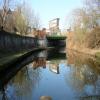
Bristol Road Bridge No 80
is a minor waterways place
on the Worcester and Birmingham Canal (Birmingham to King's Norton) between
New Selly Oak Junction (Junction with re-aligned and restored Dudley No 2 Canal) (a few yards
to the northwest) and
King's Norton Junction (Junction of Stratford and Worcester and Birmingham Canals) (2 miles and 3½ furlongs
to the southeast).
The nearest place in the direction of King's Norton Junction is Selly Oak Winding Hole (The entrance to the works basin (infilled) is opposite, under the Towpath Bridge No 79C.);
1½ furlongs
away.
There may be access to the towpath here.
Mooring here is unrated.
There is a bridge here which takes a major road over the canal.
| Ariel Aqueduct | 2¾ furlongs | |
| Selly Oak Railway Bridge No 81 | 1¼ furlongs | |
| Selly Oak Pipe Bridge | 1 furlong | |
| Selly Oak Junction | ½ furlongs | |
| New Selly Oak Junction | a few yards | |
| Bristol Road Bridge No 80 | ||
| Selly Oak Winding Hole | 1½ furlongs | |
| Entrance to Works Basin (infilled) | 1¾ furlongs | |
| Selly Oak Enamel Works Basin | 2¾ furlongs | |
| Selly Oak Railway Bridge No 79 | 3 furlongs | |
| The Country Girl PH | 4 furlongs | |
Amenities here
Amenities nearby at New Selly Oak Junction
Amenities nearby at Selly Oak Winding Hole
There are no links to external websites from here.
Why not log in and add some (select "External websites" from the menu (sometimes this is under "Edit"))?
Mouseover for more information or show routes to facility
Nearest water point
In the direction of Worcester Bar
Holliday Wharf — 2 miles, 6½ furlongs away
On this waterway in the direction of Worcester Bar
Worcester Bar — 3 miles, ½ furlongs away
On this waterway in the direction of Worcester Bar
Hawne Basin — 3 miles, 1¼ furlongs away
Travel to New Selly Oak Junction, then on the Birmingham Canal Navigations (Dudley Canal No 2 - Lapal Canal - Original Line East End ) to Somery Road Bridge, then on the Birmingham Canal Navigations (Dudley Canal No 2 - Lapal Canal - Abandoned Line ) to Lapal Canal - New line Diverges From Original Route, then on the Birmingham Canal Navigations (Dudley Canal No 2 - Lapal Canal - Original Line West End ) to Coombeswood, then on the Birmingham Canal Navigations (Dudley Canal No 2 - Coombeswood ) to Hawne Basin
Cambrian Wharf Services — 3 miles, 4¾ furlongs away
Travel to Worcester Bar, then on the Birmingham Canal Navigations (Main Line) to Deep Cuttings Junction, then on the Birmingham Canal Navigations (Newhall Branch) to Cambrian Wharf Services
Bumble Hole Visitor Centre — 5 miles, 7 furlongs away
Travel to New Selly Oak Junction, then on the Birmingham Canal Navigations (Dudley Canal No 2 - Lapal Canal - Original Line East End ) to Somery Road Bridge, then on the Birmingham Canal Navigations (Dudley Canal No 2 - Lapal Canal - Abandoned Line ) to Lapal Canal - New line Diverges From Original Route, then on the Birmingham Canal Navigations (Dudley Canal No 2 - Lapal Canal - Original Line West End ) to Coombeswood, then on the Birmingham Canal Navigations (Dudley Canal No 2 - Coombeswood ) to Bumble Hole Visitor Centre
Blowers Green Pumphouse — 8 miles, 3¼ furlongs away
Travel to New Selly Oak Junction, then on the Birmingham Canal Navigations (Dudley Canal No 2 - Lapal Canal - Original Line East End ) to Somery Road Bridge, then on the Birmingham Canal Navigations (Dudley Canal No 2 - Lapal Canal - Abandoned Line ) to Lapal Canal - New line Diverges From Original Route, then on the Birmingham Canal Navigations (Dudley Canal No 2 - Lapal Canal - Original Line West End ) to Coombeswood, then on the Birmingham Canal Navigations (Dudley Canal No 2 - Coombeswood ) to Blowers Green Pumphouse
Handsworth Wharf Winding Hole — 7 miles, 2½ furlongs and 3 locks away
Travel to Worcester Bar, then on the Birmingham Canal Navigations (Main Line) to Smethwick Junction, then on the Birmingham Canal Navigations (Old Main Line) to Engine Arm Junction, then on the Birmingham Canal Navigations (Engine Arm) to Handsworth Wharf Winding Hole
Dudley Tunnel (northern entrance) — 10 miles, 3½ furlongs and 3 locks away
Travel to New Selly Oak Junction, then on the Birmingham Canal Navigations (Dudley Canal No 2 - Lapal Canal - Original Line East End ) to Somery Road Bridge, then on the Birmingham Canal Navigations (Dudley Canal No 2 - Lapal Canal - Abandoned Line ) to Lapal Canal - New line Diverges From Original Route, then on the Birmingham Canal Navigations (Dudley Canal No 2 - Lapal Canal - Original Line West End ) to Coombeswood, then on the Birmingham Canal Navigations (Dudley Canal No 2 - Coombeswood ) to Parkhead Junction, then on the Birmingham Canal Navigations (Dudley Canal No 1 - Through Route) to Pensnett Junction, then on the Birmingham Canal Navigations (Dudley Canal No 1 - Dudley Tunnel) to Dudley Tunnel (northern entrance)
Dudley Canal & Tunnel Trust Footbridge — 10 miles, 4 furlongs and 3 locks away
Travel to New Selly Oak Junction, then on the Birmingham Canal Navigations (Dudley Canal No 2 - Lapal Canal - Original Line East End ) to Somery Road Bridge, then on the Birmingham Canal Navigations (Dudley Canal No 2 - Lapal Canal - Abandoned Line ) to Lapal Canal - New line Diverges From Original Route, then on the Birmingham Canal Navigations (Dudley Canal No 2 - Lapal Canal - Original Line West End ) to Coombeswood, then on the Birmingham Canal Navigations (Dudley Canal No 2 - Coombeswood ) to Parkhead Junction, then on the Birmingham Canal Navigations (Dudley Canal No 1 - Through Route) to Pensnett Junction, then on the Birmingham Canal Navigations (Dudley Canal No 1 - Dudley Tunnel) to Dudley Tunnel (northern entrance), then on the Birmingham Canal Navigations (Dudley Canal No 1 - Birmingham End) to Dudley Canal & Tunnel Trust Footbridge
Black Country Museum — 10 miles, 4½ furlongs and 3 locks away
Travel to New Selly Oak Junction, then on the Birmingham Canal Navigations (Dudley Canal No 2 - Lapal Canal - Original Line East End ) to Somery Road Bridge, then on the Birmingham Canal Navigations (Dudley Canal No 2 - Lapal Canal - Abandoned Line ) to Lapal Canal - New line Diverges From Original Route, then on the Birmingham Canal Navigations (Dudley Canal No 2 - Lapal Canal - Original Line West End ) to Coombeswood, then on the Birmingham Canal Navigations (Dudley Canal No 2 - Coombeswood ) to Parkhead Junction, then on the Birmingham Canal Navigations (Dudley Canal No 1 - Through Route) to Pensnett Junction, then on the Birmingham Canal Navigations (Dudley Canal No 1 - Dudley Tunnel) to Dudley Tunnel (northern entrance), then on the Birmingham Canal Navigations (Dudley Canal No 1 - Birmingham End) to Black Country Museum
Todds End Customer Service Facility — 10 miles, 4¾ furlongs and 3 locks away
Travel to New Selly Oak Junction, then on the Birmingham Canal Navigations (Dudley Canal No 2 - Lapal Canal - Original Line East End ) to Somery Road Bridge, then on the Birmingham Canal Navigations (Dudley Canal No 2 - Lapal Canal - Abandoned Line ) to Lapal Canal - New line Diverges From Original Route, then on the Birmingham Canal Navigations (Dudley Canal No 2 - Lapal Canal - Original Line West End ) to Coombeswood, then on the Birmingham Canal Navigations (Dudley Canal No 2 - Coombeswood ) to Parkhead Junction, then on the Birmingham Canal Navigations (Dudley Canal No 1 - Through Route) to Pensnett Junction, then on the Birmingham Canal Navigations (Dudley Canal No 1 - Dudley Tunnel) to Dudley Tunnel (northern entrance), then on the Birmingham Canal Navigations (Dudley Canal No 1 - Birmingham End) to Todds End Customer Service Facility
C&RT Bradley Workshops — 13 miles, 5¾ furlongs and 3 locks away
Travel to New Selly Oak Junction, then on the Birmingham Canal Navigations (Dudley Canal No 2 - Lapal Canal - Original Line East End ) to Somery Road Bridge, then on the Birmingham Canal Navigations (Dudley Canal No 2 - Lapal Canal - Abandoned Line ) to Lapal Canal - New line Diverges From Original Route, then on the Birmingham Canal Navigations (Dudley Canal No 2 - Lapal Canal - Original Line West End ) to Coombeswood, then on the Birmingham Canal Navigations (Dudley Canal No 2 - Coombeswood ) to Windmill End Junction, then on the Birmingham Canal Navigations (Netherton Tunnel Branch) to Dudley Port Junction, then on the Birmingham Canal Navigations (Main Line) to Deepfields Junction, then on the Birmingham Canal Navigations (Wednesbury Oak Loop) to C&RT Bradley Workshops
Broad Street Basin — 15 miles, 2¾ furlongs and 3 locks away
Travel to New Selly Oak Junction, then on the Birmingham Canal Navigations (Dudley Canal No 2 - Lapal Canal - Original Line East End ) to Somery Road Bridge, then on the Birmingham Canal Navigations (Dudley Canal No 2 - Lapal Canal - Abandoned Line ) to Lapal Canal - New line Diverges From Original Route, then on the Birmingham Canal Navigations (Dudley Canal No 2 - Lapal Canal - Original Line West End ) to Coombeswood, then on the Birmingham Canal Navigations (Dudley Canal No 2 - Coombeswood ) to Windmill End Junction, then on the Birmingham Canal Navigations (Netherton Tunnel Branch) to Dudley Port Junction, then on the Birmingham Canal Navigations (Main Line) to Broad Street Basin
In the direction of King's Norton Junction
King's Norton Water Point — 2 miles, 4 furlongs away
Travel to King's Norton Junction, then on the Worcester and Birmingham Canal (Diglis Basin to King's Norton Junction) to King's Norton Water Point
Yardley Wood Water Point — 5 miles away
Travel to King's Norton Junction, then on the Stratford-on-Avon Canal (Northern Section) to Yardley Wood Water Point
Hopwood Visitor Moorings — 5 miles, 5½ furlongs away
Travel to King's Norton Junction, then on the Worcester and Birmingham Canal (Diglis Basin to King's Norton Junction) to Hopwood Visitor Moorings
Earlswood Reservoir Feeder — 9 miles, 1 furlong away
Travel to King's Norton Junction, then on the Stratford-on-Avon Canal (Northern Section) to Earlswood Reservoir Feeder
Waring's Green Wharf — 10 miles, 1 furlong away
Travel to King's Norton Junction, then on the Stratford-on-Avon Canal (Northern Section) to Waring's Green Wharf
Tardebigge Wharf — 11 miles, 1¼ furlongs away
Travel to King's Norton Junction, then on the Worcester and Birmingham Canal (Diglis Basin to King's Norton Junction) to Tardebigge Wharf
Swallow Wharf — 12 miles, 6½ furlongs away
Travel to King's Norton Junction, then on the Stratford-on-Avon Canal (Northern Section) to Swallow WharfNearest rubbish disposal
In the direction of Worcester Bar
Worcester Bar — 3 miles, ½ furlongs away
On this waterway in the direction of Worcester Bar
Hawne Basin — 3 miles, 1¼ furlongs away
Travel to New Selly Oak Junction, then on the Birmingham Canal Navigations (Dudley Canal No 2 - Lapal Canal - Original Line East End ) to Somery Road Bridge, then on the Birmingham Canal Navigations (Dudley Canal No 2 - Lapal Canal - Abandoned Line ) to Lapal Canal - New line Diverges From Original Route, then on the Birmingham Canal Navigations (Dudley Canal No 2 - Lapal Canal - Original Line West End ) to Coombeswood, then on the Birmingham Canal Navigations (Dudley Canal No 2 - Coombeswood ) to Hawne Basin
Cambrian Wharf Services — 3 miles, 4¾ furlongs away
Travel to Worcester Bar, then on the Birmingham Canal Navigations (Main Line) to Deep Cuttings Junction, then on the Birmingham Canal Navigations (Newhall Branch) to Cambrian Wharf Services
Blowers Green Bridge — 8 miles, 3 furlongs away
Travel to New Selly Oak Junction, then on the Birmingham Canal Navigations (Dudley Canal No 2 - Lapal Canal - Original Line East End ) to Somery Road Bridge, then on the Birmingham Canal Navigations (Dudley Canal No 2 - Lapal Canal - Abandoned Line ) to Lapal Canal - New line Diverges From Original Route, then on the Birmingham Canal Navigations (Dudley Canal No 2 - Lapal Canal - Original Line West End ) to Coombeswood, then on the Birmingham Canal Navigations (Dudley Canal No 2 - Coombeswood ) to Blowers Green Bridge
Handsworth Wharf Winding Hole — 7 miles, 2½ furlongs and 3 locks away
Travel to Worcester Bar, then on the Birmingham Canal Navigations (Main Line) to Smethwick Junction, then on the Birmingham Canal Navigations (Old Main Line) to Engine Arm Junction, then on the Birmingham Canal Navigations (Engine Arm) to Handsworth Wharf Winding Hole
Waterfront Services (Dudley) — 9 miles, 4¼ furlongs and 1 lock away
Travel to New Selly Oak Junction, then on the Birmingham Canal Navigations (Dudley Canal No 2 - Lapal Canal - Original Line East End ) to Somery Road Bridge, then on the Birmingham Canal Navigations (Dudley Canal No 2 - Lapal Canal - Abandoned Line ) to Lapal Canal - New line Diverges From Original Route, then on the Birmingham Canal Navigations (Dudley Canal No 2 - Lapal Canal - Original Line West End ) to Coombeswood, then on the Birmingham Canal Navigations (Dudley Canal No 2 - Coombeswood ) to Parkhead Junction, then on the Birmingham Canal Navigations (Dudley Canal No 1 - Through Route) to Waterfront Services (Dudley)
Farmers Bridge Lock No 8 — 4 miles and 7 locks away
Travel to Worcester Bar, then on the Birmingham Canal Navigations (Main Line) to Deep Cuttings Junction, then on the Birmingham Canal Navigations (Newhall Branch) to Farmers Bridge Junction, then on the Birmingham Canal Navigations (Birmingham and Fazeley Canal - Main Line) to Farmers Bridge Lock No 8
Black Country Museum — 10 miles, 4½ furlongs and 3 locks away
Travel to New Selly Oak Junction, then on the Birmingham Canal Navigations (Dudley Canal No 2 - Lapal Canal - Original Line East End ) to Somery Road Bridge, then on the Birmingham Canal Navigations (Dudley Canal No 2 - Lapal Canal - Abandoned Line ) to Lapal Canal - New line Diverges From Original Route, then on the Birmingham Canal Navigations (Dudley Canal No 2 - Lapal Canal - Original Line West End ) to Coombeswood, then on the Birmingham Canal Navigations (Dudley Canal No 2 - Coombeswood ) to Parkhead Junction, then on the Birmingham Canal Navigations (Dudley Canal No 1 - Through Route) to Pensnett Junction, then on the Birmingham Canal Navigations (Dudley Canal No 1 - Dudley Tunnel) to Dudley Tunnel (northern entrance), then on the Birmingham Canal Navigations (Dudley Canal No 1 - Birmingham End) to Black Country Museum
C&RT Bradley Workshops — 13 miles, 5¾ furlongs and 3 locks away
Travel to New Selly Oak Junction, then on the Birmingham Canal Navigations (Dudley Canal No 2 - Lapal Canal - Original Line East End ) to Somery Road Bridge, then on the Birmingham Canal Navigations (Dudley Canal No 2 - Lapal Canal - Abandoned Line ) to Lapal Canal - New line Diverges From Original Route, then on the Birmingham Canal Navigations (Dudley Canal No 2 - Lapal Canal - Original Line West End ) to Coombeswood, then on the Birmingham Canal Navigations (Dudley Canal No 2 - Coombeswood ) to Windmill End Junction, then on the Birmingham Canal Navigations (Netherton Tunnel Branch) to Dudley Port Junction, then on the Birmingham Canal Navigations (Main Line) to Deepfields Junction, then on the Birmingham Canal Navigations (Wednesbury Oak Loop) to C&RT Bradley Workshops
Broad Street Basin — 15 miles, 2¾ furlongs and 3 locks away
Travel to New Selly Oak Junction, then on the Birmingham Canal Navigations (Dudley Canal No 2 - Lapal Canal - Original Line East End ) to Somery Road Bridge, then on the Birmingham Canal Navigations (Dudley Canal No 2 - Lapal Canal - Abandoned Line ) to Lapal Canal - New line Diverges From Original Route, then on the Birmingham Canal Navigations (Dudley Canal No 2 - Lapal Canal - Original Line West End ) to Coombeswood, then on the Birmingham Canal Navigations (Dudley Canal No 2 - Coombeswood ) to Windmill End Junction, then on the Birmingham Canal Navigations (Netherton Tunnel Branch) to Dudley Port Junction, then on the Birmingham Canal Navigations (Main Line) to Broad Street Basin
Delph Bottom Lock No 8 — 10 miles, 4 furlongs and 8 locks away
Travel to New Selly Oak Junction, then on the Birmingham Canal Navigations (Dudley Canal No 2 - Lapal Canal - Original Line East End ) to Somery Road Bridge, then on the Birmingham Canal Navigations (Dudley Canal No 2 - Lapal Canal - Abandoned Line ) to Lapal Canal - New line Diverges From Original Route, then on the Birmingham Canal Navigations (Dudley Canal No 2 - Lapal Canal - Original Line West End ) to Coombeswood, then on the Birmingham Canal Navigations (Dudley Canal No 2 - Coombeswood ) to Parkhead Junction, then on the Birmingham Canal Navigations (Dudley Canal No 1 - Through Route) to Delph Bottom Lock No 8
Lower Ocker Hill Branch Junction — 11 miles, 1 furlong and 8 locks away
Travel to Worcester Bar, then on the Birmingham Canal Navigations (Main Line) to Pudding Green Junction, then on the Birmingham Canal Navigations (Wednesbury Old Canal - Main Line) to Ryders Green Junction, then on the Birmingham Canal Navigations (Walsall Canal) to Lower Ocker Hill Branch Junction
Perry Barr Top Lock Services — 16 miles, 6½ furlongs and 8 locks away
Travel to Worcester Bar, then on the Birmingham Canal Navigations (Main Line) to Pudding Green Junction, then on the Birmingham Canal Navigations (Wednesbury Old Canal - Main Line) to Ryders Green Junction, then on the Birmingham Canal Navigations (Walsall Canal) to Tame Valley Junction, then on the Birmingham Canal Navigations (Tame Valley Canal) to Perry Barr Top Lock Services
Wolverhampton Lock No 9 — 16 miles, ¼ furlongs and 11 locks away
Travel to New Selly Oak Junction, then on the Birmingham Canal Navigations (Dudley Canal No 2 - Lapal Canal - Original Line East End ) to Somery Road Bridge, then on the Birmingham Canal Navigations (Dudley Canal No 2 - Lapal Canal - Abandoned Line ) to Lapal Canal - New line Diverges From Original Route, then on the Birmingham Canal Navigations (Dudley Canal No 2 - Lapal Canal - Original Line West End ) to Coombeswood, then on the Birmingham Canal Navigations (Dudley Canal No 2 - Coombeswood ) to Windmill End Junction, then on the Birmingham Canal Navigations (Netherton Tunnel Branch) to Dudley Port Junction, then on the Birmingham Canal Navigations (Main Line) to Wolverhampton Lock No 9
Minworth Services — 9 miles, 5½ furlongs and 25 locks away
Travel to Worcester Bar, then on the Birmingham Canal Navigations (Main Line) to Deep Cuttings Junction, then on the Birmingham Canal Navigations (Newhall Branch) to Farmers Bridge Junction, then on the Birmingham Canal Navigations (Birmingham and Fazeley Canal - Main Line) to Minworth Services
Longwood Junction — 17 miles, 4 furlongs and 17 locks away
Travel to Worcester Bar, then on the Birmingham Canal Navigations (Main Line) to Pudding Green Junction, then on the Birmingham Canal Navigations (Wednesbury Old Canal - Main Line) to Ryders Green Junction, then on the Birmingham Canal Navigations (Walsall Canal) to Tame Valley Junction, then on the Birmingham Canal Navigations (Tame Valley Canal) to Tame Valley - Rushall Junction, then on the Birmingham Canal Navigations (Rushall Canal) to Longwood Junction
Stourbridge Basin — 16 miles, 2¾ furlongs and 25 locks away
Travel to New Selly Oak Junction, then on the Birmingham Canal Navigations (Dudley Canal No 2 - Lapal Canal - Original Line East End ) to Somery Road Bridge, then on the Birmingham Canal Navigations (Dudley Canal No 2 - Lapal Canal - Abandoned Line ) to Lapal Canal - New line Diverges From Original Route, then on the Birmingham Canal Navigations (Dudley Canal No 2 - Lapal Canal - Original Line West End ) to Coombeswood, then on the Birmingham Canal Navigations (Dudley Canal No 2 - Coombeswood ) to Parkhead Junction, then on the Birmingham Canal Navigations (Dudley Canal No 1 - Through Route) to Black Delph, then on the Stourbridge Canals (Main Line) to Wordsley Junction, then on the Stourbridge Canals (Stourbridge Branch) to Stourbridge Basin
In the direction of King's Norton Junction
Waring's Green Wharf — 10 miles, 1 furlong away
Travel to King's Norton Junction, then on the Stratford-on-Avon Canal (Northern Section) to Waring's Green Wharf
Tardebigge Wharf — 11 miles, 1¼ furlongs away
Travel to King's Norton Junction, then on the Worcester and Birmingham Canal (Diglis Basin to King's Norton Junction) to Tardebigge Wharf
Lapworth Lock No 21 — 14 miles, 7¾ furlongs and 18 locks away
Travel to King's Norton Junction, then on the Stratford-on-Avon Canal (Northern Section) to Lapworth Lock No 21Nearest chemical toilet disposal
In the direction of Worcester Bar
Holliday Wharf — 2 miles, 6½ furlongs away
On this waterway in the direction of Worcester Bar
Worcester Bar — 3 miles, ½ furlongs away
On this waterway in the direction of Worcester Bar
Hawne Basin — 3 miles, 1¼ furlongs away
Travel to New Selly Oak Junction, then on the Birmingham Canal Navigations (Dudley Canal No 2 - Lapal Canal - Original Line East End ) to Somery Road Bridge, then on the Birmingham Canal Navigations (Dudley Canal No 2 - Lapal Canal - Abandoned Line ) to Lapal Canal - New line Diverges From Original Route, then on the Birmingham Canal Navigations (Dudley Canal No 2 - Lapal Canal - Original Line West End ) to Coombeswood, then on the Birmingham Canal Navigations (Dudley Canal No 2 - Coombeswood ) to Hawne Basin
Cambrian Wharf Services — 3 miles, 4¾ furlongs away
Travel to Worcester Bar, then on the Birmingham Canal Navigations (Main Line) to Deep Cuttings Junction, then on the Birmingham Canal Navigations (Newhall Branch) to Cambrian Wharf Services
Blowers Green Pumphouse — 8 miles, 3¼ furlongs away
Travel to New Selly Oak Junction, then on the Birmingham Canal Navigations (Dudley Canal No 2 - Lapal Canal - Original Line East End ) to Somery Road Bridge, then on the Birmingham Canal Navigations (Dudley Canal No 2 - Lapal Canal - Abandoned Line ) to Lapal Canal - New line Diverges From Original Route, then on the Birmingham Canal Navigations (Dudley Canal No 2 - Lapal Canal - Original Line West End ) to Coombeswood, then on the Birmingham Canal Navigations (Dudley Canal No 2 - Coombeswood ) to Blowers Green Pumphouse
Handsworth Wharf Winding Hole — 7 miles, 2½ furlongs and 3 locks away
Travel to Worcester Bar, then on the Birmingham Canal Navigations (Main Line) to Smethwick Junction, then on the Birmingham Canal Navigations (Old Main Line) to Engine Arm Junction, then on the Birmingham Canal Navigations (Engine Arm) to Handsworth Wharf Winding Hole
Waterfront Services (Dudley) — 9 miles, 4¼ furlongs and 1 lock away
Travel to New Selly Oak Junction, then on the Birmingham Canal Navigations (Dudley Canal No 2 - Lapal Canal - Original Line East End ) to Somery Road Bridge, then on the Birmingham Canal Navigations (Dudley Canal No 2 - Lapal Canal - Abandoned Line ) to Lapal Canal - New line Diverges From Original Route, then on the Birmingham Canal Navigations (Dudley Canal No 2 - Lapal Canal - Original Line West End ) to Coombeswood, then on the Birmingham Canal Navigations (Dudley Canal No 2 - Coombeswood ) to Parkhead Junction, then on the Birmingham Canal Navigations (Dudley Canal No 1 - Through Route) to Waterfront Services (Dudley)
Dudley Tunnel (northern entrance) — 10 miles, 3½ furlongs and 3 locks away
Travel to New Selly Oak Junction, then on the Birmingham Canal Navigations (Dudley Canal No 2 - Lapal Canal - Original Line East End ) to Somery Road Bridge, then on the Birmingham Canal Navigations (Dudley Canal No 2 - Lapal Canal - Abandoned Line ) to Lapal Canal - New line Diverges From Original Route, then on the Birmingham Canal Navigations (Dudley Canal No 2 - Lapal Canal - Original Line West End ) to Coombeswood, then on the Birmingham Canal Navigations (Dudley Canal No 2 - Coombeswood ) to Parkhead Junction, then on the Birmingham Canal Navigations (Dudley Canal No 1 - Through Route) to Pensnett Junction, then on the Birmingham Canal Navigations (Dudley Canal No 1 - Dudley Tunnel) to Dudley Tunnel (northern entrance)
Black Country Museum — 10 miles, 4½ furlongs and 3 locks away
Travel to New Selly Oak Junction, then on the Birmingham Canal Navigations (Dudley Canal No 2 - Lapal Canal - Original Line East End ) to Somery Road Bridge, then on the Birmingham Canal Navigations (Dudley Canal No 2 - Lapal Canal - Abandoned Line ) to Lapal Canal - New line Diverges From Original Route, then on the Birmingham Canal Navigations (Dudley Canal No 2 - Lapal Canal - Original Line West End ) to Coombeswood, then on the Birmingham Canal Navigations (Dudley Canal No 2 - Coombeswood ) to Parkhead Junction, then on the Birmingham Canal Navigations (Dudley Canal No 1 - Through Route) to Pensnett Junction, then on the Birmingham Canal Navigations (Dudley Canal No 1 - Dudley Tunnel) to Dudley Tunnel (northern entrance), then on the Birmingham Canal Navigations (Dudley Canal No 1 - Birmingham End) to Black Country Museum
Todds End Customer Service Facility — 10 miles, 4¾ furlongs and 3 locks away
Travel to New Selly Oak Junction, then on the Birmingham Canal Navigations (Dudley Canal No 2 - Lapal Canal - Original Line East End ) to Somery Road Bridge, then on the Birmingham Canal Navigations (Dudley Canal No 2 - Lapal Canal - Abandoned Line ) to Lapal Canal - New line Diverges From Original Route, then on the Birmingham Canal Navigations (Dudley Canal No 2 - Lapal Canal - Original Line West End ) to Coombeswood, then on the Birmingham Canal Navigations (Dudley Canal No 2 - Coombeswood ) to Parkhead Junction, then on the Birmingham Canal Navigations (Dudley Canal No 1 - Through Route) to Pensnett Junction, then on the Birmingham Canal Navigations (Dudley Canal No 1 - Dudley Tunnel) to Dudley Tunnel (northern entrance), then on the Birmingham Canal Navigations (Dudley Canal No 1 - Birmingham End) to Todds End Customer Service Facility
Broad Street Basin — 15 miles, 2¾ furlongs and 3 locks away
Travel to New Selly Oak Junction, then on the Birmingham Canal Navigations (Dudley Canal No 2 - Lapal Canal - Original Line East End ) to Somery Road Bridge, then on the Birmingham Canal Navigations (Dudley Canal No 2 - Lapal Canal - Abandoned Line ) to Lapal Canal - New line Diverges From Original Route, then on the Birmingham Canal Navigations (Dudley Canal No 2 - Lapal Canal - Original Line West End ) to Coombeswood, then on the Birmingham Canal Navigations (Dudley Canal No 2 - Coombeswood ) to Windmill End Junction, then on the Birmingham Canal Navigations (Netherton Tunnel Branch) to Dudley Port Junction, then on the Birmingham Canal Navigations (Main Line) to Broad Street Basin
Lower Ocker Hill Branch Junction — 11 miles, 1 furlong and 8 locks away
Travel to Worcester Bar, then on the Birmingham Canal Navigations (Main Line) to Pudding Green Junction, then on the Birmingham Canal Navigations (Wednesbury Old Canal - Main Line) to Ryders Green Junction, then on the Birmingham Canal Navigations (Walsall Canal) to Lower Ocker Hill Branch Junction
Perry Barr Top Lock Services — 16 miles, 6½ furlongs and 8 locks away
Travel to Worcester Bar, then on the Birmingham Canal Navigations (Main Line) to Pudding Green Junction, then on the Birmingham Canal Navigations (Wednesbury Old Canal - Main Line) to Ryders Green Junction, then on the Birmingham Canal Navigations (Walsall Canal) to Tame Valley Junction, then on the Birmingham Canal Navigations (Tame Valley Canal) to Perry Barr Top Lock Services
Cuckoo Wharf — 6 miles, 4¾ furlongs and 24 locks away
Travel to Worcester Bar, then on the Birmingham Canal Navigations (Main Line) to Deep Cuttings Junction, then on the Birmingham Canal Navigations (Newhall Branch) to Farmers Bridge Junction, then on the Birmingham Canal Navigations (Birmingham and Fazeley Canal - Main Line) to Cuckoo Wharf
Minworth Services — 9 miles, 5½ furlongs and 25 locks away
Travel to Worcester Bar, then on the Birmingham Canal Navigations (Main Line) to Deep Cuttings Junction, then on the Birmingham Canal Navigations (Newhall Branch) to Farmers Bridge Junction, then on the Birmingham Canal Navigations (Birmingham and Fazeley Canal - Main Line) to Minworth Services
In the direction of King's Norton Junction
Earlswood Reservoir Feeder — 9 miles, 1 furlong away
Travel to King's Norton Junction, then on the Stratford-on-Avon Canal (Northern Section) to Earlswood Reservoir Feeder
Waring's Green Wharf — 10 miles, 1 furlong away
Travel to King's Norton Junction, then on the Stratford-on-Avon Canal (Northern Section) to Waring's Green Wharf
Tardebigge Wharf — 11 miles, 1¼ furlongs away
Travel to King's Norton Junction, then on the Worcester and Birmingham Canal (Diglis Basin to King's Norton Junction) to Tardebigge Wharf
Swallow Wharf — 12 miles, 6½ furlongs away
Travel to King's Norton Junction, then on the Stratford-on-Avon Canal (Northern Section) to Swallow Wharf
Lapworth Services — 15 miles, ½ furlongs and 19 locks away
Travel to King's Norton Junction, then on the Stratford-on-Avon Canal (Northern Section) to Kingswood Junction (south), then on the Stratford-on-Avon Canal (Southern Section) to Lapworth ServicesNearest place to turn
In the direction of Worcester Bar
The Vale Winding Hole — 1 mile, 5¼ furlongs away
On this waterway in the direction of Worcester Bar
Gas Street Basin — 3 miles, ¼ furlongs away
On this waterway in the direction of Worcester Bar
Gas Street Basin (Old Wharf) — 3 miles, ¾ furlongs away
Travel to Worcester Bar, then on the Birmingham Canal Navigations (Main Line) to Gas Street Basin (Old Wharf)
Hawne Basin — 3 miles, 1¼ furlongs away
Travel to New Selly Oak Junction, then on the Birmingham Canal Navigations (Dudley Canal No 2 - Lapal Canal - Original Line East End ) to Somery Road Bridge, then on the Birmingham Canal Navigations (Dudley Canal No 2 - Lapal Canal - Abandoned Line ) to Lapal Canal - New line Diverges From Original Route, then on the Birmingham Canal Navigations (Dudley Canal No 2 - Lapal Canal - Original Line West End ) to Coombeswood, then on the Birmingham Canal Navigations (Dudley Canal No 2 - Coombeswood ) to Hawne Basin
Deep Cuttings Junction — 3 miles, 3 furlongs away
Travel to Worcester Bar, then on the Birmingham Canal Navigations (Main Line) to Deep Cuttings Junction
Old Turn Junction — 3 miles, 3¼ furlongs away
Travel to Worcester Bar, then on the Birmingham Canal Navigations (Main Line) to Old Turn Junction
Monument Lane Basin — 4 miles, ½ furlongs away
Travel to Worcester Bar, then on the Birmingham Canal Navigations (Main Line) to Monument Lane Basin
Sandy Turn — 4 miles, 2¼ furlongs away
Travel to Worcester Bar, then on the Birmingham Canal Navigations (Main Line) to Sandy Turn
Rotton Park Junction — 4 miles, 3 furlongs away
Travel to Worcester Bar, then on the Birmingham Canal Navigations (Main Line) to Rotton Park Junction
Neptune Winding Hole — 4 miles, 7½ furlongs away
Travel to New Selly Oak Junction, then on the Birmingham Canal Navigations (Dudley Canal No 2 - Lapal Canal - Original Line East End ) to Somery Road Bridge, then on the Birmingham Canal Navigations (Dudley Canal No 2 - Lapal Canal - Abandoned Line ) to Lapal Canal - New line Diverges From Original Route, then on the Birmingham Canal Navigations (Dudley Canal No 2 - Lapal Canal - Original Line West End ) to Coombeswood, then on the Birmingham Canal Navigations (Dudley Canal No 2 - Coombeswood ) to Neptune Winding Hole
Hockley Port Junction — 4 miles, 7¾ furlongs away
Travel to Worcester Bar, then on the Birmingham Canal Navigations (Main Line) to Rotton Park Junction, then on the Birmingham Canal Navigations (Soho Loop) to Hockley Port Junction
Winson Green Junction — 5 miles, 1½ furlongs away
Travel to Worcester Bar, then on the Birmingham Canal Navigations (Main Line) to Winson Green Junction
Brickhouse Farm Winding Hole — 5 miles, 1¾ furlongs away
Travel to New Selly Oak Junction, then on the Birmingham Canal Navigations (Dudley Canal No 2 - Lapal Canal - Original Line East End ) to Somery Road Bridge, then on the Birmingham Canal Navigations (Dudley Canal No 2 - Lapal Canal - Abandoned Line ) to Lapal Canal - New line Diverges From Original Route, then on the Birmingham Canal Navigations (Dudley Canal No 2 - Lapal Canal - Original Line West End ) to Coombeswood, then on the Birmingham Canal Navigations (Dudley Canal No 2 - Coombeswood ) to Brickhouse Farm Winding Hole
Hockley Port Interchange Basins — 5 miles, 2¾ furlongs away
Travel to Worcester Bar, then on the Birmingham Canal Navigations (Main Line) to Rotton Park Junction, then on the Birmingham Canal Navigations (Soho Loop) to Hockley Port Junction, then on the Birmingham Canal Navigations (Birmingham Heath, or Soho, Branch) to Hockley Port Interchange Basins
Warrens Colliery Basin — 5 miles, 5¾ furlongs away
Travel to New Selly Oak Junction, then on the Birmingham Canal Navigations (Dudley Canal No 2 - Lapal Canal - Original Line East End ) to Somery Road Bridge, then on the Birmingham Canal Navigations (Dudley Canal No 2 - Lapal Canal - Abandoned Line ) to Lapal Canal - New line Diverges From Original Route, then on the Birmingham Canal Navigations (Dudley Canal No 2 - Lapal Canal - Original Line West End ) to Coombeswood, then on the Birmingham Canal Navigations (Dudley Canal No 2 - Coombeswood ) to Warrens Colliery Basin
In the direction of King's Norton Junction
Selly Oak Winding Hole — 1½ furlongs away
On this waterway in the direction of King's Norton Junction
King's Norton Junction — 2 miles, 3½ furlongs away
On this waterway in the direction of King's Norton Junction
Wast Hill Tunnel (east portal) — 3 miles, 3¾ furlongs away
Travel to King's Norton Junction, then on the Worcester and Birmingham Canal (Diglis Basin to King's Norton Junction) to Wast Hill Tunnel (east portal)
Yardley Wood Winding Hole — 5 miles, ¼ furlongs away
Travel to King's Norton Junction, then on the Stratford-on-Avon Canal (Northern Section) to Yardley Wood Winding Hole
Hopwood Bridge Winding Hole — 5 miles, 5 furlongs away
Travel to King's Norton Junction, then on the Worcester and Birmingham Canal (Diglis Basin to King's Norton Junction) to Hopwood Bridge Winding HoleNearest self-operated pump-out
In the direction of Worcester Bar
Handsworth Wharf Winding Hole — 7 miles, 2½ furlongs and 3 locks away
Travel to Worcester Bar, then on the Birmingham Canal Navigations (Main Line) to Smethwick Junction, then on the Birmingham Canal Navigations (Old Main Line) to Engine Arm Junction, then on the Birmingham Canal Navigations (Engine Arm) to Handsworth Wharf Winding Hole
Dudley Tunnel (northern entrance) — 10 miles, 3½ furlongs and 3 locks away
Travel to New Selly Oak Junction, then on the Birmingham Canal Navigations (Dudley Canal No 2 - Lapal Canal - Original Line East End ) to Somery Road Bridge, then on the Birmingham Canal Navigations (Dudley Canal No 2 - Lapal Canal - Abandoned Line ) to Lapal Canal - New line Diverges From Original Route, then on the Birmingham Canal Navigations (Dudley Canal No 2 - Lapal Canal - Original Line West End ) to Coombeswood, then on the Birmingham Canal Navigations (Dudley Canal No 2 - Coombeswood ) to Parkhead Junction, then on the Birmingham Canal Navigations (Dudley Canal No 1 - Through Route) to Pensnett Junction, then on the Birmingham Canal Navigations (Dudley Canal No 1 - Dudley Tunnel) to Dudley Tunnel (northern entrance)
Black Country Museum — 10 miles, 4½ furlongs and 3 locks away
Travel to New Selly Oak Junction, then on the Birmingham Canal Navigations (Dudley Canal No 2 - Lapal Canal - Original Line East End ) to Somery Road Bridge, then on the Birmingham Canal Navigations (Dudley Canal No 2 - Lapal Canal - Abandoned Line ) to Lapal Canal - New line Diverges From Original Route, then on the Birmingham Canal Navigations (Dudley Canal No 2 - Lapal Canal - Original Line West End ) to Coombeswood, then on the Birmingham Canal Navigations (Dudley Canal No 2 - Coombeswood ) to Parkhead Junction, then on the Birmingham Canal Navigations (Dudley Canal No 1 - Through Route) to Pensnett Junction, then on the Birmingham Canal Navigations (Dudley Canal No 1 - Dudley Tunnel) to Dudley Tunnel (northern entrance), then on the Birmingham Canal Navigations (Dudley Canal No 1 - Birmingham End) to Black Country Museum
Todds End Customer Service Facility — 10 miles, 4¾ furlongs and 3 locks away
Travel to New Selly Oak Junction, then on the Birmingham Canal Navigations (Dudley Canal No 2 - Lapal Canal - Original Line East End ) to Somery Road Bridge, then on the Birmingham Canal Navigations (Dudley Canal No 2 - Lapal Canal - Abandoned Line ) to Lapal Canal - New line Diverges From Original Route, then on the Birmingham Canal Navigations (Dudley Canal No 2 - Lapal Canal - Original Line West End ) to Coombeswood, then on the Birmingham Canal Navigations (Dudley Canal No 2 - Coombeswood ) to Parkhead Junction, then on the Birmingham Canal Navigations (Dudley Canal No 1 - Through Route) to Pensnett Junction, then on the Birmingham Canal Navigations (Dudley Canal No 1 - Dudley Tunnel) to Dudley Tunnel (northern entrance), then on the Birmingham Canal Navigations (Dudley Canal No 1 - Birmingham End) to Todds End Customer Service Facility
Lower Ocker Hill Branch Junction — 11 miles, 1 furlong and 8 locks away
Travel to Worcester Bar, then on the Birmingham Canal Navigations (Main Line) to Pudding Green Junction, then on the Birmingham Canal Navigations (Wednesbury Old Canal - Main Line) to Ryders Green Junction, then on the Birmingham Canal Navigations (Walsall Canal) to Lower Ocker Hill Branch Junction
Kinver Services — 18 miles, 5¾ furlongs and 31 locks away
Travel to New Selly Oak Junction, then on the Birmingham Canal Navigations (Dudley Canal No 2 - Lapal Canal - Original Line East End ) to Somery Road Bridge, then on the Birmingham Canal Navigations (Dudley Canal No 2 - Lapal Canal - Abandoned Line ) to Lapal Canal - New line Diverges From Original Route, then on the Birmingham Canal Navigations (Dudley Canal No 2 - Lapal Canal - Original Line West End ) to Coombeswood, then on the Birmingham Canal Navigations (Dudley Canal No 2 - Coombeswood ) to Parkhead Junction, then on the Birmingham Canal Navigations (Dudley Canal No 1 - Through Route) to Black Delph, then on the Stourbridge Canals (Main Line) to Stourton Junction, then on the Staffordshire and Worcestershire Canal (Main Line: Stourport to Stourton) to Kinver Services
In the direction of King's Norton Junction
Lapworth Services — 15 miles, ½ furlongs and 19 locks away
Travel to King's Norton Junction, then on the Stratford-on-Avon Canal (Northern Section) to Kingswood Junction (south), then on the Stratford-on-Avon Canal (Southern Section) to Lapworth Services
Droitwich Spa Marina — 18 miles, 1 furlong and 45 locks away
Travel to King's Norton Junction, then on the Worcester and Birmingham Canal (Diglis Basin to King's Norton Junction) to Hanbury Junction, then on the Droitwich Canals (Droitwich Junction Canal) to Droitwich Spa MarinaNearest boatyard pump-out
In the direction of Worcester Bar
Hawne Basin — 3 miles, 1¼ furlongs away
Travel to New Selly Oak Junction, then on the Birmingham Canal Navigations (Dudley Canal No 2 - Lapal Canal - Original Line East End ) to Somery Road Bridge, then on the Birmingham Canal Navigations (Dudley Canal No 2 - Lapal Canal - Abandoned Line ) to Lapal Canal - New line Diverges From Original Route, then on the Birmingham Canal Navigations (Dudley Canal No 2 - Lapal Canal - Original Line West End ) to Coombeswood, then on the Birmingham Canal Navigations (Dudley Canal No 2 - Coombeswood ) to Hawne Basin
Sherborne Wharf Services — 3 miles, 5 furlongs away
Travel to Worcester Bar, then on the Birmingham Canal Navigations (Main Line) to Sherborne Wharf Services
Withymoor Island Service Wharf — 6 miles, 2¼ furlongs away
Travel to New Selly Oak Junction, then on the Birmingham Canal Navigations (Dudley Canal No 2 - Lapal Canal - Original Line East End ) to Somery Road Bridge, then on the Birmingham Canal Navigations (Dudley Canal No 2 - Lapal Canal - Abandoned Line ) to Lapal Canal - New line Diverges From Original Route, then on the Birmingham Canal Navigations (Dudley Canal No 2 - Lapal Canal - Original Line West End ) to Coombeswood, then on the Birmingham Canal Navigations (Dudley Canal No 2 - Coombeswood ) to Withymoor Island Service Wharf
Barston Lane Bridge No 76 — 15 miles and 25 locks away
Travel to Worcester Bar, then on the Birmingham Canal Navigations (Main Line) to Deep Cuttings Junction, then on the Birmingham Canal Navigations (Newhall Branch) to Farmers Bridge Junction, then on the Birmingham Canal Navigations (Birmingham and Fazeley Canal - Main Line) to Aston Junction, then on the Birmingham Canal Navigations (Birmingham and Fazeley Canal - Digbeth Branch) to Proof House Junction, then on the Grand Union Canal (Warwick and Birmingham Canal) to Camp Hill Top Lock Winding Hole, then on the Grand Union Canal (Warwick and Birmingham Canal: widened section - Main Line) to Barston Lane Bridge No 76
Oxley Marine — 17 miles, 4¾ furlongs and 24 locks away
Travel to New Selly Oak Junction, then on the Birmingham Canal Navigations (Dudley Canal No 2 - Lapal Canal - Original Line East End ) to Somery Road Bridge, then on the Birmingham Canal Navigations (Dudley Canal No 2 - Lapal Canal - Abandoned Line ) to Lapal Canal - New line Diverges From Original Route, then on the Birmingham Canal Navigations (Dudley Canal No 2 - Lapal Canal - Original Line West End ) to Coombeswood, then on the Birmingham Canal Navigations (Dudley Canal No 2 - Coombeswood ) to Windmill End Junction, then on the Birmingham Canal Navigations (Netherton Tunnel Branch) to Dudley Port Junction, then on the Birmingham Canal Navigations (Main Line) to Aldersley Junction, then on the Staffordshire and Worcestershire Canal (Main Line: Aldersley to Autherley) to Oxley Marine
Autherley Wharf — 17 miles, 6¼ furlongs and 25 locks away
Travel to New Selly Oak Junction, then on the Birmingham Canal Navigations (Dudley Canal No 2 - Lapal Canal - Original Line East End ) to Somery Road Bridge, then on the Birmingham Canal Navigations (Dudley Canal No 2 - Lapal Canal - Abandoned Line ) to Lapal Canal - New line Diverges From Original Route, then on the Birmingham Canal Navigations (Dudley Canal No 2 - Lapal Canal - Original Line West End ) to Coombeswood, then on the Birmingham Canal Navigations (Dudley Canal No 2 - Coombeswood ) to Windmill End Junction, then on the Birmingham Canal Navigations (Netherton Tunnel Branch) to Dudley Port Junction, then on the Birmingham Canal Navigations (Main Line) to Aldersley Junction, then on the Staffordshire and Worcestershire Canal (Main Line: Aldersley to Autherley) to Autherley Junction, then on the Shropshire Union Canal (Birmingham and Liverpool Junction Canal - Main Line) to Autherley Wharf
In the direction of King's Norton Junction
Earlswood Reservoir Feeder — 9 miles, 1 furlong away
Travel to King's Norton Junction, then on the Stratford-on-Avon Canal (Northern Section) to Earlswood Reservoir Feeder
Waring's Green Wharf — 10 miles, 1 furlong away
Travel to King's Norton Junction, then on the Stratford-on-Avon Canal (Northern Section) to Waring's Green Wharf
Swallow Wharf — 12 miles, 6½ furlongs away
Travel to King's Norton Junction, then on the Stratford-on-Avon Canal (Northern Section) to Swallow Wharf
Hanbury Boatyard — 17 miles, 6¾ furlongs and 42 locks away
Travel to King's Norton Junction, then on the Worcester and Birmingham Canal (Diglis Basin to King's Norton Junction) to Hanbury Boatyard
Dunhampstead Boatyard — 19 miles, 5¼ furlongs and 42 locks away
Travel to King's Norton Junction, then on the Worcester and Birmingham Canal (Diglis Basin to King's Norton Junction) to Dunhampstead BoatyardDirection of TV transmitter (From Wolfbane Cybernetic)
There is no page on Wikipedia called “Bristol Road Bridge”
Wikipedia pages that might relate to Bristol Road Bridge
[Burlington–Bristol Bridge]
The Burlington–Bristol Bridge is a truss bridge with a lift span crossing the Delaware River from Burlington, New Jersey to Bristol Township, Pennsylvania
[Bristol Bridge]
Bristol Bridge is a bridge over the floating harbour in Bristol, England, the original course of the River Avon. It is a grade II listed building. Bristol's
[Bristol riots]
transactions on Bristol-bridge." The Bristol Bridge Riot of 30 September 1793 began as a protest at renewal of an act levying tolls on Bristol Bridge, which included
[Clifton Suspension Bridge]
The Clifton Suspension Bridge is a suspension bridge spanning the Avon Gorge and the River Avon, linking Clifton in Bristol to Leigh Woods in North Somerset
[Bristol]
settlement was known as Brycgstow (Old English "the place at the bridge"). Bristol received a royal charter in 1155 and was historically divided between
[Pennybacker Bridge]
the Port of Houston and then trucked to the bridge site. The bridge was erected by Bristol Steel of Bristol, Virginia. The roadway surface is built from
[Mount Hope Bridge]
the narrowest gaps in Narragansett Bay. The bridge connects the Rhode Island towns of Portsmouth and Bristol and is part of Route 114. Its towers are 285
[Arch Bridge (Bristol, Maine)]
The Arch Bridge is a historic stone arch bridge, carrying Benner Road over the Pemaquid River near the village of Bristol Mills in Bristol, Maine. Probably
[River Avon, Bristol]
of other rivers of the same name, this river is often also known as the Bristol Avon. The name ‘Avon’ is a cognate of the Welsh word afon, ‘river’. The
[A38 road]
which are known as Devon Expressway, Bristol Road and Gloucester Road, is a major A-class trunk road in England. The road runs from Bodmin in Cornwall to Mansfield
Results of Google Search
List of road–rail bridges - WikipediaRoad–rail bridges are bridges shared by road and rail lines. Road and rail may be segregated so that trains may operate at the same time as cars The rail track can be above the roadway or vice versa with truss bridges. Road and rail may share the same carriageway so that road traffic must stop when the trains operate  ...
Jun 4, 2015 ... If you're planning a trip on an unfamiliar highway, bridge, or tunnel, look up the toll and payment details on the corresponding website. Florida is notorious for having an abundance of toll roads with no humans to collect cash payments. Drivers who don't have SunPass transponders on the Florida Turnpike, ...
Road Work. Inactive Road Work. Message Sign. Travel Time Sign. High Priority Incidents. Other Incidents. Rest Areas. Open Bridges. Special Events. Weather Closures. Other Weather Events. Cameras. Inactive Cameras. Truck Info. Truck Parking. Exit Numbers. RWIS Sites. Waze-Reported Events. Accident. Congestion.
Jan 10, 2018 ... Project involves relocation of SEPTA siding track, a bridge across the wetlands, widen the intersection at Bristol road and US. 202 to provide right and left ..... All Stage 1 project funding not covered by Contracts D10 (MPMS 95439) and D20 ( MPMS 95444) is included below based on the latest program ...
Sep 21, 2017 ... Traveling on the Interstate? Check the list below. Exit No. ... Exit number, Intersects, Names, City /County. 1, Routes 58 / 421, Routes 58 / 421 Bristol, Gate City, Washington County. 3, Interstate 381 ... Chapman Road, Wythe County. 80, Route 52 / 121, 52 / 121 Fort Chiswell / Max Meadows, Wythe County.
Zillow has 28 homes for sale in Monkton VT. View listing photos, review sales history, and use our detailed real estate filters to find the perfect place.
Please remember, you will need to pay special attention to bridge and tunnel height restrictions, wherever you travel. Not all States are available. State HWY # ... Local Road. Nectar-1 mile east, Locust Fork River, covered bridge. 9. 0. AL. Swan Bridge Rd. Cleveland-1 mile west at Locust Fork River Bridge. 13. 0. AL. US 31.
For a list of the rates for all toll roads, bridges and tunnels across the US visit our US Tolls page, or view the rates on the most popular toll bridges and tunnels in the US. ... Burlington-Bristol Bridge Toll: $4.00 (inbound Pennsylvania ONLY) Location: Spans the Delaware River connecting Burlington, NJ and Bristol, PA
187 Old Bristol Road, New Hampton, NH; Sold at $179,000 on 1/3/18; Listed at $179,000 on 10/24/17. Interior. Number of Rooms: 6; Interior Features: Fireplace - Wood, Hearth, Kitchen/Dining, Laundry Hookups, Natural Woodwork; Fireplace: Yes; Appliances: Dishwasher, Dryer - Energy Star, Range - Gas, Refrigerator, ...
Below are the rates for New Jersey toll roads, bridges and tunnels based on paying cash in a 2-axle vehicle. For a list of the rates ... Location: Spans the Delaware River connecting Burlington, NJ and Bristol, PA Operator: Burlington ... Delaware Water Gap (I-80) Toll Bridge Toll: $1.00 (westbound ONLY) Location: Spans the ...


![Bridge No 80 near Selly Oak, Birmingham. Here, the Bristol Road (A38) crosses the Worcester and Birmingham Canal.Good moorings are available south of the bridge, within walking distance of a supermarket and shops. It appears some tree and shrub clearance has been done on the left since 2008. [[1729415]] by Roger D Kidd – 25 August 2010](https://s3.geograph.org.uk/geophotos/02/28/45/2284519_4ecf8be7_120x120.jpg)




![Worcester and Birmingham Canal. Looking NNW along the canal from bridge No. 80, Bristol Road.Compare with [[1280770]] taken when the weather was not unseasonably cold and snowy. by David P Howard – 27 March 2013](https://s2.geograph.org.uk/geophotos/03/38/65/3386506_21ebccb2_120x120.jpg)