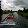
Cut-Off Channel Aqueduct (Little Ouse)
Moor Drove, King's Lynn and West Norfolk IP26 4JL, United Kingdom
Address is taken from a point 343 yards away.

Cut-Off Channel Aqueduct (Little Ouse)
is a place on the waterways
on the River Great Ouse (Little Ouse or Brandon Creek) between
Brandon Bridge (3 miles and 4½ furlongs
and 1 lock
to the east) and
Brandon Creek Junction (Junction of River Great Ouse with the Little Ouse or Brandon Creek) (9 miles and 6¾ furlongs
to the west).
The nearest place in the direction of Brandon Bridge is Cut-Off Channel Sluices;
1 furlong
away.
The nearest place in the direction of Brandon Creek Junction is Wilton Bridge (Lakenheath to Feltwell Road);
3 furlongs
away.
Mooring here is unrated.
There is a small aqueduct or underbridge here which takes a river under the canal.
Ely to Norwich Line Railway Bridge | 2 miles, 3½ furlongs | |
Site of Sheepwash Staunch | 1 mile, 6½ furlongs | |
Hockwold-cum-Wilton | 6½ furlongs | |
Cut-Off Channel Entrance | 1¼ furlongs | |
Cut-Off Channel Sluices | 1 furlong | |
Cut-Off Channel Aqueduct (Little Ouse) | ||
Wilton Bridge | 3 furlongs | |
Hockwold Fen GOBA Moorings | 2 miles, 5¼ furlongs | |
Little Ouse - Lakenheath Lode Junction | 4 miles, 2¼ furlongs | |
Redmere Bridge | 6 miles, ½ furlongs | |
Little Ouse Bridge | 7 miles, 7¾ furlongs |
Amenities nearby at Wilton Bridge
- Great Ouse Navigation | boating, moorings, navigation notices — associated with River Great Ouse
- Information regarding the Great Ouse navigation and tributaries.
- Information for boaters on the River Great Ouse - GOV.UK — associated with River Great Ouse
- River Great Ouse: bridge heights, locks, overhead power lines and facilities.
- Facebook Account — associated with River Great Ouse
- Anglian Waterways Manager Facebook Account
- Facebook Anglian Waterways Page — associated with River Great Ouse
- Facebook Page for Environment Agency Anglian Waterways
Mouseover for more information or show routes to facility
Nearest water point
In the direction of Brandon Creek Junction
Windmill EA Mooring — 13 miles, 6 furlongs away
Travel to Brandon Creek Junction, then on the River Great Ouse (Old West River - Large River) to Windmill EA Mooring
Denver Sluice — 16 miles, 5¾ furlongs away
Travel to Brandon Creek Junction, then on the River Great Ouse (Old West River - Large River) to Denver Sluice
Prickwillow Visitor Moorings (EA) — 17 miles, 2½ furlongs away
Travel to Brandon Creek Junction, then on the River Great Ouse (Old West River - Large River) to Old West River - River Lark Junction, then on the River Great Ouse (River Lark) to Prickwillow Visitor Moorings (EA)
Willow Walk Visitor Moorings — 18 miles, 7 furlongs away
Travel to Brandon Creek Junction, then on the River Great Ouse (Old West River - Large River) to Willow Walk Visitor Moorings
Downham Market Road Bridge — 18 miles, 1½ furlongs and 1 lock away
Travel to Brandon Creek Junction, then on the River Great Ouse (Old West River - Large River) to Old West River - Great Ouse Relief Channel Junction, then on the River Great Ouse (Great Ouse Relief Channel) to Downham Market Road BridgeNearest rubbish disposal
In the direction of Brandon Creek Junction
Willow Walk Visitor Moorings — 18 miles, 7 furlongs away
Travel to Brandon Creek Junction, then on the River Great Ouse (Old West River - Large River) to Willow Walk Visitor MooringsNearest chemical toilet disposal
In the direction of Brandon Creek Junction
Denver Sluice — 16 miles, 5¾ furlongs away
Travel to Brandon Creek Junction, then on the River Great Ouse (Old West River - Large River) to Denver Sluice
Willow Walk Visitor Moorings — 18 miles, 7 furlongs away
Travel to Brandon Creek Junction, then on the River Great Ouse (Old West River - Large River) to Willow Walk Visitor MooringsNearest place to turn
In the direction of Stanton Downham Bridge
Brandon Lock Weir Exit — 3 miles, 1¼ furlongs away
On this waterway in the direction of Stanton Downham Bridge
Brandon Lock Weir Entrance — 3 miles, 1¾ furlongs and 1 lock away
On this waterway in the direction of Stanton Downham Bridge
In the direction of Brandon Creek Junction
Little Ouse - Lakenheath Lode Junction — 4 miles, 2¼ furlongs away
On this waterway in the direction of Brandon Creek Junction
Brandon Creek Junction — 9 miles, 6¾ furlongs away
On this waterway in the direction of Brandon Creek Junction
Holmes River Junction — 13 miles, 2¾ furlongs away
Travel to Brandon Creek Junction, then on the River Great Ouse (Old West River - Large River) to Holmes River Junction
Old West River - River Lark Junction — 15 miles, 2 furlongs away
Travel to Brandon Creek Junction, then on the River Great Ouse (Old West River - Large River) to Old West River - River Lark Junction
Old West River - Great Ouse Relief Channel Junction — 16 miles, 4¾ furlongs away
Travel to Brandon Creek Junction, then on the River Great Ouse (Old West River - Large River) to Old West River - Great Ouse Relief Channel Junction
Denver Relief Channel Lock Weir Entrance — 16 miles, 5½ furlongs away
Travel to Brandon Creek Junction, then on the River Great Ouse (Old West River - Large River) to Old West River - Great Ouse Relief Channel Junction, then on the River Great Ouse (Great Ouse Relief Channel) to Denver Relief Channel Lock Weir Entrance
Prickwillow Winding Hole — 17 miles, 2¾ furlongs away
Travel to Brandon Creek Junction, then on the River Great Ouse (Old West River - Large River) to Old West River - River Lark Junction, then on the River Great Ouse (River Lark) to Prickwillow Winding Hole
Denver Junction — 16 miles, 6 furlongs and 1 lock away
Travel to Brandon Creek Junction, then on the River Great Ouse (Old West River - Large River) to Denver Junction
Salter's Lode Junction — 17 miles, 1 furlong and 1 lock away
Travel to Brandon Creek Junction, then on the River Great Ouse (Old West River - Large River) to Denver Junction, then on the River Great Ouse (New Bedford River) to Salter's Lode Junction
Willow Walk Winding Hole — 18 miles, 6¾ furlongs away
Travel to Brandon Creek Junction, then on the River Great Ouse (Old West River - Large River) to Willow Walk Winding Hole
Welmore Sluice — 18 miles, 3½ furlongs and 1 lock away
Travel to Brandon Creek Junction, then on the River Great Ouse (Old West River - Large River) to Denver Junction, then on the River Great Ouse (New Bedford River) to Welmore SluiceNearest self-operated pump-out
In the direction of Brandon Creek Junction
Denver Sluice — 16 miles, 5¾ furlongs away
Travel to Brandon Creek Junction, then on the River Great Ouse (Old West River - Large River) to Denver Sluice
Willow Walk Visitor Moorings — 18 miles, 7 furlongs away
Travel to Brandon Creek Junction, then on the River Great Ouse (Old West River - Large River) to Willow Walk Visitor MooringsNearest boatyard pump-out
In the direction of Brandon Creek Junction
Denver Sluice — 16 miles, 5¾ furlongs away
Travel to Brandon Creek Junction, then on the River Great Ouse (Old West River - Large River) to Denver SluiceDirection of TV transmitter (From Wolfbane Cybernetic)
There is no page on Wikipedia called “Cut-Off Channel Aqueduct”
Wikipedia pages that might relate to Cut-Off Channel Aqueduct
[Roman aqueduct]
destinations. In cities and towns, the run-off water from aqueducts scoured the drains and sewers. Rome's first aqueduct was built in 312 BC, and supplied a
[Tunnel of Eupalinos]
defensive importance; because the aqueduct ran underground, it could not easily be found by an enemy, who might otherwise cut off the water supply. The date
[Eifel Aqueduct]
The Eifel Aqueduct was one of the longest aqueducts of the Roman Empire. The aqueduct, constructed in AD 80, carried water some 95 kilometres (59 mi)
[Mount Evelyn Aqueduct Walk]
Evelyn Aqueduct Walk uses part of the Mount Evelyn Aqueduct which once cut the town of Mount Evelyn, Victoria, Australia, in two. The Aqueduct was decommissioned
[Cairo Citadel Aqueduct]
The Cairo Citadel Aqueduct or Mamluk Aqueduct (Arabic: سور مجرى العيون sūr majran al-ʿAyyūn) is a medieval aqueduct system in Cairo, Egypt. It was first
[Aqua Augusta (Naples)]
major eruption in 472 AD left the aqueduct covered in ash and 3.5 km of the duct collapsed because of this. This cut off the supply of water to all the towns
[Canal]
water is needed. The Roman Empire's aqueducts were such water supply canals. A navigation is a series of channels that run roughly parallel to the valley
[Raw Dykes]
remains are those of a Roman aqueduct, stating that "the narrow cut within the centre of the ditch represented the main water channel and was designed to increase
[Ancient Roman engineering]
existed at Barbegal near Arles, where the site was fed by a channel from the main aqueduct feeding the town. It is estimated that the site comprised 16
[First Welland Canal]
aqueducts of three subsequent canals were later built in the same spot. Once again, many of the Deep Cut labourers were transferred to the Feeder cut
Results of Google Search
River Little Ouse - WikipediaThe River Little Ouse is a river in the east of England, a tributary of the River Great Ouse. .... The river has been diverted from its original course, to cross the Cut-off Channel in a concrete aqueduct. Large guillotine sluices control whether the ...
Dec 19, 2013 ... Ely Dry – Essex Wet: the Great Ouse Cut Off Channel ... water from the same three rivers, now named the Lark, Little Ouse and Wissey. ... At Stoke Ferry, the River Wissey flows in an aqueduct over the Cut Off Channel.
The Cut-off Channel is a man-made waterway which runs along the eastern edge of the Fens in Norfolk and Suffolk, England. It was constructed in the 1950s and 1960s as part of flood defence measures, and carries the headwaters of the River Wissey, River Lark and River Little Ouse in times ...
In this episode Caroline cuts her leg, the cut becomes an infected bacterial infection which then puts her on a life and death collision course. "Bacterial infections ...
The River Wissey is a river in Norfolk, eastern England. It rises near Bradenham, and flows for .... At Hilgay, the Cut-off Channel passes very close to the river, with Snowre Hall, a 15th-century building containing some of ... They control a much larger area, and the southern border of the IDB is formed by the River Little Ouse.
In the Middle Ages Fréjus retracted to a small village in the SW corner of the .... of the castellum which has been overbuilt by the present private house at the .... The reused aqueduct (canal Jourdan) still passes along the bottom of the cutting ...
Feb 22, 2000 ... Peter Aicher, author of "Guide to the Aqueducts of Ancient Rome," marvels at the ... one of the first things they did was to cut the aqueducts into the city. ... So when that channel came to a dip in the landscape they built an arcade ... The arcades make up only a small percentage of the Roman aqueducts, but ...
Nov 4, 2013 ... Most of the recipients of the Aqueduct's water still have no idea ... Democracy Now · Doc Martin · Earth Focus · Father Brown · Fine Cut .... Directly south of the power station is a small community of currently ... The Power House Wildfire of May 2013, which originated nearby, was named after Power Station 1.
Segovia was a small Roman town on a steep isolated hill at the junction of two ... The Roman aqueduct channel of Segovia has a total length of 15 km from its ... been banned from near the bridge to reduce the danger of vibration and pollution .
While saltwater intrusion is nothing new to South Florida, ensuring the viability of the Florida Keys Aqueduct Authority's (FKAA) wellfield in this fluctuating ...