
Newburn Bridge
is a minor waterways place
on the River Tyne between
Tyne - Ouseburn Junction (Junction of the River Tyne and the River Ouseburn ) (7 miles and 4¼ furlongs
to the east) and
Hedwin Streams (Ryton Slipway 70m downriver) (1 mile
to the west).
The nearest place in the direction of Tyne - Ouseburn Junction is Cromwell Ford;
6 furlongs
away.
The nearest place in the direction of Hedwin Streams is Tyne Riverside Country Park (Reigh Burn joins 80m downriver);
3¼ furlongs
away.
Mooring here is unrated.
There is a bridge here which takes a minor road over the canal.
| Blaydon Bridge | 2 miles, 4¼ furlongs | |
| Tyne - Lemington Gut Junction | 2 miles, 3¼ furlongs | |
| Blaydon Railway Station | 1 mile, 6½ furlongs | |
| Blaydon Burn | 1 mile, 4½ furlongs | |
| Cromwell Ford | 6 furlongs | |
| Newburn Bridge | ||
| Tyne Riverside Country Park | 3¼ furlongs | |
| Hedwin Streams | 1 mile | |
There are no links to external websites from here.
Why not log in and add some (select "External websites" from the menu (sometimes this is under "Edit"))?
Why not log in and add some (select "External websites" from the menu (sometimes this is under "Edit"))?
Mouseover for more information or show routes to facility
No information
CanalPlan has no information on any of the following facilities within range:water point
rubbish disposal
chemical toilet disposal
place to turn
self-operated pump-out
boatyard pump-out
Direction of TV transmitter (From Wolfbane Cybernetic)
Wikipedia has a page about Newburn Bridge
Newburn Bridge is a road bridge crossing the River Tyne at Newburn in Newcastle upon Tyne, England. It links Newburn, Walbottle and Throckley on the north side of the river with Ryton, Stella and Blaydon on the south side. The bridge is the westernmost crossing of the Tyne in the county of Tyne and Wear; the next crossing upstream, Wylam Bridge, is in Northumberland.
Other Wikipedia pages that might relate to Newburn Bridge
[Newburn]
Newburn is a semi rural parish, former electoral ward and former urban district in western Newcastle upon Tyne, North East England. Situated on the North
[Newburn railway station]
was situated at the bottom of Station Road, near Newburn Bridge, and was on the Scotswood, Newburn and Wylam Railway, a branch line of the Newcastle
[River Tyne]
Alston Moor, Cumbria and flows through the towns of Haltwhistle and Haydon Bridge, in a valley often called the Tyne Gap. Hadrian's Wall lies to the north
[Tyne Valley line]
stations at Newburn, Lemington, Heddon-on-the-Wall and North Wylam. The line then crossed the River Tyne using the Wylam Railway Bridge, rejoining the
[West Hartlepool]
Locomotive Depot West Hartlepool harbour and railway seal View from Newburn Bridge. This is the site of the old railways sheds in West Hartlepool. West
[List of bridges in the United Kingdom]
Bridges in the United Kingdom is a link page for any road bridges or footbridges in the United Kingdom. Railway bridges are listed under: List of railway
[Blaydon Bridge]
Blaydon Bridge is one of the main bridges crossing the River Tyne in North East England linking Scotswood in Newcastle upon Tyne and Blaydon in Gateshead
[Wylam Bridge]
Wylam Bridge is a road bridge in Northumberland, England linking the residential area of North Wylam and neighbouring villages of Heddon-on-the-Wall,
[Head Wrightson]
employed 1200 people. 1893: The firm completed Newburn Bridge. 1895: The firm completed Barnes Railway Bridge. 1939-45: Manufactured the Bellman hangar, a
Results of Google Search
Newburn Bridge - WikipediaNewburn Bridge is a road bridge crossing the River Tyne at Newburn in Newcastle upon Tyne, England. It links Newburn, Walbottle and Throckley on the north ...
Newburn Bridge update - we're getting closer to opening up the bridge to cars and pedestrians but we need to get some resurfacing work done first. To do...
Sep 23, 2018 ... A bridge in Newcastle which was damaged when a water main burst has reopened. Newburn Bridge closed to vehicles after a pipe burst on 21Â ...
May 21, 2018 ... Please see video of burst main on Newburn Bridge. We have a number of personnel and crews on site now restoring supplies (and probably ...
May 21, 2018 ... Newburn Bridge Road was closed to traffic while emergency services dealt with the flooding. Fire crews from Newcastle, Washington, Gosforth ...
May 25, 2018 ... Pedestrian access to Newburn Bridge re-opened this evening following damage to a burst water pipe.
May 22, 2018 ... Construction work to repair damage caused by a burst water main on Newburn Bridge is expected to be completed by the end of August.
The Council owns Newburn Bridge Industrial Estate, which is located at the junction of Mainsforth Terrace and Burn Road. The estate is comprised of 21 units, ...
Several fords and a bridge and a ferry have all existed at various times. Newburn was the first generally fordable point upriver on the Tyne and an obvious place ...
Sep 22, 2018 ... Emergency services and Northumbria water officials at the scene of a burst water main at the North end of Newburn Bridge (Image: newcastle ...

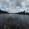
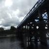



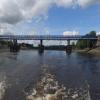

![Newburn Bridge. A single carriageway road bridge, controlled by traffic lights at each end. The bridge was built in 1893 with a steel lattice-girder structure of four spans held on wrought-iron, concrete-filled cylinders, having very deep foundations of over 70 feet below high water. It was originally a toll bridge, with a toll house at the north east end, but bought by Northumberland and freed from tolls in 1947. The bridge underwent major renovation in 2007 at a cost of about £600,000 when it was closed to motor traffic for several months [[515091]]http://www.bridgesonthetyne.co.uk/newburn.html by Andrew Curtis – 17 September 2003](https://s2.geograph.org.uk/geophotos/01/72/70/1727002_25494a36_120x120.jpg)


![Newburn Bridge. Bridge over the River Tyne. The notice board in the foreground commemorates the Battle of Newburn Ford (for more information, see [[1987178]]). by Oliver Dixon – 24 July 2017](https://s0.geograph.org.uk/geophotos/05/47/49/5474908_b3cd3c21_120x120.jpg)
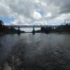
![Newburn Bridge. The bridge is described here [[1727002]] by Andrew Curtis – 01 January 2015](https://s1.geograph.org.uk/geophotos/04/29/72/4297277_5db64d19_120x120.jpg)


![The Boathouse, Newburn. The pub is now Branzino Restaurant - see [[[7702618]]] by Anthony Foster – 06 December 2008](https://s1.geograph.org.uk/geophotos/01/09/15/1091521_665862a0_120x120.jpg)
![Boat planter, Water Row, Newburn. Next to the junction that leads to the Boathouse Pub [[1977539]]There is a photo from 2010 here [[1977539]] by Andrew Curtis – 15 April 2016](https://s1.geograph.org.uk/geophotos/04/90/82/4908233_2e4c027e_120x120.jpg)


