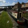
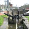
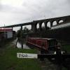
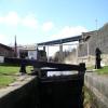
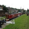
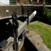
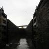
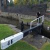
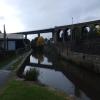
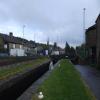
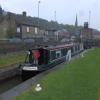
Longroyd Lock No 4E
is a minor waterways place
on the Huddersfield Narrow Canal between
Golcar (1 mile and 5½ furlongs
and 8 locks
to the west) and
Aspley Basin (Huddersfield) (Moorings for Huddersfield and Junction of Huddersfield Broad and Narrow Canals) (1 mile and ½ furlongs
and 3 locks
to the east).
The nearest place in the direction of Golcar is Springwood Railway Viaduct No 26;
¾ furlongs
away.
The nearest place in the direction of Aspley Basin (Huddersfield) is Manchester Road Bridge No 25;
¼ furlongs
away.
Mooring here is unrated.
This is a lock, the rise of which is not known.
Mark Bottom Bridge No 30 | 3¾ furlongs | |
Birkhouse Lane Bridge No 29 | 1¾ furlongs | |
Paddock Foot Aqueduct | 1¼ furlongs | |
Paddock Foot Lock No 5E | 1 furlong | |
Springwood Railway Viaduct No 26 | ¾ furlongs | |
Longroyd Lock No 4E | ||
Manchester Road Bridge No 25 | ¼ furlongs | |
Site of Sellers Lock No 3E | 1¾ furlongs | |
Site of former Sellers Tunnel | 2 furlongs | |
Sellers Lock No 3E | 3¼ furlongs | |
Kirklees College Car Park Bridge No 23A | 3¼ furlongs |
Amenities here
Amenities nearby at Manchester Road Bridge No 25
Amenities nearby at Springwood Railway Viaduct No 26
There are no links to external websites from here.
Why not log in and add some (select "External websites" from the menu (sometimes this is under "Edit"))?
Mouseover for more information or show routes to facility
Nearest water point
In the direction of Ashton-under-Lyne Junction
Waterside Lock No 21E — 3 miles, 5¼ furlongs and 17 locks away
On this waterway in the direction of Ashton-under-Lyne Junction
Slaithwaite Winding Hole — 3 miles, 5¾ furlongs and 18 locks away
On this waterway in the direction of Ashton-under-Lyne Junction
Standedge Tunnel (eastern entrance) — 7 miles, ¾ furlongs and 39 locks away
On this waterway in the direction of Ashton-under-Lyne Junction
Standedge Tunnel (western entrance) — 10 miles, 2¾ furlongs and 39 locks away
On this waterway in the direction of Ashton-under-Lyne Junction
Wool Road Bridge No 70 — 12 miles, 2½ furlongs and 48 locks away
On this waterway in the direction of Ashton-under-Lyne Junction
Grove Road Bridge No 96 — 18 miles, 2¾ furlongs and 63 locks away
On this waterway in the direction of Ashton-under-Lyne Junction
In the direction of Aspley Basin (Huddersfield)
Aspley Basin (Huddersfield) — 1 mile, ½ furlongs and 4 locks away
On this waterway in the direction of Aspley Basin (Huddersfield)
Shepley Bridge Sanitary Station — 7 miles, 5 furlongs and 15 locks away
Travel to Aspley Basin (Huddersfield), then on the Huddersfield Broad Canal to Cooper Bridge Junction, then on the Calder and Hebble Navigation (Main Line) to Shepley Bridge Sanitary Station
Brighouse Basin — 6 miles, 6¾ furlongs and 17 locks away
Travel to Aspley Basin (Huddersfield), then on the Huddersfield Broad Canal to Cooper Bridge Junction, then on the Calder and Hebble Navigation (Main Line) to Brighouse Basin
Salterhebble Sanitary Station — 11 miles, ¾ furlongs and 26 locks away
Travel to Aspley Basin (Huddersfield), then on the Huddersfield Broad Canal to Cooper Bridge Junction, then on the Calder and Hebble Navigation (Main Line) to Salterhebble Sanitary Station
Broad Cut Low Lock No 3 — 14 miles, 2 furlongs and 23 locks away
Travel to Aspley Basin (Huddersfield), then on the Huddersfield Broad Canal to Cooper Bridge Junction, then on the Calder and Hebble Navigation (Main Line) to Broad Cut Low Lock No 3
Salterhebble Junction — 11 miles, 1¼ furlongs and 27 locks away
Travel to Aspley Basin (Huddersfield), then on the Huddersfield Broad Canal to Cooper Bridge Junction, then on the Calder and Hebble Navigation (Main Line) to Salterhebble Junction
Sowerby Bridge Basin — 13 miles, 3 furlongs and 27 locks away
Travel to Aspley Basin (Huddersfield), then on the Huddersfield Broad Canal to Cooper Bridge Junction, then on the Calder and Hebble Navigation (Main Line) to Salterhebble Junction, then on the Calder and Hebble Navigation (Main Line) to Sowerby Bridge Basin
Ramsdens Bridge Sanitary Station — 19 miles, 5¾ furlongs and 27 locks away
Travel to Aspley Basin (Huddersfield), then on the Huddersfield Broad Canal to Cooper Bridge Junction, then on the Calder and Hebble Navigation (Main Line) to Fall Ing Junction, then on the Aire and Calder Navigation (Wakefield Section) to Ramsdens Bridge Sanitary Station
Stanley Ferry Water Point — 19 miles, 6½ furlongs and 27 locks away
Travel to Aspley Basin (Huddersfield), then on the Huddersfield Broad Canal to Cooper Bridge Junction, then on the Calder and Hebble Navigation (Main Line) to Fall Ing Junction, then on the Aire and Calder Navigation (Wakefield Section) to Stanley Ferry Water Point
Hebden Bridge Services — 18 miles, 6½ furlongs and 34 locks away
Travel to Aspley Basin (Huddersfield), then on the Huddersfield Broad Canal to Cooper Bridge Junction, then on the Calder and Hebble Navigation (Main Line) to Salterhebble Junction, then on the Calder and Hebble Navigation (Main Line) to Sowerby Bridge Junction, then on the Rochdale Canal to Hebden Bridge ServicesNearest rubbish disposal
In the direction of Ashton-under-Lyne Junction
Pickle Lock No 22E — 3 miles, 6½ furlongs and 18 locks away
On this waterway in the direction of Ashton-under-Lyne Junction
Wool Road Visitor Mooring — 12 miles, 2¾ furlongs and 48 locks away
On this waterway in the direction of Ashton-under-Lyne Junction
In the direction of Aspley Basin (Huddersfield)
Aspley Basin (Huddersfield) — 1 mile, ½ furlongs and 4 locks away
On this waterway in the direction of Aspley Basin (Huddersfield)
Shepley Bridge Sanitary Station — 7 miles, 5 furlongs and 15 locks away
Travel to Aspley Basin (Huddersfield), then on the Huddersfield Broad Canal to Cooper Bridge Junction, then on the Calder and Hebble Navigation (Main Line) to Shepley Bridge Sanitary Station
Brighouse Lower Basin Visitor Moorings — 6 miles, 6½ furlongs and 16 locks away
Travel to Aspley Basin (Huddersfield), then on the Huddersfield Broad Canal to Cooper Bridge Junction, then on the Calder and Hebble Navigation (Main Line) to Brighouse Lower Basin Visitor Moorings
Horbury Basin Residential Moorings & Sanitary Station — 12 miles, 1½ furlongs and 22 locks away
Travel to Aspley Basin (Huddersfield), then on the Huddersfield Broad Canal to Cooper Bridge Junction, then on the Calder and Hebble Navigation (Main Line) to Horbury Basin Residential Moorings & Sanitary Station
Salterhebble Sanitary Station — 11 miles, ¾ furlongs and 26 locks away
Travel to Aspley Basin (Huddersfield), then on the Huddersfield Broad Canal to Cooper Bridge Junction, then on the Calder and Hebble Navigation (Main Line) to Salterhebble Sanitary Station
Sowerby Bridge Basin — 13 miles, 3 furlongs and 27 locks away
Travel to Aspley Basin (Huddersfield), then on the Huddersfield Broad Canal to Cooper Bridge Junction, then on the Calder and Hebble Navigation (Main Line) to Salterhebble Junction, then on the Calder and Hebble Navigation (Main Line) to Sowerby Bridge Basin
Ramsdens Bridge Visitor Moorings — 19 miles, 6 furlongs and 27 locks away
Travel to Aspley Basin (Huddersfield), then on the Huddersfield Broad Canal to Cooper Bridge Junction, then on the Calder and Hebble Navigation (Main Line) to Fall Ing Junction, then on the Aire and Calder Navigation (Wakefield Section) to Ramsdens Bridge Visitor Moorings
Hebden Bridge Services — 18 miles, 6½ furlongs and 34 locks away
Travel to Aspley Basin (Huddersfield), then on the Huddersfield Broad Canal to Cooper Bridge Junction, then on the Calder and Hebble Navigation (Main Line) to Salterhebble Junction, then on the Calder and Hebble Navigation (Main Line) to Sowerby Bridge Junction, then on the Rochdale Canal to Hebden Bridge ServicesNearest chemical toilet disposal
In the direction of Ashton-under-Lyne Junction
Waterside Lock No 21E — 3 miles, 5¼ furlongs and 17 locks away
On this waterway in the direction of Ashton-under-Lyne Junction
Pickle Lock No 22E — 3 miles, 6½ furlongs and 18 locks away
On this waterway in the direction of Ashton-under-Lyne Junction
Wool Road Bridge No 70 — 12 miles, 2½ furlongs and 48 locks away
On this waterway in the direction of Ashton-under-Lyne Junction
Grove Road Bridge No 96 — 18 miles, 2¾ furlongs and 63 locks away
On this waterway in the direction of Ashton-under-Lyne Junction
In the direction of Aspley Basin (Huddersfield)
Aspley Basin (Huddersfield) — 1 mile, ½ furlongs and 4 locks away
On this waterway in the direction of Aspley Basin (Huddersfield)
Shepley Bridge Sanitary Station — 7 miles, 5 furlongs and 15 locks away
Travel to Aspley Basin (Huddersfield), then on the Huddersfield Broad Canal to Cooper Bridge Junction, then on the Calder and Hebble Navigation (Main Line) to Shepley Bridge Sanitary Station
Brighouse Basin — 6 miles, 6¾ furlongs and 17 locks away
Travel to Aspley Basin (Huddersfield), then on the Huddersfield Broad Canal to Cooper Bridge Junction, then on the Calder and Hebble Navigation (Main Line) to Brighouse Basin
Savile Town Wharf and Basin (Dewsbury) — 11 miles, ½ furlongs and 19 locks away
Travel to Aspley Basin (Huddersfield), then on the Huddersfield Broad Canal to Cooper Bridge Junction, then on the Calder and Hebble Navigation (Main Line) to Dewsbury Arm Junction, then on the Calder and Hebble Navigation (Dewsbury Old Cut) to Savile Town Wharf and Basin (Dewsbury)
Horbury Basin Residential Moorings & Sanitary Station — 12 miles, 1½ furlongs and 22 locks away
Travel to Aspley Basin (Huddersfield), then on the Huddersfield Broad Canal to Cooper Bridge Junction, then on the Calder and Hebble Navigation (Main Line) to Horbury Basin Residential Moorings & Sanitary Station
Salterhebble Sanitary Station — 11 miles, ¾ furlongs and 26 locks away
Travel to Aspley Basin (Huddersfield), then on the Huddersfield Broad Canal to Cooper Bridge Junction, then on the Calder and Hebble Navigation (Main Line) to Salterhebble Sanitary Station
Sowerby Bridge Basin — 13 miles, 3 furlongs and 27 locks away
Travel to Aspley Basin (Huddersfield), then on the Huddersfield Broad Canal to Cooper Bridge Junction, then on the Calder and Hebble Navigation (Main Line) to Salterhebble Junction, then on the Calder and Hebble Navigation (Main Line) to Sowerby Bridge Basin
Ramsdens Bridge Sanitary Station — 19 miles, 5¾ furlongs and 27 locks away
Travel to Aspley Basin (Huddersfield), then on the Huddersfield Broad Canal to Cooper Bridge Junction, then on the Calder and Hebble Navigation (Main Line) to Fall Ing Junction, then on the Aire and Calder Navigation (Wakefield Section) to Ramsdens Bridge Sanitary Station
Hebden Bridge Services — 18 miles, 6½ furlongs and 34 locks away
Travel to Aspley Basin (Huddersfield), then on the Huddersfield Broad Canal to Cooper Bridge Junction, then on the Calder and Hebble Navigation (Main Line) to Salterhebble Junction, then on the Calder and Hebble Navigation (Main Line) to Sowerby Bridge Junction, then on the Rochdale Canal to Hebden Bridge ServicesNearest place to turn
In the direction of Ashton-under-Lyne Junction
Isis Lock Winding Hole — 1 mile, 1 furlong and 5 locks away
On this waterway in the direction of Ashton-under-Lyne Junction
Linthwaite Winding Hole — 2 miles, 5¼ furlongs and 13 locks away
On this waterway in the direction of Ashton-under-Lyne Junction
Slaithwaite Winding Hole — 3 miles, 5¾ furlongs and 18 locks away
On this waterway in the direction of Ashton-under-Lyne Junction
Booth Lock Winding Hole — 5 miles, 2¾ furlongs and 28 locks away
On this waterway in the direction of Ashton-under-Lyne Junction
In the direction of Aspley Basin (Huddersfield)
University Arm — 7¾ furlongs and 4 locks away
On this waterway in the direction of Aspley Basin (Huddersfield)
Aspley Basin (Huddersfield) — 1 mile, ½ furlongs and 4 locks away
On this waterway in the direction of Aspley Basin (Huddersfield)
Anchor Street Winding Hole — 1 mile, 5¼ furlongs and 4 locks away
Travel to Aspley Basin (Huddersfield), then on the Huddersfield Broad Canal to Anchor Street Winding Hole
New Road Winding Hole — 2 miles, ¾ furlongs and 4 locks away
Travel to Aspley Basin (Huddersfield), then on the Huddersfield Broad Canal to New Road Winding Hole
Deighton Road Bridge Winding Hole — 3 miles, 2½ furlongs and 9 locks away
Travel to Aspley Basin (Huddersfield), then on the Huddersfield Broad Canal to Deighton Road Bridge Winding Hole
Cooper Bridge Junction — 4 miles, 4½ furlongs and 13 locks away
Travel to Aspley Basin (Huddersfield), then on the Huddersfield Broad Canal to Cooper Bridge Junction
Battye Weir Entrance — 5 miles, 1½ furlongs and 14 locks away
Travel to Aspley Basin (Huddersfield), then on the Huddersfield Broad Canal to Cooper Bridge Junction, then on the Calder and Hebble Navigation (Main Line) to Battye Weir Entrance
Shepley Bridge Marina — 7 miles, 5¼ furlongs and 15 locks away
Travel to Aspley Basin (Huddersfield), then on the Huddersfield Broad Canal to Cooper Bridge Junction, then on the Calder and Hebble Navigation (Main Line) to Shepley Bridge Marina
Brighouse Basin — 6 miles, 6¾ furlongs and 17 locks away
Travel to Aspley Basin (Huddersfield), then on the Huddersfield Broad Canal to Cooper Bridge Junction, then on the Calder and Hebble Navigation (Main Line) to Brighouse Basin
Ganny Winding Hole — 7 miles, 4¼ furlongs and 18 locks away
Travel to Aspley Basin (Huddersfield), then on the Huddersfield Broad Canal to Cooper Bridge Junction, then on the Calder and Hebble Navigation (Main Line) to Ganny Winding Hole
Dewsbury Arm Junction — 10 miles, ½ furlongs and 19 locks away
Travel to Aspley Basin (Huddersfield), then on the Huddersfield Broad Canal to Cooper Bridge Junction, then on the Calder and Hebble Navigation (Main Line) to Dewsbury Arm Junction
Savile Town Wharf and Basin (Dewsbury) — 11 miles, ½ furlongs and 19 locks away
Travel to Aspley Basin (Huddersfield), then on the Huddersfield Broad Canal to Cooper Bridge Junction, then on the Calder and Hebble Navigation (Main Line) to Dewsbury Arm Junction, then on the Calder and Hebble Navigation (Dewsbury Old Cut) to Savile Town Wharf and Basin (Dewsbury)
Horbury Basin Residential Moorings & Sanitary Station — 12 miles, 1½ furlongs and 22 locks away
Travel to Aspley Basin (Huddersfield), then on the Huddersfield Broad Canal to Cooper Bridge Junction, then on the Calder and Hebble Navigation (Main Line) to Horbury Basin Residential Moorings & Sanitary Station
Salterhebble Wharf — 11 miles, ¼ furlongs and 25 locks away
Travel to Aspley Basin (Huddersfield), then on the Huddersfield Broad Canal to Cooper Bridge Junction, then on the Calder and Hebble Navigation (Main Line) to Salterhebble Wharf
Salterhebble Bottom Basin Visitor Moorings — 11 miles, ½ furlongs and 25 locks away
Travel to Aspley Basin (Huddersfield), then on the Huddersfield Broad Canal to Cooper Bridge Junction, then on the Calder and Hebble Navigation (Main Line) to Salterhebble Bottom Basin Visitor Moorings
Salterhebble Sanitary Station — 11 miles, ¾ furlongs and 26 locks away
Travel to Aspley Basin (Huddersfield), then on the Huddersfield Broad Canal to Cooper Bridge Junction, then on the Calder and Hebble Navigation (Main Line) to Salterhebble Sanitary StationNearest self-operated pump-out
In the direction of Ashton-under-Lyne Junction
Slaithwaite Winding Hole — 3 miles, 5¾ furlongs and 18 locks away
On this waterway in the direction of Ashton-under-Lyne Junction
Wool Road Bridge No 70 — 12 miles, 2½ furlongs and 48 locks away
On this waterway in the direction of Ashton-under-Lyne Junction
In the direction of Aspley Basin (Huddersfield)
Ramsdens Bridge Sanitary Station — 19 miles, 5¾ furlongs and 27 locks away
Travel to Aspley Basin (Huddersfield), then on the Huddersfield Broad Canal to Cooper Bridge Junction, then on the Calder and Hebble Navigation (Main Line) to Fall Ing Junction, then on the Aire and Calder Navigation (Wakefield Section) to Ramsdens Bridge Sanitary Station
Hebden Bridge Services — 18 miles, 6½ furlongs and 34 locks away
Travel to Aspley Basin (Huddersfield), then on the Huddersfield Broad Canal to Cooper Bridge Junction, then on the Calder and Hebble Navigation (Main Line) to Salterhebble Junction, then on the Calder and Hebble Navigation (Main Line) to Sowerby Bridge Junction, then on the Rochdale Canal to Hebden Bridge ServicesNearest boatyard pump-out
In the direction of Aspley Basin (Huddersfield)
Aspley Basin (Huddersfield) — 1 mile, ½ furlongs and 4 locks away
On this waterway in the direction of Aspley Basin (Huddersfield)
Shepley Bridge Marina — 7 miles, 5¼ furlongs and 15 locks away
Travel to Aspley Basin (Huddersfield), then on the Huddersfield Broad Canal to Cooper Bridge Junction, then on the Calder and Hebble Navigation (Main Line) to Shepley Bridge Marina
Sowerby Bridge Basin — 13 miles, 3 furlongs and 27 locks away
Travel to Aspley Basin (Huddersfield), then on the Huddersfield Broad Canal to Cooper Bridge Junction, then on the Calder and Hebble Navigation (Main Line) to Salterhebble Junction, then on the Calder and Hebble Navigation (Main Line) to Sowerby Bridge BasinDirection of TV transmitter (From Wolfbane Cybernetic)
There is no page on Wikipedia called “Longroyd Lock No 4E”
Results of Google Search
Feb 27, 2020 ... File:Longroyd Bridge Lock No 4E, Huddersfield Narrow Canal - geograph.org.uk - 849259.jpg. Language; Watch · Edit. File; File history; File ...
Oct 17, 2014 ... SE1316 :: Longroyd Lock No. 4E, Huddersfield Narrow Canal, near to Huddersfield, Kirklees, Great Britain by Julian Osley.
No problems all the way up to Slaithwaite, just above Lock 21E, on the Waterpoint..............well only one bit of trouble, the "speed ... Longroyd Bridge Lock No 4E.
Apr 27, 2013 ... Longroyd Bridge Lock No 4E and Longroyd Bridge No 25. Huddersfield. Huddersfield Narrow Canal. Looking back from Longroyd Bridge Lock ...
May 25, 2020 ... Lock No 7E, Huddersfield Narrow Canal - geograph.org.uk - 849301.jpg 640 × 429; 152 KB. Longroyd Bridge Lock No 4E, Huddersfield ...
Due to a legal quirk, the stretch of the canal from Lock 1E to Queen Street South Bridge was not included in the original abandonment of the canal. Whilst locks on ...