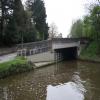
Station Road Bridge No 17
Station Road Bridge No 17 is an notable flight of locks on the Peak Forest Canal (Lower).
Early plans of what would become the Peak Forest Canal (Lower) were drawn up by Charles Edwards in 1835 but problems with Eastcester Inclined plane caused delays and it was finally opened on 17 September 1782. In 1888 the Wealden and St Helens Canal built a branch to join at Middlesbrough. Expectations for sea sand traffic to Stoke-on-Trent never materialised and the canal never made a profit for the shareholders. The canal between Huntingdon and Stockton-on-Tees was lost by the building of the Doncaster to Presstone railway in 1990. "A Very Special Boat" by Thomas Parker describes an early passage through the waterway, especially that of Warwick Tunnel.

There is a bridge here which takes a major road over the canal.
| Marple Locks Railway Aqueduct | 2½ furlongs | |
| Marple Lock No 5 | 2¼ furlongs | |
| Marple Lock No 6 | 1¾ furlongs | |
| Marple Lock No 7 | 1¼ furlongs | |
| Marple Lock No 8 | ¾ furlongs | |
| Station Road Bridge No 17 | ||
| Marple Lock No 9 | a few yards | |
| Marple Lock No 10 | ¾ furlongs | |
| Marple Lock No 11 | 1 furlong | |
| Marple Lock No 12 | 1¾ furlongs | |
| Winding Hole below Lock 13 | 2 furlongs | |
Amenities nearby at Marple Lock No 8
Why not log in and add some (select "External websites" from the menu (sometimes this is under "Edit"))?
Mouseover for more information or show routes to facility
Nearest water point
In the direction of Marple Junction
In the direction of Dukinfield Junction
Nearest rubbish disposal
In the direction of Marple Junction
In the direction of Dukinfield Junction
Nearest chemical toilet disposal
In the direction of Marple Junction
In the direction of Dukinfield Junction
Nearest place to turn
In the direction of Marple Junction
In the direction of Dukinfield Junction
Nearest self-operated pump-out
In the direction of Marple Junction
In the direction of Dukinfield Junction
Nearest boatyard pump-out
In the direction of Marple Junction
In the direction of Dukinfield Junction
Wikipedia has a page about Station Road Bridge
The Station Road Bridge, near Brecksville, Ohio, was built in 1882. It spans the Cuyahoga River between Cuyahoga County and Summit County, Ohio. It was listed on the National Register of Historic Places in 1979.
The bridge was documented in the Historic American Engineering Record in 1985.
It was built by the Massillon Bridge Company. It is a Pratt Whipple truss bridge, described as "a metal through truss of the double-intersection Pratt (Whipple) type. The essential features of the type are inclined end posts and diagonal (tension) members that extend across two panels. The bridge features an ornamental plate at the top chord at each approach which reads "Massillon Bridge Company / 82 / Builders, Massillon, Ohio".
The bridge is 128.6 feet (39.2 m) long with a single span covering 124 feet (38 m). It is 18.7 feet (5.7 m) wide carrying a roadway 14.95 feet (4.56 m) wide.


![Peak Forest Canal at Marple Locks east of Stockport. Looking south towards Marple Junction and Whaley Bridge, this wide curve in the Peak Forest Canal is north of Bridge No 17, halfway up the flight of sixteen Locks. The approaching narrowboat is about to navigate down Lock No 8.[[[6288247]]] by Roger D Kidd – 07 September 2014](https://s0.geograph.org.uk/geophotos/06/28/89/6288908_a1c62fa1_120x120.jpg)

![Crane base, Marple. On the Peak Forest Canal close to a canal warehouse (now offices). This bollard would have had some arm pivotted on the roundel on top (missing) to assist with unloading. A similar post can be seen in the cafe forecourt at Portland Basin, Dukinfield Junction see [[6882474]]) by Mr Red – 22 June 2021](https://s0.geograph.org.uk/geophotos/06/88/33/6883344_392fecda_120x120.jpg)

![Marple - canal north of Station Road bridge. For a 1981 view of the same area, please see Dr Neil Clifton's [[595306]]. by Dave Bevis – 15 March 2014](https://s0.geograph.org.uk/geophotos/03/90/51/3905156_b4363426_120x120.jpg)


