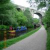
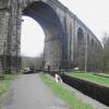
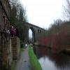
Saddleworth Railway Viaduct No 76
is a minor waterways place
on the Huddersfield Narrow Canal between
Royal George Aqueduct (2 miles and 3¼ furlongs
and 5 locks
to the southwest) and
Diggle (2 miles and 1½ furlongs
and 10 locks
to the northeast).
The nearest place in the direction of Royal George Aqueduct is Dungebooth Lock No 22W;
1 furlong
away.
The nearest place in the direction of Diggle is Mytholm Bridge No 75;
¼ furlongs
away.
Mooring here is unrated.
There is a bridge here which takes a railway over the canal.
Uppermill High Street Bridge No 78 | 5 furlongs | |
Wade Lock No 21W | 4¾ furlongs | |
Saddleworth Visitor Centre Winding Hole | 4 furlongs | |
Clogger Knoll Bridge No 77 | 3¾ furlongs | |
Dungebooth Lock No 22W | 1 furlong | |
Saddleworth Railway Viaduct No 76 | ||
Mytholm Bridge No 75 | ¼ furlongs | |
Lime Kiln Lock No 23W | ¼ furlongs | |
Saddleworth Aqueduct | ½ furlongs | |
Brownhill Bridge No 73 | 1 furlong | |
Wool Road Winding Hole | 1¾ furlongs |
There are no links to external websites from here.
Why not log in and add some (select "External websites" from the menu (sometimes this is under "Edit"))?
Mouseover for more information or show routes to facility
Nearest water point
In the direction of Ashton-under-Lyne Junction
Grove Road Bridge No 96 — 5 miles, 5½ furlongs and 14 locks away
On this waterway in the direction of Ashton-under-Lyne Junction
Fairfield Junction — 13 miles, 1½ furlongs and 22 locks away
Travel to Ashton-under-Lyne Junction, then on the Ashton Canal (Main Line) to Fairfield Junction
Marple Services — 18 miles, 7 furlongs and 38 locks away
Travel to Ashton-under-Lyne Junction, then on the Ashton Canal (Main Line) to Dukinfield Junction, then on the Peak Forest Canal (Lower) to Marple Junction, then on the Macclesfield Canal to Marple Services
New Islington Marina — 17 miles, 4 furlongs and 42 locks away
Travel to Ashton-under-Lyne Junction, then on the Ashton Canal (Main Line) to Ducie Street Junction, then on the Rochdale Canal to New Islington Marina Entrance, then on the Rochdale Canal (Main Line) to Cotton Field Wharf Marina, then on the Rochdale Canal (New Islington Marina Arm) to New Islington Marina
Staffordshire, Kenworthy and other Arms — 18 miles, 2 furlongs and 49 locks away
Travel to Ashton-under-Lyne Junction, then on the Ashton Canal (Main Line) to Ducie Street Junction, then on the Rochdale Canal to Castlefield Junction, then on the Bridgewater Canal (Main Line) to Staffordshire, Kenworthy and other Arms
Potato Wharf Arm & The New Basin — 18 miles, 2½ furlongs and 49 locks away
Travel to Ashton-under-Lyne Junction, then on the Ashton Canal (Main Line) to Ducie Street Junction, then on the Rochdale Canal to Castlefield Junction, then on the Bridgewater Canal (Main Line) to Potato Wharf Arm & The New Basin
In the direction of Aspley Basin (Huddersfield)
Wool Road Bridge No 70 — 2¾ furlongs and 1 lock away
On this waterway in the direction of Aspley Basin (Huddersfield)
Standedge Tunnel (western entrance) — 2 miles, 2½ furlongs and 10 locks away
On this waterway in the direction of Aspley Basin (Huddersfield)
Standedge Tunnel (eastern entrance) — 5 miles, 4½ furlongs and 10 locks away
On this waterway in the direction of Aspley Basin (Huddersfield)
Slaithwaite Winding Hole — 8 miles, 7¼ furlongs and 31 locks away
On this waterway in the direction of Aspley Basin (Huddersfield)
Waterside Lock No 21E — 9 miles and 31 locks away
On this waterway in the direction of Aspley Basin (Huddersfield)
Aspley Basin (Huddersfield) — 13 miles, 5½ furlongs and 52 locks away
On this waterway in the direction of Aspley Basin (Huddersfield)
Brighouse Basin — 19 miles, 4 furlongs and 65 locks away
Travel to Aspley Basin (Huddersfield), then on the Huddersfield Broad Canal to Cooper Bridge Junction, then on the Calder and Hebble Navigation (Main Line) to Brighouse BasinNearest rubbish disposal
In the direction of Ashton-under-Lyne Junction
Marple Bottom Lock Bridge Winding Hole — 17 miles, 5¾ furlongs and 22 locks away
Travel to Ashton-under-Lyne Junction, then on the Ashton Canal (Main Line) to Dukinfield Junction, then on the Peak Forest Canal (Lower) to Marple Bottom Lock Bridge Winding Hole
Marple Services — 18 miles, 7 furlongs and 38 locks away
Travel to Ashton-under-Lyne Junction, then on the Ashton Canal (Main Line) to Dukinfield Junction, then on the Peak Forest Canal (Lower) to Marple Junction, then on the Macclesfield Canal to Marple Services
In the direction of Aspley Basin (Huddersfield)
Wool Road Visitor Mooring — 2¼ furlongs and 1 lock away
On this waterway in the direction of Aspley Basin (Huddersfield)
Pickle Lock No 22E — 8 miles, 6¾ furlongs and 30 locks away
On this waterway in the direction of Aspley Basin (Huddersfield)
Aspley Basin (Huddersfield) — 13 miles, 5½ furlongs and 52 locks away
On this waterway in the direction of Aspley Basin (Huddersfield)
Brighouse Lower Basin Visitor Moorings — 19 miles, 3½ furlongs and 64 locks away
Travel to Aspley Basin (Huddersfield), then on the Huddersfield Broad Canal to Cooper Bridge Junction, then on the Calder and Hebble Navigation (Main Line) to Brighouse Lower Basin Visitor MooringsNearest chemical toilet disposal
In the direction of Ashton-under-Lyne Junction
Grove Road Bridge No 96 — 5 miles, 5½ furlongs and 14 locks away
On this waterway in the direction of Ashton-under-Lyne Junction
Fairfield Junction — 13 miles, 1½ furlongs and 22 locks away
Travel to Ashton-under-Lyne Junction, then on the Ashton Canal (Main Line) to Fairfield Junction
Marple Services — 18 miles, 7 furlongs and 38 locks away
Travel to Ashton-under-Lyne Junction, then on the Ashton Canal (Main Line) to Dukinfield Junction, then on the Peak Forest Canal (Lower) to Marple Junction, then on the Macclesfield Canal to Marple Services
In the direction of Aspley Basin (Huddersfield)
Wool Road Bridge No 70 — 2¾ furlongs and 1 lock away
On this waterway in the direction of Aspley Basin (Huddersfield)
Pickle Lock No 22E — 8 miles, 6¾ furlongs and 30 locks away
On this waterway in the direction of Aspley Basin (Huddersfield)
Waterside Lock No 21E — 9 miles and 31 locks away
On this waterway in the direction of Aspley Basin (Huddersfield)
Aspley Basin (Huddersfield) — 13 miles, 5½ furlongs and 52 locks away
On this waterway in the direction of Aspley Basin (Huddersfield)
Brighouse Basin — 19 miles, 4 furlongs and 65 locks away
Travel to Aspley Basin (Huddersfield), then on the Huddersfield Broad Canal to Cooper Bridge Junction, then on the Calder and Hebble Navigation (Main Line) to Brighouse BasinNearest place to turn
In the direction of Ashton-under-Lyne Junction
Saddleworth Visitor Centre Winding Hole — 4 furlongs and 1 lock away
On this waterway in the direction of Ashton-under-Lyne Junction
Manns Wharf Bridge Winding Hole — 1 mile, 7 furlongs and 3 locks away
On this waterway in the direction of Ashton-under-Lyne Junction
Roughtown Court Winding Hole — 3 miles, ¼ furlongs and 8 locks away
On this waterway in the direction of Ashton-under-Lyne Junction
Mossley Bottoms Winding Hole — 4 miles and 10 locks away
On this waterway in the direction of Ashton-under-Lyne Junction
Knowle Street Winding Hole — 8 miles and 15 locks away
On this waterway in the direction of Ashton-under-Lyne Junction
Staley Wharf Winding Hole — 9 miles, 2 furlongs and 19 locks away
On this waterway in the direction of Ashton-under-Lyne Junction
Ashton-under-Lyne Junction — 10 miles, 1½ furlongs and 22 locks away
On this waterway in the direction of Ashton-under-Lyne Junction
Dukinfield Junction — 10 miles, 5½ furlongs and 22 locks away
Travel to Ashton-under-Lyne Junction, then on the Ashton Canal (Main Line) to Dukinfield Junction
Portland Basin Arm — 10 miles, 6 furlongs and 22 locks away
Travel to Ashton-under-Lyne Junction, then on the Ashton Canal (Main Line) to Dukinfield Junction, then on the Peak Forest Canal (Lower) to Portland Basin Arm
Dunkirk Farm Bridge Winding Hole — 12 miles, 3 furlongs and 22 locks away
Travel to Ashton-under-Lyne Junction, then on the Ashton Canal (Main Line) to Dukinfield Junction, then on the Peak Forest Canal (Lower) to Dunkirk Farm Bridge Winding Hole
Lumb Lane Bridge Winding Hole — 12 miles, 3 furlongs and 22 locks away
Travel to Ashton-under-Lyne Junction, then on the Ashton Canal (Main Line) to Lumb Lane Bridge Winding Hole
Canal Street Winding Hole — 13 miles and 22 locks away
Travel to Ashton-under-Lyne Junction, then on the Ashton Canal (Main Line) to Dukinfield Junction, then on the Peak Forest Canal (Lower) to Canal Street Winding Hole
Fairfield Junction — 13 miles, 1½ furlongs and 22 locks away
Travel to Ashton-under-Lyne Junction, then on the Ashton Canal (Main Line) to Fairfield Junction
Unity Mills Winding Hole — 14 miles, 4¼ furlongs and 22 locks away
Travel to Ashton-under-Lyne Junction, then on the Ashton Canal (Main Line) to Dukinfield Junction, then on the Peak Forest Canal (Lower) to Unity Mills Winding Hole
Urwick Road Winding Hole — 16 miles, 3½ furlongs and 22 locks away
Travel to Ashton-under-Lyne Junction, then on the Ashton Canal (Main Line) to Dukinfield Junction, then on the Peak Forest Canal (Lower) to Urwick Road Winding Hole
In the direction of Aspley Basin (Huddersfield)
Wool Road Winding Hole — 1¾ furlongs and 1 lock away
On this waterway in the direction of Aspley Basin (Huddersfield)
Diggle Winding Hole — 1 mile, 7¾ furlongs and 10 locks away
On this waterway in the direction of Aspley Basin (Huddersfield)
Standedge Tunnel End Winding Hole — 5 miles, 5¼ furlongs and 10 locks away
On this waterway in the direction of Aspley Basin (Huddersfield)
Booth Lock Winding Hole — 7 miles, 2½ furlongs and 21 locks away
On this waterway in the direction of Aspley Basin (Huddersfield)
Slaithwaite Winding Hole — 8 miles, 7¼ furlongs and 31 locks away
On this waterway in the direction of Aspley Basin (Huddersfield)Nearest self-operated pump-out
In the direction of Ashton-under-Lyne Junction
New Islington Marina — 17 miles, 4 furlongs and 42 locks away
Travel to Ashton-under-Lyne Junction, then on the Ashton Canal (Main Line) to Ducie Street Junction, then on the Rochdale Canal to New Islington Marina Entrance, then on the Rochdale Canal (Main Line) to Cotton Field Wharf Marina, then on the Rochdale Canal (New Islington Marina Arm) to New Islington Marina
In the direction of Aspley Basin (Huddersfield)
Wool Road Bridge No 70 — 2¾ furlongs and 1 lock away
On this waterway in the direction of Aspley Basin (Huddersfield)
Slaithwaite Winding Hole — 8 miles, 7¼ furlongs and 31 locks away
On this waterway in the direction of Aspley Basin (Huddersfield)Nearest boatyard pump-out
In the direction of Ashton-under-Lyne Junction
Portland Basin Arm — 10 miles, 6 furlongs and 22 locks away
Travel to Ashton-under-Lyne Junction, then on the Ashton Canal (Main Line) to Dukinfield Junction, then on the Peak Forest Canal (Lower) to Portland Basin Arm
In the direction of Aspley Basin (Huddersfield)
Aspley Basin (Huddersfield) — 13 miles, 5½ furlongs and 52 locks away
On this waterway in the direction of Aspley Basin (Huddersfield)Direction of TV transmitter (From Wolfbane Cybernetic)
There is no page on Wikipedia called “Saddleworth Railway Viaduct”
Wikipedia pages that might relate to Saddleworth Railway Viaduct
[Saddleworth]
however, notably the Saddleworth Viaduct and several cottages and terraces, many built by the local mill owners. For centuries Saddleworth was linked, ecclesiastically
[Listed buildings in Saddleworth from 1800]
Saddleworth is a civil parish in the Metropolitan Borough of Oldham, Greater Manchester, England. It lies between the town of Oldham and the Pennine hills
[Listed buildings in Saddleworth to 1800]
Saddleworth is a civil parish in the Metropolitan Borough of Oldham, Greater Manchester, England. It lies between the town of Oldham and the Pennine hills
[Manchester Liverpool Road railway station]
developed under the ownership of the London and North Western Railway. An iron viaduct (an early girder-frame structure) was constructed to provide access
[Greenfield, Greater Manchester]
Greenfield is a village in the Saddleworth parish of the Metropolitan Borough of Oldham, England. It is 4 miles (6.4 km) east of Oldham, and 13 miles
[Standedge Tunnels]
David and Charles. ISBN 978-0-7153-4992-2. Hodge, Mary (1994). "The Saddleworth Story" (5th reprint ed.). Archived from the original on 11 August 2007
[Huddersfield Narrow Canal]
Eastern portal of Bates Tunnel Saddleworth Viaduct carries the Manchester-Huddersfield railway over the canal between Saddleworth and Dobcross The section of
[West Vale]
directly east of Greetland and is primarily based around Rochdale Road, Saddleworth Road and Stainland Road. These roads form a triangle within West Vale
[Park Bridge railway station]
side of the viaduct at Park Bridge. The line remained in use for goods traffic until 1967, when the entire route was closed. Park Bridge viaduct was demolished
[Broadbottom railway station]
Manchester Railway in 1842. It was renamed "Mottram" in 1845, but has since reverted to its original name. East of the station is the Broadbottom Viaduct that
Results of Google Search
Apr 25, 2013 ... Railway Aqueduct No 74 and Brownhill Bridge No 73. Huddersfield Narrow Canal. Looking back at Saddleworth Railway Viaduct No 76 and ...
Saddleworth is a civil parish of the Metropolitan Borough of Oldham in Greater Manchester, ... Despite excavations, no grave goods or human remains have been found in the ... these were built was purchased in 1849 from L. & N.W. Railway Company. ... Saddleworth makes up around 52?9.4 square miles (76 km2) of the ...
... 08:00 inclusive. Type: Advice. Reason: 3rd Party Works. Is the towpath closed? No ... Hill Road Bridge. Ends at: Bridge 76, Saddleworth Railway Viaduct ...
Saddleworth is a civil parish in the Metropolitan Borough of Oldham, Greater Manchester, ... a former mill, milestones, a boundary stone, tenter posts, a railway viaduct, two ... The windows are mullioned, and there are no windows on the rear . ... a twelve-light workshop window in the top floor. II. Bentley Farmhouse, Diggle
Image ID: BCA76T. Trans Pennine train on viaduct Uppermill Saddleworth Huddersfield Narrow Canal Oldham Greater Manchester Lancashire Stock Photo .