Dunham Woodhouse Underbridge
Woodhouse Lane (B5160)
Woodhouse Lane, Dunham Town WA14 5SF, United Kingdom
(B5160)
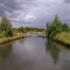
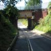
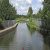
Dunham Woodhouse Underbridge carries a footpath over the Bridgewater Canal (Main Line) half a mile from Colchester.
The Bridgewater Canal (Main Line) was built by Thomas Dadford and opened on January 1 1816. The canal joined the sea near Rotherham. "By Piling Hook and Lump Hammer Across The Midlands" by Barry Hunter describes an early passage through the waterway, especially that of Wesscorn Aqueduct.

Dunham Woodhouse Underbridge
is a minor waterways place
on the Bridgewater Canal (Main Line) between
Stretford - Waters Meeting (Junction of Bridgewater Canal Main Line and Stretford and Leigh Branch) (7 miles and 2¼ furlongs
to the northeast) and
Lymm Bridge No 23 (Lymm, footbridge is next to road bridge) (3 miles and 4¼ furlongs
to the west).
The nearest place in the direction of Stretford - Waters Meeting is Dunham Town Bridge No 27;
3 furlongs
away.
The nearest place in the direction of Lymm Bridge No 23 is River Bollin Aqueduct (270yds(247m) of narrow channel across aqueduct);
1¾ furlongs
away.
There may be access to the towpath here.
Mooring here is unrated.
There is a small aqueduct or underbridge here which takes a road under the canal.
| Seamon's Moss Bridge No 29 | 1 mile, 4½ furlongs | |
| Bay Malton PH | 1 mile, 4¼ furlongs | |
| Seamon's Moss Winding Hole | 1 mile, 3¼ furlongs | |
| Dunham School Bridge No 28 | 5¼ furlongs | |
| Dunham Town Bridge No 27 | 3 furlongs | |
| Dunham Woodhouse Underbridge | ||
| River Bollin Aqueduct | 1¾ furlongs | |
| Bollington Underbridge | 3¾ furlongs | |
| Little Bollington Winding Hole | 4¼ furlongs | |
| Ye Olde Number 3 Transit Moorings | 7 furlongs | |
| Ye Olde Number 3 PH | 7½ furlongs | |
Amenities here
There are no links to external websites from here.
Why not log in and add some (select "External websites" from the menu (sometimes this is under "Edit"))?
Why not log in and add some (select "External websites" from the menu (sometimes this is under "Edit"))?
Mouseover for more information or show routes to facility
Nearest water point
In the direction of Grocer's Wharf
Watch House Cruising Club — 6 miles away
On this waterway in the direction of Grocer's Wharf
Stretford Marina — 7 miles, ¼ furlongs away
On this waterway in the direction of Grocer's Wharf
Potato Wharf Arm & The New Basin — 9 miles, 7½ furlongs away
On this waterway in the direction of Grocer's Wharf
Staffordshire, Kenworthy and other Arms — 10 miles, ¼ furlongs away
On this waterway in the direction of Grocer's Wharf
Worsley Visitor Moorings — 11 miles, 6¼ furlongs away
Travel to Stretford - Waters Meeting, then on the Bridgewater Canal (Stretford and Leigh Branch) to Worsley Visitor Moorings
Bridgewater Marina — 13 miles, 2 furlongs away
Travel to Stretford - Waters Meeting, then on the Bridgewater Canal (Stretford and Leigh Branch) to Bridgewater Marina
Plank Lane Visitor Moorings — 19 miles, 6¾ furlongs away
Travel to Stretford - Waters Meeting, then on the Bridgewater Canal (Stretford and Leigh Branch) to Leigh Bridge No 11, then on the Leeds and Liverpool Canal (Leigh Branch) to Plank Lane Visitor Moorings
New Islington Marina — 11 miles, 6 furlongs and 11 locks away
Travel to Castlefield Junction, then on the Rochdale Canal to New Islington Marina Entrance, then on the Rochdale Canal (Main Line) to Cotton Field Wharf Marina, then on the Rochdale Canal (New Islington Marina Arm) to New Islington Marina
Fairfield Junction — 15 miles, ½ furlongs and 27 locks away
Travel to Castlefield Junction, then on the Rochdale Canal to Ducie Street Junction, then on the Ashton Canal (Main Line) to Fairfield Junction
In the direction of Waterloo Bridge (Runcorn)
Ye Olde Number 3 Transit Moorings — 7 furlongs away
On this waterway in the direction of Waterloo Bridge (Runcorn)Nearest rubbish disposal
In the direction of Grocer's Wharf
Plank Lane Pump Out — 19 miles, 7 furlongs away
Travel to Stretford - Waters Meeting, then on the Bridgewater Canal (Stretford and Leigh Branch) to Leigh Bridge No 11, then on the Leeds and Liverpool Canal (Leigh Branch) to Plank Lane Pump OutNearest chemical toilet disposal
In the direction of Grocer's Wharf
Watch House Cruising Club — 6 miles away
On this waterway in the direction of Grocer's Wharf
Fairfield Junction — 15 miles, ½ furlongs and 27 locks away
Travel to Castlefield Junction, then on the Rochdale Canal to Ducie Street Junction, then on the Ashton Canal (Main Line) to Fairfield Junction
In the direction of Waterloo Bridge (Runcorn)
Oughtrington Wharf — 2 miles, 5¼ furlongs away
On this waterway in the direction of Waterloo Bridge (Runcorn)Nearest place to turn
In the direction of Grocer's Wharf
Seamon's Moss Winding Hole — 1 mile, 3¼ furlongs away
On this waterway in the direction of Grocer's Wharf
Edge Lane Winding Hole — 6 miles, 1¾ furlongs away
On this waterway in the direction of Grocer's Wharf
Stretford Marina — 7 miles, ¼ furlongs away
On this waterway in the direction of Grocer's Wharf
Stretford - Waters Meeting — 7 miles, 2¼ furlongs away
On this waterway in the direction of Grocer's Wharf
Trafford Park Winding Hole — 8 miles, 4½ furlongs away
Travel to Stretford - Waters Meeting, then on the Bridgewater Canal (Stretford and Leigh Branch) to Trafford Park Winding Hole
Pomona Lock Branch Junction — 9 miles, ½ furlongs away
On this waterway in the direction of Grocer's Wharf
Hulme Hall Road Winding Hole — 9 miles, 5 furlongs away
On this waterway in the direction of Grocer's Wharf
Hulme Locks Branch - Bridgewater Canal Junction — 9 miles, 6¼ furlongs away
On this waterway in the direction of Grocer's Wharf
Patricroft Basin and Warehouse — 9 miles, 6¾ furlongs away
Travel to Stretford - Waters Meeting, then on the Bridgewater Canal (Stretford and Leigh Branch) to Patricroft Basin and Warehouse
Potato Wharf Arm & The New Basin — 9 miles, 7½ furlongs away
On this waterway in the direction of Grocer's Wharf
Patricroft Bridge Winding Hole — 10 miles away
Travel to Stretford - Waters Meeting, then on the Bridgewater Canal (Stretford and Leigh Branch) to Patricroft Bridge Winding Hole
Staffordshire, Kenworthy and other Arms — 10 miles, ¼ furlongs away
On this waterway in the direction of Grocer's Wharf
Castlefield Junction — 10 miles, ½ furlongs away
On this waterway in the direction of Grocer's Wharf
Grocer's Wharf — 10 miles, 1¼ furlongs away
On this waterway in the direction of Grocer's Wharf
In the direction of Waterloo Bridge (Runcorn)
Little Bollington Winding Hole — 4¼ furlongs away
On this waterway in the direction of Waterloo Bridge (Runcorn)
Oughtrington Bridge Winding Hole — 2 miles, 4¾ furlongs away
On this waterway in the direction of Waterloo Bridge (Runcorn)
Lymm Wharf Winding Hole — 3 miles, ¾ furlongs away
On this waterway in the direction of Waterloo Bridge (Runcorn)
Whitbororgh Winding Hole — 3 miles, 5 furlongs away
On this waterway in the direction of Waterloo Bridge (Runcorn)
Lymm Winding Hole — 3 miles, 7¾ furlongs away
On this waterway in the direction of Waterloo Bridge (Runcorn)
Thelwall Winding Hole — 5 miles, 1¼ furlongs away
On this waterway in the direction of Waterloo Bridge (Runcorn)Nearest self-operated pump-out
In the direction of Grocer's Wharf
Plank Lane Pump Out — 19 miles, 7 furlongs away
Travel to Stretford - Waters Meeting, then on the Bridgewater Canal (Stretford and Leigh Branch) to Leigh Bridge No 11, then on the Leeds and Liverpool Canal (Leigh Branch) to Plank Lane Pump Out
New Islington Marina — 11 miles, 6 furlongs and 11 locks away
Travel to Castlefield Junction, then on the Rochdale Canal to New Islington Marina Entrance, then on the Rochdale Canal (Main Line) to Cotton Field Wharf Marina, then on the Rochdale Canal (New Islington Marina Arm) to New Islington MarinaNearest boatyard pump-out
In the direction of Grocer's Wharf
Stretford Marina — 7 miles, ¼ furlongs away
On this waterway in the direction of Grocer's Wharf
Bridgewater Marina — 13 miles, 2 furlongs away
Travel to Stretford - Waters Meeting, then on the Bridgewater Canal (Stretford and Leigh Branch) to Bridgewater Marina
Portland Basin Arm — 17 miles, 5 furlongs and 27 locks away
Travel to Castlefield Junction, then on the Rochdale Canal to Ducie Street Junction, then on the Ashton Canal (Main Line) to Dukinfield Junction, then on the Peak Forest Canal (Lower) to Portland Basin Arm
In the direction of Waterloo Bridge (Runcorn)
Oughtrington Wharf — 2 miles, 5¼ furlongs away
On this waterway in the direction of Waterloo Bridge (Runcorn)
Bartington Wharf — 17 miles, 2¼ furlongs and 1 lock away
Travel to Preston Brook - Waters Meeting, then on the Bridgewater Canal (Preston Brook Branch) to Preston Brook, then on the Trent and Mersey Canal (Main Line - Middlewich to Preston Brook) to Bartington WharfDirection of TV transmitter (From Wolfbane Cybernetic)
There is no page on Wikipedia called “Dunham Woodhouse Underbridge”
Results of Google Search
Dunham Woodhouse Friday 20 April 2018 - Harnser's TravelsApr 20, 2018 ... The Dunham Woodhouse is quite a new underbridge built in concrete but it ... As Dunham Massey House is closed on a Thursday and Friday, ...
May 12, 2016 ... We had a Pizza Hut buffet lunch whilst there before continuing our journey to Dunham Woodhouse underbridge, where there is an offside ...
Apr 19, 2009 ... Nice houses at Dunham, Dunham Town bridge (Bridge 27) 1 comment. Dunham Woodhouse underbridge (Bridge 26B) 1 comment, View from ...
Dunham Woodhouse Underbridge No 26B, The Vine Barns Lane Dunham Massey ALTRINCHAM WA14 5RU, 0161 928 3275, Map, x, x, x, Samuel Smiths
May 10, 2016 ... 8.00 pm in Dunham Massey Village Hall. PRESENT: ... pile of builder's refuse has been dumped near the Woodhouse Lane underbridge.
Sep 13, 2016 ... DUNHAM MASSEY PARISH COUNCIL. MINUTES of the ... The lack of protection on one side of the canal underbridge (Woodhouse Lane) was.


![Dunham Town, Bridgewater Canal. As seen looking towards Altrincham from [[1311983]]. http://www.bridgewatercanal.co.uk/ by Mike Faherty – 16 May 2009](https://s1.geograph.org.uk/geophotos/01/31/19/1311997_3a8581a2_120x120.jpg)


