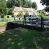
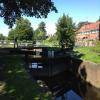
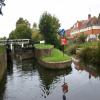
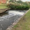
Barge Lock and Swing Bridge No 20
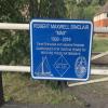
Max Sinclair Memorial Lock No.8
Also known as: Max Sinclair Lock
John Corbett Way, Vines Lane, Wychavon WR9 8LR, United Kingdom

Barge Lock and Swing Bridge No 20
is a place on the waterways
on the Droitwich Canals (Droitwich Barge Canal) between
Hawford Junction (Junction of Droitwich Canal with River Severn) (5 miles and 6¼ furlongs
and 8 locks
to the west) and
Droitwich Junction (Junction of Droitwich Barge Canal and Droitwich Junction Canal) (¼ furlongs
to the east).
The nearest place in the direction of Hawford Junction is Droitwich Town Wharf;
½ furlongs
away.
Mooring here is unrated.
There is a swing bridge here. The bridge requires a BW key to operate it.
This is a lock with a rise of 0’ 4”.
Saltway Footbridge No 17 | 1¼ furlongs | |
Saltway Footbridge No 18 | 1 furlong | |
Droitwich Barge Canal New Wharf | ¾ furlongs | |
Saltway Footbridge No 19 | ½ furlongs | |
Droitwich Town Wharf | ½ furlongs | |
Barge Lock and Swing Bridge No 20 | ||
Droitwich Junction | ¼ furlongs |
Amenities in Droitwich
Amenities at other places in Droitwich
at
at
at
at
at
at
at
at
at
at
at
at
at
at
at
at
at
at
at
at
at
at
at
There are no links to external websites from here.
Why not log in and add some (select "External websites" from the menu (sometimes this is under "Edit"))?
Mouseover for more information or show routes to facility
Nearest water point
In the direction of Hawford Junction
Netherwich Basin — 2½ furlongs and 1 lock away
On this waterway in the direction of Hawford Junction
Holt Lock (Holt Fleet) — 8 miles, 5¾ furlongs and 9 locks away
Travel to Hawford Junction, then on the River Severn (main river - Stourport to Worcester) to Holt Lock (Holt Fleet)
Worcester Trip Boat Moorings — 9 miles, 3¼ furlongs and 10 locks away
Travel to Hawford Junction, then on the River Severn (main river - Stourport to Worcester) to Worcester Trip Boat Moorings
Diglis Locks — 10 miles, 3¾ furlongs and 10 locks away
Travel to Hawford Junction, then on the River Severn (main river - Stourport to Worcester) to Diglis Junction, then on the River Severn (main river - Worcester to Gloucester) to Diglis Locks
Diglis Services — 10 miles, 3 furlongs and 12 locks away
Travel to Hawford Junction, then on the River Severn (main river - Stourport to Worcester) to Diglis Junction, then on the Worcester and Birmingham Canal (Diglis Junction to Diglis Basin) to Diglis Basin, then on the Worcester and Birmingham Canal (Diglis Basin to King's Norton Junction) to Diglis Services
Lincomb Lock — 12 miles, 7½ furlongs and 10 locks away
Travel to Hawford Junction, then on the River Severn (main river - Stourport to Worcester) to Lincomb Lock
Lowesmoor Basin — 11 miles, 2¾ furlongs and 14 locks away
Travel to Hawford Junction, then on the River Severn (main river - Stourport to Worcester) to Diglis Junction, then on the Worcester and Birmingham Canal (Diglis Junction to Diglis Basin) to Diglis Basin, then on the Worcester and Birmingham Canal (Diglis Basin to King's Norton Junction) to Lowesmoor Basin
Upper Basin Waterpoint — 14 miles, 3 furlongs and 13 locks away
Travel to Hawford Junction, then on the River Severn (main river - Stourport to Worcester) to Severn - Stourport Broad Locks Entrance, then on the Staffordshire and Worcestershire Canal (Stourport Basins: Broad Route) to Stourport Upper Basin, then on the Staffordshire and Worcestershire Canal (Stourport Basins: Narrow Route) to Upper Basin Waterpoint
Caldwall Mill Bridge No 14 — 18 miles, 1¼ furlongs and 16 locks away
Travel to Hawford Junction, then on the River Severn (main river - Stourport to Worcester) to Severn - Stourport Broad Locks Entrance, then on the Staffordshire and Worcestershire Canal (Stourport Basins: Broad Route) to Stourport Upper Basin, then on the Staffordshire and Worcestershire Canal (Stourport Basins: Narrow Route) to York Street Bridge, then on the Staffordshire and Worcestershire Canal (Main Line: Stourport to Stourton) to Caldwall Mill Bridge No 14
In the direction of Droitwich Junction
Droitwich Spa Marina — 1 mile, 1 furlong and 5 locks away
Travel to Droitwich Junction, then on the Droitwich Canals (Droitwich Junction Canal) to Droitwich Spa Marina
Hanbury Boatyard — 1 mile, 5 furlongs and 8 locks away
Travel to Droitwich Junction, then on the Droitwich Canals (Droitwich Junction Canal) to Hanbury Junction, then on the Worcester and Birmingham Canal (Diglis Basin to King's Norton Junction) to Hanbury Boatyard
Stoke Works Water Point — 4 miles, ½ furlongs and 14 locks away
Travel to Droitwich Junction, then on the Droitwich Canals (Droitwich Junction Canal) to Hanbury Junction, then on the Worcester and Birmingham Canal (Diglis Basin to King's Norton Junction) to Stoke Works Water Point
Tardebigge Wharf — 8 miles, ¾ furlongs and 50 locks away
Travel to Droitwich Junction, then on the Droitwich Canals (Droitwich Junction Canal) to Hanbury Junction, then on the Worcester and Birmingham Canal (Diglis Basin to King's Norton Junction) to Tardebigge Wharf
Hopwood Visitor Moorings — 13 miles, 4½ furlongs and 50 locks away
Travel to Droitwich Junction, then on the Droitwich Canals (Droitwich Junction Canal) to Hanbury Junction, then on the Worcester and Birmingham Canal (Diglis Basin to King's Norton Junction) to Hopwood Visitor Moorings
King's Norton Water Point — 16 miles, 6 furlongs and 50 locks away
Travel to Droitwich Junction, then on the Droitwich Canals (Droitwich Junction Canal) to Hanbury Junction, then on the Worcester and Birmingham Canal (Diglis Basin to King's Norton Junction) to King's Norton Water Point
Yardley Wood Water Point — 19 miles, 3¼ furlongs and 50 locks away
Travel to Droitwich Junction, then on the Droitwich Canals (Droitwich Junction Canal) to Hanbury Junction, then on the Worcester and Birmingham Canal (Diglis Basin to King's Norton Junction) to King's Norton Junction, then on the Stratford-on-Avon Canal (Northern Section) to Yardley Wood Water PointNearest rubbish disposal
In the direction of Hawford Junction
Netherwich Basin — 2½ furlongs and 1 lock away
On this waterway in the direction of Hawford Junction
Sabrina Footbridge — 9 miles, 1½ furlongs and 10 locks away
Travel to Hawford Junction, then on the River Severn (main river - Stourport to Worcester) to Sabrina Footbridge
Diglis Basin — 10 miles, 2½ furlongs and 12 locks away
Travel to Hawford Junction, then on the River Severn (main river - Stourport to Worcester) to Diglis Junction, then on the Worcester and Birmingham Canal (Diglis Junction to Diglis Basin) to Diglis Basin
Lowesmoor Basin — 11 miles, 2¾ furlongs and 14 locks away
Travel to Hawford Junction, then on the River Severn (main river - Stourport to Worcester) to Diglis Junction, then on the Worcester and Birmingham Canal (Diglis Junction to Diglis Basin) to Diglis Basin, then on the Worcester and Birmingham Canal (Diglis Basin to King's Norton Junction) to Lowesmoor Basin
Upper Basin Waterpoint — 14 miles, 3 furlongs and 13 locks away
Travel to Hawford Junction, then on the River Severn (main river - Stourport to Worcester) to Severn - Stourport Broad Locks Entrance, then on the Staffordshire and Worcestershire Canal (Stourport Basins: Broad Route) to Stourport Upper Basin, then on the Staffordshire and Worcestershire Canal (Stourport Basins: Narrow Route) to Upper Basin Waterpoint
In the direction of Droitwich Junction
Droitwich Spa Marina — 1 mile, 1 furlong and 5 locks away
Travel to Droitwich Junction, then on the Droitwich Canals (Droitwich Junction Canal) to Droitwich Spa Marina
Stoke Bottom Lock No 23 — 4 miles, 6¼ furlongs and 14 locks away
Travel to Droitwich Junction, then on the Droitwich Canals (Droitwich Junction Canal) to Hanbury Junction, then on the Worcester and Birmingham Canal (Diglis Basin to King's Norton Junction) to Stoke Bottom Lock No 23
Tardebigge Wharf — 8 miles, ¾ furlongs and 50 locks away
Travel to Droitwich Junction, then on the Droitwich Canals (Droitwich Junction Canal) to Hanbury Junction, then on the Worcester and Birmingham Canal (Diglis Basin to King's Norton Junction) to Tardebigge WharfNearest chemical toilet disposal
In the direction of Droitwich Junction
Droitwich Spa Marina — 1 mile, 1 furlong and 5 locks away
Travel to Droitwich Junction, then on the Droitwich Canals (Droitwich Junction Canal) to Droitwich Spa Marina
Stoke Bottom Lock No 23 — 4 miles, 6¼ furlongs and 14 locks away
Travel to Droitwich Junction, then on the Droitwich Canals (Droitwich Junction Canal) to Hanbury Junction, then on the Worcester and Birmingham Canal (Diglis Basin to King's Norton Junction) to Stoke Bottom Lock No 23
Tardebigge Wharf — 8 miles, ¾ furlongs and 50 locks away
Travel to Droitwich Junction, then on the Droitwich Canals (Droitwich Junction Canal) to Hanbury Junction, then on the Worcester and Birmingham Canal (Diglis Basin to King's Norton Junction) to Tardebigge Wharf
In the direction of Hawford Junction
Diglis Services — 10 miles, 3 furlongs and 12 locks away
Travel to Hawford Junction, then on the River Severn (main river - Stourport to Worcester) to Diglis Junction, then on the Worcester and Birmingham Canal (Diglis Junction to Diglis Basin) to Diglis Basin, then on the Worcester and Birmingham Canal (Diglis Basin to King's Norton Junction) to Diglis Services
Stourport Marina — 13 miles, 3 furlongs and 11 locks away
Travel to Hawford Junction, then on the River Severn (main river - Stourport to Worcester) to Stourport Marina
Lowesmoor Basin — 11 miles, 2¾ furlongs and 14 locks away
Travel to Hawford Junction, then on the River Severn (main river - Stourport to Worcester) to Diglis Junction, then on the Worcester and Birmingham Canal (Diglis Junction to Diglis Basin) to Diglis Basin, then on the Worcester and Birmingham Canal (Diglis Basin to King's Norton Junction) to Lowesmoor Basin
Upper Basin Waterpoint — 14 miles, 3 furlongs and 13 locks away
Travel to Hawford Junction, then on the River Severn (main river - Stourport to Worcester) to Severn - Stourport Broad Locks Entrance, then on the Staffordshire and Worcestershire Canal (Stourport Basins: Broad Route) to Stourport Upper Basin, then on the Staffordshire and Worcestershire Canal (Stourport Basins: Narrow Route) to Upper Basin Waterpoint
Caldwall Mill Bridge No 14 — 18 miles, 1¼ furlongs and 16 locks away
Travel to Hawford Junction, then on the River Severn (main river - Stourport to Worcester) to Severn - Stourport Broad Locks Entrance, then on the Staffordshire and Worcestershire Canal (Stourport Basins: Broad Route) to Stourport Upper Basin, then on the Staffordshire and Worcestershire Canal (Stourport Basins: Narrow Route) to York Street Bridge, then on the Staffordshire and Worcestershire Canal (Main Line: Stourport to Stourton) to Caldwall Mill Bridge No 14Nearest place to turn
In the direction of Hawford Junction
Droitwich Town Wharf — ½ furlongs and 1 lock away
On this waterway in the direction of Hawford Junction
Netherwich Basin — 2½ furlongs and 1 lock away
On this waterway in the direction of Hawford Junction
Winding Hole (east of Salwarpe Road Bridge) — 4 furlongs and 1 lock away
On this waterway in the direction of Hawford Junction
Ladywood Top Lock Winding Hole — 3 miles, ½ furlongs and 1 lock away
On this waterway in the direction of Hawford Junction
Bevere Lock Weir Entrance — 6 miles, ¼ furlongs and 9 locks away
Travel to Hawford Junction, then on the River Severn (main river - Stourport to Worcester) to Bevere Lock Weir Entrance
Bevere Lock Weir Exit — 6 miles, 3 furlongs and 10 locks away
Travel to Hawford Junction, then on the River Severn (main river - Stourport to Worcester) to Bevere Lock Weir Exit
Holt Lock Weir Exit — 8 miles, 4¾ furlongs and 9 locks away
Travel to Hawford Junction, then on the River Severn (main river - Stourport to Worcester) to Holt Lock Weir Exit
Holt Lock Weir Entrance — 9 miles, ¼ furlongs and 10 locks away
Travel to Hawford Junction, then on the River Severn (main river - Stourport to Worcester) to Holt Lock Weir Entrance
Diglis Junction — 10 miles, 1½ furlongs and 10 locks away
Travel to Hawford Junction, then on the River Severn (main river - Stourport to Worcester) to Diglis Junction
Diglis Locks Weir Exit — 10 miles, 4½ furlongs and 11 locks away
Travel to Hawford Junction, then on the River Severn (main river - Stourport to Worcester) to Diglis Junction, then on the River Severn (main river - Worcester to Gloucester) to Diglis Locks Weir Exit
In the direction of Droitwich Junction
Lock No 6 Winding Hole — 6 furlongs and 3 locks away
Travel to Droitwich Junction, then on the Droitwich Canals (Droitwich Junction Canal) to Lock No 6 Winding Hole
Droitwich Spa Marina — 1 mile, 1 furlong and 5 locks away
Travel to Droitwich Junction, then on the Droitwich Canals (Droitwich Junction Canal) to Droitwich Spa Marina
Hanbury Junction — 1 mile, 4¼ furlongs and 8 locks away
Travel to Droitwich Junction, then on the Droitwich Canals (Droitwich Junction Canal) to Hanbury Junction
Hanbury Boatyard — 1 mile, 5 furlongs and 8 locks away
Travel to Droitwich Junction, then on the Droitwich Canals (Droitwich Junction Canal) to Hanbury Junction, then on the Worcester and Birmingham Canal (Diglis Basin to King's Norton Junction) to Hanbury Boatyard
Hanbury Junction Winding Hole — 1 mile, 5½ furlongs and 8 locks away
Travel to Droitwich Junction, then on the Droitwich Canals (Droitwich Junction Canal) to Hanbury Junction, then on the Worcester and Birmingham Canal (Diglis Basin to King's Norton Junction) to Hanbury Junction Winding Hole
Dunhampstead Boatyard — 3 miles, 3½ furlongs and 8 locks away
Travel to Droitwich Junction, then on the Droitwich Canals (Droitwich Junction Canal) to Hanbury Junction, then on the Worcester and Birmingham Canal (Diglis Basin to King's Norton Junction) to Dunhampstead Boatyard
Dunhampstead Winding Hole — 3 miles, 5¾ furlongs and 8 locks away
Travel to Droitwich Junction, then on the Droitwich Canals (Droitwich Junction Canal) to Hanbury Junction, then on the Worcester and Birmingham Canal (Diglis Basin to King's Norton Junction) to Dunhampstead Winding Hole
Tibberton Winding Hole — 4 miles, 5¼ furlongs and 8 locks away
Travel to Droitwich Junction, then on the Droitwich Canals (Droitwich Junction Canal) to Hanbury Junction, then on the Worcester and Birmingham Canal (Diglis Basin to King's Norton Junction) to Tibberton Winding Hole
Astwood Winding Hole — 3 miles, 1¾ furlongs and 10 locks away
Travel to Droitwich Junction, then on the Droitwich Canals (Droitwich Junction Canal) to Hanbury Junction, then on the Worcester and Birmingham Canal (Diglis Basin to King's Norton Junction) to Astwood Winding Hole
Stoke Wharf — 4 miles, 6¾ furlongs and 15 locks away
Travel to Droitwich Junction, then on the Droitwich Canals (Droitwich Junction Canal) to Hanbury Junction, then on the Worcester and Birmingham Canal (Diglis Basin to King's Norton Junction) to Stoke WharfNearest self-operated pump-out
In the direction of Droitwich Junction
Droitwich Spa Marina — 1 mile, 1 furlong and 5 locks away
Travel to Droitwich Junction, then on the Droitwich Canals (Droitwich Junction Canal) to Droitwich Spa Marina
In the direction of Hawford Junction
Diglis Services — 10 miles, 3 furlongs and 12 locks away
Travel to Hawford Junction, then on the River Severn (main river - Stourport to Worcester) to Diglis Junction, then on the Worcester and Birmingham Canal (Diglis Junction to Diglis Basin) to Diglis Basin, then on the Worcester and Birmingham Canal (Diglis Basin to King's Norton Junction) to Diglis ServicesNearest boatyard pump-out
In the direction of Droitwich Junction
Hanbury Boatyard — 1 mile, 5 furlongs and 8 locks away
Travel to Droitwich Junction, then on the Droitwich Canals (Droitwich Junction Canal) to Hanbury Junction, then on the Worcester and Birmingham Canal (Diglis Basin to King's Norton Junction) to Hanbury Boatyard
Dunhampstead Boatyard — 3 miles, 3½ furlongs and 8 locks away
Travel to Droitwich Junction, then on the Droitwich Canals (Droitwich Junction Canal) to Hanbury Junction, then on the Worcester and Birmingham Canal (Diglis Basin to King's Norton Junction) to Dunhampstead Boatyard
In the direction of Hawford Junction
Stourport Marina — 13 miles, 3 furlongs and 11 locks away
Travel to Hawford Junction, then on the River Severn (main river - Stourport to Worcester) to Stourport Marina
Lowesmoor Basin — 11 miles, 2¾ furlongs and 14 locks away
Travel to Hawford Junction, then on the River Severn (main river - Stourport to Worcester) to Diglis Junction, then on the Worcester and Birmingham Canal (Diglis Junction to Diglis Basin) to Diglis Basin, then on the Worcester and Birmingham Canal (Diglis Basin to King's Norton Junction) to Lowesmoor Basin
Stourport Upper Basin — 14 miles, 2¾ furlongs and 13 locks away
Travel to Hawford Junction, then on the River Severn (main river - Stourport to Worcester) to Severn - Stourport Broad Locks Entrance, then on the Staffordshire and Worcestershire Canal (Stourport Basins: Broad Route) to Stourport Upper Basin
Upper Staircase Lock Landing Pontoon — 14 miles, 3½ furlongs and 13 locks away
Travel to Hawford Junction, then on the River Severn (main river - Stourport to Worcester) to Severn - Stourport Broad Locks Entrance, then on the Staffordshire and Worcestershire Canal (Stourport Basins: Broad Route) to Stourport Upper Basin, then on the Staffordshire and Worcestershire Canal (Stourport Basins: Narrow Route) to Upper Staircase Lock Landing PontoonDirection of TV transmitter (From Wolfbane Cybernetic)
Uncharted waters from Scribblings from the Mintball posted Tuesday the 23rd of September, 2014
There is no page on Wikipedia called “Barge Lock and Swing Bridge”
Wikipedia pages that might relate to Barge Lock and Swing Bridge
[Lock (water navigation)]
to strike bridges or get stuck. "Lock mooring" was a commonly used method of navigating into a lock by a barge travelling upstream. The barge would be
[Dutch barge]
13 m) narrow lock The Barge Association ( or "DBA"): A British club for barge enthusiasts. Trekschuit Dutch barge "Hosanna" Dutch barge "Princess Matilda"
[Caledonian Canal]
Bottom Lock Corpach sea lock A sailingboat on the Caledonian Canal approaches from the Loch Linnhe side of the Mallaig Extension Railway swing bridge. Lord
[River Ouse, Sussex]
identified as Pikesbridge Upper and Lower Lock on the 1875 map. Each was 52.5 by 13.5 feet (16.0 by 4.1 m), and the barges used on the navigation could carry
[Welland Canal]
The original bridges across the fourth canal were numbered in order. Numbering was not changed as bridges were removed. Container on barge "The Welland
[Barton Swing Aqueduct]
to pass through and smaller craft, both narrowboats and broad-beam barges to cross over the top. The aqueduct, the first and only swing aqueduct in the
[Bonneville Dam]
swing bridge begins to open as a barge approaches the Bonneville Navigation Locks The swing bridge is open as a barge approaches the Bonneville Navigation
[Bridgwater and Taunton Canal]
basins were connected by a lock, whilst towards the river a ship lock consisting of a single 40-foot (12 m) gate, and a barge lock, consisting of a pair of
[Stainforth and Keadby Canal]
the bridge, Keadby gas-fired power station is located on the north bank. The final bridge is Keadby Swing Bridge, situated at the head of Keadby Lock. The
[Bridge of the Americas]
bridge, built into the lock structure at Gatún, and a swinging road/rail bridge constructed in 1942 at Miraflores. The Centennial Bridge was constructed to
Results of Google Search
New York State Barge Canal Historic District. National ... East Side of Oswego River, State Street at end of Lock Street, Village of Phoenix,. Oswego ... number of bascule and swing bridges were built, including three at Phoenix. In other ... ( later 20') above the water, structures were built that could accommodate installation.
All elevations are in Barge Canal Datum (BCD), which was established prior to the ... can be obtained by calling the nearest lock and asking for the gage reading of either the upper or lower pool. ... 39.29, Bridge E-20, catwalk (Lock E11), 267.00, 23.95, 269.00, 21.95, E11 upper ... Oneida Lake - No Overhead Obstructions.
Oct 29, 2016 ... The swing bridge connects Rock Island and Davenport over the ... Operators in the tower control the speed of the swing span, using line of sight to perfectly permit passage of barges, ... The lock system raised the water in the pool above it by nearly 20 ... Communication does not shut down with the river.
Sep 18, 2011 ... Fort Madison Swing Bridge & Barge. jfreelan1964. Loading. ... "Oh no no no... have to put on the boots, hard hat, belt......" she lasted 45 minutes.
Bonneville Lock and Dam /ˈbɒnəvɪl/ consists of several run-of-the-river dam structures that ... Catchment area, 240,000 sq mi (620,000 km2). Power Station. Turbines, 20 ... NRHP reference No. 86000727 (original) 86003598 (increase). Significant dates.
OMB No. 10024-0018. United States Department of the Interior National Park Service ... and carries heavy commercial traffic as well as some recreational boat traffic. ... History The first Great Bridge Lock was built by the Albemarle & Chesapeake ... present swing-bridges over the canal were built between 1941 and 1955.
"Scene in Buffalo Harbor Showing Coal Docks, Buffalo, N.Y." (no publisher information) ... Erie Canal, Buffalo, N.Y." (7211, no publisher info.) -- Postcard ; postmarked Jul. 20, 1918. ... Erie Canal and Bridge, Gasport, N.Y., Barge Canal, Contract No. ... "Swing Bridge, Erie Canal, Albion, N.Y." 1125 - no publisher information)Â ...
The Bridgwater and Taunton Canal is a canal in the south-west of England between Bridgwater and Taunton, opened in 1827 and linking the River Tone to the River Parrett. There were a number of abortive schemes to link the Bristol Channel to the ... The concrete wall across the barge lock was removed, but there was no ...
Mar 24, 2016 ... The problem arose with the building of Lock and Dam No. 9 in 1937, creating Pool 9. “We have four tugs, 20 barges and a large amount of land equipment ... Michael G. transits the Dubuque Rail Bridge, a swing bridge across ...