

Aylestone Gasometer Pipe Bridge
Grand Union Canal Towpath, Leicester LE2 8TB, United Kingdom
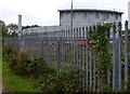
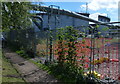
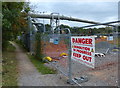
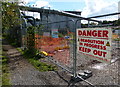
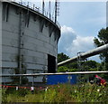
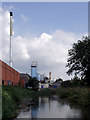
Aylestone Gasometer Pipe Bridge carries a footpath over the Grand Union Canal (Leicester Section - River Soar Navigation).
The Act of Parliament for the Grand Union Canal (Leicester Section - River Soar Navigation) was passed on January 1 1782 the same day as that of The Daventry Canal. "Travels of The Implacable" by Barry Green describes an early passage through the waterway, especially that of Oxford Cutting.

Aylestone Gasometer Pipe Bridge
is a minor waterways place
on the Grand Union Canal (Leicester Section - River Soar Navigation) between
River Soar Junction (Junction of GU Leicester Section and River Soar Navigation) (1 mile and 2 furlongs
and 1 lock
to the southwest) and
Soar Lane Bridge No 3 (1 mile and 6¼ furlongs
and 2 locks
to the north).
The nearest place in the direction of River Soar Junction is Aylestone Road Arm;
1¾ furlongs
away.
The nearest place in the direction of Soar Lane Bridge No 3 is St Marys Mill Lock No 40;
1¾ furlongs
away.
Mooring here is unrated.
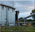
There is a bridge here which takes a pipe over the canal.
| Freestone Bridge No 106 | 1 mile, ¾ furlongs | |
| Parsons Bridge No 107 | 6¼ furlongs | |
| Aylestone Mill Lock No 39 | 3½ furlongs | |
| Aylestone Mill Bridge No 108 | 3¼ furlongs | |
| Aylestone Road Arm | 1¾ furlongs | |
| Aylestone Gasometer Pipe Bridge | ||
St Marys Mill Lock No 40  | 1¾ furlongs | |
| Branch of the Soar Junction | 3 furlongs | |
| Echo Railway Bridge | 3¼ furlongs | |
| Leicester City Football Club | 4 furlongs | |
| Freeman's Lock No 41 | 4¼ furlongs | |
Amenities here
 Bus stop (Boundary Road)
Bus stop (Gas Museum)
Bus stop (Gas Museum)
Bus stop (Meredith Road)
Bus stop (Boundary Road)
Bus stop (Boundary Road)
Bus stop (Gas Museum)
Bus stop (Gas Museum)
Bus stop (Meredith Road)
Amenities nearby at Aylestone Road Arm
 Cashpoint TSB
 Halfords Homebase Plumbing Trade Supplies Screwfix Bus stop (Aston Hill)
Bus stop (Aston Hill)
Bus stop (Aylestone Leisure Centre)
Bus stop (Aylestone Leisure Centre)
Bus stop (Cavendish Road)
Bus stop (Cavendish Road)
Bus stop (Hawkins Road)
Bus stop (Hawkins Road)
Bus stop (Lansdowne Road)
Bus stop (Lothair Road)
Bus stop (Lothair Road)
Bus stop (Recreation Ground)
Bus stop (Recreation Ground)
Halfords Homebase Plumbing Trade Supplies Screwfix Bus stop (Aston Hill)
Bus stop (Aston Hill)
Bus stop (Aylestone Leisure Centre)
Bus stop (Aylestone Leisure Centre)
Bus stop (Cavendish Road)
Bus stop (Cavendish Road)
Bus stop (Hawkins Road)
Bus stop (Hawkins Road)
Bus stop (Lansdowne Road)
Bus stop (Lothair Road)
Bus stop (Lothair Road)
Bus stop (Recreation Ground)
Bus stop (Recreation Ground)
Amenities nearby at St Marys Mill Lock No 40
 KFC Cashpoint Bus stop (Barbara Road)
Bus stop (Collingham Road)
Bus stop (Dumbleton Avenue)
Bus stop (Dumbleton Avenue)
Bus stop (Ellesmere Road)
Bus stop (Ellesmere Road)
Bus stop (Fulhurst Avenue)
Bus stop (Fulhurst Avenue)
Bus stop (Fullhurst Avenue)
Bus stop (Fullhurst Avenue)
Bus stop (Harlaxton Street)
Bus stop (Harlaxton Street)
Bus stop (Hopefield Road)
Bus stop (Medical Centre)
Bus stop (Medical Centre)
Bus stop (Meredith Road)
Bus stop (Roundhay Road)
Bus stop (Somerville Road)
Bus stop (Somerville Road)
KFC Cashpoint Bus stop (Barbara Road)
Bus stop (Collingham Road)
Bus stop (Dumbleton Avenue)
Bus stop (Dumbleton Avenue)
Bus stop (Ellesmere Road)
Bus stop (Ellesmere Road)
Bus stop (Fulhurst Avenue)
Bus stop (Fulhurst Avenue)
Bus stop (Fullhurst Avenue)
Bus stop (Fullhurst Avenue)
Bus stop (Harlaxton Street)
Bus stop (Harlaxton Street)
Bus stop (Hopefield Road)
Bus stop (Medical Centre)
Bus stop (Medical Centre)
Bus stop (Meredith Road)
Bus stop (Roundhay Road)
Bus stop (Somerville Road)
Bus stop (Somerville Road)
- Grand Union Canal Walk — associated with Grand Union Canal
- An illustrated walk along the Grand Union Canal from London to Birmingham
Mouseover for more information or show routes to facility
Nearest water point
In the direction of Trent Junction
Friars Mill Visitor Moorings — 1 mile, 5 furlongs and 2 locks away
On this waterway in the direction of Trent Junction
Hope and Anchor Bridge No 19 — 7 miles, 4¾ furlongs and 7 locks away
On this waterway in the direction of Trent Junction
Barrow Boating — 13 miles, 1¾ furlongs and 11 locks away
On this waterway in the direction of Trent Junction
Loughborough Basin — 17 miles, 3 furlongs and 13 locks away
Travel to Loughborough Branch Junction, then on the Grand Union Canal (Leicester Section - Loughborough Branch) to Loughborough Basin
Bishop Meadow Lock No 54 — 18 miles, 1¾ furlongs and 14 locks away
On this waterway in the direction of Trent Junction
In the direction of River Soar Junction
Kilby Bridge No 87 — 6 miles, 6¾ furlongs and 10 locks away
Travel to River Soar Junction, then on the Grand Union Canal (Leicester Section - Leicestershire and Northamptonshire Union Canal) to Kilby Bridge No 87
Foxton Junction — 16 miles, 5 furlongs and 22 locks away
Travel to River Soar Junction, then on the Grand Union Canal (Leicester Section - Leicestershire and Northamptonshire Union Canal) to Foxton Junction
Inclined Plane Upper Access Arm Junction — 17 miles, ¼ furlongs and 22 locks away
Travel to River Soar Junction, then on the Grand Union Canal (Leicester Section - Leicestershire and Northamptonshire Union Canal) to Foxton Junction, then on the Grand Union Canal (Leicester Section - Market Harborough Branch) to Inclined Plane Lower Access Arm Junction, then on the Grand Union Canal (Leicester Section - Inclined Plane Branch) to Inclined Plane Upper Access Arm JunctionNearest rubbish disposal
In the direction of Trent Junction
Broome Island — 12 miles, 3½ furlongs and 11 locks away
On this waterway in the direction of Trent Junction
Barrow Boating — 13 miles, 1¾ furlongs and 11 locks away
On this waterway in the direction of Trent Junction
Loughborough Basin — 17 miles, 3 furlongs and 13 locks away
Travel to Loughborough Branch Junction, then on the Grand Union Canal (Leicester Section - Loughborough Branch) to Loughborough Basin
In the direction of River Soar Junction
Kilby Bridge No 87 — 6 miles, 6¾ furlongs and 10 locks away
Travel to River Soar Junction, then on the Grand Union Canal (Leicester Section - Leicestershire and Northamptonshire Union Canal) to Kilby Bridge No 87
Foxton Junction Swing Bridge — 16 miles, 5½ furlongs and 22 locks away
Travel to River Soar Junction, then on the Grand Union Canal (Leicester Section - Leicestershire and Northamptonshire Union Canal) to Foxton Junction, then on the Grand Union Canal (Leicester Section - Market Harborough Branch) to Foxton Junction Swing BridgeNearest chemical toilet disposal
In the direction of Trent Junction
Sileby Mill Mooring Basin — 10 miles, 5½ furlongs and 10 locks away
On this waterway in the direction of Trent Junction
Barrow Boating — 13 miles, 1¾ furlongs and 11 locks away
On this waterway in the direction of Trent Junction
In the direction of River Soar Junction
Kilby Bridge No 87 — 6 miles, 6¾ furlongs and 10 locks away
Travel to River Soar Junction, then on the Grand Union Canal (Leicester Section - Leicestershire and Northamptonshire Union Canal) to Kilby Bridge No 87
Foxton Junction Swing Bridge — 16 miles, 5½ furlongs and 22 locks away
Travel to River Soar Junction, then on the Grand Union Canal (Leicester Section - Leicestershire and Northamptonshire Union Canal) to Foxton Junction, then on the Grand Union Canal (Leicester Section - Market Harborough Branch) to Foxton Junction Swing BridgeNearest place to turn
In the direction of Trent Junction
Memory Lane Wharf — 2 miles, 5¼ furlongs and 3 locks away
On this waterway in the direction of Trent Junction
Belgrave Circle Arm (disused) — 2 miles, 6¼ furlongs and 4 locks away
On this waterway in the direction of Trent Junction
Entrance to Riverside Lakes — 4 miles, ¾ furlongs and 5 locks away
On this waterway in the direction of Trent Junction
Birstall Lock Winding Hole — 5 miles, 2¼ furlongs and 5 locks away
On this waterway in the direction of Trent Junction
White Horse Lane Junction — 5 miles, 3½ furlongs and 6 locks away
On this waterway in the direction of Trent Junction
Leicester Marina Entrance — 6 miles, 1¼ furlongs and 6 locks away
On this waterway in the direction of Trent Junction
Thurmaston Lock Arm — 6 miles, 2¾ furlongs and 6 locks away
On this waterway in the direction of Trent Junction
MGM Boats Winding Hole — 6 miles, 3¼ furlongs and 7 locks away
On this waterway in the direction of Trent Junction
MGM Boats, Thurmaston — 6 miles, 4 furlongs and 7 locks away
On this waterway in the direction of Trent Junction
Old Junction Boatyard (Syston) — 8 miles, ½ furlongs and 7 locks away
On this waterway in the direction of Trent Junction
River Wreake Junction — 8 miles, 1 furlong and 7 locks away
On this waterway in the direction of Trent Junction
Wreake Outlet by Junction Lock No 47 — 8 miles, 5½ furlongs and 8 locks away
On this waterway in the direction of Trent Junction
Wreake Mouth — 9 miles, ¾ furlongs and 8 locks away
On this waterway in the direction of Trent Junction
Cossington Mill Stream Junction — 9 miles, 2½ furlongs and 9 locks away
On this waterway in the direction of Trent Junction
Loughborough Road Winding Hole — 9 miles, 3 furlongs and 9 locks away
On this waterway in the direction of Trent Junction
Sileby Mill — 10 miles, 4¾ furlongs and 10 locks away
On this waterway in the direction of Trent Junction
Sileby Mill Mooring Basin — 10 miles, 5½ furlongs and 10 locks away
On this waterway in the direction of Trent Junction
In the direction of River Soar Junction
Blaby Bridge Winding Hole — 3 miles, 5¾ furlongs and 5 locks away
Travel to River Soar Junction, then on the Grand Union Canal (Leicester Section - Leicestershire and Northamptonshire Union Canal) to Blaby Bridge Winding Hole
Bush Lock Winding Hole — 4 miles, 6¾ furlongs and 6 locks away
Travel to River Soar Junction, then on the Grand Union Canal (Leicester Section - Leicestershire and Northamptonshire Union Canal) to Bush Lock Winding Hole
Kilby Bridge Winding Hole — 6 miles, 5¾ furlongs and 10 locks away
Travel to River Soar Junction, then on the Grand Union Canal (Leicester Section - Leicestershire and Northamptonshire Union Canal) to Kilby Bridge Winding HoleNearest self-operated pump-out
In the direction of River Soar Junction
Kilby Bridge No 87 — 6 miles, 6¾ furlongs and 10 locks away
Travel to River Soar Junction, then on the Grand Union Canal (Leicester Section - Leicestershire and Northamptonshire Union Canal) to Kilby Bridge No 87Nearest boatyard pump-out
In the direction of Trent Junction
Sileby Mill Mooring Basin — 10 miles, 5½ furlongs and 10 locks away
On this waterway in the direction of Trent JunctionDirection of TV transmitter (From Wolfbane Cybernetic)










There is no page on Wikipedia called “Aylestone Gasometer Pipe Bridge”