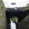
Smithy Holme Bridge No 56
is a minor waterways place
on the Huddersfield Narrow Canal between
Railway Lock No 42E (Marsden. Eastern summit lock) (2½ furlongs
and 3 locks
to the west) and
Titanic Mill (Linthwaite) (3 miles and 3 furlongs
and 22 locks
to the east).
The nearest place in the direction of Railway Lock No 42E is Warehouse Hill Lock No 39E;
¼ furlongs
away.
The nearest place in the direction of Titanic Mill is Colne Lock No 38E;
¼ furlongs
away.
There may be access to the towpath here.
Mooring here is unrated.
There is a bridge here which takes a minor road over the canal.
Station Approach Bridge No 59 | 2¼ furlongs | |
Goods Yard Bridge No 58 | 2 furlongs | |
Dirker Lock No 41E | 1½ furlongs | |
Hopper Lock No 40E | 1 furlong | |
Warehouse Hill Lock No 39E | ¼ furlongs | |
Smithy Holme Bridge No 56 | ||
Colne Lock No 38E | ¼ furlongs | |
Smudger's Lock No 37E | ¾ furlongs | |
White Skye Lock No 36E | 1¼ furlongs | |
White Syke Bridge No 55 | 1¼ furlongs | |
Moorvale Lock No 35E | 1¾ furlongs |
There are no links to external websites from here.
Why not log in and add some (select "External websites" from the menu (sometimes this is under "Edit"))?
Mouseover for more information or show routes to facility
Nearest water point
In the direction of Ashton-under-Lyne Junction
Standedge Tunnel (eastern entrance) — 7½ furlongs and 4 locks away
On this waterway in the direction of Ashton-under-Lyne Junction
Standedge Tunnel (western entrance) — 4 miles, 1½ furlongs and 4 locks away
On this waterway in the direction of Ashton-under-Lyne Junction
Wool Road Bridge No 70 — 6 miles, 1¼ furlongs and 13 locks away
On this waterway in the direction of Ashton-under-Lyne Junction
Grove Road Bridge No 96 — 12 miles, 1½ furlongs and 28 locks away
On this waterway in the direction of Ashton-under-Lyne Junction
Fairfield Junction — 19 miles, 5½ furlongs and 36 locks away
Travel to Ashton-under-Lyne Junction, then on the Ashton Canal (Main Line) to Fairfield Junction
In the direction of Aspley Basin (Huddersfield)
Slaithwaite Winding Hole — 2 miles, 3¼ furlongs and 17 locks away
On this waterway in the direction of Aspley Basin (Huddersfield)
Waterside Lock No 21E — 2 miles, 4 furlongs and 17 locks away
On this waterway in the direction of Aspley Basin (Huddersfield)
Aspley Basin (Huddersfield) — 7 miles, 1½ furlongs and 38 locks away
On this waterway in the direction of Aspley Basin (Huddersfield)
Shepley Bridge Sanitary Station — 13 miles, 6¼ furlongs and 49 locks away
Travel to Aspley Basin (Huddersfield), then on the Huddersfield Broad Canal to Cooper Bridge Junction, then on the Calder and Hebble Navigation (Main Line) to Shepley Bridge Sanitary Station
Brighouse Basin — 13 miles and 51 locks away
Travel to Aspley Basin (Huddersfield), then on the Huddersfield Broad Canal to Cooper Bridge Junction, then on the Calder and Hebble Navigation (Main Line) to Brighouse Basin
Salterhebble Sanitary Station — 17 miles, 2 furlongs and 60 locks away
Travel to Aspley Basin (Huddersfield), then on the Huddersfield Broad Canal to Cooper Bridge Junction, then on the Calder and Hebble Navigation (Main Line) to Salterhebble Sanitary Station
Salterhebble Junction — 17 miles, 2½ furlongs and 61 locks away
Travel to Aspley Basin (Huddersfield), then on the Huddersfield Broad Canal to Cooper Bridge Junction, then on the Calder and Hebble Navigation (Main Line) to Salterhebble Junction
Sowerby Bridge Basin — 19 miles, 4¼ furlongs and 61 locks away
Travel to Aspley Basin (Huddersfield), then on the Huddersfield Broad Canal to Cooper Bridge Junction, then on the Calder and Hebble Navigation (Main Line) to Salterhebble Junction, then on the Calder and Hebble Navigation (Main Line) to Sowerby Bridge BasinNearest rubbish disposal
In the direction of Ashton-under-Lyne Junction
Wool Road Visitor Mooring — 6 miles, 1¾ furlongs and 13 locks away
On this waterway in the direction of Ashton-under-Lyne Junction
In the direction of Aspley Basin (Huddersfield)
Pickle Lock No 22E — 2 miles, 2¾ furlongs and 16 locks away
On this waterway in the direction of Aspley Basin (Huddersfield)
Aspley Basin (Huddersfield) — 7 miles, 1½ furlongs and 38 locks away
On this waterway in the direction of Aspley Basin (Huddersfield)
Shepley Bridge Sanitary Station — 13 miles, 6¼ furlongs and 49 locks away
Travel to Aspley Basin (Huddersfield), then on the Huddersfield Broad Canal to Cooper Bridge Junction, then on the Calder and Hebble Navigation (Main Line) to Shepley Bridge Sanitary Station
Brighouse Lower Basin Visitor Moorings — 12 miles, 7¾ furlongs and 50 locks away
Travel to Aspley Basin (Huddersfield), then on the Huddersfield Broad Canal to Cooper Bridge Junction, then on the Calder and Hebble Navigation (Main Line) to Brighouse Lower Basin Visitor Moorings
Horbury Basin Residential Moorings & Sanitary Station — 18 miles, 2½ furlongs and 56 locks away
Travel to Aspley Basin (Huddersfield), then on the Huddersfield Broad Canal to Cooper Bridge Junction, then on the Calder and Hebble Navigation (Main Line) to Horbury Basin Residential Moorings & Sanitary Station
Salterhebble Sanitary Station — 17 miles, 2 furlongs and 60 locks away
Travel to Aspley Basin (Huddersfield), then on the Huddersfield Broad Canal to Cooper Bridge Junction, then on the Calder and Hebble Navigation (Main Line) to Salterhebble Sanitary Station
Sowerby Bridge Basin — 19 miles, 4¼ furlongs and 61 locks away
Travel to Aspley Basin (Huddersfield), then on the Huddersfield Broad Canal to Cooper Bridge Junction, then on the Calder and Hebble Navigation (Main Line) to Salterhebble Junction, then on the Calder and Hebble Navigation (Main Line) to Sowerby Bridge BasinNearest chemical toilet disposal
In the direction of Ashton-under-Lyne Junction
Wool Road Bridge No 70 — 6 miles, 1¼ furlongs and 13 locks away
On this waterway in the direction of Ashton-under-Lyne Junction
Grove Road Bridge No 96 — 12 miles, 1½ furlongs and 28 locks away
On this waterway in the direction of Ashton-under-Lyne Junction
Fairfield Junction — 19 miles, 5½ furlongs and 36 locks away
Travel to Ashton-under-Lyne Junction, then on the Ashton Canal (Main Line) to Fairfield Junction
In the direction of Aspley Basin (Huddersfield)
Pickle Lock No 22E — 2 miles, 2¾ furlongs and 16 locks away
On this waterway in the direction of Aspley Basin (Huddersfield)
Waterside Lock No 21E — 2 miles, 4 furlongs and 17 locks away
On this waterway in the direction of Aspley Basin (Huddersfield)
Aspley Basin (Huddersfield) — 7 miles, 1½ furlongs and 38 locks away
On this waterway in the direction of Aspley Basin (Huddersfield)
Shepley Bridge Sanitary Station — 13 miles, 6¼ furlongs and 49 locks away
Travel to Aspley Basin (Huddersfield), then on the Huddersfield Broad Canal to Cooper Bridge Junction, then on the Calder and Hebble Navigation (Main Line) to Shepley Bridge Sanitary Station
Brighouse Basin — 13 miles and 51 locks away
Travel to Aspley Basin (Huddersfield), then on the Huddersfield Broad Canal to Cooper Bridge Junction, then on the Calder and Hebble Navigation (Main Line) to Brighouse Basin
Savile Town Wharf and Basin (Dewsbury) — 17 miles, 1¾ furlongs and 53 locks away
Travel to Aspley Basin (Huddersfield), then on the Huddersfield Broad Canal to Cooper Bridge Junction, then on the Calder and Hebble Navigation (Main Line) to Dewsbury Arm Junction, then on the Calder and Hebble Navigation (Dewsbury Old Cut) to Savile Town Wharf and Basin (Dewsbury)
Horbury Basin Residential Moorings & Sanitary Station — 18 miles, 2½ furlongs and 56 locks away
Travel to Aspley Basin (Huddersfield), then on the Huddersfield Broad Canal to Cooper Bridge Junction, then on the Calder and Hebble Navigation (Main Line) to Horbury Basin Residential Moorings & Sanitary Station
Salterhebble Sanitary Station — 17 miles, 2 furlongs and 60 locks away
Travel to Aspley Basin (Huddersfield), then on the Huddersfield Broad Canal to Cooper Bridge Junction, then on the Calder and Hebble Navigation (Main Line) to Salterhebble Sanitary Station
Sowerby Bridge Basin — 19 miles, 4¼ furlongs and 61 locks away
Travel to Aspley Basin (Huddersfield), then on the Huddersfield Broad Canal to Cooper Bridge Junction, then on the Calder and Hebble Navigation (Main Line) to Salterhebble Junction, then on the Calder and Hebble Navigation (Main Line) to Sowerby Bridge BasinNearest place to turn
In the direction of Ashton-under-Lyne Junction
Standedge Tunnel End Winding Hole — 6¾ furlongs and 4 locks away
On this waterway in the direction of Ashton-under-Lyne Junction
Diggle Winding Hole — 4 miles, 4¼ furlongs and 4 locks away
On this waterway in the direction of Ashton-under-Lyne Junction
Wool Road Winding Hole — 6 miles, 2 furlongs and 13 locks away
On this waterway in the direction of Ashton-under-Lyne Junction
Saddleworth Visitor Centre Winding Hole — 7 miles and 15 locks away
On this waterway in the direction of Ashton-under-Lyne Junction
Manns Wharf Bridge Winding Hole — 8 miles, 2¾ furlongs and 17 locks away
On this waterway in the direction of Ashton-under-Lyne Junction
Roughtown Court Winding Hole — 9 miles, 4¼ furlongs and 22 locks away
On this waterway in the direction of Ashton-under-Lyne Junction
Mossley Bottoms Winding Hole — 10 miles, 3¾ furlongs and 24 locks away
On this waterway in the direction of Ashton-under-Lyne Junction
Knowle Street Winding Hole — 14 miles, 4 furlongs and 29 locks away
On this waterway in the direction of Ashton-under-Lyne Junction
Staley Wharf Winding Hole — 15 miles, 6 furlongs and 33 locks away
On this waterway in the direction of Ashton-under-Lyne Junction
Ashton-under-Lyne Junction — 16 miles, 5½ furlongs and 36 locks away
On this waterway in the direction of Ashton-under-Lyne Junction
Dukinfield Junction — 17 miles, 1½ furlongs and 36 locks away
Travel to Ashton-under-Lyne Junction, then on the Ashton Canal (Main Line) to Dukinfield Junction
In the direction of Aspley Basin (Huddersfield)
Booth Lock Winding Hole — 6½ furlongs and 7 locks away
On this waterway in the direction of Aspley Basin (Huddersfield)
Slaithwaite Winding Hole — 2 miles, 3¼ furlongs and 17 locks away
On this waterway in the direction of Aspley Basin (Huddersfield)
Linthwaite Winding Hole — 3 miles, 4 furlongs and 22 locks away
On this waterway in the direction of Aspley Basin (Huddersfield)
Isis Lock Winding Hole — 5 miles, ¼ furlongs and 30 locks away
On this waterway in the direction of Aspley Basin (Huddersfield)
University Arm — 7 miles, 1 furlong and 38 locks away
On this waterway in the direction of Aspley Basin (Huddersfield)
Aspley Basin (Huddersfield) — 7 miles, 1½ furlongs and 38 locks away
On this waterway in the direction of Aspley Basin (Huddersfield)
Anchor Street Winding Hole — 7 miles, 6½ furlongs and 38 locks away
Travel to Aspley Basin (Huddersfield), then on the Huddersfield Broad Canal to Anchor Street Winding Hole
New Road Winding Hole — 8 miles, 2 furlongs and 38 locks away
Travel to Aspley Basin (Huddersfield), then on the Huddersfield Broad Canal to New Road Winding Hole
Deighton Road Bridge Winding Hole — 9 miles, 3¾ furlongs and 43 locks away
Travel to Aspley Basin (Huddersfield), then on the Huddersfield Broad Canal to Deighton Road Bridge Winding HoleNearest self-operated pump-out
In the direction of Ashton-under-Lyne Junction
Wool Road Bridge No 70 — 6 miles, 1¼ furlongs and 13 locks away
On this waterway in the direction of Ashton-under-Lyne Junction
In the direction of Aspley Basin (Huddersfield)
Slaithwaite Winding Hole — 2 miles, 3¼ furlongs and 17 locks away
On this waterway in the direction of Aspley Basin (Huddersfield)Nearest boatyard pump-out
In the direction of Ashton-under-Lyne Junction
Portland Basin Arm — 17 miles, 2 furlongs and 36 locks away
Travel to Ashton-under-Lyne Junction, then on the Ashton Canal (Main Line) to Dukinfield Junction, then on the Peak Forest Canal (Lower) to Portland Basin Arm
In the direction of Aspley Basin (Huddersfield)
Aspley Basin (Huddersfield) — 7 miles, 1½ furlongs and 38 locks away
On this waterway in the direction of Aspley Basin (Huddersfield)
Shepley Bridge Marina — 13 miles, 6½ furlongs and 49 locks away
Travel to Aspley Basin (Huddersfield), then on the Huddersfield Broad Canal to Cooper Bridge Junction, then on the Calder and Hebble Navigation (Main Line) to Shepley Bridge Marina
Sowerby Bridge Basin — 19 miles, 4¼ furlongs and 61 locks away
Travel to Aspley Basin (Huddersfield), then on the Huddersfield Broad Canal to Cooper Bridge Junction, then on the Calder and Hebble Navigation (Main Line) to Salterhebble Junction, then on the Calder and Hebble Navigation (Main Line) to Sowerby Bridge BasinDirection of TV transmitter (From Wolfbane Cybernetic)
There is no page on Wikipedia called “Smithy Holme Bridge”
Wikipedia pages that might relate to Smithy Holme Bridge
[River Holme]
The Holme of the Holme Valley, West Yorkshire, England is a tributary of the River Colne, West Yorkshire. The source is via Digley Reservoir, fed firstly
[Listed buildings in Holme Valley (central area)]
Holme Valley (1134741)", National Heritage List for England, retrieved 6 July 2020 Historic England, "Ward Boundary Stone 400 yards south of Smithy Place
[List of places in Yorkshire]
Hoyland, High Hunsley, Higham, Hightown, Hilston, Hive, Hollym, Holme, Holme on the Wolds, Holme-on-Spalding-Moor, Holmfield, Holmfirth, Holmpton, Honeywell
[Calder Valley line]
crosses into the Rochdale District of Greater Manchester Littleborough Smithy Bridge Rochdale: junction for two lines: to Bacup (closed to passengers 16
[Brockholes]
village, and a late 18th- to early 19th-century single-span bridge over the River Holme on Smithy Place Lane. A more modern primary school, Brockholes C of E
[Listed buildings in Holme Valley (outer areas)]
England, retrieved 21 June 2020 Historic England, "Bridge over River Holme at Smithy Place, Holme Valley (1228482)", National Heritage List for England
[Grosmont, North Yorkshire]
close to the priory; and a late or post-medieval iron forge existed in Smithy Holme Wood less than 0.3 miles (0.5 km) south-east of the present village;
[Hebden Bridge railway station]
for major repair work on Holme Tunnel. A replacement bus service ran, and trains from York terminated/started at Hebden Bridge. The station will see a
[Burnley Manchester Road railway station]
Hebden Bridge) were suspended for 5 months from November 2013 until the end of March 2014 whilst Network Rail carried out major repairs to Holme Tunnel
[River Taff]
an extended railway to the construction site. Although the contractors Holme and King of Liverpool were employed to do much of the preparatory work,
Results of Google Search
22 October 2008 77936 (1) NORTH HOLME SOUTH HOLME AND SMITHY ... THE OLD WHARF NEAR SMITHS BRIDGE - WALKERINGHAM NO.CL.56.pdf
1, (1) NORTH HOLME SOUTH HOLME AND SMITHY MARSH - (2) 26.878 ACRES ... 56, THE OLD WHARF NEAR SMITHS BRIDGE - WALKERINGHAM NO .
Monday - Friday (not Bank Holidays). Operated by: ... Holme, Smithy Inn. 06:57 ... 07:56. 08:51. 09:41. 10:21. 11:21. 12:21. Levens Bridge, Levens Bridge. 06:08.
CL 1 (1) NORTH HOLME SOUTH HOLME AND SMITHY MARSH - (2) 26.878 ... CL 56 THE OLD WHARF NEAR SMITHS BRIDGE - WALKERINGHAM NO.CL.56.
HOLME,Smithy Inn (opp), 13:57, 14:57, 16:02, ----, 17:02, 18:02, ----, 18:32, 19:32 ... LEVENS BRIDGE,Levens Bridge (o/s), 14:13, 15:13, 16:18, ----, 17:18, 18:18 ... (Stand 2), 15:29, 16:29, 17:29, ----, 18:29, ----, 19:42, ----, ----, 20:56, ----, ---- ... SCH - Lancashire School Terms only; NSCH - Not Lancashire School Terms.