CanalPlanAC

Stainforth Junction

 
Junction of Sheffield and South Yorkshire Navigation and Stainforth and Keadby Canal
Fishlake Nab, Doncaster DN7 5JQ, United Kingdom
 
Information about the place
 
 
The nearest place in the direction of Bramwith Junction is Water Lane Bridge (Stainforth); 2 furlongs away.
 
The nearest place in the direction of Keadby Visitor Moorings is East Bank Marina (Home of Thorne Cruising Club ); a few yards away.

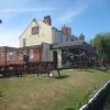
Mooring here is good (a nice place to moor), mooring rings or bollards are available. Mooring is limited to 2 days. Moorings for 3 - 4 boats on the New Inn Pub gardens :-).


Amenities

Amenities nearby at Water Lane Bridge

 Cashpoint
 Millfield Lane Caravan Park

Amenities nearby at East Bank Marina

 McColls
 
Maps
If you are a user and are logged on, or if you are actively planning a route, a map will be displayed here.
Show on external mapping site: Google | OSM | Bing
 
Photos
 
External websites
  S&SY navigation info — associated with Sheffield and South Yorkshire Navigation
Sheffield & South Yorkshire navigation info from IWA
 
Nearest facilities

Mouseover for more information or show routes to facility

Nearest water point

In the direction of Keadby Junction

Thorne Visitor Moorings2 miles, 6¾ furlongs and 1 lock away
On the Sheffield and South Yorkshire Navigation (Stainforth and Keadby Canal) in the direction of Keadby Junction
Keadby Visitor Moorings12 miles, 5 furlongs and 1 lock away
On the Sheffield and South Yorkshire Navigation (Stainforth and Keadby Canal) in the direction of Keadby Junction

In the direction of Bramwith Junction

Bramwith Swing Bridge1 mile, 3¾ furlongs away
On the Sheffield and South Yorkshire Navigation (Bramwith to Stainforth) in the direction of Bramwith Junction
Bramwith Lock No 141 mile, 6½ furlongs away
On the Sheffield and South Yorkshire Navigation (Bramwith to Stainforth) in the direction of Bramwith Junction
Barnby Dun Lift Bridge3 miles, 1¼ furlongs and 1 lock away
Travel to Bramwith Junction, then on the Sheffield and South Yorkshire Navigation (Main Line) to Barnby Dun Lift Bridge
Long Sandall Lock No 135 miles, 2¾ furlongs and 1 lock away
Travel to Bramwith Junction, then on the Sheffield and South Yorkshire Navigation (Main Line) to Long Sandall Lock No 13
Doncaster Visitor Pontoon Moorings8 miles, 4 furlongs and 2 locks away
Travel to Bramwith Junction, then on the Sheffield and South Yorkshire Navigation (Main Line) to Doncaster Visitor Pontoon Moorings
Doncaster Town Lock No 128 miles, 6½ furlongs and 2 locks away
Travel to Bramwith Junction, then on the Sheffield and South Yorkshire Navigation (Main Line) to Doncaster Town Lock No 12
Pollington Visitor Mooring9 miles, 5¼ furlongs and 2 locks away
Travel to Bramwith Junction, then on the Sheffield and South Yorkshire Navigation (New Junction Canal) to Sykehouse Junction, then on the Aire and Calder Navigation (Main Line - Goole to Castleford) to Pollington Visitor Mooring
Pollington Manor Swing Bridge9 miles, 5¾ furlongs and 2 locks away
Travel to Bramwith Junction, then on the Sheffield and South Yorkshire Navigation (New Junction Canal) to Sykehouse Junction, then on the Aire and Calder Navigation (Main Line - Goole to Castleford) to Pollington Manor Swing Bridge
Sprotbrough Lock No 1112 miles, ½ furlongs and 3 locks away
Travel to Bramwith Junction, then on the Sheffield and South Yorkshire Navigation (Main Line) to Sprotbrough Lock No 11
Dutch Riverside13 miles, 6¼ furlongs and 2 locks away
Travel to Bramwith Junction, then on the Sheffield and South Yorkshire Navigation (New Junction Canal) to Sykehouse Junction, then on the Aire and Calder Navigation (Main Line - Goole to Castleford) to Dutch Riverside
Goole Marina13 miles, 7¾ furlongs and 2 locks away
Travel to Bramwith Junction, then on the Sheffield and South Yorkshire Navigation (New Junction Canal) to Sykehouse Junction, then on the Aire and Calder Navigation (Main Line - Goole to Castleford) to Goole Marina
Whitley Lock No 1213 miles, 3¾ furlongs and 3 locks away
Travel to Bramwith Junction, then on the Sheffield and South Yorkshire Navigation (New Junction Canal) to Sykehouse Junction, then on the Aire and Calder Navigation (Main Line - Goole to Castleford) to Whitley Lock No 12
Mexborough Low Lock No 1015 miles, 4 furlongs and 4 locks away
Travel to Bramwith Junction, then on the Sheffield and South Yorkshire Navigation (Main Line) to Mexborough Low Lock No 10
Bank Dole Lock No 117 miles, 5 furlongs and 4 locks away
Travel to Bramwith Junction, then on the Sheffield and South Yorkshire Navigation (New Junction Canal) to Sykehouse Junction, then on the Aire and Calder Navigation (Main Line - Goole to Castleford) to Bank Dole Junction, then on the Aire and Calder Navigation (Selby Section) to Bank Dole Lock No 1
Ferrybridge Flood Lock No 1118 miles, 7½ furlongs and 4 locks away
Travel to Bramwith Junction, then on the Sheffield and South Yorkshire Navigation (New Junction Canal) to Sykehouse Junction, then on the Aire and Calder Navigation (Main Line - Goole to Castleford) to Ferrybridge Flood Lock No 11
Ferrybridge Flood Lock Footbridge19 miles and 5 locks away
Travel to Bramwith Junction, then on the Sheffield and South Yorkshire Navigation (New Junction Canal) to Sykehouse Junction, then on the Aire and Calder Navigation (Main Line - Goole to Castleford) to Ferrybridge Flood Lock Footbridge
Swinton Lock Activity Centre and CRT Sanitary Station18 miles, ¾ furlongs and 6 locks away
Travel to Bramwith Junction, then on the Sheffield and South Yorkshire Navigation (Main Line) to Swinton Lock Activity Centre and CRT Sanitary Station
Beal Bridge19 miles, 7½ furlongs and 5 locks away
Travel to Bramwith Junction, then on the Sheffield and South Yorkshire Navigation (New Junction Canal) to Sykehouse Junction, then on the Aire and Calder Navigation (Main Line - Goole to Castleford) to Bank Dole Junction, then on the Aire and Calder Navigation (Selby Section) to Beal Bridge

Nearest rubbish disposal

In the direction of Keadby Junction

Thorne Visitor Moorings2 miles, 6¾ furlongs and 1 lock away
On the Sheffield and South Yorkshire Navigation (Stainforth and Keadby Canal) in the direction of Keadby Junction
Keadby Visitor Moorings12 miles, 5 furlongs and 1 lock away
On the Sheffield and South Yorkshire Navigation (Stainforth and Keadby Canal) in the direction of Keadby Junction

In the direction of Bramwith Junction

Bramwith Swing Bridge1 mile, 3¾ furlongs away
On the Sheffield and South Yorkshire Navigation (Bramwith to Stainforth) in the direction of Bramwith Junction
Barnby Dun Lift Bridge3 miles, 1¼ furlongs and 1 lock away
Travel to Bramwith Junction, then on the Sheffield and South Yorkshire Navigation (Main Line) to Barnby Dun Lift Bridge
Doncaster Visitor Pontoon Moorings8 miles, 4 furlongs and 2 locks away
Travel to Bramwith Junction, then on the Sheffield and South Yorkshire Navigation (Main Line) to Doncaster Visitor Pontoon Moorings
Dutch Riverside13 miles, 6¼ furlongs and 2 locks away
Travel to Bramwith Junction, then on the Sheffield and South Yorkshire Navigation (New Junction Canal) to Sykehouse Junction, then on the Aire and Calder Navigation (Main Line - Goole to Castleford) to Dutch Riverside
Goole Marina13 miles, 7¾ furlongs and 2 locks away
Travel to Bramwith Junction, then on the Sheffield and South Yorkshire Navigation (New Junction Canal) to Sykehouse Junction, then on the Aire and Calder Navigation (Main Line - Goole to Castleford) to Goole Marina
Whitley Lock No 1213 miles, 3¾ furlongs and 3 locks away
Travel to Bramwith Junction, then on the Sheffield and South Yorkshire Navigation (New Junction Canal) to Sykehouse Junction, then on the Aire and Calder Navigation (Main Line - Goole to Castleford) to Whitley Lock No 12

Nearest chemical toilet disposal

In the direction of Keadby Junction

Thorne Visitor Moorings2 miles, 6¾ furlongs and 1 lock away
On the Sheffield and South Yorkshire Navigation (Stainforth and Keadby Canal) in the direction of Keadby Junction
Keadby Visitor Moorings12 miles, 5 furlongs and 1 lock away
On the Sheffield and South Yorkshire Navigation (Stainforth and Keadby Canal) in the direction of Keadby Junction

In the direction of Bramwith Junction

Bramwith Swing Bridge1 mile, 3¾ furlongs away
On the Sheffield and South Yorkshire Navigation (Bramwith to Stainforth) in the direction of Bramwith Junction
Barnby Dun Lift Bridge3 miles, 1¼ furlongs and 1 lock away
Travel to Bramwith Junction, then on the Sheffield and South Yorkshire Navigation (Main Line) to Barnby Dun Lift Bridge
Dutch Riverside13 miles, 6¼ furlongs and 2 locks away
Travel to Bramwith Junction, then on the Sheffield and South Yorkshire Navigation (New Junction Canal) to Sykehouse Junction, then on the Aire and Calder Navigation (Main Line - Goole to Castleford) to Dutch Riverside
Goole Marina13 miles, 7¾ furlongs and 2 locks away
Travel to Bramwith Junction, then on the Sheffield and South Yorkshire Navigation (New Junction Canal) to Sykehouse Junction, then on the Aire and Calder Navigation (Main Line - Goole to Castleford) to Goole Marina
Whitley Lock No 1213 miles, 3¾ furlongs and 3 locks away
Travel to Bramwith Junction, then on the Sheffield and South Yorkshire Navigation (New Junction Canal) to Sykehouse Junction, then on the Aire and Calder Navigation (Main Line - Goole to Castleford) to Whitley Lock No 12
Swinton Lock Activity Centre and CRT Sanitary Station18 miles, ¾ furlongs and 6 locks away
Travel to Bramwith Junction, then on the Sheffield and South Yorkshire Navigation (Main Line) to Swinton Lock Activity Centre and CRT Sanitary Station

Nearest place to turn

In the direction of Keadby Junction

Huddle Grounds Winding Hole3½ furlongs away
On the Sheffield and South Yorkshire Navigation (Stainforth and Keadby Canal) in the direction of Keadby Junction

In the direction of Bramwith Junction

Wheatley Hall Road Winding Hole6 miles, 3¼ furlongs and 2 locks away
Travel to Bramwith Junction, then on the Sheffield and South Yorkshire Navigation (Main Line) to Wheatley Hall Road Winding Hole
Gas House Bight8 miles, 2½ furlongs and 2 locks away
Travel to Bramwith Junction, then on the Sheffield and South Yorkshire Navigation (Main Line) to Gas House Bight
Doncaster Visitor Pontoon Moorings8 miles, 4 furlongs and 2 locks away
Travel to Bramwith Junction, then on the Sheffield and South Yorkshire Navigation (Main Line) to Doncaster Visitor Pontoon Moorings
Sprotbrough Lock Weir Exit12 miles and 3 locks away
Travel to Bramwith Junction, then on the Sheffield and South Yorkshire Navigation (Main Line) to Sprotbrough Lock Weir Exit
Viking Marina13 miles, 7 furlongs and 2 locks away
Travel to Bramwith Junction, then on the Sheffield and South Yorkshire Navigation (New Junction Canal) to Sykehouse Junction, then on the Aire and Calder Navigation (Main Line - Goole to Castleford) to Viking Marina
Bank Dole Lock Junction17 miles, 5¼ furlongs and 5 locks away
Travel to Bramwith Junction, then on the Sheffield and South Yorkshire Navigation (New Junction Canal) to Sykehouse Junction, then on the Aire and Calder Navigation (Main Line - Goole to Castleford) to Bank Dole Junction, then on the Aire and Calder Navigation (Selby Section) to Bank Dole Lock Junction
Swinton Road Corner17 miles, 5¾ furlongs and 6 locks away
Travel to Bramwith Junction, then on the Sheffield and South Yorkshire Navigation (Main Line) to Swinton Road Corner
Beal Lock No 2 Weir Entrance19 miles, 7¾ furlongs and 5 locks away
Travel to Bramwith Junction, then on the Sheffield and South Yorkshire Navigation (New Junction Canal) to Sykehouse Junction, then on the Aire and Calder Navigation (Main Line - Goole to Castleford) to Bank Dole Junction, then on the Aire and Calder Navigation (Selby Section) to Beal Lock No 2 Weir Entrance
Swinton Junction18 miles, 1½ furlongs and 7 locks away
Travel to Bramwith Junction, then on the Sheffield and South Yorkshire Navigation (Main Line) to Swinton Junction

Nearest self-operated pump-out

In the direction of Bramwith Junction

Long Sandall Lock No 135 miles, 2¾ furlongs and 1 lock away
Travel to Bramwith Junction, then on the Sheffield and South Yorkshire Navigation (Main Line) to Long Sandall Lock No 13

Nearest boatyard pump-out

Direction of TV transmitter (From Wolfbane Cybernetic)
 
 
Geograph
 
Wikipedia

There is no page on Wikipedia called “Stainforth Junction”

Wikipedia pages that might relate to Stainforth Junction
[South Yorkshire Railway] Riding and Grimsby Railway (act of 1862) at Stainforth junction (or Hatfield junction) southwest of Stainforth and Hatfield station. The 1863 act also enabled [Hatfield, South Yorkshire] has led to the creation of a new link road from Junction 5 to Waggons Way in Stainforth. Junction 5 also has a motorway service area (MSA) known as [West Riding and Grimsby Railway] from a junction at Adwick to Doncaster. The main line would be 21 miles 40 chains in extent. The junction near Stainforth was Haggs Wood Junction, (shifted [Stainforth and Keadby Canal] The Stainforth and Keadby Canal is a navigable canal in South Yorkshire and Lincolnshire, England. It connects the River Don Navigation at Bramwith to [Manchester, Sheffield and Lincolnshire Railway] WR&GR was opened in February 1866, but the section from Adwick junction to Stainforth junction was delayed until the SYR finished its Doncaster – Thorne direct [New Junction Canal] Navigation, and was opened in 1905. It links the River Don Navigation and the Stainforth and Keadby Canal with the Aire and Calder Navigation (Knottingley Canal) [South Humberside main line] where the lines diverge at Thorne Junction. The line runs across Thorne and Hatfield Moors to run along the Stainforth and Keadby Canal toward the River [Sheffield and South Yorkshire Navigation] the early 1970s but revitalised since the 1990s) The Stainforth and Keadby Canal The New Junction Canal The Dearne and Dove Canal (closed 1961) The River [Sheffield–Lincoln line] Saturdays only) Joins the South Humberside Main Line (from Hatfield and Stainforth) and Grimsby–Lincoln–Newark line (from Market Rasen) Barnetby connections [Hull and Doncaster Branch] Stainforth and Keadby Canal section of the Sheffield and South Yorkshire Navigation, connecting with the Barnsley to Barnetby Line at Thorne junction
 
Google

Results of Google Search

57316 | 57316 & 57601 approach Stainforth Junction at the he ...
57316 & 57601 approach Stainforth Junction at the head of 5Z28 11:43 Barnetby Dn Recp Sdg - Carnforth Steamtown. 02-10-2016. Done. 585 views.
Stainforth Childrens Centre - Child Care & Day Care - Junction ...
1 review of Stainforth Childrens Centre "as a special guardian for my nephew, i am always greeted kindly and made to feel welcome on every visit. health visitors  ...
Stainforth Junction Road school.... - Stainforth Old Photos | Facebook
Stainforth Junction Road school. Stainforth Junior School building was opened in 1937. It was knocked down in 2003. In the 40's 50's & 60's it was known...
Stainforth and Keadby Canal - Wikipedia
There were plans to upgrade it to take larger barges and to improve the port facilities at Keadby, but the completion of the New Junction Canal in 1905 made this ...
Stainforth Junction Road School. If the... - Stainforth Old Photos ...
Stainforth Junction Road School. If the boy's on here are aged 9-10 then the year is 1955-56 Top row: 1 Brian Davis, 2 Jeff Chandler, 3 Alan Stayse, 4...
Report on the Accident at Stainforth on 18th December 1919 :: The ...
... from Grimsby to Milford Junction, was permitted to enter the section between Thorne Junction and Stainforth Junction, under full acceptance, and collided with  ...
House Prices in Junction Road, Stainforth, Doncaster, South ...
Sold House Prices in Junction Road, Stainforth, Doncaster, South Yorkshire, DN7 . Use Rightmove online house price checker tool to find out exactly how much ...
West Riding and Grimsby Railway - Wikipedia
The junction near Stainforth was Haggs Wood Junction, (shifted to Stainforth later ), in a district known as Barnby upon Don. The Doncaster branch was 4 miles 32  ...
New Junction Canal - Virtual canal trip along the Stainforth and ...
The New Junction Canal runs between the western end of the Stainforth and Keadby Canal and the Aire and Calder Navigation. It was one of the last canals to ...