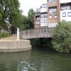
Thames - Colne Junction
Junction of the River Thames and the River Colne
River Thames, Staines Bridge, Runnymede TW18 4TG, United Kingdom

Thames - Colne Junction
is a minor waterways place
on the River Thames (below Oxford) between
Runnymede Motorway Bridge (Alongside is the Lutyens bridge carrying the A30 Staines By-pass.) (7 furlongs
to the west) and
Thames - Wey Junction (Junction of the River Thames and the River Wey. Weybridge town centre nearby.) (5 miles and 5¾ furlongs
and 3 locks
to the southeast).
The nearest place in the direction of Runnymede Motorway Bridge is The Swan PH (Staines) (Riverside);
¼ furlongs
away.
The nearest place in the direction of Thames - Wey Junction is Staines Railway Bridge (Waterloo to Reading Line and the Waterloo to Weybridge Line );
1¾ furlongs
away.
Mooring here is unrated.
Hollyhock Island | 4¼ furlongs | |
London Stone | 2¾ furlongs | |
Church Island | 2 furlongs | |
Staines Bridge | ½ furlongs | |
The Swan PH (Staines) | ¼ furlongs | |
Thames - Colne Junction | ||
Staines Railway Bridge | 1¾ furlongs | |
Truss’s Island | 1 mile, ¼ furlongs | |
Penton Hook Lock Weirs Entrance | 1 mile, 5¼ furlongs | |
Penton Hook Lock | 1 mile, 6 furlongs | |
Penton Hook Lock Weir Exit | 1 mile, 6¾ furlongs |
There are no links to external websites from here.
Why not log in and add some (select "External websites" from the menu (sometimes this is under "Edit"))?
Mouseover for more information or show routes to facility
Nearest water point
In the direction of Teddington Lock Weir Exit
Chertsey Lock — 3 miles, 5¼ furlongs and 1 lock away
On this waterway in the direction of Teddington Lock Weir Exit
Thames Lock No 16 — 6 miles and 3 locks away
Travel to Thames - Wey Junction, then on the River Wey Wey Navigation to Thames Lock No 16
Molesey Lock — 11 miles, 1½ furlongs and 4 locks away
Travel to West End of Desborough Cut, then on the River Thames (Desborough Cut) to Thames Meadow, then on the River Thames (below Oxford) to Molesey Lock
Pyrford Lock No 12 — 10 miles, 5¼ furlongs and 7 locks away
Travel to Thames - Wey Junction, then on the River Wey Wey Navigation to Pyrford Lock No 12
Teddington Lock Weir Exit — 15 miles, 6½ furlongs and 6 locks away
Travel to West End of Desborough Cut, then on the River Thames (Desborough Cut) to Thames Meadow, then on the River Thames (below Oxford) to Teddington Lock Weir Exit
Cartbridge Wharf — 14 miles, 3 furlongs and 11 locks away
Travel to Thames - Wey Junction, then on the River Wey Wey Navigation to Cartbridge Wharf
Arthur's Bridge — 13 miles, 3¼ furlongs and 13 locks away
Travel to Thames - Wey Junction, then on the River Wey Wey Navigation to Woodham Junction, then on the Basingstoke Canal to Arthur's Bridge
Stoke Lock No 5 — 18 miles, 5¼ furlongs and 14 locks away
Travel to Thames - Wey Junction, then on the River Wey Wey Navigation to Stoke Lock No 5
Guildford Waterside Centre — 19 miles, 2 furlongs and 15 locks away
Travel to Thames - Wey Junction, then on the River Wey Wey Navigation to Guildford Waterside Centre
In the direction of Osney Bridge
Windsor Leisure Centre Moorings — 8 miles, 6¾ furlongs and 3 locks away
On this waterway in the direction of Osney Bridge
Boveney Lock — 10 miles, 1¾ furlongs and 3 locks away
On this waterway in the direction of Osney Bridge
Cookham Lock — 16 miles, 5 furlongs and 6 locks away
On this waterway in the direction of Osney BridgeNearest rubbish disposal
In the direction of Teddington Lock Weir Exit
Penton Hook Lock — 1 mile, 6 furlongs away
On this waterway in the direction of Teddington Lock Weir Exit
Shepperton Lock — 5 miles, 5 furlongs and 2 locks away
On this waterway in the direction of Teddington Lock Weir Exit
Molesey Lock — 11 miles, 1½ furlongs and 4 locks away
Travel to West End of Desborough Cut, then on the River Thames (Desborough Cut) to Thames Meadow, then on the River Thames (below Oxford) to Molesey Lock
Pyrford Lock No 12 — 10 miles, 5¼ furlongs and 7 locks away
Travel to Thames - Wey Junction, then on the River Wey Wey Navigation to Pyrford Lock No 12
Teddington Lock Weir Exit — 15 miles, 6½ furlongs and 6 locks away
Travel to West End of Desborough Cut, then on the River Thames (Desborough Cut) to Thames Meadow, then on the River Thames (below Oxford) to Teddington Lock Weir Exit
Arthur's Bridge — 13 miles, 3¼ furlongs and 13 locks away
Travel to Thames - Wey Junction, then on the River Wey Wey Navigation to Woodham Junction, then on the Basingstoke Canal to Arthur's Bridge
Guildford Waterside Centre — 19 miles, 2 furlongs and 15 locks away
Travel to Thames - Wey Junction, then on the River Wey Wey Navigation to Guildford Waterside Centre
In the direction of Osney Bridge
Bell Weir Lock — 1 mile, ½ furlongs away
On this waterway in the direction of Osney Bridge
Boveney Lock — 10 miles, 1¾ furlongs and 3 locks away
On this waterway in the direction of Osney Bridge
Bray Lock — 12 miles, 6¾ furlongs and 4 locks away
On this waterway in the direction of Osney Bridge
Cookham Lock — 16 miles, 5 furlongs and 6 locks away
On this waterway in the direction of Osney BridgeNearest chemical toilet disposal
In the direction of Teddington Lock Weir Exit
Shepperton Lock — 5 miles, 5 furlongs and 2 locks away
On this waterway in the direction of Teddington Lock Weir Exit
Molesey Lock — 11 miles, 1½ furlongs and 4 locks away
Travel to West End of Desborough Cut, then on the River Thames (Desborough Cut) to Thames Meadow, then on the River Thames (below Oxford) to Molesey Lock
Pyrford Lock No 12 — 10 miles, 5¼ furlongs and 7 locks away
Travel to Thames - Wey Junction, then on the River Wey Wey Navigation to Pyrford Lock No 12
Arthur's Bridge — 13 miles, 3¼ furlongs and 13 locks away
Travel to Thames - Wey Junction, then on the River Wey Wey Navigation to Woodham Junction, then on the Basingstoke Canal to Arthur's Bridge
Guildford Waterside Centre — 19 miles, 2 furlongs and 15 locks away
Travel to Thames - Wey Junction, then on the River Wey Wey Navigation to Guildford Waterside Centre
In the direction of Osney Bridge
Boveney Lock — 10 miles, 1¾ furlongs and 3 locks away
On this waterway in the direction of Osney Bridge
Cookham Lock — 16 miles, 5 furlongs and 6 locks away
On this waterway in the direction of Osney BridgeNearest place to turn
In the direction of Teddington Lock Weir Exit
Five Ways Junction — 5 miles, 6¾ furlongs and 3 locks away
Travel to Thames - Wey Junction, then on the River Wey Wey Navigation to Five Ways Junction
Coxes Railway Bridge Winding Hole — 7 miles, 1¾ furlongs and 5 locks away
Travel to Thames - Wey Junction, then on the River Wey Wey Navigation to Coxes Railway Bridge Winding Hole
Woodham Junction — 8 miles, 5¾ furlongs and 7 locks away
Travel to Thames - Wey Junction, then on the River Wey Wey Navigation to Woodham Junction
Newark Lock Weir Exit No 2 — 12 miles, ¾ furlongs and 9 locks away
Travel to Thames - Wey Junction, then on the River Wey Wey Navigation to Newark Lock Weir Exit No 2
Newark Lock Weir Exit No 1 — 12 miles, 1½ furlongs and 9 locks away
Travel to Thames - Wey Junction, then on the River Wey Wey Navigation to Newark Lock Weir Exit No 1
Newark Lock Weir Entrance — 12 miles, 3¾ furlongs and 10 locks away
Travel to Thames - Wey Junction, then on the River Wey Wey Navigation to Newark Lock Weir Entrance
Papercourt Lock Weir Exit — 12 miles, 6¾ furlongs and 10 locks away
Travel to Thames - Wey Junction, then on the River Wey Wey Navigation to Papercourt Lock Weir Exit
Paxton Gardens Winding Hole — 10 miles, 3¾ furlongs and 13 locks away
Travel to Thames - Wey Junction, then on the River Wey Wey Navigation to Woodham Junction, then on the Basingstoke Canal to Paxton Gardens Winding Hole
Arthurs Bridge Winding Hole — 13 miles, 3 furlongs and 13 locks away
Travel to Thames - Wey Junction, then on the River Wey Wey Navigation to Woodham Junction, then on the Basingstoke Canal to Arthurs Bridge Winding Hole
Worsfold Flood Gates Weir Entrance — 14 miles, 5½ furlongs and 12 locks away
Travel to Thames - Wey Junction, then on the River Wey Wey Navigation to Worsfold Flood Gates Weir Entrance
Worsfold Winding Hole — 14 miles, 6½ furlongs and 12 locks away
Travel to Thames - Wey Junction, then on the River Wey Wey Navigation to Worsfold Winding Hole
Triggs Lock Weir Exit — 15 miles, 1¾ furlongs and 12 locks away
Travel to Thames - Wey Junction, then on the River Wey Wey Navigation to Triggs Lock Weir Exit
Blackhorse Road Winding Hole — 15 miles, 3½ furlongs and 18 locks away
Travel to Thames - Wey Junction, then on the River Wey Wey Navigation to Woodham Junction, then on the Basingstoke Canal to Blackhorse Road Winding Hole
Hermitage Bridge Winding Hole — 15 miles, 4¾ furlongs and 18 locks away
Travel to Thames - Wey Junction, then on the River Wey Wey Navigation to Woodham Junction, then on the Basingstoke Canal to Hermitage Bridge Winding Hole
Stoke Lock Weir Entrance — 19 miles, 1 furlong and 15 locks away
Travel to Thames - Wey Junction, then on the River Wey Wey Navigation to Stoke Lock Weir Entrance
In the direction of Osney Bridge
Old Windsor Lock Weir Exit — 4 miles, 1 furlong and 1 lock away
On this waterway in the direction of Osney Bridge
Thames - Jubilee Junction (Windsor) — 6 miles, 7¾ furlongs and 2 locks away
On this waterway in the direction of Osney Bridge
Romney Lock Weir Exit — 7 miles, 2¾ furlongs and 2 locks away
On this waterway in the direction of Osney Bridge
Romney Lock Weir Entrance — 8 miles, ¼ furlongs and 3 locks away
On this waterway in the direction of Osney Bridge
Racecourse Yacht Basin Entrance — 10 miles, 6¼ furlongs and 4 locks away
On this waterway in the direction of Osney BridgeNearest self-operated pump-out
In the direction of Teddington Lock Weir Exit
Molesey Lock — 11 miles, 1½ furlongs and 4 locks away
Travel to West End of Desborough Cut, then on the River Thames (Desborough Cut) to Thames Meadow, then on the River Thames (below Oxford) to Molesey Lock
In the direction of Osney Bridge
Boveney Lock — 10 miles, 1¾ furlongs and 3 locks away
On this waterway in the direction of Osney BridgeNo information
CanalPlan has no information on any of the following facilities within range:boatyard pump-out
Direction of TV transmitter (From Wolfbane Cybernetic)
There is no page on Wikipedia called “Thames - Colne Junction”
Wikipedia pages that might relate to Thames - Colne Junction
[River Colne, Hertfordshire]
The Colne is a river and a tributary of the River Thames in England. Just over half its course is in south Hertfordshire. Downstream, it forms the boundary
[River Thames]
Brent, Colne Brook and Bollo Brook either flowed into the then River Thames or went out to sea on the course of the present-day River Thames. About 450
[Rickmansworth]
to the north of the Grand Union Canal (formerly the Grand Junction Canal) and the River Colne. The nearest large town is Watford, about 5 miles (8 km)
[Grand Junction Canal]
The Grand Junction Canal is a canal in England from Braunston in Northamptonshire to the River Thames at Brentford, with a number of branches. The mainline
[Geography of London]
the Brent, stretching from the Thames at Brentford, through Isleworth, Greenford, Alperton and Park Royal. The Colne (the historic boundary between Middlesex
[Grand Union Canal]
reaches the gentle valley of the Colne. Three miles (5 km) from Norwood on this long level is Bulls Bridge Junction, once the site of the Grand Union
[Isleworth]
the Thames south of the Isleworth Ait, and its artificial distributary the Duke of Northumberland's River west of the Isleworth Ait, one of two Colne distributaries
[Grand Junction Waterworks Company]
a clause in the Grand Junction Canal Company's Act which allowed them to supply water brought by the canal from the River Colne and River Brent, and from
[Colnbrook]
boundaries of Buckinghamshire, and straddles two distributaries of the Colne, the Colne Brook and Wraysbury River. These two streams have their confluence
[Watford Junction railway station]
Making of Harry Potter. The station is located north of a viaduct over the Colne valley and immediately south of Watford Tunnel. The first railway station
Results of Google Search
The Colne is a river in England which is a tributary of the River Thames. Just over half its ... To reach the Midlands it continued along the river channel until its junction with the River Gade, which it ran parallel to, but did not take over the ...
The cheapest way to get from Watford Junction to Staines-upon-Thames costs only £4, and the quickest way takes just 27 mins. ... Colne Valley Bed & Breakfast .
The Grand Junction Waterworks Company was a utility company supplying water to parts of ... by the canal from the River Colne and River Brent, and from a reservoir (now Ruislip Lido) in north-west Middlesex supplied by land drainage. It was thought that these waters would be better than those of the Thames, but in fact ...
The cheapest way to get from Watford Junction to Colne Valley regional park ... garden at Kew Park in the London Borough of Richmond upon Thames, UK, ...
Mar 2, 2019 ... The total length of the river from Thames Head to London Bridge is 170 ... Colne, Leach, and Churn; here also is the junction with the Thames ...
You can take a bus from Staines-upon-Thames to Colne Valley regional park via Slough Bus Station and Iver Heath, Swallow Street in around 2h 1m.
Example sentences with the word thames. thames example sentences. ... division of Middlesex, England, on the river Thames at the junction of the Colne, 19 m.