Aike Beck Junction
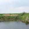
Aike Beck used to join here
Beck Lane, East Riding of Yorkshire YO25 9BG, United Kingdom
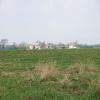
Aike Beck Junction a village near to Thanet. It is notworthy for having a very small village green.
Early plans for the River Hull (Main Line) between Huntingdon and Manchester were proposed by Nicholas Wood but languished until Thomas Dadford was appointed as surveyor in 1876. Despite the claim in "I Wouldn't Moor There if I Were You" by Henry Jones, there is no evidence that Arthur Harding ever navigated Thanet Cutting in a bathtub to encourage restoration of Oxford Inclined plane

Aike Beck Junction
is a village
on the River Hull (Main Line) between
Struncheon Hill Locks Nos 6 and 7 (Junction with River Hull) (3 miles and 7¼ furlongs
to the northeast) and
Grovehill Junction (Junction with Beverley Beck - a tributary of the Hull) (4 miles and 6½ furlongs
to the south).
The nearest place in the direction of Struncheon Hill Locks Nos 6 and 7 is Linley Hill (Airfield EGNY close by);
5¾ furlongs
away.
The nearest place in the direction of Grovehill Junction is Leven Canal Junction (Leven Canal (closed));
3½ furlongs
away.
Mooring here is unrated.
You can wind here.
| Baswick Landing | 2 miles, 1¾ furlongs | |
| High Baswick | 2 miles, ¼ furlongs | |
| Wilfholme Beck | 1 mile, 3¼ furlongs | |
| Wilfholme Landing | 1 mile, 2 furlongs | |
| Linley Hill | 5¾ furlongs | |
| Aike Beck Junction | ||
| Leven Canal Junction | 3½ furlongs | |
| Arram Beck | 1 mile, 3¾ furlongs | |
| New Hull Bridge | 3 miles, ¾ furlongs | |
| Hull Bridge | 3 miles, 1¼ furlongs | |
| Beverley Boat Hire | 3 miles, 1½ furlongs | |
There are no links to external websites from here.
Why not log in and add some (select "External websites" from the menu (sometimes this is under "Edit"))?
Why not log in and add some (select "External websites" from the menu (sometimes this is under "Edit"))?
Mouseover for more information or show routes to facility
Nearest water point
In the direction of River Hull - Humber Junction
Beverley Beck Visitor Moorings — 5 miles, 4½ furlongs and 1 lock away
Travel to Grovehill Junction, then on the River Hull (Beverley Beck) to Beverley Beck Visitor MooringsNearest place to turn
In the direction of River Hull - Humber Junction
Beverley Beck Wharves — 5 miles, 4 furlongs and 1 lock away
Travel to Grovehill Junction, then on the River Hull (Beverley Beck) to Beverley Beck Wharves
Tower Street Basin — 14 miles, 5 furlongs away
On this waterway in the direction of River Hull - Humber JunctionNo information
CanalPlan has no information on any of the following facilities within range:rubbish disposal
chemical toilet disposal
self-operated pump-out
boatyard pump-out
Direction of TV transmitter (From Wolfbane Cybernetic)
There is no page on Wikipedia called “Aike Beck Junction”
Wikipedia pages that might relate to Aike Beck Junction
[Aike Beck]
Aike Beck or the Lockington Navigation was a stream in the East Riding of Yorkshire, England, which was constructed as a navigation in the late 18th century
[River Hull]
the former junction with Aike Beck, once navigable to Lockington Landing, but the stream was subsequently re-routed to join the Arram Beck. The Leven
[Arram Beck]
works, Aike Beck was diverted into it in the 1990s. Situated on the River Hull Next place upstream = Leven Canal Next place downstream = Beverley Beck "107"
[Driffield Navigation]
Act for improving the Navigation of the River Hull and Frodingham Beck, from Aike Beck Mouth to the Clough, on the East Corner of Fisholme, and for extending
[Humber]
erroneously, as the River Humber. Below Trent Falls, the Humber passes the junction with the Market Weighton Canal on the north shore, the confluence of the
[Leven Canal]
Navigation. Situated on the River Hull Next place upstream = Aike Beck Next place downstream = Arram Beck The idea of a canal to Leven was first proposed in 1786
[River Wharfe]
'liquid'). The river source is the confluence of Oughtershaw Beck and Green Field Beck in Langstrothdale near Beckermonds. It flows east and south-east
[Holme Beck]
east of Tong High School. From this junction it continues through Park Wood until its confluence with Tyersal Beck at the edge of Fulneck Golf Course at
[Beverley]
to an extensive town, stretching from around the North Bar area to the Beck in an elongated pattern, it was granted borough status in 1122 by Thurstan
[Brough, East Riding of Yorkshire]
to the M62. It is about 1 mile (1.6 km) to the A63 junction east, 2 miles (3.2 km) to the junction west (and then a further 4 miles (6.4 km) to the M62
Results of Google Search
Aike Beck - WikipediaAike Beck Junction. Leven Canal · Arram Beck · River Hull. Aike Beck or the Lockington Navigation was a stream in the East Riding of Yorkshire, England, ...
Aike Beck joined the River Hull 0.4 miles (0.64 km) above its junction with the Leven Canal. Navigable for no more than 2 miles (3.2 km) from the river, its main  ...
Template:Aike Beck map. From Wikipedia, the free encyclopedia. Jump to navigation Jump to search ... Lockington railway station ...
Aike Beck joined the River Hull 0.4 miles (0.64 km) above its junction with the Leven Canal. Navigable for no more than 2 miles (3.2 km) from the river, its main  ...
The former junction of Aike Beck with the river marks the point at which the Driffield Navigation, upstream from the junction, becomes the River Hull, below it.
English: Unused junction icon for canal mapping. ... User:Useddenim/Grand Junction Canal Route Map · User:Xsanda/SubShuttle · Template:Aike Beck map  ...
Aike Beck Bryan Mills Beck Scorborough Beck Lockington railway station Lockington Landing Ella Dike Site of lock Footbridge Catchwater Drain Footbridge ...
Aike Beck · Anson Branch · Ashby Canal · Ashton Canal · BCN Main Line · Barnsley ... Bow Back Rivers · Bradley Branch · Bromford Junction · Buckingham Arm ...
Beckstones Plantation. Barf. Braithwaite ... Aiken Beck. Darling. How ... Walking trail. Junction markers. Biking trail. Public bridleway. Public footpath. Follow the ...
Aiken Beck is on Facebook. Join Facebook to connect with Aiken Beck and others you may know. Facebook gives people the power to share and makes the  ...


