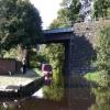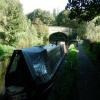
Salterhebble Junction 
Junction of Halifax Branch (closed after 600 yards) with Calder and Hebble Main Line (limit of 72ft navigation)
Towpath, Calderdale HX3 0QH, United Kingdom

Salterhebble Junction
is a major waterways place
at the junction of
the Calder and Hebble Navigation (Halifax Branch)
with
the Calder and Hebble Navigation (Main Line)
and
the Calder and Hebble Navigation (Main Line).
Salterhebble Basin (End of navigation)
is on
the Calder and Hebble Navigation (Halifax Branch),
4 furlongs
to the northeast.
Elland Basin
is on
the Calder and Hebble Navigation (Main Line),
1 mile and 4 furlongs
and 5 locks
to the southeast.
Sowerby Bridge Junction (Junction of the Calder and Hebble Navigation and the Rochdale Canal)
is on
the Calder and Hebble Navigation (Main Line),
2 miles and ¾ furlongs
to the west.
The nearest place in the direction of Salterhebble Basin is Wakefield Road Bridge;
¼ furlongs
away.
The nearest place in the direction of Elland Basin is Salterhebble Top Lock No 27;
¼ furlongs
away.
The nearest place in the direction of Sowerby Bridge Junction is Railway Bridge No 9 (Calder and Hebble);
¼ furlongs
away.
Mooring here is unrated.
Facilities: water point.
Calder and Hebble Navigation (Halifax Branch) | ||
---|---|---|
Salterhebble Junction | ||
Wakefield Road Bridge | ¼ furlongs | |
Salterhebble Old Line Junction | 2¾ furlongs | |
Salterhebble Narrows | 3½ furlongs | |
Salterhebble Basin | 4 furlongs | |
Calder and Hebble Navigation (Main Line) | ||
Salterhebble Junction | ||
Salterhebble Top Lock No 27 | ¼ furlongs | |
Salterhebble Sanitary Station | ½ furlongs | |
Salterhebble Middle Lock No 26 | ½ furlongs | |
Salterhebble Bottom Basin Visitor Moorings | ¾ furlongs | |
Salterhebble Wharf | 1 furlong | |
Calder and Hebble Navigation (Main Line) | ||
Salterhebble Junction | ||
Railway Bridge No 9 (Calder and Hebble) | ¼ furlongs | |
Lister Bridge No 8 | 1½ furlongs | |
Copley Lane Bridge No 7 | 4 furlongs | |
Railway Bridge No 6 | 6 furlongs | |
Copley Footbridge No 7 | 7¾ furlongs |
There are no links to external websites from here.
Why not log in and add some (select "External websites" from the menu (sometimes this is under "Edit"))?
Mouseover for more information or show routes to facility
Nearest water point
The nearest water point is here. Others are at:
In the direction of Fall Ing Junction
Salterhebble Sanitary Station — ½ furlongs and 1 lock away
On the Calder and Hebble Navigation (Main Line) in the direction of Fall Ing Junction
Brighouse Basin — 4 miles, 2½ furlongs and 10 locks away
On the Calder and Hebble Navigation (Main Line) in the direction of Fall Ing Junction
Shepley Bridge Sanitary Station — 9 miles, 5½ furlongs and 16 locks away
On the Calder and Hebble Navigation (Main Line) in the direction of Fall Ing Junction
Aspley Basin (Huddersfield) — 10 miles, ¾ furlongs and 23 locks away
Travel to Cooper Bridge Junction, then on the Huddersfield Broad Canal to Aspley Basin (Huddersfield)
Broad Cut Low Lock No 3 — 16 miles, 2½ furlongs and 24 locks away
On the Calder and Hebble Navigation (Main Line) in the direction of Fall Ing Junction
Waterside Lock No 21E — 14 miles, 6½ furlongs and 43 locks away
Travel to Cooper Bridge Junction, then on the Huddersfield Broad Canal to Aspley Basin (Huddersfield), then on the Huddersfield Narrow Canal to Waterside Lock No 21E
Slaithwaite Winding Hole — 14 miles, 7 furlongs and 44 locks away
Travel to Cooper Bridge Junction, then on the Huddersfield Broad Canal to Aspley Basin (Huddersfield), then on the Huddersfield Narrow Canal to Slaithwaite Winding Hole
Standedge Tunnel (eastern entrance) — 18 miles, 2 furlongs and 65 locks away
Travel to Cooper Bridge Junction, then on the Huddersfield Broad Canal to Aspley Basin (Huddersfield), then on the Huddersfield Narrow Canal to Standedge Tunnel (eastern entrance)
In the direction of Sowerby Bridge Basin
Sowerby Bridge Basin — 2 miles, 1¾ furlongs away
On the Calder and Hebble Navigation (Main Line) in the direction of Sowerby Bridge Basin
Hebden Bridge Services — 7 miles, 5¼ furlongs and 7 locks away
Travel to Sowerby Bridge Junction, then on the Rochdale Canal to Hebden Bridge Services
Baltimore Marina — 11 miles, 4¾ furlongs and 16 locks away
Travel to Sowerby Bridge Junction, then on the Rochdale Canal to Baltimore Marina
Fielden Wharf & Services — 11 miles, 7¾ furlongs and 17 locks away
Travel to Sowerby Bridge Junction, then on the Rochdale Canal to Fielden Wharf & Services
Travis Mill Lock No 28 — 13 miles, 5 furlongs and 26 locks away
Travel to Sowerby Bridge Junction, then on the Rochdale Canal to Travis Mill Lock No 28
Littleborough Sanitary Station — 17 miles, 2¼ furlongs and 45 locks away
Travel to Sowerby Bridge Junction, then on the Rochdale Canal to Littleborough Sanitary StationNearest rubbish disposal
In the direction of Fall Ing Junction
Salterhebble Sanitary Station — ½ furlongs and 1 lock away
On the Calder and Hebble Navigation (Main Line) in the direction of Fall Ing Junction
Brighouse Lower Basin Visitor Moorings — 4 miles, 2¾ furlongs and 11 locks away
On the Calder and Hebble Navigation (Main Line) in the direction of Fall Ing Junction
Shepley Bridge Sanitary Station — 9 miles, 5½ furlongs and 16 locks away
On the Calder and Hebble Navigation (Main Line) in the direction of Fall Ing Junction
Aspley Basin (Huddersfield) — 10 miles, ¾ furlongs and 23 locks away
Travel to Cooper Bridge Junction, then on the Huddersfield Broad Canal to Aspley Basin (Huddersfield)
Horbury Basin Residential Moorings & Sanitary Station — 14 miles, 1¾ furlongs and 23 locks away
On the Calder and Hebble Navigation (Main Line) in the direction of Fall Ing Junction
Pickle Lock No 22E — 14 miles, 7½ furlongs and 44 locks away
Travel to Cooper Bridge Junction, then on the Huddersfield Broad Canal to Aspley Basin (Huddersfield), then on the Huddersfield Narrow Canal to Pickle Lock No 22E
In the direction of Sowerby Bridge Basin
Sowerby Bridge Basin — 2 miles, 1¾ furlongs away
On the Calder and Hebble Navigation (Main Line) in the direction of Sowerby Bridge Basin
Hebden Bridge Services — 7 miles, 5¼ furlongs and 7 locks away
Travel to Sowerby Bridge Junction, then on the Rochdale Canal to Hebden Bridge Services
Fielden Wharf & Services — 11 miles, 7¾ furlongs and 17 locks away
Travel to Sowerby Bridge Junction, then on the Rochdale Canal to Fielden Wharf & Services
Littleborough Sanitary Station — 17 miles, 2¼ furlongs and 45 locks away
Travel to Sowerby Bridge Junction, then on the Rochdale Canal to Littleborough Sanitary StationNearest chemical toilet disposal
In the direction of Fall Ing Junction
Salterhebble Sanitary Station — ½ furlongs and 1 lock away
On the Calder and Hebble Navigation (Main Line) in the direction of Fall Ing Junction
Brighouse Basin — 4 miles, 2½ furlongs and 10 locks away
On the Calder and Hebble Navigation (Main Line) in the direction of Fall Ing Junction
Shepley Bridge Sanitary Station — 9 miles, 5½ furlongs and 16 locks away
On the Calder and Hebble Navigation (Main Line) in the direction of Fall Ing Junction
Aspley Basin (Huddersfield) — 10 miles, ¾ furlongs and 23 locks away
Travel to Cooper Bridge Junction, then on the Huddersfield Broad Canal to Aspley Basin (Huddersfield)
Savile Town Wharf and Basin (Dewsbury) — 13 miles, ¾ furlongs and 20 locks away
Travel to Dewsbury Arm Junction, then on the Calder and Hebble Navigation (Dewsbury Old Cut) to Savile Town Wharf and Basin (Dewsbury)
Horbury Basin Residential Moorings & Sanitary Station — 14 miles, 1¾ furlongs and 23 locks away
On the Calder and Hebble Navigation (Main Line) in the direction of Fall Ing Junction
Waterside Lock No 21E — 14 miles, 6½ furlongs and 43 locks away
Travel to Cooper Bridge Junction, then on the Huddersfield Broad Canal to Aspley Basin (Huddersfield), then on the Huddersfield Narrow Canal to Waterside Lock No 21E
Pickle Lock No 22E — 14 miles, 7½ furlongs and 44 locks away
Travel to Cooper Bridge Junction, then on the Huddersfield Broad Canal to Aspley Basin (Huddersfield), then on the Huddersfield Narrow Canal to Pickle Lock No 22E
In the direction of Sowerby Bridge Basin
Sowerby Bridge Basin — 2 miles, 1¾ furlongs away
On the Calder and Hebble Navigation (Main Line) in the direction of Sowerby Bridge Basin
Hebden Bridge Services — 7 miles, 5¼ furlongs and 7 locks away
Travel to Sowerby Bridge Junction, then on the Rochdale Canal to Hebden Bridge Services
Baltimore Marina — 11 miles, 4¾ furlongs and 16 locks away
Travel to Sowerby Bridge Junction, then on the Rochdale Canal to Baltimore Marina
Littleborough Sanitary Station — 17 miles, 2¼ furlongs and 45 locks away
Travel to Sowerby Bridge Junction, then on the Rochdale Canal to Littleborough Sanitary StationNearest place to turn
In the direction of Salterhebble Basin
Salterhebble Basin — 4 furlongs away
On the Calder and Hebble Navigation (Halifax Branch) in the direction of Salterhebble Basin
In the direction of Fall Ing Junction
Salterhebble Sanitary Station — ½ furlongs and 1 lock away
On the Calder and Hebble Navigation (Main Line) in the direction of Fall Ing Junction
Salterhebble Bottom Basin Visitor Moorings — ¾ furlongs and 2 locks away
On the Calder and Hebble Navigation (Main Line) in the direction of Fall Ing Junction
Salterhebble Wharf — 1 furlong and 2 locks away
On the Calder and Hebble Navigation (Main Line) in the direction of Fall Ing Junction
Ganny Winding Hole — 3 miles, 5 furlongs and 9 locks away
On the Calder and Hebble Navigation (Main Line) in the direction of Fall Ing Junction
Brighouse Basin — 4 miles, 2½ furlongs and 10 locks away
On the Calder and Hebble Navigation (Main Line) in the direction of Fall Ing Junction
Cooper Bridge Junction — 6 miles, 4¾ furlongs and 14 locks away
On the Calder and Hebble Navigation (Main Line) in the direction of Fall Ing Junction
Battye Weir Entrance — 7 miles, 2 furlongs and 15 locks away
On the Calder and Hebble Navigation (Main Line) in the direction of Fall Ing Junction
Deighton Road Bridge Winding Hole — 7 miles, 6¾ furlongs and 18 locks away
Travel to Cooper Bridge Junction, then on the Huddersfield Broad Canal to Deighton Road Bridge Winding Hole
In the direction of Sowerby Bridge Basin
Sterne Mill Winding Hole — 1 mile, 2½ furlongs away
On the Calder and Hebble Navigation (Main Line) in the direction of Sowerby Bridge Basin
Sowerby Bridge Junction — 2 miles, ¾ furlongs away
On the Calder and Hebble Navigation (Main Line) in the direction of Sowerby Bridge Basin
Sowerby Bridge Winding Hole — 2 miles, 2¾ furlongs and 1 lock away
Travel to Sowerby Bridge Junction, then on the Rochdale Canal to Sowerby Bridge Winding Hole
Tower Hill Winding Hole — 2 miles, 4¾ furlongs and 3 locks away
Travel to Sowerby Bridge Junction, then on the Rochdale Canal to Tower Hill Winding Hole
Winding Hole below Lock No 5 — 4 miles, 7¾ furlongs and 3 locks away
Travel to Sowerby Bridge Junction, then on the Rochdale Canal to Winding Hole below Lock No 5
Walkley's Clog Mill — 6 miles, 7 furlongs and 6 locks away
Travel to Sowerby Bridge Junction, then on the Rochdale Canal to Walkley's Clog Mill
Hebden Bridge Wharf — 7 miles, 5 furlongs and 7 locks away
Travel to Sowerby Bridge Junction, then on the Rochdale Canal to Hebden Bridge Wharf
Rawden Mill Lock Winding Hole — 8 miles, 7 furlongs and 10 locks away
Travel to Sowerby Bridge Junction, then on the Rochdale Canal to Rawden Mill Lock Winding Hole
Winding Hole below Holmcoat Lock — 9 miles, 6½ furlongs and 12 locks away
Travel to Sowerby Bridge Junction, then on the Rochdale Canal to Winding Hole below Holmcoat Lock
Stoodley Bridge Winding Hole — 10 miles, ½ furlongs and 13 locks away
Travel to Sowerby Bridge Junction, then on the Rochdale Canal to Stoodley Bridge Winding Hole
Lobb Mill Lock Winding Hole — 10 miles, 5¼ furlongs and 14 locks away
Travel to Sowerby Bridge Junction, then on the Rochdale Canal to Lobb Mill Lock Winding HoleNearest self-operated pump-out
In the direction of Fall Ing Junction
Slaithwaite Winding Hole — 14 miles, 7 furlongs and 44 locks away
Travel to Cooper Bridge Junction, then on the Huddersfield Broad Canal to Aspley Basin (Huddersfield), then on the Huddersfield Narrow Canal to Slaithwaite Winding Hole
In the direction of Sowerby Bridge Basin
Hebden Bridge Services — 7 miles, 5¼ furlongs and 7 locks away
Travel to Sowerby Bridge Junction, then on the Rochdale Canal to Hebden Bridge ServicesNearest boatyard pump-out
In the direction of Fall Ing Junction
Shepley Bridge Marina — 9 miles, 5¾ furlongs and 16 locks away
On the Calder and Hebble Navigation (Main Line) in the direction of Fall Ing Junction
Aspley Basin (Huddersfield) — 10 miles, ¾ furlongs and 23 locks away
Travel to Cooper Bridge Junction, then on the Huddersfield Broad Canal to Aspley Basin (Huddersfield)
In the direction of Sowerby Bridge Basin
Sowerby Bridge Basin — 2 miles, 1¾ furlongs away
On the Calder and Hebble Navigation (Main Line) in the direction of Sowerby Bridge Basin
Pickwell and Arnold Boatyard — 10 miles, 3 furlongs and 13 locks away
Travel to Sowerby Bridge Junction, then on the Rochdale Canal to Pickwell and Arnold BoatyardDirection of TV transmitter (From Wolfbane Cybernetic)
There is no page on Wikipedia called “Salterhebble Junction”
Wikipedia pages that might relate to Salterhebble Junction
[Calder and Hebble Navigation]
use the River Calder from Wakefield to its junction with the River Hebble, follow the Hebble to Salterhebble bridge, and then follow the Halifax Brook
[A629 road]
towns and incorporates a bad junction with the A6026 in Salterhebble and the Elland bypass that leads up towards a junction with the M62 Motorway. The bypass
[Narrowboat]
wider, but shorter, boats. The shortest lock on the main network is Salterhebble Middle Lock on the Calder and Hebble Navigation, at about 56 feet (17
[Lock (water navigation)]
pairs of swinging gates is replaced by a guillotine: for instance at Salterhebble Locks, where space to swing the balance beams of bottom gates of the
[Halifax, West Yorkshire]
Bradford and Huddersfield. The Hebble Brook joins the River Calder at Salterhebble. In 2004 Calderdale had a population of 192,405, of which 82,500 live
[Huddersfield]
services are split between there and the Calderdale Royal Hospital at Salterhebble, near Halifax. Kirkwood Hospice provides care for the terminally ill
[North Pennine Ring]
are now flooded and used for water skiing. There are three locks at Salterhebble. The bottom gate of the first was replaced by a guillotine gate when
[B roads in Zone 6 of the Great Britain numbering scheme]
Armitage Bridge Meltham B6109 Slaithwaite B6107 south of Slaithwaite B6112 Salterhebble Outlane part of the road was formerly the A6026 B6113 West Vale Ripponden
[Listed buildings in Halifax, West Yorkshire]
"Salterhebble Middle Lock at SE09492239, Halifax (1247238)", National Heritage List for England, retrieved 2 June 2020 Historic England, "Salterhebble
[List of churches in the Anglican Diocese of Leeds]
www.crockford.org.uk. Retrieved 2019-04-08. "The Benefice of Horbury Junction (St Mary)". www.crockford.org.uk. Retrieved 2019-04-08. "The Benefice of
Results of Google Search
Segment Details for Elland Bridge To Salterhebble Junction Sprint ...Elland Bridge To Salterhebble Junction Sprint. Important note: Segment placings and history are only available to Strava Subscribers - More info. Details; History ...
The A629 Calder and Hebble Junction project includes: Widening the A629 to two continuous lanes in each direction from Elland Wood Bottom to Salterhebble ...
May 25, 2020 ... Salterhebble Hill, Halifax, West Yorkshire#x200e; (1 F) ... Salterhebble Junction, Calder and Hebble Canal - geograph.org.uk - 718336.jpg 640 × 566; ...
Back to Salterhebble junction. The canal from Brighouse emerges from the Salterhebble Locks on the right. The branch towards Halifax runs under the road ...
Transport nearby Stainland Road Salterhebble Junction. Stops: 343, 501, 503, 536, 539. Updated, actual departure times - HERE WeGo.
Dec 24, 2019 ... The Calder and Hebble Junction, also known as Salterhebble Junction as the public house it was named after has long since been demolished ...