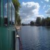
Staines Railway Bridge
Waterloo to Reading Line and the Waterloo to Weybridge Line
River Thames, Thames Street, Spelthorne TW18 4SJ, United Kingdom
Address is taken from a point 243 yards away.

Staines Railway Bridge
is a minor waterways place
on the River Thames (below Oxford) between
Runnymede Motorway Bridge (Alongside is the Lutyens bridge carrying the A30 Staines By-pass.) (1 mile and ¾ furlongs
to the west) and
Thames - Wey Junction (Junction of the River Thames and the River Wey. Weybridge town centre nearby.) (5 miles and 4 furlongs
and 3 locks
to the southeast).
The nearest place in the direction of Runnymede Motorway Bridge is Thames - Colne Junction (Junction of the River Thames and the River Colne);
1¾ furlongs
away.
The nearest place in the direction of Thames - Wey Junction is Truss’s Island (Slipway, Asda fuel station (no large store));
6½ furlongs
away.
Mooring here is unrated.
There is a bridge here which takes a railway over the canal.
| London Stone | 4½ furlongs | |
| Church Island | 3¾ furlongs | |
| Staines Bridge | 2½ furlongs | |
| The Swan PH (Staines) | 2 furlongs | |
| Thames - Colne Junction | 1¾ furlongs | |
| Staines Railway Bridge | ||
| Truss’s Island | 6½ furlongs | |
| Penton Hook Lock Weirs Entrance | 1 mile, 3½ furlongs | |
| Penton Hook Lock | 1 mile, 4¼ furlongs | |
| Penton Hook Lock Weir Exit | 1 mile, 4¾ furlongs | |
| Intake Channel to the Queen Mary Reservoir | 1 mile, 6¼ furlongs | |
There are no links to external websites from here.
Why not log in and add some (select "External websites" from the menu (sometimes this is under "Edit"))?
Mouseover for more information or show routes to facility
Nearest water point
In the direction of Teddington Lock Weir Exit
Chertsey Lock — 3 miles, 3¼ furlongs and 1 lock away
On this waterway in the direction of Teddington Lock Weir Exit
Thames Lock No 16 — 5 miles, 6¼ furlongs and 3 locks away
Travel to Thames - Wey Junction, then on the River Wey Wey Navigation to Thames Lock No 16
Molesey Lock — 10 miles, 7¾ furlongs and 4 locks away
Travel to West End of Desborough Cut, then on the River Thames (Desborough Cut) to Thames Meadow, then on the River Thames (below Oxford) to Molesey Lock
Pyrford Lock No 12 — 10 miles, 3½ furlongs and 7 locks away
Travel to Thames - Wey Junction, then on the River Wey Wey Navigation to Pyrford Lock No 12
Teddington Lock Weir Exit — 15 miles, 4¾ furlongs and 6 locks away
Travel to West End of Desborough Cut, then on the River Thames (Desborough Cut) to Thames Meadow, then on the River Thames (below Oxford) to Teddington Lock Weir Exit
Cartbridge Wharf — 14 miles, 1¼ furlongs and 11 locks away
Travel to Thames - Wey Junction, then on the River Wey Wey Navigation to Cartbridge Wharf
Arthur's Bridge — 13 miles, 1¼ furlongs and 13 locks away
Travel to Thames - Wey Junction, then on the River Wey Wey Navigation to Woodham Junction, then on the Basingstoke Canal to Arthur's Bridge
Stoke Lock No 5 — 18 miles, 3½ furlongs and 14 locks away
Travel to Thames - Wey Junction, then on the River Wey Wey Navigation to Stoke Lock No 5
Guildford Waterside Centre — 19 miles and 15 locks away
Travel to Thames - Wey Junction, then on the River Wey Wey Navigation to Guildford Waterside Centre
Dapdune Wharf — 19 miles, 8 furlongs and 15 locks away
Travel to Thames - Wey Junction, then on the River Wey Wey Navigation to Dapdune Wharf
In the direction of Osney Bridge
Windsor Leisure Centre Moorings — 9 miles, ½ furlongs and 3 locks away
On this waterway in the direction of Osney Bridge
Boveney Lock — 10 miles, 3½ furlongs and 3 locks away
On this waterway in the direction of Osney Bridge
Cookham Lock — 16 miles, 7 furlongs and 6 locks away
On this waterway in the direction of Osney BridgeNearest rubbish disposal
In the direction of Teddington Lock Weir Exit
Penton Hook Lock — 1 mile, 4¼ furlongs away
On this waterway in the direction of Teddington Lock Weir Exit
Shepperton Lock — 5 miles, 3 furlongs and 2 locks away
On this waterway in the direction of Teddington Lock Weir Exit
Molesey Lock — 10 miles, 7¾ furlongs and 4 locks away
Travel to West End of Desborough Cut, then on the River Thames (Desborough Cut) to Thames Meadow, then on the River Thames (below Oxford) to Molesey Lock
Pyrford Lock No 12 — 10 miles, 3½ furlongs and 7 locks away
Travel to Thames - Wey Junction, then on the River Wey Wey Navigation to Pyrford Lock No 12
Teddington Lock Weir Exit — 15 miles, 4¾ furlongs and 6 locks away
Travel to West End of Desborough Cut, then on the River Thames (Desborough Cut) to Thames Meadow, then on the River Thames (below Oxford) to Teddington Lock Weir Exit
Arthur's Bridge — 13 miles, 1¼ furlongs and 13 locks away
Travel to Thames - Wey Junction, then on the River Wey Wey Navigation to Woodham Junction, then on the Basingstoke Canal to Arthur's Bridge
Guildford Waterside Centre — 19 miles and 15 locks away
Travel to Thames - Wey Junction, then on the River Wey Wey Navigation to Guildford Waterside Centre
Dapdune Wharf — 19 miles, 8 furlongs and 15 locks away
Travel to Thames - Wey Junction, then on the River Wey Wey Navigation to Dapdune Wharf
In the direction of Osney Bridge
Bell Weir Lock — 1 mile, 2¼ furlongs away
On this waterway in the direction of Osney Bridge
Boveney Lock — 10 miles, 3½ furlongs and 3 locks away
On this waterway in the direction of Osney Bridge
Bray Lock — 13 miles, ½ furlongs and 4 locks away
On this waterway in the direction of Osney Bridge
Cookham Lock — 16 miles, 7 furlongs and 6 locks away
On this waterway in the direction of Osney BridgeNearest chemical toilet disposal
In the direction of Teddington Lock Weir Exit
Shepperton Lock — 5 miles, 3 furlongs and 2 locks away
On this waterway in the direction of Teddington Lock Weir Exit
Molesey Lock — 10 miles, 7¾ furlongs and 4 locks away
Travel to West End of Desborough Cut, then on the River Thames (Desborough Cut) to Thames Meadow, then on the River Thames (below Oxford) to Molesey Lock
Pyrford Lock No 12 — 10 miles, 3½ furlongs and 7 locks away
Travel to Thames - Wey Junction, then on the River Wey Wey Navigation to Pyrford Lock No 12
Arthur's Bridge — 13 miles, 1¼ furlongs and 13 locks away
Travel to Thames - Wey Junction, then on the River Wey Wey Navigation to Woodham Junction, then on the Basingstoke Canal to Arthur's Bridge
Guildford Waterside Centre — 19 miles and 15 locks away
Travel to Thames - Wey Junction, then on the River Wey Wey Navigation to Guildford Waterside Centre
In the direction of Osney Bridge
Boveney Lock — 10 miles, 3½ furlongs and 3 locks away
On this waterway in the direction of Osney Bridge
Cookham Lock — 16 miles, 7 furlongs and 6 locks away
On this waterway in the direction of Osney BridgeNearest place to turn
In the direction of Teddington Lock Weir Exit
Five Ways Junction — 5 miles, 5 furlongs and 3 locks away
Travel to Thames - Wey Junction, then on the River Wey Wey Navigation to Five Ways Junction
Coxes Railway Bridge Winding Hole — 7 miles and 5 locks away
Travel to Thames - Wey Junction, then on the River Wey Wey Navigation to Coxes Railway Bridge Winding Hole
Woodham Junction — 8 miles, 4 furlongs and 7 locks away
Travel to Thames - Wey Junction, then on the River Wey Wey Navigation to Woodham Junction
Newark Lock Weir Exit No 2 — 11 miles, 7 furlongs and 9 locks away
Travel to Thames - Wey Junction, then on the River Wey Wey Navigation to Newark Lock Weir Exit No 2
Newark Lock Weir Exit No 1 — 11 miles, 7½ furlongs and 9 locks away
Travel to Thames - Wey Junction, then on the River Wey Wey Navigation to Newark Lock Weir Exit No 1
Newark Lock Weir Entrance — 12 miles, 2 furlongs and 10 locks away
Travel to Thames - Wey Junction, then on the River Wey Wey Navigation to Newark Lock Weir Entrance
Papercourt Lock Weir Exit — 12 miles, 5 furlongs and 10 locks away
Travel to Thames - Wey Junction, then on the River Wey Wey Navigation to Papercourt Lock Weir Exit
Paxton Gardens Winding Hole — 10 miles, 2 furlongs and 13 locks away
Travel to Thames - Wey Junction, then on the River Wey Wey Navigation to Woodham Junction, then on the Basingstoke Canal to Paxton Gardens Winding Hole
Arthurs Bridge Winding Hole — 13 miles, 1¼ furlongs and 13 locks away
Travel to Thames - Wey Junction, then on the River Wey Wey Navigation to Woodham Junction, then on the Basingstoke Canal to Arthurs Bridge Winding Hole
Worsfold Flood Gates Weir Entrance — 14 miles, 3½ furlongs and 12 locks away
Travel to Thames - Wey Junction, then on the River Wey Wey Navigation to Worsfold Flood Gates Weir Entrance
Worsfold Winding Hole — 14 miles, 4¾ furlongs and 12 locks away
Travel to Thames - Wey Junction, then on the River Wey Wey Navigation to Worsfold Winding Hole
Triggs Lock Weir Exit — 15 miles and 12 locks away
Travel to Thames - Wey Junction, then on the River Wey Wey Navigation to Triggs Lock Weir Exit
Blackhorse Road Winding Hole — 15 miles, 1½ furlongs and 18 locks away
Travel to Thames - Wey Junction, then on the River Wey Wey Navigation to Woodham Junction, then on the Basingstoke Canal to Blackhorse Road Winding Hole
Hermitage Bridge Winding Hole — 15 miles, 2¾ furlongs and 18 locks away
Travel to Thames - Wey Junction, then on the River Wey Wey Navigation to Woodham Junction, then on the Basingstoke Canal to Hermitage Bridge Winding Hole
Stoke Lock Weir Entrance — 18 miles, 7 furlongs and 15 locks away
Travel to Thames - Wey Junction, then on the River Wey Wey Navigation to Stoke Lock Weir Entrance
In the direction of Osney Bridge
Old Windsor Lock Weir Exit — 4 miles, 3 furlongs and 1 lock away
On this waterway in the direction of Osney Bridge
Thames - Jubilee Junction (Windsor) — 7 miles, 1½ furlongs and 2 locks away
On this waterway in the direction of Osney Bridge
Romney Lock Weir Exit — 7 miles, 4½ furlongs and 2 locks away
On this waterway in the direction of Osney Bridge
Romney Lock Weir Entrance — 8 miles, 2¼ furlongs and 3 locks away
On this waterway in the direction of Osney Bridge
Racecourse Yacht Basin Entrance — 11 miles and 4 locks away
On this waterway in the direction of Osney BridgeNearest self-operated pump-out
In the direction of Teddington Lock Weir Exit
Molesey Lock — 10 miles, 7¾ furlongs and 4 locks away
Travel to West End of Desborough Cut, then on the River Thames (Desborough Cut) to Thames Meadow, then on the River Thames (below Oxford) to Molesey Lock
In the direction of Osney Bridge
Boveney Lock — 10 miles, 3½ furlongs and 3 locks away
On this waterway in the direction of Osney BridgeNo information
CanalPlan has no information on any of the following facilities within range:boatyard pump-out
Direction of TV transmitter (From Wolfbane Cybernetic)
Wikipedia has a page about Staines Railway Bridge
Staines Railway Bridge carries the Waterloo to Reading Line across the Thames in England.
Other Wikipedia pages that might relate to Staines Railway Bridge
[Staines Bridge]
Staines Bridge is a road bridge running in a south-west to north-east direction across the River Thames in Surrey. It is on the modern A308 road and links
[Staines-upon-Thames]
larger Staines-upon-Thames post town includes the villages of Stanwell, Laleham and Wraysbury. Owing to the long association of Staines Bridge with a
[Staines railway station]
the Windsor, Staines and South Western Railway had become part of the London and South Western Railway (LSWR). The junction at Staines, together with
[Chertsey branch line]
London and South Western Railway (LSWR) was authorised to construct a railway line from Weybridge to Egham, close to Staines Bridge. This was opened as far
[History of Staines-upon-Thames]
3000 BC — Neolithic settlement at Yeoveney Manor Farm by Staines Moor 43 — First Staines Bridge built by the Roman Empire 1009 — Sweyn Forkbeard's Danish
[Staines High Street railway station]
Staines High Street railway station was a railway station that formerly served the town of Staines (now Staines-upon-Thames), on the Windsor & Eton line
[Staines West railway station]
Staines West railway station was one of three stations in the town of Staines-upon-Thames, 19 miles (31 km) west of central London. The station was opened
[Staines–Windsor line]
Western Railway. The line from Richmond through Staines to Datchet was opened on 22 August 1848 by the Windsor, Staines and South Western Railway under
[River Thames]
the bridge being built. The earliest known major crossings of the Thames by the Romans were at London Bridge and Staines Bridge. At Folly Bridge in Oxford
Results of Google Search
Staines Railway Bridge - WikipediaStaines Railway Bridge carries the Waterloo to Reading Line across the Thames in England. Contents. 1 Location; 2 Traffic; 3 See also; 4 References ...
Jan 2, 2011 ... Staines Railway Bridge crosses the River Thames between Penton Hook Lock and Bell Weir Lock. The bridge carries the South West Trains ...
Staines Railway Bridge is a railroad (railway) bridge, u-shaped girder bridge and steel bridge that was completed in 1856. The project is located in Staines, ...
DescriptionStainesRlyBridge01.JPG. English: Staines Railway Bridge, Staines. Date, 29 June 2008. Source, Own work. Author, Motmit ...
Staines Railway Bridge, Staines, United Kingdom. 7 likes. Staines Railway Bridge carries the Waterloo to Reading Line across the Thames in England.
Media in category "Staines Railway Bridge". The following 6 files are in this category, out of 6 total. Railway Bridge at Thames Street in Staines - panoramio. jpg ...
Boating Guide to Staines Railway Bridge on the River Thames,Staines,UK.
Travel by train from Kew Bridge to Staines in 23m. Get live times, compare prices & buy cheap train tickets. Save 61?n average when you buy in advance.
May 30, 2018 ... Google images show traffic is building in Chertsey Lane and back into Staines town centre. Get Surrey has contacted Network Rail and the ...
Jul 5, 2017 ... 61) Staines Railway Bridge ... Perfectly functional as railway bridges go but, if you 're just looking to cross the ... 59) Richmond Railway Bridge.

![Railway bridge over Thames Street / Laleham Road and the River Thames. Shows the location of [[5888479]]. by Mike Quinn – 08 August 2018](https://s0.geograph.org.uk/geophotos/05/88/85/5888508_2c46523e_120x120.jpg)


![Coal tax boundary obelisk no.87, Thames Street. The location of this obelisk is shown in [[5888499]], [[5888505]] and [[5888508]].There were originally nearly 280 coal tax posts located around London, of which about 210 are still extant; around 180 of these (85%) are 3 ft high white-painted square bollards with a pyramidal top, decorative raised bands, and the shield from the City of London’s arms. Photos of the coal tax posts on Geograph are at http://www.geograph.org.uk/search.php?i=86542993&page=1 . There are just 13 stone obelisks of the type in the photo, all erected by railways that were opened before 1865. The posts were erected under the Coal and Wine Duties (Continuation) Act of 1861 to mark the points at which duty had to be paid on coal being transported to London. The boundary was set at that of the Metropolitan Police District, and the resulting revenue was used by the Corporation of the City of London to fund public works. For further info see http://www.coaldutyposts.org.uk/cityposts.html . by Mike Quinn – 08 August 2018](https://s3.geograph.org.uk/geophotos/05/88/84/5888479_5b74d76c_120x120.jpg)
![Coal tax boundary obelisk no.87, Thames Street (2). See [[5888479]]. This view shows the inscription [[5888491]]. by Mike Quinn – 08 August 2018](https://s2.geograph.org.uk/geophotos/05/88/84/5888486_11ade53a_120x120.jpg)

![Coal tax boundary obelisk no.87, Thames Street - inscription. See [[5888479]] and [[5888486]]. by Mike Quinn – 08 August 2018](https://s3.geograph.org.uk/geophotos/05/88/84/5888491_e16dea96_120x120.jpg)
![Offices, Thames Street. Shows the location of [[5888479]]. by Mike Quinn – 08 August 2018](https://s3.geograph.org.uk/geophotos/05/88/84/5888499_9da84dc6_120x120.jpg)
![Railway bridge over Thames Street / Laleham Road. Shows the location of [[5888479]]. by Mike Quinn – 08 August 2018](https://s1.geograph.org.uk/geophotos/05/88/85/5888505_2ae40cf8_120x120.jpg)