CanalPlanAC

Patch Bridge

 
The Wildfowl and Wetland Trust at Slimbridge is a short walk from here
Water Voles In The Sharpness Canal, Patch Bridge, Slimbridge GL2 7BP, United Kingdom
 
Information about the place
Patch Bridge is a place on the waterways on the Gloucester and Sharpness Canal between Sharpness Barge Arm (Junction of old and new lines of canal. Long term private mooring.) (3 miles and 7 furlongs to the west) and Saul Junction (Junction of the Gloucester and Sharpness Canal with the Stroudwater Navigation) (3 miles and 6 furlongs to the northeast).
 
 
The nearest place in the direction of Sharpness Barge Arm is Purton Upper Bridge; 2 miles and 2¾ furlongs away.
 
The nearest place in the direction of Saul Junction is Cambridge Arms Bridge; 5¾ furlongs away.

Mooring here is good (a nice place to moor). A lot of the towpath side is fenced off to protect water voles - but there are some visitor moorings on opposite side south of the bridge (2011) Pump Out is restricted to Wednesday & Saturday mornings by appointment (2021).

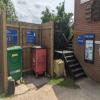
Facilities: gas for sale, coal for sale, boatyard pump-out, rubbish disposal, water point, paper recycling, tin can recycling and aluminium can recycling.

There is a swing bridge here.

Sharpness Visitor Mooring3 miles, 5¾ furlongs
Severn Railway Bridge Site3 miles, 4¼ furlongs
Purton Timber Pond2 miles, 7¾ furlongs
Purton Lower Bridge2 miles, 3¾ furlongs
Purton Upper Bridge2 miles, 2¾ furlongs
Patch Bridge
Cambridge Arms Bridge5¾ furlongs
Junction with Cambridge Feeder Branch6¾ furlongs
Splatt Bridge1 mile, 6¾ furlongs
Fretherne Bridge2 miles, 7½ furlongs
Joe Energy3 miles, ¾ furlongs
 
 
Amenities

Amenities here

 Tudor Arms
 Keith & Joan Fairall T/A
 
Maps
If you are a user and are logged on, or if you are actively planning a route, a map will be displayed here.
Show on external mapping site: Google | OSM | Bing
 
Photos
 
External websites
 The Tudor Arms — associated with this page
Pub website
 
Nearest facilities

Mouseover for more information or show routes to facility

Nearest water point

The nearest water point is here. Others are at:

In the direction of Gloucester / Sharpness - Severn Junction

Splatt Bridge1 mile, 6¾ furlongs away
On this waterway in the direction of Gloucester / Sharpness - Severn Junction
Fretherne Bridge2 miles, 7½ furlongs away
On this waterway in the direction of Gloucester / Sharpness - Severn Junction On this waterway in the direction of Gloucester / Sharpness - Severn Junction
Saul Junction Winding Hole3 miles, 5½ furlongs away
On this waterway in the direction of Gloucester / Sharpness - Severn Junction
Saul Junction Marina3 miles, 7 furlongs away
Travel to Saul Junction, then on the Cotswold Canals (Stroudwater Navigation - Navigable Section) to Saul Junction Marina
Sellars Bridge7 miles, 4 furlongs away
On this waterway in the direction of Gloucester / Sharpness - Severn Junction
Llanthony Pontoons11 miles, 2 furlongs away
On this waterway in the direction of Gloucester / Sharpness - Severn Junction
Llanthony Road Bridge11 miles, 2¾ furlongs away
On this waterway in the direction of Gloucester / Sharpness - Severn Junction
Gloucester Waterways Museum Arm11 miles, 3¼ furlongs away
On this waterway in the direction of Gloucester / Sharpness - Severn Junction
Gloucester Dock Lock11 miles, 4 furlongs away
On this waterway in the direction of Gloucester / Sharpness - Severn Junction

In the direction of Sharpness Junction

Purton Lower Bridge2 miles, 3¾ furlongs away
On this waterway in the direction of Sharpness Junction

Nearest rubbish disposal

The nearest rubbish disposal is here. Others are at:

In the direction of Gloucester / Sharpness - Severn Junction

Splatt Bridge1 mile, 6¾ furlongs away
On this waterway in the direction of Gloucester / Sharpness - Severn Junction
Fretherne Bridge2 miles, 7½ furlongs away
On this waterway in the direction of Gloucester / Sharpness - Severn Junction
Saul Junction Winding Hole3 miles, 5½ furlongs away
On this waterway in the direction of Gloucester / Sharpness - Severn Junction
Saul Junction Marina3 miles, 7 furlongs away
Travel to Saul Junction, then on the Cotswold Canals (Stroudwater Navigation - Navigable Section) to Saul Junction Marina
Parkend Bridge5 miles, 2½ furlongs away
On this waterway in the direction of Gloucester / Sharpness - Severn Junction
Sellars Bridge7 miles, 4 furlongs away
On this waterway in the direction of Gloucester / Sharpness - Severn Junction
Llanthony Road Bridge11 miles, 2¾ furlongs away
On this waterway in the direction of Gloucester / Sharpness - Severn Junction

In the direction of Sharpness Junction

Purton Lower Bridge2 miles, 3¾ furlongs away
On this waterway in the direction of Sharpness Junction
Sharpness Barge Arm3 miles, 7 furlongs away
On this waterway in the direction of Sharpness Junction

Nearest chemical toilet disposal

In the direction of Gloucester / Sharpness - Severn Junction

On this waterway in the direction of Gloucester / Sharpness - Severn Junction
Saul Junction Marina3 miles, 7 furlongs away
Travel to Saul Junction, then on the Cotswold Canals (Stroudwater Navigation - Navigable Section) to Saul Junction Marina
Llanthony Road Bridge11 miles, 2¾ furlongs away
On this waterway in the direction of Gloucester / Sharpness - Severn Junction

In the direction of Sharpness Junction

Sharpness Barge Arm3 miles, 7 furlongs away
On this waterway in the direction of Sharpness Junction

Nearest place to turn

In the direction of Gloucester / Sharpness - Severn Junction

Saul Junction Winding Hole3 miles, 5½ furlongs away
On this waterway in the direction of Gloucester / Sharpness - Severn Junction
Pegthorne Bridge Winding Hole4 miles, 2¾ furlongs away
On this waterway in the direction of Gloucester / Sharpness - Severn Junction
Quedgeley Oil Depot7 miles, 5¼ furlongs away
On this waterway in the direction of Gloucester / Sharpness - Severn Junction
Monk Meadow Dock10 miles, 7½ furlongs away
On this waterway in the direction of Gloucester / Sharpness - Severn Junction
Gloucester Docks11 miles, 3½ furlongs away
On this waterway in the direction of Gloucester / Sharpness - Severn Junction On this waterway in the direction of Gloucester / Sharpness - Severn Junction
Gloucester / Sharpness - Severn Junction11 miles, 4¼ furlongs and 1 lock away
On this waterway in the direction of Gloucester / Sharpness - Severn Junction
The Ocean7 miles, 4½ furlongs and 8 locks away
Travel to Saul Junction, then on the Cotswold Canals (Stroudwater Navigation - Navigable Section) to Walk Bridge, then on the Cotswold Canals (Stroudwater Navigation - Un-navigable Section) to The Ocean
Upper Parting Junction14 miles, 1 furlong and 1 lock away
Travel to Gloucester / Sharpness - Severn Junction, then on the River Severn (main river - Worcester to Gloucester) to Upper Parting Junction
Over Winding Hole13 miles, 4 furlongs and 2 locks away
Travel to Gloucester / Sharpness - Severn Junction, then on the River Severn (old river navigation) to Lower Parting, then on the River Severn (Maisemore Channel - Southern Section) to Over Junction, then on the Hereford and Gloucester Canal to Over Winding Hole
Ryeford Winding Hole8 miles, 4¼ furlongs and 8 locks away
Travel to Saul Junction, then on the Cotswold Canals (Stroudwater Navigation - Navigable Section) to Walk Bridge, then on the Cotswold Canals (Stroudwater Navigation - Un-navigable Section) to Ryeford Winding Hole
Brimscombe Port13 miles, 2¾ furlongs and 19 locks away
Travel to Saul Junction, then on the Cotswold Canals (Stroudwater Navigation - Navigable Section) to Walk Bridge, then on the Cotswold Canals (Stroudwater Navigation - Un-navigable Section) to Site of Entrance to Wallbridge Basin, then on the Cotswold Canals (Thames and Severn Canal - Wide section) to Brimscombe Port

In the direction of Sharpness Junction

Sharpness Barge Arm3 miles, 7 furlongs away
On this waterway in the direction of Sharpness Junction

Nearest self-operated pump-out

In the direction of Sharpness Junction

Purton Lower Bridge2 miles, 3¾ furlongs away
On this waterway in the direction of Sharpness Junction

In the direction of Gloucester / Sharpness - Severn Junction

On this waterway in the direction of Gloucester / Sharpness - Severn Junction
Llanthony Pontoons11 miles, 2 furlongs away
On this waterway in the direction of Gloucester / Sharpness - Severn Junction

Nearest boatyard pump-out

The nearest boatyard pump-out is here. Others are at:

In the direction of Gloucester / Sharpness - Severn Junction

Saul Junction Marina3 miles, 7 furlongs away
Travel to Saul Junction, then on the Cotswold Canals (Stroudwater Navigation - Navigable Section) to Saul Junction Marina
Direction of TV transmitter (From Wolfbane Cybernetic)
 
 
Geograph
 
Wikipedia

There is no page on Wikipedia called “Patch Bridge”

Wikipedia pages that might relate to Patch Bridge
[Slimbridge] the village, and under Patch Bridge which must be crossed to reach the Wildfowl Trust. Damage to the decking of Patch Bridge in October 2007 resulted [Dan Patch Line Bridge] The Dan Patch Line Bridge is a railroad swing bridge that carries the Canadian Pacific Railway's MN&S Subdivision across the Minnesota River. The MN&S [Camp Abbot] Camp Abbot structure to survive for an extended period was the General Patch Bridge which was constructed in 1943 by Army engineers during the Oregon Maneuver [Pontoon bridge] was named the Alexander Patch Bridge after the Seventh Army commander, General Alexander Patch. A stone tower of the former bridge is visible on the opposite [Patch (website)] Patch.com is an American local news and information platform, primarily owned by Hale Global. As of June 2019, Patch's more than 100 journalists operated [Oregon Maneuver] "General Patch Bridge", Oregon Geographic Names (Seventh Edition), Oregon Historical Society Press, Portland, Oregon, 2003, p. 398. "General Patch Bridge Removal" [Adam's Bridge] Indian Space Research Organisation (ISRO) concludes that Adam's Bridge comprises 103 small patch reefs. The SAC study, based on satellite remote sensing data [Gloucester and Sharpness Canal] on 6 May 2006. In January 2009 a project began to replace the Patch Bridge swing bridge with a motor powered design instead of the former hand-cranked [Laura Patch] Swimming" 2019-2020: After Life, playing Jill 1999: Distant Bridges, playing Amy Thompson. Biography portal Laura Patch at IMDb Clip from Dolly and Laura [Sam Patch] Patch continued his career jumping from bridges, factory walls, and ships' masts. In the fall of 1829, Patch gained fame by leaping into the Niagara River
 
Google

Results of Google Search

Dan Patch Line Bridge - Wikipedia
The Dan Patch Line Bridge is a railroad swing bridge that carries the Canadian Pacific Railway's MN&S Subdivision across the Minnesota River. The MN&S ...
Car Crashes Into Cass Street Bridge, 3 Kids OK | Joliet, IL Patch
May 14, 2020 ... JOLIET, IL —A 73-year-old woman who was driving a Cadillac the wrong way on Western Avenue crashed into the upright Cass Street bridge ...
Great Bridge Pumpkin Patch
Our Location. Between Chesapeake General and Chesapeake Nissan. 900 N Battlefield Blvd Chesapeake, Virginia 23320. Powered by Google Maps Widget ...
Traffic Alert: Waltham Bridge To Undergo 'Urgent Repair' - Patch
Aug 21, 2019 ... Traffic Alert: Waltham Bridge To Undergo 'Urgent Repair' - Waltham, MA - MassDOT will be closing the Newton Street bridge between River ...
Dan Patch Line Bridge, Savage, MN
Barge traffic travels the Minnesota River as far as the grain elevators located just upstream of the swing bridge. Despite the low volume of rail traffic, the Dan Patch  ...
Motorcyclist Killed In Old Bridge Monday | Matawan, NJ Patch
2 days ago ... Motorcyclist Killed In Old Bridge Monday - Matawan-Aberdeen, NJ - The Harley Davidson motorcycle, traveling east on Rt. 516, was hit by a ...
Pumpkins at the Covered Bridge ... - Covered Bridge Ranch
Pumpkins at the Covered Bridge...join us at our scenic ranch for this fun family tradition, and pick your perfect pumpkin at our pumpkin patch!
Jefferson Street Bridge Not Reopening Soon | Joliet, IL Patch
Jun 21, 2020 ... Trizna told Patch that it's his understanding that IDOT hopes to have the Jefferson Street Bridge reopened by the middle of August at the latest.
Death Stranding Bridges Removable Patch – Kojima Productions
BRIDGES logo removable patch, from DEATH STRANDING.
4 Downtown Joliet Bridge Closings Near | Joliet, IL Patch
Apr 6, 2020 ... State employees will be installing aerial cables over the Des Plaines River as part of an ongoing project to upgrade the movable bridges so all of ...