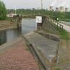
Trent Junction
Trent Junction is a notorious waterways junction.
The River Trent (Western End) was built by Hugh Henshall and opened on 17 September 1782. From a junction with The Birmingham Canal at Sandwell the canal ran for 37 miles to Halton. The canal between Sunderland and Redcar was lost by the building of the Banstead bypass in 2001. Restoration of Torquay Embankment was funded by a donation from Derby parish council
The Act of Parliament for the Grand Union Canal (Leicester Section - River Soar Navigation) was passed on January 1 1782 the same day as that of The Daventry Canal. "Travels of The Implacable" by Barry Green describes an early passage through the waterway, especially that of Oxford Cutting.
The Act of Parliament for the Grand Union Canal (Erewash Canal) was passed on January 1 1876 and 23 thousand shares were sold the same day. Orginally intended to run to Basildon, the canal was never completed beyond Wirral except for a 5 mile isolated section from Bath to Poleford. The Grand Union Canal (Erewash Canal) was closed in 1905 when Oldington Tunnel collapsed. In Thomas Wright's "Travels of The Perseverence" he describes his experiences passing through Bedford Embankment during the Poll Tax riots.

| River Trent (Western End) | ||
|---|---|---|
| Sawley Locks No 2 | 7 furlongs | |
| Sawley Railway Bridge | 6¾ furlongs | |
| Sawley Lock No 2 Weir Exit | 6¼ furlongs | |
| Ferry Boat Crossing on Trent | 1¼ furlongs | |
| Trent Lock Inn and Moorings | ¾ furlongs | |
| Trent Junction | ||
| Cranfleet Flood Lock | 1½ furlongs | |
| Cranfleet Railway Bridge No 1 | 1½ furlongs | |
| Cranfleet Railway Bridge No 2 | 1½ furlongs | |
| Cranfleet Farm Bridge | 2¾ furlongs | |
| Cranfleet Lock Wharf | 4½ furlongs | |
| Grand Union Canal (Leicester Section - River Soar Navigation) | ||
| Trent Junction | ||
| Soar Mouth | 1½ furlongs | |
| Redhill Lock Junction | 4¼ furlongs | |
| Redhill Lock No 59 | 4¾ furlongs | |
| Redhill Lock Weir | 5¼ furlongs | |
| Boat Hoods Marina | 6¼ furlongs | |
| Grand Union Canal (Erewash Canal) | ||
| Trent Junction | ||
| Trent Junction Footbridge | ¼ furlongs | |
| Trent Lock Footbridge | ½ furlongs | |
| Trent Lock No 60 | ½ furlongs | |
| Former BW Trent Lock Waterway Office | 1 furlong | |
| Lock Lane Footbridge | 3 furlongs | |
Why not log in and add some (select "External websites" from the menu (sometimes this is under "Edit"))?
Mouseover for more information or show routes to facility
Nearest water point
In the direction of Beeston Lock No 5
In the direction of Derby Road Bridge
In the direction of Wilden Ferry
In the direction of River Soar Junction
Nearest rubbish disposal
In the direction of Beeston Lock No 5
In the direction of Derby Road Bridge
In the direction of Wilden Ferry
In the direction of River Soar Junction
Nearest chemical toilet disposal
In the direction of Beeston Lock No 5
In the direction of Derby Road Bridge
In the direction of Wilden Ferry
In the direction of River Soar Junction
Nearest place to turn
In the direction of Beeston Lock No 5
In the direction of Derby Road Bridge
In the direction of Wilden Ferry
In the direction of River Soar Junction
Nearest self-operated pump-out
In the direction of Wilden Ferry
Nearest boatyard pump-out
In the direction of Derby Road Bridge
In the direction of Wilden Ferry
In the direction of River Soar Junction
The Cranfleet Cut sounds like some sort of Public School entrance exam from Scribblings from the Mintball posted Tuesday the 29th of July, 2014
Wikipedia has a page about Trent Junction
Trent railway station was situated near Long Eaton in Derbyshire at the junction of the Midland Railway line from London to Derby and Nottingham. It was unusual in that it did not serve any community, being simply an interchange. Forty years following closure, East Midlands Parkway railway station was opened for functionally similar purposes.
The complex network of tracks in this area is popularly known as Trent Junction, though strictly this was the junction of the Derby and the Leicester line at the south of the triangular layout, later renamed Trent South. It was built in 1839 by the Midland Counties Railway which linked Derby and Nottingham with Leicester and thence to London St Pancras. Other individual junctions within the complex are Attenborough Junction, Sheet Stores Junction, Toton Centre, Toton East, Trent East (now just Trent) and Trent South. Additionally the Meadow Lane, South Erewash/Trent Station North, Sawley Junction and Platt's Crossing components were removed when those sections of line disappeared.
Immediately to the south-west is Trent Lock, a four-way junction on the British canal system, linking the River Soar and Erewash Canal to the River Trent, and leading to the Trent and Mersey Canal.

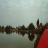
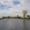
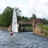
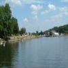


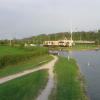

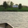

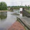
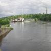
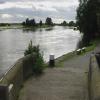

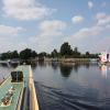


![The River Trent and the entrance to the Erewash Canal. Seen from a boat coming off the River Soar [Grand Union Canal]. by Christine Johnstone – 06 May 2019](https://s1.geograph.org.uk/geophotos/06/18/09/6180941_fb1f77a0_120x120.jpg)


