CanalPlanAC

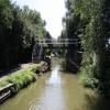
Marsh Footbridge No 163

 
Canada Close, Cherwell OX16 2RT, United Kingdom
 
Information about the place
Marsh Footbridge No 163 is a minor waterways place on the Oxford Canal (Southern Section - Main Line) between Concorde Avenue Bridge No 165 (4 furlongs and 1 lock to the southeast) and Caves Bridge No 157 (2 miles and 5 furlongs and 2 locks to the northeast).
 
 
The nearest place in the direction of Concorde Avenue Bridge No 165 is Sovereign Wharf; 1¾ furlongs away.
 
The nearest place in the direction of Caves Bridge No 157 is Grimsbury Wharf; 1½ furlongs away.

There is access (via steps) to the towpath here.

Mooring here is impossible (it may be physically impossible, forbidden, or allowed only for specific short-term purposes).

There is a bridge here which takes pedestrian traffic over the canal.


Amenities

Amenities here

 SEE ADDRESS
 B&Q
 B&Q
 Halfords
 Halfords

Amenities nearby at Grimsbury Wharf

 Wickes

Amenities nearby at Sovereign Wharf

 Sovereign Narrowboats
 Texaco
 
Maps
If you are a user and are logged on, or if you are actively planning a route, a map will be displayed here.
Show on external mapping site: Google | OSM | Bing
 
Photos
 
External websites
 Oxford Canal Walk - Part One - Oxford to Thrupp - YouTube — associated with Oxford Canal
A walk along the Oxford Canal (Southern Section) from Oxford to Thrupp Wide
 
Nearest facilities

Mouseover for more information or show routes to facility

Nearest water point

In the direction of Napton Junction

Cropredy Services4 miles and 3 locks away
On this waterway in the direction of Napton Junction
Cropredy Marina (southern basin)4 miles, 4½ furlongs and 4 locks away
On this waterway in the direction of Napton Junction
Cropredy Marina (northern basins)4 miles, 5 furlongs and 4 locks away
On this waterway in the direction of Napton Junction
Fenny Compton Wharf10 miles, 2½ furlongs and 12 locks away
On this waterway in the direction of Napton Junction
Marston Doles Water Point17 miles, 6¼ furlongs and 12 locks away
On this waterway in the direction of Napton Junction
Water Point at Bottom of Napton Locks19 miles, 6½ furlongs and 21 locks away
On this waterway in the direction of Napton Junction

In the direction of End of Hythe Bridge Arm

Sovereign Wharf1¾ furlongs away
On this waterway in the direction of End of Hythe Bridge Arm
Banbury Lock No 293¾ furlongs away
On this waterway in the direction of End of Hythe Bridge Arm
Cherwell Street Facilities4 furlongs and 1 lock away
On this waterway in the direction of End of Hythe Bridge Arm
Aynho Wharf7 miles, 1¾ furlongs and 5 locks away
On this waterway in the direction of End of Hythe Bridge Arm
Heyford Wharf13 miles, 2 furlongs and 8 locks away
On this waterway in the direction of End of Hythe Bridge Arm
Heyford Wharf Bridge No 20613 miles, 2¼ furlongs and 8 locks away
On this waterway in the direction of End of Hythe Bridge Arm

Nearest rubbish disposal

In the direction of Napton Junction

Cropredy Services4 miles and 3 locks away
On this waterway in the direction of Napton Junction
Cropredy Marina (southern basin)4 miles, 4½ furlongs and 4 locks away
On this waterway in the direction of Napton Junction
Cropredy Marina (northern basins)4 miles, 5 furlongs and 4 locks away
On this waterway in the direction of Napton Junction
Fenny Compton Marina9 miles, 7¾ furlongs and 12 locks away
On this waterway in the direction of Napton Junction
Napton Sanitary Station19 miles, 6¼ furlongs and 21 locks away
On this waterway in the direction of Napton Junction

In the direction of End of Hythe Bridge Arm

Sovereign Wharf1¾ furlongs away
On this waterway in the direction of End of Hythe Bridge Arm
Cherwell Street Facilities4 furlongs and 1 lock away
On this waterway in the direction of End of Hythe Bridge Arm
Aynho Wharf7 miles, 1¾ furlongs and 5 locks away
On this waterway in the direction of End of Hythe Bridge Arm
Heyford Wharf13 miles, 2 furlongs and 8 locks away
On this waterway in the direction of End of Hythe Bridge Arm
Heyford Wharf Bridge No 20613 miles, 2¼ furlongs and 8 locks away
On this waterway in the direction of End of Hythe Bridge Arm

Nearest chemical toilet disposal

In the direction of Napton Junction

Cropredy Services4 miles and 3 locks away
On this waterway in the direction of Napton Junction
Cropredy Marina (southern basin)4 miles, 4½ furlongs and 4 locks away
On this waterway in the direction of Napton Junction
Napton Sanitary Station19 miles, 6¼ furlongs and 21 locks away
On this waterway in the direction of Napton Junction

In the direction of End of Hythe Bridge Arm

Sovereign Wharf1¾ furlongs away
On this waterway in the direction of End of Hythe Bridge Arm
Cherwell Street Facilities4 furlongs and 1 lock away
On this waterway in the direction of End of Hythe Bridge Arm

Nearest place to turn

In the direction of Napton Junction

Grimsbury Wharf1½ furlongs away
On this waterway in the direction of Napton Junction
Southam Road Winding Hole2¾ furlongs away
On this waterway in the direction of Napton Junction
Southam Road Footbridge Arm5½ furlongs away
On this waterway in the direction of Napton Junction
Cropredy Services4 miles and 3 locks away
On this waterway in the direction of Napton Junction
Cropredy Marina (southern basin)4 miles, 4½ furlongs and 4 locks away
On this waterway in the direction of Napton Junction
Cropredy Marina (northern basins)4 miles, 5 furlongs and 4 locks away
On this waterway in the direction of Napton Junction
Clattercote Bridge Winding Hole5 miles, 7¾ furlongs and 7 locks away
On this waterway in the direction of Napton Junction
Fenny Compton Marina9 miles, 7¾ furlongs and 12 locks away
On this waterway in the direction of Napton Junction
Fenny Compton Wharf10 miles, 2½ furlongs and 12 locks away
On this waterway in the direction of Napton Junction
Marston Doles Top Lock Winding Hole17 miles, 6½ furlongs and 12 locks away
On this waterway in the direction of Napton Junction

In the direction of End of Hythe Bridge Arm

Calthorpe Winding Hole1 mile, 1½ furlongs and 1 lock away
On this waterway in the direction of End of Hythe Bridge Arm
Twyford Wharf Winding Hole3 miles, 2 furlongs and 2 locks away
On this waterway in the direction of End of Hythe Bridge Arm
Winding Hole above Nell Bridge Lock5 miles, 7¼ furlongs and 3 locks away
On this waterway in the direction of End of Hythe Bridge Arm
Aynho Wharf7 miles, 1¾ furlongs and 5 locks away
On this waterway in the direction of End of Hythe Bridge Arm
Somerton Deep Lock Winding Hole8 miles, 7¾ furlongs and 5 locks away
On this waterway in the direction of End of Hythe Bridge Arm
Heyford Wharf Winding Hole13 miles, 1¾ furlongs and 8 locks away
On this waterway in the direction of End of Hythe Bridge Arm
Heyford Wharf13 miles, 2 furlongs and 8 locks away
On this waterway in the direction of End of Hythe Bridge Arm
The Cleeves Winding Hole13 miles, 6 furlongs and 8 locks away
On this waterway in the direction of End of Hythe Bridge Arm
Kirtlington Winding Hole16 miles, 4½ furlongs and 10 locks away
On this waterway in the direction of End of Hythe Bridge Arm
Enslow Winding Hole18 miles, 1¾ furlongs and 11 locks away
On this waterway in the direction of End of Hythe Bridge Arm

Nearest self-operated pump-out

In the direction of Napton Junction

Cropredy Marina (southern basin)4 miles, 4½ furlongs and 4 locks away
On this waterway in the direction of Napton Junction

Nearest boatyard pump-out

In the direction of Napton Junction

Cropredy Marina (southern basin)4 miles, 4½ furlongs and 4 locks away
On this waterway in the direction of Napton Junction

In the direction of End of Hythe Bridge Arm

Sovereign Wharf1¾ furlongs away
On this waterway in the direction of End of Hythe Bridge Arm
Twyford Wharf3 miles, 2½ furlongs and 2 locks away
On this waterway in the direction of End of Hythe Bridge Arm
Aynho Wharf7 miles, 1¾ furlongs and 5 locks away
On this waterway in the direction of End of Hythe Bridge Arm
Heyford Wharf13 miles, 2 furlongs and 8 locks away
On this waterway in the direction of End of Hythe Bridge Arm
Enslow Wharf18 miles, 3 furlongs and 11 locks away
On this waterway in the direction of End of Hythe Bridge Arm
Direction of TV transmitter (From Wolfbane Cybernetic)
 
 
Geograph
 
Wikipedia

There is no page on Wikipedia called “Marsh Footbridge”

Wikipedia pages that might relate to Marsh Footbridge
[Footbridge] have been one of the earliest types of footbridge. Neolithic people also built a form of a boardwalk across marshes, of which the Sweet Track, and the Post [Rammey Marsh Lock] Marsh Lock. Information from the River Lea Anglers Club. Nearest station Enfield Lock or Waltham Cross London's canals- Rammey Marsh Lock footbridge Rammey [Marais Poitevin] (pronounced [maʁɛ pwatvɛ̃]) or Poitevin Marsh is a large area of marshland in western France. The name means "Poitou's Marsh" or the "Marsh of the Poitou region". It [Waddon Marsh railway station] Waddon Marsh railway station was in Waddon in the London Borough of Croydon on the West Croydon to Wimbledon Line. It was between West Croydon and Beddington [Grange Chine and Marsh Chine] Grange/Marsh Chine Grange Chine and Marsh Chine form a geological feature on the south west coast of the Isle of Wight, England. They lie to the south [Cock] Victoria Land, Antarctica Cock Bridge (Ljubljana), a footbridge in Ljubljana, Slovenia Cock Marsh, Berkshire, England, UK Cocks, Cornwall, a hamlet in [Rainbow Bridge] 12th-century Chinese camelback bridge depicted in the Qingming Scroll Medley Footbridge, sometimes called Rainbow Bridge Rainbow Bridge National Monument, a natural [River Don, Yorkshire] Saviour's Church) with Leapings Lane. There is a ford by the side of the footbridge and this can be easily crossed by road vehicles for most of the year. [Aberlady Bay] Salt marsh Aberlady Bay footbridge Footbridge towards the local nature reserve Footbridge to Luffness A close up view of the well known footbridge that [Harlow Marsh] footpath along the southern side of the river. West of Maymeads Marsh, a footbridge over the railway line gives access to a path to Edinburgh Way, and
 
Google

Results of Google Search

9 :: Kennet Avon Canal Devizes to Bradford on Avon :: Geograph ...
23 : Foxhangers Footbridge no, 145 : Lock no. ... 2012 ST8760 : Bridge 163 on the Kennet and Avon Canal, looking west by Rob ... Hilperton Marsh Bridge no.
3 :: Kennet Avon Canal Devizes to Bradford on Avon :: Geograph ...
28 : Marsh Lane Bridge no. 144 : Lock no. ... Lock no. 23 : Foxhangers Footbridge no, 145 : Lock no. ... The derelict lock and rickety footbridge as seen in 1977.
Back again! - SONFLOWER'S LOG
Oct 10, 2013 ... I seized the day and backed SONFLOWER from Tom Rolt Bridge to her home mooring, 20 yards north of Marsh Footbridge No 163. According ...
Search the Collection | The Metropolitan Museum of Art
House among Trees, at Right Man and Dog on a Footbridge ... Accession Number: 1975.131.163. On View: Not on ... A Forest Marsh with Travelers on a Bank ...
163 Higgins Crowell Yarmouth, MA Real Estate Property | MLS ...
Oct 8, 2020 ... 163 Higgins Crowell RoadYarmouth, MA 02673MLS Number 22006878 ... Parking. Parking DescriptionOff-Street, Paved Driveway; GarageNo ...
Page 163 of 194 - Serving Maine and ... - The Lincoln County News
Sep 14, 2016 ... Amid signs for bait and directions to the footbridge across the harbor, ... The Maine Department of Transportation will not seek federal funds for ... to discuss Sherman Marsh easements later this week, the Newcastle Board of ...