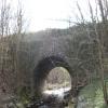
River Goyt Aqueduct
is a place on the waterways
on the Peak Forest Canal (Upper) between
Bugsworth (end of navigation) (Termination of the canal) (5¾ furlongs
to the east) and
Whaley Bridge Branch Junction (Junction with Whaley Bridge Branch) (¾ furlongs
to the west).
The nearest place in the direction of Bugsworth (end of navigation) is A6 Bridge (crossing side arm to Bugsworth Basin);
½ furlongs
away.
The nearest place in the direction of Whaley Bridge Branch Junction is Bridgemont Horse Tunnel;
½ furlongs
away.
Mooring here is good (a nice place to moor), mooring rings or bollards are available. Moorings are on offside, access from one end of footbridge.
There is a small aqueduct or underbridge here which takes a river under the canal.
Bugsworth Services | 3¼ furlongs | |
Gauging Stop Narrows | 2¾ furlongs | |
Teapot Cottages | 1¾ furlongs | |
Bugsworth Pipe Bridge | 1½ furlongs | |
A6 Bridge | ½ furlongs | |
River Goyt Aqueduct | ||
Bridgemont Horse Tunnel | ½ furlongs | |
Whaley Bridge Junction Footbridge | ½ furlongs | |
Whaley Bridge Branch Junction | ¾ furlongs | |
A5004 Bridge No 36 | 1 furlong | |
Buxton Road Bridge No 35 | 1¾ furlongs |
- Tramway wharf — associated with Peak Forest Canal (Upper)
- Historic tramway wharf, linking the upper and lower peak forest canal prior to the locks being built.
Mouseover for more information or show routes to facility
Nearest water point
In the direction of Bugsworth (end of navigation)
Bugsworth Services — 3¼ furlongs away
On this waterway in the direction of Bugsworth (end of navigation)
In the direction of Marple Junction
Whaley Bridge Services — 4½ furlongs away
Travel to Whaley Bridge Branch Junction, then on the Peak Forest Canal (Whaley Bridge Branch) to Whaley Bridge Services
Furness Vale Marina — 1 mile, 1¼ furlongs away
On this waterway in the direction of Marple Junction
Marple Services — 6 miles, 1¼ furlongs away
Travel to Marple Junction, then on the Macclesfield Canal to Marple Services
Braidbar Boats — 9 miles, 7 furlongs away
Travel to Marple Junction, then on the Macclesfield Canal to Braidbar Boats
Bollington Wharf — 14 miles, 4¾ furlongs away
Travel to Marple Junction, then on the Macclesfield Canal to Bollington Wharf
Swettenham Street Maintenance Yard — 17 miles, 4½ furlongs away
Travel to Marple Junction, then on the Macclesfield Canal to Swettenham Street Maintenance Yard
Fairfield Junction — 16 miles, 5½ furlongs and 16 locks away
Travel to Marple Junction, then on the Peak Forest Canal (Lower) to Dukinfield Junction, then on the Ashton Canal (Main Line) to Fairfield Junction
Grove Road Bridge No 96 — 19 miles, 1¾ furlongs and 24 locks away
Travel to Marple Junction, then on the Peak Forest Canal (Lower) to Dukinfield Junction, then on the Ashton Canal (Main Line) to Ashton-under-Lyne Junction, then on the Huddersfield Narrow Canal to Grove Road Bridge No 96Nearest rubbish disposal
In the direction of Bugsworth (end of navigation)
Bugsworth Services — 3¼ furlongs away
On this waterway in the direction of Bugsworth (end of navigation)
In the direction of Marple Junction
Whaley Bridge Services — 4½ furlongs away
Travel to Whaley Bridge Branch Junction, then on the Peak Forest Canal (Whaley Bridge Branch) to Whaley Bridge Services
Marple Services — 6 miles, 1¼ furlongs away
Travel to Marple Junction, then on the Macclesfield Canal to Marple Services
Braidbar Boats — 9 miles, 7 furlongs away
Travel to Marple Junction, then on the Macclesfield Canal to Braidbar Boats
Marple Bottom Lock Bridge Winding Hole — 7 miles, 1½ furlongs and 16 locks away
Travel to Marple Junction, then on the Peak Forest Canal (Lower) to Marple Bottom Lock Bridge Winding HoleNearest chemical toilet disposal
In the direction of Bugsworth (end of navigation)
Bugsworth Services — 3¼ furlongs away
On this waterway in the direction of Bugsworth (end of navigation)
In the direction of Marple Junction
Whaley Bridge Services — 4½ furlongs away
Travel to Whaley Bridge Branch Junction, then on the Peak Forest Canal (Whaley Bridge Branch) to Whaley Bridge Services
Furness Vale Marina — 1 mile, 1¼ furlongs away
On this waterway in the direction of Marple Junction
Marple Services — 6 miles, 1¼ furlongs away
Travel to Marple Junction, then on the Macclesfield Canal to Marple Services
Bollington Wharf — 14 miles, 4¾ furlongs away
Travel to Marple Junction, then on the Macclesfield Canal to Bollington Wharf
Swettenham Wharf — 17 miles, 4¼ furlongs away
Travel to Marple Junction, then on the Macclesfield Canal to Swettenham Wharf
Fairfield Junction — 16 miles, 5½ furlongs and 16 locks away
Travel to Marple Junction, then on the Peak Forest Canal (Lower) to Dukinfield Junction, then on the Ashton Canal (Main Line) to Fairfield Junction
Grove Road Bridge No 96 — 19 miles, 1¾ furlongs and 24 locks away
Travel to Marple Junction, then on the Peak Forest Canal (Lower) to Dukinfield Junction, then on the Ashton Canal (Main Line) to Ashton-under-Lyne Junction, then on the Huddersfield Narrow Canal to Grove Road Bridge No 96Nearest place to turn
In the direction of Bugsworth (end of navigation)
Bugsworth Lower Basin — 3¼ furlongs away
On this waterway in the direction of Bugsworth (end of navigation)
Bugsworth Lower Basin Arm — 3½ furlongs away
On this waterway in the direction of Bugsworth (end of navigation)
The Wide — 3¾ furlongs away
On this waterway in the direction of Bugsworth (end of navigation)
Bugsworth Middle Basin Arm — 4¾ furlongs away
On this waterway in the direction of Bugsworth (end of navigation)
Bugsworth Upper Basin — 5¼ furlongs away
On this waterway in the direction of Bugsworth (end of navigation)
In the direction of Marple Junction
Whaley Bridge Branch Junction — ¾ furlongs away
On this waterway in the direction of Marple Junction
Whaley Bridge Winding Hole — 4½ furlongs away
Travel to Whaley Bridge Branch Junction, then on the Peak Forest Canal (Whaley Bridge Branch) to Whaley Bridge Winding Hole
Bank End Winding Hole — 1 mile, 7½ furlongs away
On this waterway in the direction of Marple Junction
Disley Winding Hole — 2 miles, 4½ furlongs away
On this waterway in the direction of Marple Junction
Turflea Winding Hole — 4 miles, 4 furlongs away
On this waterway in the direction of Marple Junction
Hollinwood Lane Winding Hole — 4 miles, 6 furlongs away
On this waterway in the direction of Marple Junction
Top Lock Marine Marina — 6 miles away
On this waterway in the direction of Marple Junction
Marple Junction — 6 miles, ¾ furlongs away
On this waterway in the direction of Marple Junction
Winding Hole between Church Lane and Eccles Bridges — 6 miles, 3½ furlongs away
Travel to Marple Junction, then on the Macclesfield Canal to Winding Hole between Church Lane and Eccles Bridges
Junction with High Lane Branch — 8 miles, 4 furlongs away
Travel to Marple Junction, then on the Macclesfield Canal to Junction with High Lane Branch
Brownhills Bridge Winding Hole — 9 miles, 7 furlongs away
Travel to Marple Junction, then on the Macclesfield Canal to Brownhills Bridge Winding Hole
Winding Hole below Lock 13 — 6 miles, 2 furlongs and 4 locks away
Travel to Marple Junction, then on the Peak Forest Canal (Lower) to Winding Hole below Lock 13
Higher Poynton Winding Hole — 10 miles, 1 furlong away
Travel to Marple Junction, then on the Macclesfield Canal to Higher Poynton Winding Hole
Grimshaws Bridge Winding Hole — 11 miles, 2¾ furlongs away
Travel to Marple Junction, then on the Macclesfield Canal to Grimshaws Bridge Winding Hole
Ryles Bridge Winding Hole — 12 miles, 1¾ furlongs away
Travel to Marple Junction, then on the Macclesfield Canal to Ryles Bridge Winding HoleNearest boatyard pump-out
In the direction of Marple Junction
New Mills Marina — 2 miles, ½ furlongs away
On this waterway in the direction of Marple Junction
Braidbar Boats — 9 miles, 7 furlongs away
Travel to Marple Junction, then on the Macclesfield Canal to Braidbar Boats
Bollington Wharf — 14 miles, 4¾ furlongs away
Travel to Marple Junction, then on the Macclesfield Canal to Bollington Wharf
Kerridge Dry Dock — 14 miles, 7½ furlongs away
Travel to Marple Junction, then on the Macclesfield Canal to Kerridge Dry Dock
Swettenham Wharf — 17 miles, 4¼ furlongs away
Travel to Marple Junction, then on the Macclesfield Canal to Swettenham Wharf
Portland Basin Arm — 14 miles, 1¼ furlongs and 16 locks away
Travel to Marple Junction, then on the Peak Forest Canal (Lower) to Portland Basin ArmNo information
CanalPlan has no information on any of the following facilities within range:self-operated pump-out
Direction of TV transmitter (From Wolfbane Cybernetic)
There is no page on Wikipedia called “River Goyt Aqueduct”
Wikipedia pages that might relate to River Goyt Aqueduct
[River Goyt]
The River Goyt is a river in North West England. It is one of the tributaries of the River Mersey. The name Goyt may be derived from the Middle English
[Marple Aqueduct]
Marple Aqueduct (also known as Goyt Aqueduct) at Marple, Greater Manchester, in north-west England was built to carry the lower level of the Peak Forest
[River Dane]
Cheshire before meeting the Weaver near Northwich. The river rises close to the source of the River Goyt just to the south west of Buxton, at Dane Head on
[List of canal aqueducts in the United Kingdom]
This list of canal aqueducts in the United Kingdom covers aqueducts that have articles in Wikipedia. The actual number of canal aqueducts is much greater
[Marple, Greater Manchester]
Metropolitan Borough of Stockport, Greater Manchester, England. It is on the River Goyt and 9 miles (14 km) southeast of Manchester, 9 miles (14 km) north of
[Peak Forest Canal]
Tame Aqueduct (grid reference SJ934984) through Newton, Hyde, Woodley, Bredbury and Romiley, before crossing the River Goyt on Marple Aqueduct, alongside
[Marple railway station]
the River Goyt and the Peak Forest Canal. Alongside the viaduct is the Marple Aqueduct, which carries the Peak Forest Canal over the River Goyt. In 1902
[Manchester Ship Canal]
Aqueduct, the world's only swing aqueduct, and Trafford Park, the world's first planned industrial estate and still the largest in Europe. The rivers
[List of railway bridges and viaducts in the United Kingdom]
R S T U V W X Y Z List of bridges in the United Kingdom List of canal aqueducts in the United Kingdom List of lattice girder bridges in the United Kingdom
[Vernon Mill, Stockport]
Manchester, England. It lies on elevated ground on the River Mersey at the confluence of the rivers Goyt and Tame, 6.1 miles (9.8 km) southeast of the city
Results of Google Search
Marple Aqueduct - WikipediaMarple Aqueduct at Marple, Greater Manchester, in north-west England was built to carry the lower level of the Peak Forest Canal across the River Goyt The ...
Wandering Duck Canal Boat Tours, Buxworth Picture: Travelling over Marple Aqueduct high over the River Goyt - Check out Tripadvisor members' 101 candid ...
The Peak Forest Canal in Marple, Greater Manchester. After a level run from Dukinfield, the canal crosses the River Goyt. The aqueduct from below in the River ...
Canal aqueduct over River Goyt. Between 1794 and 1801. Benjamin Outram and Thomas Brown engineers. Ashlar, dressed and rock-faced stone. 3 wide spans ...
BBC North West Tonight's Judy Hobson spoke to the engineers working on the 200 year-old aqueduct - 100ft (30m) above the River Goyt. 18 Feb 2015.
Marple aqueduct opened 1800 over the River Goyt on the Peak Forest Canal which ... Englands highest aqueduct the Canal River Trusts Marple Aqueduct near ...
Apr 5, 2017 ... A man plunged into the River Goyt after he fell from Marple Aqueduct in Stockport . Emergency services scrambled to Station Road, close to ...
Marple aqueduct, opened 1800, over the River Goyt on the Peak Forest Canal which was constructed 1794-1805 from Whaley Bridge, Derbyshire, England, ...