Reading Road South Bridge
is a minor waterways place
on the Basingstoke Canal between
Woodham Junction (Junction of Basingstoke Canal with River Wey) (21 miles and 4¾ furlongs
and 29 locks
to the east) and
Odiham Castle Stop (End of Navigation) (9 miles
to the west).
The nearest place in the direction of Woodham Junction is Old Pondtail Bridge;
7¾ furlongs
away.
The nearest place in the direction of Odiham Castle Stop is Fleet Town Football Ground;
2¼ furlongs
away.
There may be access to the towpath here.
Mooring here is excellent (this is a really good mooring), mooring pins are needed. Excellent mooring about 1km from the centre of Fleet which has numerous eating establishments and good shopping.
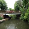
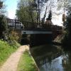
There is a bridge here which takes a road over the canal.
| Norris Bridge No 2 | 1 mile, 4½ furlongs | |
| Pondtail Bridge | 1 mile | |
| Pondtail Bridge Winding Hole | 7¾ furlongs | |
| Pondtail Pipe Bridge | 7¾ furlongs | |
| Old Pondtail Bridge | 7¾ furlongs | |
| Reading Road South Bridge | ||
| Fleet Town Football Ground | 2¼ furlongs | |
| The Fox and Hounds (Crookham) | 4¾ furlongs | |
| Coxheath Bridge | 7¼ furlongs | |
| Malthouse Bridge | 1 mile, 1 furlong | |
| Crookham Swing Bridge | 1 mile, 4½ furlongs | |
There are no links to external websites from here.
Why not log in and add some (select "External websites" from the menu (sometimes this is under "Edit"))?
Why not log in and add some (select "External websites" from the menu (sometimes this is under "Edit"))?
Mouseover for more information or show routes to facility
Nearest water point
In the direction of Odiham Castle Stop
The Fox and Hounds (Crookham) — 4¾ furlongs away
On this waterway in the direction of Odiham Castle Stop
Barley Mow Bridge — 4 miles, 5½ furlongs away
On this waterway in the direction of Odiham Castle Stop
In the direction of Woodham Junction
Ash Lock Canal Depot — 5 miles, 1¾ furlongs away
On this waterway in the direction of Woodham Junction
Mytchett Bridge — 8 miles, 4 furlongs and 1 lock away
On this waterway in the direction of Woodham Junction
Canal Centre Swing Bridge — 8 miles, 5 furlongs and 1 lock away
On this waterway in the direction of Woodham Junction
Arthur's Bridge — 16 miles, 7¼ furlongs and 23 locks away
On this waterway in the direction of Woodham JunctionNearest rubbish disposal
In the direction of Woodham Junction
Ash Lock Canal Depot — 5 miles, 1¾ furlongs away
On this waterway in the direction of Woodham Junction
Mytchett Bridge — 8 miles, 4 furlongs and 1 lock away
On this waterway in the direction of Woodham Junction
Canal Centre Swing Bridge — 8 miles, 5 furlongs and 1 lock away
On this waterway in the direction of Woodham Junction
Arthur's Bridge — 16 miles, 7¼ furlongs and 23 locks away
On this waterway in the direction of Woodham JunctionNearest chemical toilet disposal
In the direction of Woodham Junction
Canal Centre Swing Bridge — 8 miles, 5 furlongs and 1 lock away
On this waterway in the direction of Woodham Junction
Arthur's Bridge — 16 miles, 7¼ furlongs and 23 locks away
On this waterway in the direction of Woodham JunctionNearest place to turn
In the direction of Odiham Castle Stop
Crondall Bridge Winding Hole — 1 mile, 7¾ furlongs away
On this waterway in the direction of Odiham Castle Stop
Blacksmiths Bridge Winding Hole — 3 miles, 5 furlongs away
On this waterway in the direction of Odiham Castle Stop
Colt Hill Bridge Winding Hole — 7 miles, 2½ furlongs away
On this waterway in the direction of Odiham Castle Stop
Whitewater Winding Hole — 8 miles, 7¾ furlongs away
On this waterway in the direction of Odiham Castle Stop
In the direction of Woodham Junction
Pondtail Bridge Winding Hole — 7¾ furlongs away
On this waterway in the direction of Woodham Junction
Eelmoor Bridge Winding Hole — 2 miles, 2¾ furlongs away
On this waterway in the direction of Woodham Junction
Wharf Bridge (Aldershot) Winding Hole — 3 miles, 6 furlongs away
On this waterway in the direction of Woodham Junction
Ash Lock Canal Depot — 5 miles, 1¾ furlongs away
On this waterway in the direction of Woodham Junction
Ash Wharf Bridge Winding Hole — 6 miles, 2 furlongs and 1 lock away
On this waterway in the direction of Woodham Junction
Great Bottom Flash — 7 miles, 2½ furlongs and 1 lock away
On this waterway in the direction of Woodham Junction
Winter's Close Winding Hole — 7 miles, 5½ furlongs and 1 lock away
On this waterway in the direction of Woodham Junction
Anglers' Flash — 7 miles, 7 furlongs and 1 lock away
On this waterway in the direction of Woodham Junction
Potter's Wharf — 8 miles, 3½ furlongs and 1 lock away
On this waterway in the direction of Woodham Junction
Lock No 26 Winding Hole — 11 miles, 2¼ furlongs and 4 locks away
On this waterway in the direction of Woodham Junction
Frimley Lock Winding Hole — 12 miles, 1¼ furlongs and 10 locks away
On this waterway in the direction of Woodham Junction
Frimley Bottom Lock Winding Hole — 13 miles and 14 locks away
On this waterway in the direction of Woodham Junction
Connaught Crescent Winding Hole — 13 miles, 2¾ furlongs and 15 locks away
On this waterway in the direction of Woodham Junction
Hermitage Bridge Winding Hole — 14 miles, 5¾ furlongs and 18 locks away
On this waterway in the direction of Woodham Junction
Blackhorse Road Winding Hole — 14 miles, 7 furlongs and 18 locks away
On this waterway in the direction of Woodham Junction
Arthurs Bridge Winding Hole — 16 miles, 7½ furlongs and 23 locks away
On this waterway in the direction of Woodham JunctionNearest self-operated pump-out
In the direction of Woodham Junction
Mytchett Bridge — 8 miles, 4 furlongs and 1 lock away
On this waterway in the direction of Woodham Junction
Canal Centre Swing Bridge — 8 miles, 5 furlongs and 1 lock away
On this waterway in the direction of Woodham JunctionNo information
CanalPlan has no information on any of the following facilities within range:boatyard pump-out
Direction of TV transmitter (From Wolfbane Cybernetic)
There is no page on Wikipedia called “Reading Road South Bridge”
Wikipedia pages that might relate to Reading Road South Bridge
[Reading Bridge]
Reading Bridge is a road bridge over the River Thames at Reading in the English county of Berkshire. The bridge links the centre of Reading on the south
[Caversham, Reading]
Caversham Bridge, Reading Bridge, Christchurch Bridge, and Caversham Lock provide crossing points (the last two for pedestrians only), with Sonning Bridge also
[Reading, Berkshire]
Reading (/ˈrɛdɪŋ/ (listen) RED-ing) is a historic market town in Berkshire, South East England. Situated in the Thames Valley at the confluence of the
[Whiteknights Park]
and Earley Regis. Whiteknights Park is some two miles south of the centre of the town of Reading in the English county of Berkshire. The campus is 1.3
[Bridge]
A bridge is a structure built to span a physical obstacle, such as a body of water, valley, or road, without closing the way underneath. It is constructed
[Crimean Bridge]
for both road and rail traffic, and has a length of 19 km (11.8 mi), making it the longest bridge Russia has ever built, and the longest bridge in Europe
[A4 road (England)]
major road in England from Central London to Avonmouth via Heathrow Airport, Reading, Bath and Bristol. It is historically known as the Bath Road with
[Lower Trenton Bridge]
Joint Toll Bridge Commission (DRJTBC). It is known as the Trenton Makes Bridge because of large lettering of its motto on the south side reading "TRENTON
[West Reading, Pennsylvania]
at Westside Road (now called Museum Road) and Sycamore Road. 1932 – The Buttonwood Street Bridge is built between West Reading and Reading. 1939 – Wyomissing
[Delaware Valley]
Expressway I-76 (Walt Whitman Bridge) I-295 I-676 / US 30 (Benjamin Franklin Bridge) I-76 / I-676 / Route 42 (North-South Freeway) US 9 US 30 US 40 US 130
Results of Google Search
Contact Us : FlitePartnersBridge House, First Floor 27-31 Reading Road South Fleet, Hampshire, GU52 7QP United Kingdom. Telephone: +44 (0)1252 560 380. Email: frontdesk@ flitepartners.com. Company Registration: FlitePartners Limited is a Private Limited Company registered in England and Wales with Company No. 4489161, VAT No: 800Â ...
Call +44 1252 207644 - PrimeLocation > Bridges Estate Agents - Fleet, GU52 - Property for sale from Bridges Estate Agents - Fleet, GU52 and property listings from all GU52 estate agents.
On Friday, April 1, 2016, two Southbridge High School juniors participated in the Commonwealth of Massachusetts' 69th annual Student Government Day. On this day, two high school juniors from public schools all over the state engage in a participatory event to learn more about how our commonwealth's government ...
Reading Bridge is a road bridge over the River Thames at Reading in the English county of Berkshire. The bridge links the centre of Reading on the south bank with the Lower Caversham area of the cross-river suburb, and former village, of Caversham on the north bank. It crosses the river a short way above Caversham  ...
FLEET OFFICE. Bridge House 27-31 Reading Road South Fleet Hampshire, GU52 7QP DX 32645 Fleet Tel 01252 811070. Fax No. 01252 811133. Neale Turk LLP is authorised and regulated by the Solicitors' Regulation Authority. SRA Numbers: 535128 & 542157 | Registered at Companies House: OC343756Â ...
Southbridge Public Schools. Central Office. 25 Cole Ave. Southbridge, MA 01550 . 508-764-5415. #x200b;. Eastford Road School. tel: 508-764-5460 fax: 508-764-5495. #x200b;. Charlton Street School. tel: 508-764-5475 fax: 508-764-5491. #x200b;. West Street School. tel: 508-764-5470 fax: 508-764-5493. #x200b;. Southbridge Middle School.
Proudly educating preschool and kindergarten students of. Southbridge, Massachusettes. ERS Instructional Focus Statement All staff and students at Eastford Road School will engage in a coordinated whole-school effort to show growth in pre-reading readiness skills through the implementation of Wilson Fundations, small ...
( No one will be allowed to go under the freeway) William Brothers will pour US 59 NB Bridge at FM 2218. ... Starting Sunday, February 4th at 8:00 pm – 5:00 am between Reading Rd to Rabbs Bayou, They will be moving South bound Mainlane traffic to the South Bound Frontage and North Bound Mainlane Traffic will be ...
Reading Road South improvement: Canal Bridge to Appendix B. Castle Street. Figure 5.3. The Route of Fleet Eastern Access Roads. Appendix B. Figure 5.4. Fleet Station Forecourt Improvement. Appendix B. Figure 5.5. Pedestrian and Traffic Management Review. 59. Figure 5.6. Locations of Alternative Bridge Crossings.
2018-01-17, 2:33 PM, Reading Road Overpass, Cleared, YES. 2018-01-17, 2:11 PM, US 59 North and South bound, East of Spur 10, Cleared, YES. 2018-01-17, 3 :04 PM, Hwy 59 SB @ Dairy Ashford (SB lanes on bridges), Cleared, YES. 2018- 01-17, 3:04 PM, Hwy 59 @ Brazos River Turnaround (all lanes), Cleared, YES.


![Basingstoke Canal: View from the Reading Road Bridge (1). This is the view looking east from [[[5941713]]] by Nigel Cox – 31 January 2016](https://s3.geograph.org.uk/geophotos/05/94/17/5941719_53eef376_120x120.jpg)
![Basingstoke Canal: View from the Reading Road Bridge (2). This is the view looking west from [[[5941713]]]The regular sheet metal piled bank on the right is modern. Taking the angle in the piling as the widest point of the canal, the maximum width here is less than 50 feet, obtained by measuring the satellite imagery. by Nigel Cox – 31 January 2016](https://s3.geograph.org.uk/geophotos/05/94/17/5941739_24617e5b_120x120.jpg)


