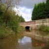
Burghfield Island Entrance No 2
Kennet House, Burghfield Road, West Berkshire RG30 3BR, United Kingdom

Burghfield Island Entrance No 2
is a minor waterways place
on the River Kennet between
Burghfield Bridge No 14 (Burghfield) (a few yards
to the east) and
Newbury Lock No 85 (15 miles
and 17 locks
to the west).
The nearest place in the direction of Newbury Lock No 85 is The Cunning Man PH;
½ furlongs
away.
Mooring here is unrated.
You can wind here.
Southcote Lock Weir Exit | 6¾ furlongs | |
Milkmaids Footbridge No 12 | 6½ furlongs | |
Southcote Lock No 104 | 6¼ furlongs | |
Burghfield Island Entrance No 1 | 1¾ furlongs | |
Burghfield Bridge No 14 | a few yards | |
Burghfield Island Entrance No 2 | ||
The Cunning Man PH | ½ furlongs | |
Swans Bridge No 15 | 2½ furlongs | |
Burghfield Lock Weir Exit | 3 furlongs | |
Burghfield Lock No 103 | 4 furlongs | |
Burghfield Mill Winding Hole | 6½ furlongs |
Amenities nearby at The Cunning Man PH
There is a very strong current down through the towpath side bridge hole.
There are no links to external websites from here.
Why not log in and add some (select "External websites" from the menu (sometimes this is under "Edit"))?
Mouseover for more information or show routes to facility
Nearest water point
In the direction of Northcroft Lane Arm
Tyle Mill Lock C&RT Services — 3 miles, 7¼ furlongs and 4 locks away
On this waterway in the direction of Northcroft Lane Arm
Aldermaston Lock No 95 — 6 miles, 1¾ furlongs and 7 locks away
On this waterway in the direction of Northcroft Lane Arm
Ham Manor Marina — 13 miles, 7¾ furlongs and 16 locks away
On this waterway in the direction of Northcroft Lane Arm
In the direction of High Bridge Reading
Thames & Kennet Marina — 4 miles, 4¼ furlongs and 4 locks away
Travel to High Bridge Reading, then on the River Thames (River Kennet) to Thames - Kennet Junction (Kennet Mouth), then on the River Thames (below Oxford) to Thames & Kennet Marina
Shiplake Lock — 9 miles, 1¼ furlongs and 5 locks away
Travel to High Bridge Reading, then on the River Thames (River Kennet) to Thames - Kennet Junction (Kennet Mouth), then on the River Thames (below Oxford) to Shiplake Lock
Cleeve Lock — 16 miles, 4 furlongs and 8 locks away
Travel to High Bridge Reading, then on the River Thames (River Kennet) to Thames - Kennet Junction (Kennet Mouth), then on the River Thames (below Oxford) to Cleeve Lock
Hurley Lock — 18 miles, 7¼ furlongs and 8 locks away
Travel to High Bridge Reading, then on the River Thames (River Kennet) to Thames - Kennet Junction (Kennet Mouth), then on the River Thames (below Oxford) to Hurley LockNearest rubbish disposal
In the direction of Northcroft Lane Arm
Tyle Mill Lock C&RT Services — 3 miles, 7¼ furlongs and 4 locks away
On this waterway in the direction of Northcroft Lane Arm
Aldermaston Lock No 95 — 6 miles, 1¾ furlongs and 7 locks away
On this waterway in the direction of Northcroft Lane Arm
Ham Manor Marina — 13 miles, 7¾ furlongs and 16 locks away
On this waterway in the direction of Northcroft Lane Arm
In the direction of High Bridge Reading
Shiplake Lock — 9 miles, 1¼ furlongs and 5 locks away
Travel to High Bridge Reading, then on the River Thames (River Kennet) to Thames - Kennet Junction (Kennet Mouth), then on the River Thames (below Oxford) to Shiplake Lock
Mapledurham Lock — 9 miles, 4¼ furlongs and 5 locks away
Travel to High Bridge Reading, then on the River Thames (River Kennet) to Thames - Kennet Junction (Kennet Mouth), then on the River Thames (below Oxford) to Mapledurham Lock
Marsh Lock — 11 miles, 7 furlongs and 6 locks away
Travel to High Bridge Reading, then on the River Thames (River Kennet) to Thames - Kennet Junction (Kennet Mouth), then on the River Thames (below Oxford) to Marsh Lock
Hambleden Lock — 15 miles, 1¾ furlongs and 7 locks away
Travel to High Bridge Reading, then on the River Thames (River Kennet) to Thames - Kennet Junction (Kennet Mouth), then on the River Thames (below Oxford) to Hambleden Lock
Goring Lock — 15 miles, 7¼ furlongs and 7 locks away
Travel to High Bridge Reading, then on the River Thames (River Kennet) to Thames - Kennet Junction (Kennet Mouth), then on the River Thames (below Oxford) to Goring Lock
Hurley Lock — 18 miles, 7¼ furlongs and 8 locks away
Travel to High Bridge Reading, then on the River Thames (River Kennet) to Thames - Kennet Junction (Kennet Mouth), then on the River Thames (below Oxford) to Hurley LockNearest chemical toilet disposal
In the direction of Northcroft Lane Arm
Tyle Mill Lock C&RT Services — 3 miles, 7¼ furlongs and 4 locks away
On this waterway in the direction of Northcroft Lane Arm
Aldermaston Lock No 95 — 6 miles, 1¾ furlongs and 7 locks away
On this waterway in the direction of Northcroft Lane Arm
Ham Manor Marina — 13 miles, 7¾ furlongs and 16 locks away
On this waterway in the direction of Northcroft Lane Arm
In the direction of High Bridge Reading
Thames & Kennet Marina — 4 miles, 4¼ furlongs and 4 locks away
Travel to High Bridge Reading, then on the River Thames (River Kennet) to Thames - Kennet Junction (Kennet Mouth), then on the River Thames (below Oxford) to Thames & Kennet Marina
Shiplake Lock — 9 miles, 1¼ furlongs and 5 locks away
Travel to High Bridge Reading, then on the River Thames (River Kennet) to Thames - Kennet Junction (Kennet Mouth), then on the River Thames (below Oxford) to Shiplake Lock
Mapledurham Lock — 9 miles, 4¼ furlongs and 5 locks away
Travel to High Bridge Reading, then on the River Thames (River Kennet) to Thames - Kennet Junction (Kennet Mouth), then on the River Thames (below Oxford) to Mapledurham Lock
Hurley Lock — 18 miles, 7¼ furlongs and 8 locks away
Travel to High Bridge Reading, then on the River Thames (River Kennet) to Thames - Kennet Junction (Kennet Mouth), then on the River Thames (below Oxford) to Hurley LockNearest place to turn
In the direction of Northcroft Lane Arm
Burghfield Lock Weir Exit — 3 furlongs away
On this waterway in the direction of Northcroft Lane Arm
Burghfield Mill Winding Hole — 6½ furlongs and 1 lock away
On this waterway in the direction of Northcroft Lane Arm
Winding Hole below Garston Lock — 1 mile, 5½ furlongs and 1 lock away
On this waterway in the direction of Northcroft Lane Arm
Sheffield Lock Weir Entrance — 2 miles, 4½ furlongs and 3 locks away
On this waterway in the direction of Northcroft Lane Arm
Winding Hole below Sulhampstead Lock — 3 miles, ¾ furlongs and 3 locks away
On this waterway in the direction of Northcroft Lane Arm
Draper's Osier Bed Stream Leaves — 3 miles, 4 furlongs and 4 locks away
On this waterway in the direction of Northcroft Lane Arm
Winding Hole below Tyle Mill Lock — 3 miles, 7 furlongs and 4 locks away
On this waterway in the direction of Northcroft Lane Arm
Tyle Mill Winding Hole — 4 miles, 1½ furlongs and 5 locks away
On this waterway in the direction of Northcroft Lane Arm
Winding Hole by Ufton Swing Bridge — 4 miles, 4¼ furlongs and 5 locks away
On this waterway in the direction of Northcroft Lane Arm
In the direction of High Bridge Reading
Burghfield Island Entrance No 1 — 1¾ furlongs away
On this waterway in the direction of High Bridge Reading
Southcote Lock Weir Exit — 6¾ furlongs and 1 lock away
On this waterway in the direction of High Bridge Reading
Fobney Lock Weir Entrance — 1 mile, ¾ furlongs and 1 lock away
On this waterway in the direction of High Bridge Reading
Winding Hole above Fobney Lock — 1 mile, 4½ furlongs and 1 lock away
On this waterway in the direction of High Bridge Reading
Fobney Lock Weir Exit — 1 mile, 5 furlongs and 2 locks away
On this waterway in the direction of High Bridge Reading
Winding Hole above County Lock — 3 miles, 1¼ furlongs and 2 locks away
On this waterway in the direction of High Bridge Reading
Reading Jail Loop (western entrance) — 3 miles, 6½ furlongs and 3 locks away
Travel to High Bridge Reading, then on the River Thames (River Kennet) to Reading Jail Loop (western entrance)
Reading Jail Loop (eastern entrance) — 4 miles, ¼ furlongs and 3 locks away
Travel to High Bridge Reading, then on the River Thames (River Kennet) to Reading Jail Loop (eastern entrance)
Blakes Lock Weir Exit — 4 miles, 1¾ furlongs and 4 locks away
Travel to High Bridge Reading, then on the River Thames (River Kennet) to Blakes Lock Weir Exit
Thames - Kennet Junction (Kennet Mouth) — 4 miles, 3¼ furlongs and 4 locks away
Travel to High Bridge Reading, then on the River Thames (River Kennet) to Thames - Kennet Junction (Kennet Mouth)
Caversham Lock Weir Exit — 5 miles, ¾ furlongs and 4 locks away
Travel to High Bridge Reading, then on the River Thames (River Kennet) to Thames - Kennet Junction (Kennet Mouth), then on the River Thames (below Oxford) to Caversham Lock Weir ExitNearest self-operated pump-out
In the direction of Northcroft Lane Arm
Tyle Mill Lock C&RT Services — 3 miles, 7¼ furlongs and 4 locks away
On this waterway in the direction of Northcroft Lane Arm
In the direction of High Bridge Reading
Mapledurham Lock — 9 miles, 4¼ furlongs and 5 locks away
Travel to High Bridge Reading, then on the River Thames (River Kennet) to Thames - Kennet Junction (Kennet Mouth), then on the River Thames (below Oxford) to Mapledurham LockNearest boatyard pump-out
In the direction of Northcroft Lane Arm
Newbury Marina — 14 miles, 4½ furlongs and 17 locks away
On this waterway in the direction of Northcroft Lane Arm
In the direction of High Bridge Reading
Thames & Kennet Marina — 4 miles, 4¼ furlongs and 4 locks away
Travel to High Bridge Reading, then on the River Thames (River Kennet) to Thames - Kennet Junction (Kennet Mouth), then on the River Thames (below Oxford) to Thames & Kennet MarinaDirection of TV transmitter (From Wolfbane Cybernetic)
There is no page on Wikipedia called “Burghfield Island Entrance”
Wikipedia pages that might relate to Burghfield Island Entrance
[Burghfield]
Burghfield /ˈbɜːr.fiːld/ is a village and large civil parish in West Berkshire, England, with a boundary with Reading. Burghfield can trace its history
[Kennet and Avon Canal]
begun. In 1968, restoration work was undertaken on the Bath Locks and Burghfield Lock. In Reading at Bridge Street the navigable headroom had been reduced
[Theale]
name to the hundred containing the parishes of Aldermaston, Bradfield, Burghfield, Englefield, Padworth, Purley, Stratfield Mortimer, Sulham, Sulhamstead
[Scouting in South East England]
just outside the town of Woodley, and the 1st Burghfield & Sulhamstead Scout HQ, in the village of Burghfield and part of Pang Valley District) offer a single
[Yeo Vale]
Ireland, 34 Imperial Square, Cheltenham, Gloucestershire, and Boldrewood, Burghfield Common, Berkshire, later JP for Devon, who married the heiress of Yeo
Results of Google Search
Burghfield /ˈbɜːr.fiːld/ is a village and large civil parish in West Berkshire, England, with a ... Burghfield. Location within Berkshire. Area, 17.11 km2 (6.61 sq mi) ... There are areas in the flow of the river Kennet where drainage is not as good as it ... The Hatch Gate and The Six Bells sit opposite each other in Burghfield ...
Jan 6, 2020 ... Originally the coco grinding Mill for 'Huntley & Palmers' this beautiful building was professionally converted into luxury apartments. Located ...
Continuing down stream from Burghfield river, Beat 1 is a relatively under fished venue but does hold good silver stocks throughout. Specimen ... No Close Season Fishing. BEAT 2. #x200b; ... Opposite site entrance turn right, down lane, public car park at end of lane. #x200b; ... A Section from Fobney Island end of Beat 3 to A33 Bridge.
1.2 Why produce a Parish Design Statement for Burghfield? ... the east. Burghfield Mill Island, to the west of ... House in Burghfield Village nr the Hatch Gate Pub.
21 Abr 2020 ... English: Burghfield is a village and civil parish in Berkshire, England. ... Burghfield Island Boat Club - geograph.org.uk - 1383804.jpg 640 × 426; ... Burghfield Bridge No. ... Burghfield Domesday entry 2.png 698 × 224; 79 KB.