CanalPlanAC

Site of Stocking Lane Pipe Bridge

 
Stocking Lane, Wakefield WF11 8DZ, United Kingdom
 
Information about the place
Site of Stocking Lane Pipe Bridge is a minor waterways place on the Aire and Calder Navigation (Selby Section) between Bank Dole Junction (Junction of the Aire and Calder Navigation (Selby Section) and the Aire and Calder Navigation (Main Line)) (2½ furlongs and 1 lock to the west) and Haddlesey Junction (Junction of River Aire and Selby Canal) (6 miles and 1½ furlongs and 1 lock to the east).
 
 
The nearest place in the direction of Bank Dole Junction is Bank Dole Lock Junction; ½ furlongs away.
 
The nearest place in the direction of Haddlesey Junction is Beal Bridge (Beal Bridge Wharf); 2 miles and 1¾ furlongs away.

Mooring here is unrated.

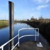
There is a bridge here which takes a pipe over the canal.

Bank Dole Junction2½ furlongs
Marsh Lane Footbridge2 furlongs
Bank Dole Lock No 1¾ furlongs
Bank Dole Lock Junction½ furlongs
Site of Stocking Lane Pipe Bridge
Beal Bridge2 miles, 1¾ furlongs
Beal Lock No 2 Weir Entrance2 miles, 2 furlongs
Beal Lock No 22 miles, 3 furlongs
Birkin Wharf3 miles, 2¾ furlongs
Haddlesey Junction Pipe Bridge6 miles, 1¼ furlongs
 
 
Amenities

Amenities nearby at Beal Bridge

 Birkin Post Office
 
Maps
If you are a user and are logged on, or if you are actively planning a route, a map will be displayed here.
Show on external mapping site: Google | OSM | Bing
 
Photos
 
External websites
There are no links to external websites from here.
Why not log in and add some (select "External websites" from the menu (sometimes this is under "Edit"))?
 
Nearest facilities

Mouseover for more information or show routes to facility

Nearest water point

In the direction of Selby Junction (River Ouse)

Beal Bridge2 miles, 1¾ furlongs away
On this waterway in the direction of Selby Junction (River Ouse)
Beal Lock No 22 miles, 3 furlongs away
On this waterway in the direction of Selby Junction (River Ouse)
Selby Basin10 miles, 7¾ furlongs and 2 locks away
On this waterway in the direction of Selby Junction (River Ouse)

In the direction of Bank Dole Junction

Bank Dole Lock No 1¾ furlongs away
On this waterway in the direction of Bank Dole Junction
Ferrybridge Flood Lock No 111 mile, 7 furlongs and 1 lock away
Travel to Bank Dole Junction, then on the Aire and Calder Navigation (Main Line - Goole to Castleford) to Ferrybridge Flood Lock No 11
Ferrybridge Flood Lock Footbridge1 mile, 7¼ furlongs and 2 locks away
Travel to Bank Dole Junction, then on the Aire and Calder Navigation (Main Line - Goole to Castleford) to Ferrybridge Flood Lock Footbridge
Whitley Lock No 124 miles, 2 furlongs and 1 lock away
Travel to Bank Dole Junction, then on the Aire and Calder Navigation (Main Line - Goole to Castleford) to Whitley Lock No 12
Bulholme Lock No 106 miles, 5 furlongs and 2 locks away
Travel to Bank Dole Junction, then on the Aire and Calder Navigation (Main Line - Goole to Castleford) to Bulholme Lock No 10
Castleford Sanitary Station7 miles, 1¾ furlongs and 3 locks away
Travel to Bank Dole Junction, then on the Aire and Calder Navigation (Main Line - Goole to Castleford) to Castleford Sanitary Station
Pollington Manor Swing Bridge8 miles and 3 locks away
Travel to Bank Dole Junction, then on the Aire and Calder Navigation (Main Line - Goole to Castleford) to Pollington Manor Swing Bridge
Pollington Visitor Mooring8 miles, ½ furlongs and 3 locks away
Travel to Bank Dole Junction, then on the Aire and Calder Navigation (Main Line - Goole to Castleford) to Pollington Visitor Mooring
Woodnook Lock No 69 miles, 4¼ furlongs and 4 locks away
Travel to Bank Dole Junction, then on the Aire and Calder Navigation (Main Line - Goole to Castleford) to Castleford Junction, then on the Aire and Calder Navigation (Wakefield Section) to Woodnook Lock No 6
Fairies Hill Moorings9 miles, 3 furlongs and 5 locks away
Travel to Bank Dole Junction, then on the Aire and Calder Navigation (Main Line - Goole to Castleford) to Castleford Junction, then on the Aire and Calder Navigation (Wakefield Section) to Fairies Hill Lock Junction, then on the Aire and Calder Navigation (Wakefield Section - Fairies Hill Mooring Arm) to Fairies Hill Moorings
Lemonroyd Lock No 710 miles, 6 furlongs and 4 locks away
Travel to Bank Dole Junction, then on the Aire and Calder Navigation (Main Line - Goole to Castleford) to Castleford Junction, then on the Aire and Calder Navigation (Main Line - Castleford to Leeds) to Lemonroyd Lock No 7
Lemonroyd Marina10 miles, 7 furlongs and 5 locks away
Travel to Bank Dole Junction, then on the Aire and Calder Navigation (Main Line - Goole to Castleford) to Castleford Junction, then on the Aire and Calder Navigation (Main Line - Castleford to Leeds) to Lemonroyd Marina
King's Road Lock No 310 miles, 5¾ furlongs and 5 locks away
Travel to Bank Dole Junction, then on the Aire and Calder Navigation (Main Line - Goole to Castleford) to Castleford Junction, then on the Aire and Calder Navigation (Wakefield Section) to King's Road Lock No 3
Woodlesford Lock No 512 miles, ¾ furlongs and 5 locks away
Travel to Bank Dole Junction, then on the Aire and Calder Navigation (Main Line - Goole to Castleford) to Castleford Junction, then on the Aire and Calder Navigation (Main Line - Castleford to Leeds) to Woodlesford Lock No 5
Fishpond Lock No 412 miles, 7¾ furlongs and 6 locks away
Travel to Bank Dole Junction, then on the Aire and Calder Navigation (Main Line - Goole to Castleford) to Castleford Junction, then on the Aire and Calder Navigation (Main Line - Castleford to Leeds) to Fishpond Lock No 4
Stanley Ferry Water Point12 miles, 3 furlongs and 7 locks away
Travel to Bank Dole Junction, then on the Aire and Calder Navigation (Main Line - Goole to Castleford) to Castleford Junction, then on the Aire and Calder Navigation (Wakefield Section) to Stanley Ferry Water Point
Ramsdens Bridge Sanitary Station12 miles, 3¾ furlongs and 7 locks away
Travel to Bank Dole Junction, then on the Aire and Calder Navigation (Main Line - Goole to Castleford) to Castleford Junction, then on the Aire and Calder Navigation (Wakefield Section) to Ramsdens Bridge Sanitary Station

Nearest rubbish disposal

In the direction of Selby Junction (River Ouse)

Selby Basin10 miles, 7¾ furlongs and 2 locks away
On this waterway in the direction of Selby Junction (River Ouse)

In the direction of Bank Dole Junction

Whitley Lock No 124 miles, 2 furlongs and 1 lock away
Travel to Bank Dole Junction, then on the Aire and Calder Navigation (Main Line - Goole to Castleford) to Whitley Lock No 12
Castleford Sanitary Station7 miles, 1¾ furlongs and 3 locks away
Travel to Bank Dole Junction, then on the Aire and Calder Navigation (Main Line - Goole to Castleford) to Castleford Sanitary Station
Lemonroyd Marina10 miles, 7 furlongs and 5 locks away
Travel to Bank Dole Junction, then on the Aire and Calder Navigation (Main Line - Goole to Castleford) to Castleford Junction, then on the Aire and Calder Navigation (Main Line - Castleford to Leeds) to Lemonroyd Marina
Woodlesford Lock No 512 miles, ¾ furlongs and 5 locks away
Travel to Bank Dole Junction, then on the Aire and Calder Navigation (Main Line - Goole to Castleford) to Castleford Junction, then on the Aire and Calder Navigation (Main Line - Castleford to Leeds) to Woodlesford Lock No 5
Ramsdens Bridge Visitor Moorings12 miles, 3¼ furlongs and 7 locks away
Travel to Bank Dole Junction, then on the Aire and Calder Navigation (Main Line - Goole to Castleford) to Castleford Junction, then on the Aire and Calder Navigation (Wakefield Section) to Ramsdens Bridge Visitor Moorings
Dutch Riverside16 miles, 2½ furlongs and 3 locks away
Travel to Bank Dole Junction, then on the Aire and Calder Navigation (Main Line - Goole to Castleford) to Dutch Riverside
Goole Marina16 miles, 4 furlongs and 3 locks away
Travel to Bank Dole Junction, then on the Aire and Calder Navigation (Main Line - Goole to Castleford) to Goole Marina
Barnby Dun Lift Bridge16 miles, 5½ furlongs and 4 locks away
Travel to Bank Dole Junction, then on the Aire and Calder Navigation (Main Line - Goole to Castleford) to Sykehouse Junction, then on the Sheffield and South Yorkshire Navigation (New Junction Canal) to Bramwith Junction, then on the Sheffield and South Yorkshire Navigation (Main Line) to Barnby Dun Lift Bridge
Bramwith Swing Bridge16 miles, 2 furlongs and 5 locks away
Travel to Bank Dole Junction, then on the Aire and Calder Navigation (Main Line - Goole to Castleford) to Sykehouse Junction, then on the Sheffield and South Yorkshire Navigation (New Junction Canal) to Bramwith Junction, then on the Sheffield and South Yorkshire Navigation (Bramwith to Stainforth) to Bramwith Swing Bridge
Leeds Sanitary Station16 miles, 5½ furlongs and 8 locks away
Travel to Bank Dole Junction, then on the Aire and Calder Navigation (Main Line - Goole to Castleford) to Castleford Junction, then on the Aire and Calder Navigation (Main Line - Castleford to Leeds) to Leeds Sanitary Station
Leeds Basin17 miles, 4¾ furlongs and 10 locks away
Travel to Bank Dole Junction, then on the Aire and Calder Navigation (Main Line - Goole to Castleford) to Castleford Junction, then on the Aire and Calder Navigation (Main Line - Castleford to Leeds) to Leeds Bridge, then on the Leeds and Liverpool Canal (Main Line - Wigan to Leeds) to Leeds Basin

Nearest chemical toilet disposal

In the direction of Selby Junction (River Ouse)

Selby Basin10 miles, 7¾ furlongs and 2 locks away
On this waterway in the direction of Selby Junction (River Ouse)

In the direction of Bank Dole Junction

Whitley Lock No 124 miles, 2 furlongs and 1 lock away
Travel to Bank Dole Junction, then on the Aire and Calder Navigation (Main Line - Goole to Castleford) to Whitley Lock No 12
Castleford Sanitary Station7 miles, 1¾ furlongs and 3 locks away
Travel to Bank Dole Junction, then on the Aire and Calder Navigation (Main Line - Goole to Castleford) to Castleford Sanitary Station
Fairies Hill Moorings9 miles, 3 furlongs and 5 locks away
Travel to Bank Dole Junction, then on the Aire and Calder Navigation (Main Line - Goole to Castleford) to Castleford Junction, then on the Aire and Calder Navigation (Wakefield Section) to Fairies Hill Lock Junction, then on the Aire and Calder Navigation (Wakefield Section - Fairies Hill Mooring Arm) to Fairies Hill Moorings
Lemonroyd Marina10 miles, 7 furlongs and 5 locks away
Travel to Bank Dole Junction, then on the Aire and Calder Navigation (Main Line - Goole to Castleford) to Castleford Junction, then on the Aire and Calder Navigation (Main Line - Castleford to Leeds) to Lemonroyd Marina
Ramsdens Bridge Sanitary Station12 miles, 3¾ furlongs and 7 locks away
Travel to Bank Dole Junction, then on the Aire and Calder Navigation (Main Line - Goole to Castleford) to Castleford Junction, then on the Aire and Calder Navigation (Wakefield Section) to Ramsdens Bridge Sanitary Station
Dutch Riverside16 miles, 2½ furlongs and 3 locks away
Travel to Bank Dole Junction, then on the Aire and Calder Navigation (Main Line - Goole to Castleford) to Dutch Riverside
Goole Marina16 miles, 4 furlongs and 3 locks away
Travel to Bank Dole Junction, then on the Aire and Calder Navigation (Main Line - Goole to Castleford) to Goole Marina
Barnby Dun Lift Bridge16 miles, 5½ furlongs and 4 locks away
Travel to Bank Dole Junction, then on the Aire and Calder Navigation (Main Line - Goole to Castleford) to Sykehouse Junction, then on the Sheffield and South Yorkshire Navigation (New Junction Canal) to Bramwith Junction, then on the Sheffield and South Yorkshire Navigation (Main Line) to Barnby Dun Lift Bridge
Bramwith Swing Bridge16 miles, 2 furlongs and 5 locks away
Travel to Bank Dole Junction, then on the Aire and Calder Navigation (Main Line - Goole to Castleford) to Sykehouse Junction, then on the Sheffield and South Yorkshire Navigation (New Junction Canal) to Bramwith Junction, then on the Sheffield and South Yorkshire Navigation (Bramwith to Stainforth) to Bramwith Swing Bridge
Leeds Sanitary Station16 miles, 5½ furlongs and 8 locks away
Travel to Bank Dole Junction, then on the Aire and Calder Navigation (Main Line - Goole to Castleford) to Castleford Junction, then on the Aire and Calder Navigation (Main Line - Castleford to Leeds) to Leeds Sanitary Station

Nearest place to turn

In the direction of Selby Junction (River Ouse)

Beal Lock No 2 Weir Entrance2 miles, 2 furlongs away
On this waterway in the direction of Selby Junction (River Ouse)
Haddlesey Junction6 miles, 1½ furlongs and 1 lock away
On this waterway in the direction of Selby Junction (River Ouse)
Selby Basin10 miles, 7¾ furlongs and 2 locks away
On this waterway in the direction of Selby Junction (River Ouse)

In the direction of Bank Dole Junction

Bank Dole Lock Junction½ furlongs away
On this waterway in the direction of Bank Dole Junction
Bulholme Lock Weir Exit6 miles, 4½ furlongs and 2 locks away
Travel to Bank Dole Junction, then on the Aire and Calder Navigation (Main Line - Goole to Castleford) to Bulholme Lock Weir Exit
Lemonroyd Lock Weir Exit10 miles, 5¼ furlongs and 4 locks away
Travel to Bank Dole Junction, then on the Aire and Calder Navigation (Main Line - Goole to Castleford) to Castleford Junction, then on the Aire and Calder Navigation (Main Line - Castleford to Leeds) to Lemonroyd Lock Weir Exit
Fairies Hill Lock Arm9 miles, 6 furlongs and 5 locks away
Travel to Bank Dole Junction, then on the Aire and Calder Navigation (Main Line - Goole to Castleford) to Castleford Junction, then on the Aire and Calder Navigation (Wakefield Section) to Fairies Hill Lock Arm
Fleet Lane Arm11 miles, 1¼ furlongs and 5 locks away
Travel to Bank Dole Junction, then on the Aire and Calder Navigation (Main Line - Goole to Castleford) to Castleford Junction, then on the Aire and Calder Navigation (Main Line - Castleford to Leeds) to Fleet Lane Arm
Stanley Ferry Marina12 miles, 2¼ furlongs and 7 locks away
Travel to Bank Dole Junction, then on the Aire and Calder Navigation (Main Line - Goole to Castleford) to Castleford Junction, then on the Aire and Calder Navigation (Wakefield Section) to Stanley Ferry Marina
Viking Marina16 miles, 3¼ furlongs and 3 locks away
Travel to Bank Dole Junction, then on the Aire and Calder Navigation (Main Line - Goole to Castleford) to Viking Marina
Junction with River Aire (Old Channel) South15 miles, 3½ furlongs and 7 locks away
Travel to Bank Dole Junction, then on the Aire and Calder Navigation (Main Line - Goole to Castleford) to Castleford Junction, then on the Aire and Calder Navigation (Main Line - Castleford to Leeds) to Junction with River Aire (Old Channel) South
Huddle Grounds Winding Hole18 miles, 1¼ furlongs and 5 locks away
Travel to Bank Dole Junction, then on the Aire and Calder Navigation (Main Line - Goole to Castleford) to Sykehouse Junction, then on the Sheffield and South Yorkshire Navigation (New Junction Canal) to Bramwith Junction, then on the Sheffield and South Yorkshire Navigation (Bramwith to Stainforth) to Stainforth Junction, then on the Sheffield and South Yorkshire Navigation (Stainforth and Keadby Canal) to Huddle Grounds Winding Hole
Junction with River Aire (Old Channel) North16 miles, ½ furlongs and 8 locks away
Travel to Bank Dole Junction, then on the Aire and Calder Navigation (Main Line - Goole to Castleford) to Castleford Junction, then on the Aire and Calder Navigation (Main Line - Castleford to Leeds) to Junction with River Aire (Old Channel) North
Knostrop Flood Lock Weir Entrance16 miles, ¾ furlongs and 8 locks away
Travel to Bank Dole Junction, then on the Aire and Calder Navigation (Main Line - Goole to Castleford) to Castleford Junction, then on the Aire and Calder Navigation (Main Line - Castleford to Leeds) to Knostrop Flood Lock Weir Entrance
Wakefield Weir Entrance15 miles, 2½ furlongs and 9 locks away
Travel to Bank Dole Junction, then on the Aire and Calder Navigation (Main Line - Goole to Castleford) to Castleford Junction, then on the Aire and Calder Navigation (Wakefield Section) to Fall Ing Junction, then on the Calder and Hebble Navigation (Main Line) to Wakefield Weir Entrance
Wheatley Hall Road Winding Hole19 miles, 7½ furlongs and 5 locks away
Travel to Bank Dole Junction, then on the Aire and Calder Navigation (Main Line - Goole to Castleford) to Sykehouse Junction, then on the Sheffield and South Yorkshire Navigation (New Junction Canal) to Bramwith Junction, then on the Sheffield and South Yorkshire Navigation (Main Line) to Wheatley Hall Road Winding Hole
Leeds Dock Side Arm16 miles, 7¾ furlongs and 9 locks away
Travel to Bank Dole Junction, then on the Aire and Calder Navigation (Main Line - Goole to Castleford) to Castleford Junction, then on the Aire and Calder Navigation (Main Line - Castleford to Leeds) to Leeds Dock Entrance, then on the Aire and Calder Navigation (Leeds Dock) to Leeds Dock Side Arm
River Aire Junction17 miles, 4¼ furlongs and 9 locks away
Travel to Bank Dole Junction, then on the Aire and Calder Navigation (Main Line - Goole to Castleford) to Castleford Junction, then on the Aire and Calder Navigation (Main Line - Castleford to Leeds) to Leeds Bridge, then on the Leeds and Liverpool Canal (Main Line - Wigan to Leeds) to River Aire Junction
Leeds Basin17 miles, 4¾ furlongs and 10 locks away
Travel to Bank Dole Junction, then on the Aire and Calder Navigation (Main Line - Goole to Castleford) to Castleford Junction, then on the Aire and Calder Navigation (Main Line - Castleford to Leeds) to Leeds Bridge, then on the Leeds and Liverpool Canal (Main Line - Wigan to Leeds) to Leeds Basin
Broad Cut Weir Entrance17 miles, 7 furlongs and 10 locks away
Travel to Bank Dole Junction, then on the Aire and Calder Navigation (Main Line - Goole to Castleford) to Castleford Junction, then on the Aire and Calder Navigation (Wakefield Section) to Fall Ing Junction, then on the Calder and Hebble Navigation (Main Line) to Broad Cut Weir Entrance

Nearest boatyard pump-out

Direction of TV transmitter (From Wolfbane Cybernetic)
 
 
Geograph
 
Wikipedia

There is no page on Wikipedia called “Site of Stocking Lane Pipe Bridge”

Wikipedia pages that might relate to Site of Stocking Lane Pipe Bridge
[Tooleybuc Bridge] the lift span which has a pipe handrail. The deck is 8.5 metres (28 ft) above flood level. As at 23 June 2005, the bridge was in fair condition having [Sherlock Holmes] key visual qualities commonly associated with Holmes today: his calabash pipe; the play also formed the basis for Gillette's 1916 film, Sherlock Holmes [List of places in Herefordshire] Arrow (SO365603) Staunton-on-Wye (SO363457) Steen's Bridge (SO547575) Steventon (SO525735) Stocking (SO625304) Stockton (SO514619) Stoke Bliss (SO659625) [List of The Tonight Show Starring Jimmy Fallon episodes (2014)] David Brenner; Tonight Show Popular Mathematics; Kermit gave Jimmy a Muppet pipe wrench for his Muppet pipes; Kermit performed "Bein' Green" with Jimmy; Black [List of Emily Dickinson poems] 608 So has a Daisy vanished F01.03.019 1945 1.364 28 19 So I pull my Stockings off S11.01.001 1945 1.158 1201 1271 So large my Will S07.22.110 1945 1 [Axis powers] Dinu C. Giurescu, Romania in the Second World War (1939–1945), p. Craig Stockings, Eleanor Hancock, Swastika over the Acropolis: Re-interpreting the Nazi [List of works by Vincent van Gogh] Gogh series): paintings of the hospital garden and a sick ward Langlois Bridge at Arles (Van Gogh series): Arles, combination of new influences and those [Underfloor heating] Localized discomfort due to cold and warm floors wearing normal footwear and stocking feet is addressed in the ISO 7730 and ASHRAE 55 standards and ASHRAE Fundamentals [List of unidentified murder victims in the United States] a dark thermal shirt, a long-sleeved shirt with several colors, a red stocking-style hat, black Air Jordan tennis shoes, a scarf, gloves and two pairs [Hemp] various textiles normally not produced from hemp fiber, such as very thin stockings for women. While the Marijuana Tax Act of 1937 had just been signed into
 
Google

Results of Google Search

Pennsylvania Fish and Boat Commission 2018 Trout Stocking
Feb 1, 2018 ... Wierman's Mill Road Bridge (SR 1009) .... Pennsylvania Fish and Boat Commission 2018 Trout Stocking Schedule ...... PIPELINE CROSSING.
Atlanta I-85 bridge update: 2017 fire caused bridge span to collapse
UPDATE: I-85 bridge in Atlanta to open Monday for rush hour commute. The fire and collapse happened March 30, 2017; I-85 northbound lanes reopened May ... Stored there were high-density polyethylene pipes, which are commonly used in  ...
Morris
Nov 12, 2002 ... enclosed by a simple pipe railing that is original to 1907. ... or south side of the track required rebuilding the road and bridge into Landing.
2015 trout stocking schedules available here!
Mar 4, 2015 ... Stocking. Date. Meeting Place. Meeting. Time. Brook Brown Rbow ..... 2 Lemmon Hollow Road Bridge ...... 2 Pipe Xing At State Gm Lnd 120.
Deer Creek Tribute Trail – Urban | Bear Yuba Land Trust
Now go down the road on the right side of the Foundry (this is Bridge Street) to ... Deer Creek to Stocking Flat and a loop trail on the far side of the Chinese Bridge. .... to the east end where the open canal stops and water emerges from a pipe.
Stream Crossings
Jul 2, 2012 ... GP-8 Temporary Road Crossings. â–« ... A dike, bridge, culvert, wall, wing wall, fill, pier, wharf, ... Any pipe or pipeline for the transportation.
Columbia Trail in New Jersey | TrailLink
Trail end points: Main St. at Church St. (High Bridge) and Bartley Road ... this line , the Columbia Gas company constructed a pipeline under the former rail bed.
Stocking Overview
STOCKING. The Fish & Boat Commission annually stocks streams and lakes in Pennsylvania with Coldwater (Trout) and Warmwater / Coolwater (Muskellunge, ...
FY13 Fatalities and Catastrophes To Date
Jul 17, 2013 ... Worker died after fall from the deck of a bridge under construction. Fatality ..... Worker stocking merchandise died in fall from step ladder. Fatality. 9/9/2013 ... Plumber was electrocuted while cutting through a pipe. Fatality. 9/5/2013 ..... Worker struck and killed by vehicle while performing road work. Fatality.