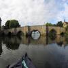
Huntingdon Old Road Bridge
With footbridge alongside
Ouse Bridge (1332), B1044, Huntingdonshire PE29 2EP, United Kingdom

Huntingdon Old Road Bridge
is a minor waterways place
on the River Great Ouse (Canalized Section) between
Hartford (1 mile and ¾ furlongs
to the northeast) and
Great Ouse - Godmanchester Backwater Junction (Junction of the River Great Ouse and the Godmanchester Backwater) (6¼ furlongs
and 1 lock
to the south).
The nearest place in the direction of Hartford is Huntingdon Town Moorings;
½ furlongs
away.
The nearest place in the direction of Great Ouse - Godmanchester Backwater Junction is Huntingdon Bridge Hotel Visitor Moorings;
¼ furlongs
away.
There is no access to the towpath here.
Mooring here is unrated.
There is a bridge here which takes a road over the canal.
| Hartford Marina | 1 mile, 6 furlongs | |
| Hartford | 1 mile, ¾ furlongs | |
| Purvis Marine Wharf | 2 furlongs | |
| Huntingdon Riverside Visitor Moorings | 1¾ furlongs | |
| Huntingdon Town Moorings | ½ furlongs | |
| Huntingdon Old Road Bridge | ||
| Huntingdon Bridge Hotel Visitor Moorings | ¼ furlongs | |
| A14 Road Bridge (Huntingdon) | ¾ furlongs | |
| Mill Common Arm | 1 furlong | |
| Huntingdon Boathaven Marina | 1¾ furlongs | |
| Godmanchester Bypass Exit below Weir Exit | 3¾ furlongs | |
Amenities nearby at Huntingdon Bridge Hotel Visitor Moorings
Amenities nearby at Huntingdon Town Moorings
- Great Ouse Navigation | boating, moorings, navigation notices — associated with River Great Ouse
- Information regarding the Great Ouse navigation and tributaries.
- Information for boaters on the River Great Ouse - GOV.UK — associated with River Great Ouse
- River Great Ouse: bridge heights, locks, overhead power lines and facilities.
- Facebook Account — associated with River Great Ouse
- Anglian Waterways Manager Facebook Account
- Facebook Anglian Waterways Page — associated with River Great Ouse
- Facebook Page for Environment Agency Anglian Waterways
Mouseover for more information or show routes to facility
Nearest water point
In the direction of Kempston Mill
Huntingdon Boathaven Marina — 1¾ furlongs away
On this waterway in the direction of Kempston Mill
St Neots Priory Centre Mooring — 10 miles, 1 furlong and 4 locks away
On this waterway in the direction of Kempston Mill
In the direction of Brownshill Staunch (Lock)
Hartford Marina — 1 mile, 6 furlongs away
On this waterway in the direction of Brownshill Staunch (Lock)
The Waits Moorings — 5 miles, 5 furlongs and 2 locks away
Travel to The Waits Moorings Junction, then on the River Great Ouse (Waits Mooring Arm) to The Waits Moorings
Jones Boatyard — 5 miles, 7½ furlongs and 2 locks away
On this waterway in the direction of Brownshill Staunch (Lock)
Pike and Eel Marina — 9 miles, 7¾ furlongs and 3 locks away
On this waterway in the direction of Brownshill Staunch (Lock)
Westview Marina & Leisure Park — 12 miles, 5½ furlongs and 4 locks away
Travel to Brownshill Staunch (Lock), then on the River Great Ouse (Tidal Section) to Westview Marina & Leisure ParkNearest rubbish disposal
In the direction of Kempston Mill
Buckden Marina — 4 miles, ½ furlongs and 2 locks away
On this waterway in the direction of Kempston Mill
St Neots Priory Centre Mooring — 10 miles, 1 furlong and 4 locks away
On this waterway in the direction of Kempston Mill
In the direction of Brownshill Staunch (Lock)
Hermitage Lock — 13 miles, 2¾ furlongs and 4 locks away
Travel to Brownshill Staunch (Lock), then on the River Great Ouse (Tidal Section) to Earith Junction, then on the River Great Ouse (Old West River - Small River) to Hermitage LockNearest chemical toilet disposal
In the direction of Brownshill Staunch (Lock)
Hartford Marina — 1 mile, 6 furlongs away
On this waterway in the direction of Brownshill Staunch (Lock)
Jones Boatyard — 5 miles, 7½ furlongs and 2 locks away
On this waterway in the direction of Brownshill Staunch (Lock)
Westview Marina & Leisure Park — 12 miles, 5½ furlongs and 4 locks away
Travel to Brownshill Staunch (Lock), then on the River Great Ouse (Tidal Section) to Westview Marina & Leisure ParkNearest place to turn
In the direction of Kempston Mill
Godmanchester Lock Weir Exit — 4¼ furlongs away
On this waterway in the direction of Kempston Mill
Great Ouse - Godmanchester Backwater Junction — 6¼ furlongs and 1 lock away
On this waterway in the direction of Kempston Mill
Godmanchester — 7¼ furlongs and 1 lock away
Travel to Great Ouse - Godmanchester Backwater Junction, then on the River Great Ouse (Godmanchester Backwater) to Godmanchester
Brampton Mill Marina — 1 mile, 7 furlongs and 1 lock away
On this waterway in the direction of Kempston Mill
Brampton Mill — 1 mile, 7¼ furlongs and 1 lock away
On this waterway in the direction of Kempston Mill
Brampton Lock Weir Exit No 2 — 2 miles and 1 lock away
On this waterway in the direction of Kempston Mill
Brampton Lock Weir Entrance No 2 — 2 miles, ¾ furlongs and 2 locks away
On this waterway in the direction of Kempston Mill
Offord Lock Weir Exit No 1 — 4 miles, 2¾ furlongs and 2 locks away
On this waterway in the direction of Kempston Mill
Offord Lock Weir Exit No 3 — 4 miles, 3 furlongs and 2 locks away
On this waterway in the direction of Kempston Mill
St Neots Lock Weir Exit — 8 miles, 3½ furlongs and 3 locks away
On this waterway in the direction of Kempston Mill
Mill Lane Bridge Winding Hole — 8 miles, 7¼ furlongs and 3 locks away
On this waterway in the direction of Kempston Mill
In the direction of Brownshill Staunch (Lock)
Hartford Marina — 1 mile, 6 furlongs away
On this waterway in the direction of Brownshill Staunch (Lock)
Houghton Lock Weir Entrance No 2 — 2 miles, 5¾ furlongs away
On this waterway in the direction of Brownshill Staunch (Lock)
Houghton Lock Weir Exit No 1 — 3 miles, 4 furlongs and 1 lock away
On this waterway in the direction of Brownshill Staunch (Lock)
Hemingford Lock Weir Exit No 2 — 4 miles, 2¼ furlongs and 2 locks away
On this waterway in the direction of Brownshill Staunch (Lock)
Hemingford Lock Weir Exit No 1 — 4 miles, 2½ furlongs and 2 locks away
On this waterway in the direction of Brownshill Staunch (Lock)
The Waits Moorings Junction — 5 miles, 3¾ furlongs and 2 locks away
On this waterway in the direction of Brownshill Staunch (Lock)
The Waits Moorings Winding Hole — 5 miles, 6¼ furlongs and 2 locks away
Travel to The Waits Moorings Junction, then on the River Great Ouse (Waits Mooring Arm) to The Waits Moorings Winding Hole
Jones Boatyard — 5 miles, 7½ furlongs and 2 locks away
On this waterway in the direction of Brownshill Staunch (Lock)
Pike and Eel Marina — 9 miles, 7¾ furlongs and 3 locks away
On this waterway in the direction of Brownshill Staunch (Lock)Nearest self-operated pump-out
In the direction of Brownshill Staunch (Lock)
Hartford Marina — 1 mile, 6 furlongs away
On this waterway in the direction of Brownshill Staunch (Lock)
Westview Marina & Leisure Park — 12 miles, 5½ furlongs and 4 locks away
Travel to Brownshill Staunch (Lock), then on the River Great Ouse (Tidal Section) to Westview Marina & Leisure ParkNearest boatyard pump-out
In the direction of Kempston Mill
Buckden Marina Fuel & Pump Out — 4 miles, 2¾ furlongs and 2 locks away
On this waterway in the direction of Kempston MillDirection of TV transmitter (From Wolfbane Cybernetic)
There is no page on Wikipedia called “Huntingdon Old Road Bridge”
Wikipedia pages that might relate to Huntingdon Old Road Bridge
[Old Bridge, Huntingdon]
The Old Bridge in Huntingdon (now part of Cambridgeshire, England) is a well-preserved medieval stone bridge over the River Great Ouse, connecting Huntingdon
[Huntingdon]
Huntingdon is a market town in Cambridgeshire, England, chartered by King John in 1205. Having been the county town of historic Huntingdonshire, it is
[A roads in Zone 1 of the Great Britain numbering scheme]
List of A roads in zone 1 in Great Britain beginning north of the River Thames, east of the A1 (roads beginning with 1). "Old Stoke Bridge, Ipswich". www
[Godmanchester]
kilometre). There are several bridges across the Great Ouse to Huntingdon, but until 1975, Old Bridge, Huntingdon, a medieval bridge, was the only one. It is
[St Ives, Cambridgeshire]
town and civil parish in Cambridgeshire, England, 5 miles (8 km) east of Huntingdon and 12 miles (19 km) north-west of Cambridge. Historically in Huntingdonshire
[A14 road (England)]
Ives, Huntingdon and its junction with the A1, through Kettering, Northamptonshire, to end at junction 19 of the M1 and the start of the M6. The road is
[Stamford Bridge (stadium)]
bridges: Stamford Bridge on the Fulham Road (also recorded as Little Chelsea Bridge) and Stanbridge on the King's Road, now known as Stanley Bridge.
[List of schools in Cambridgeshire]
Cambridgeshire, England. Abbots Ripton CE Primary School, Huntingdon Alconbury CE Primary School, Huntingdon Alderman Jacobs School, Whittlesey Alderman Payne
[A roads in Zone 6 of the Great Britain numbering scheme]
A roads in zone 6 in Great Britain starting east of the A6 and A7 roads, and west of the A1 (road beginning with 6). "A613 (Gateshead)". sabre-roads.org
[National Cycle Route 12]
| St Neots |Huntingdon This section of the route is incomplete until the southern edge of Biggleswade, so you have to follow local roads. At Biggleswade
Results of Google Search
Old Bridge to Huntingdon Valley - 4 ways to travel via train, and line ...The cheapest way to get from Old Bridge to Huntingdon Valley costs only $6, and ... Take the line 818 bus from Nj 18 At Hillsdale Rd to George St At Albany St ...
Be advised that the Fetters Mill Road bridge over the Pennypack Creek is closed until further notice. Access to the trail and the post office is from the Huntingdon ...
Apr 17, 2013 ... My apologies! Still a nice video! Railroad influence on this beautiful arch bridge. US 22 William penn highway now penn st huntingdon.
The cheapest way to get from Huntingdon Valley to Old Bridge costs only $6, and the ... Rd. Alternatively, you can take a vehicle from Huntingdon Valley to Old ...
Preserve. Trail Map. 2955 Edge Hill Rd. Huntingdon Valley, PA 19006. (215) 657 -0830 ... Constructed in 1817, the Paper Mill Road Bridge is the third-oldest ... Trail follows old road across Pennypack Creek via the third-oldest bridge in ...
Huntingdon Boro Muddy Run #2 Culvert. • Scope: ... Covered Bridge Road over Shade Creek. Cromwell ... Route 22 (William Penn Highway) – Old. Route 22 to ...
May 27, 2020 ... Pennsylvania State Police trooper Robert Broadwater speaks to the media along Chaintown Bridge Road in South Huntingdon Township on ...
Saint Mary's Covered Bridge is the only covered bridge in Huntingdon County, ... PhotographyThe Moseley covered bridge allows traffic on Stony brook road ... Horton Mill Bridge 2 _ By Nathan Young - Geek Alabama Bridges Of America, Old.
Oct 17, 2017 ... The Old Bridge, Huntingdon Picture: Interior - Check out Tripadvisor ... Wasn't in love with busy road but they are moving it which will make this ...
Aug 26, 2015 ... Future of North Huntingdon's Leger Road, bridge still uncertain ... close the 112- year-old wooden-deck bridge but would consider replacing it ...


