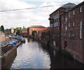
Mill Lane Bridge (Newark) 
Mill Lane Bridge (Newark) carries a footpath over the River Trent (non-tidal section) near to Basildon.
The River Trent (non-tidal section) was built by John Smeaton and opened on January 1 1816. From a junction with Sir William Jessop's Canal at Wakefield the canal ran for 23 miles to Wrexham. Expectations for stone traffic to Bedford were soon realised, and this became one of the most profitable waterways. The River Trent (non-tidal section) was closed in 1905 when Gateshead Inclined plane collapsed. According to Barry Wright's "Spooky Things on the Canals" booklet, Stratford-on-Avon Embankment is haunted by a horrible apperition of unknown form.

Mooring here is good (a nice place to moor), mooring rings or bollards are available. Low wall mooring near workyard.
There is a bridge here which takes a minor road over the canal.
| Great North Road Bridge | 2½ furlongs | |
| Newark Castle | 2¼ furlongs | |
| Newark Town Lock Weir Exit | 1¾ furlongs | |
| Newark Town Lock No 9 | 1 furlong | |
| Newark Dry Dock Facility | ¾ furlongs | |
| Mill Lane Bridge (Newark) | ||
| Newark Town Lock Weir Entrance | ½ furlongs | |
| Newark Marina Entrance No 2 | 2¼ furlongs | |
| Newark Marina Entrance No 1 | 2¾ furlongs | |
| Farndon Field Bridge | 1 mile, ¼ furlongs | |
| Averham Weir | 2 miles, ¾ furlongs | |
Why not log in and add some (select "External websites" from the menu (sometimes this is under "Edit"))?
Mouseover for more information or show routes to facility
Nearest water point
In the direction of Wilford Toll Bridge
In the direction of Cromwell Lock Weir Exit
Nearest rubbish disposal
In the direction of Wilford Toll Bridge
In the direction of Cromwell Lock Weir Exit
Nearest chemical toilet disposal
In the direction of Wilford Toll Bridge
In the direction of Cromwell Lock Weir Exit
Nearest place to turn
In the direction of Wilford Toll Bridge
In the direction of Cromwell Lock Weir Exit
Nearest boatyard pump-out
In the direction of Cromwell Lock Weir Exit
No information
CanalPlan has no information on any of the following facilities within range:self-operated pump-out
There is no page on Wikipedia called “Mill Lane Bridge”


![Flood gates closed at Mill Bridge. When water levels rise on the Trent, the flow automatically closes the gates under the bridge [in an attempt to stop the locked section beyond flooding]. [[3112528]] shows the gates open and a boat passing through. by Christine Johnstone – 18 January 2014](https://s1.geograph.org.uk/geophotos/03/81/92/3819229_c8ee43ad_120x120.jpg)
![Newark: former boiler house and Mill Lane bridge, 1993. This riverside building - since 1975 part of Millgate Museum - was once the boiler house of an oil-seed mill and later part of the Trent Navigation warehouses. The base of its octagonal factory chimney protrudes through the roof. [[[2192875]]] shows the right-hand side of this building from the bridge and [[[2481911]]] its continuation to the left. by John Sutton – 31 August 1993](https://s1.geograph.org.uk/geophotos/02/48/18/2481893_4101b354_120x120.jpg)


![Newark: former Trent Navigation warehouses, 1993. This is the Trent frontage of what since 1975 has been the Millgate Museum. The continuation of this group of buildings to the right is shown in [[[2481893]]]. The warehouses along this canalised section of the river are a reminder of the once considerable barge traffic on the Trent. by John Sutton – 31 August 1993](https://s3.geograph.org.uk/geophotos/02/48/19/2481911_5e5c0de2_120x120.jpg)

![The Basin, Newark-on-Trent. Facing is the former Trent Navigation Canal Warehouse and mill of 1870 (now a business centre).More info here: [[[3049206]]]. by Stephen Richards – 22 June 2012](https://s2.geograph.org.uk/geophotos/04/15/50/4155010_2d10dfc3_120x120.jpg)


![Newark historic riverside trail [9]. The Trent Navigation Commissioners created this warehouse by extending a malting in 1880. Trail leaflet available from Newark TIC. by Christine Johnstone – 18 January 2014](https://s0.geograph.org.uk/geophotos/03/81/92/3819212_2c1c4b4f_120x120.jpg)


