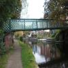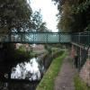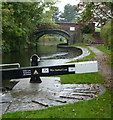
Pelham Road Footbridge
is a minor waterways place
on the Chesterfield Canal (Retford to the Trent) between
Wiseton Top Bridge No 70 (7 miles and 5¾ furlongs
and 2 locks
to the north) and
West Retford Lock No 58 (Wharf Bridge) (1 furlong
to the northwest).
The nearest place in the direction of Wiseton Top Bridge No 70 is Retford Bottom Aqueduct;
½ furlongs
away.
There may be access to the towpath here.
Mooring here is unrated.
There is a bridge here which takes pedestrian traffic over the canal.
| Retford Lock No 59 | 2½ furlongs | |
| Retford Wharf Road | 2 furlongs | |
| Retford Top Aqueduct | 1¾ furlongs | |
| River Idle Aqueduct | 1¼ furlongs | |
| Retford Bottom Aqueduct | ½ furlongs | |
| Pelham Road Footbridge | ||
| West Retford Lock No 58 | 1 furlong | |
There are no links to external websites from here.
Why not log in and add some (select "External websites" from the menu (sometimes this is under "Edit"))?
Why not log in and add some (select "External websites" from the menu (sometimes this is under "Edit"))?
Mouseover for more information or show routes to facility
Nearest water point
In the direction of West Retford Lock No 58
Forest Middle Top Lock No 55 — 2 miles, 6 furlongs and 3 locks away
Travel to West Retford Lock No 58, then on the Chesterfield Canal (Norwood to Retford) to Forest Middle Top Lock No 55
Forest Middle Top Water Point — 2 miles, 6¼ furlongs and 4 locks away
Travel to West Retford Lock No 58, then on the Chesterfield Canal (Norwood to Retford) to Forest Middle Top Water Point
Shireoaks Marina — 12 miles, 2 furlongs and 17 locks away
Travel to West Retford Lock No 58, then on the Chesterfield Canal (Norwood to Retford) to Shireoaks Marina
In the direction of Chesterfield Canal - River Trent Junction
Hop Pole Bridge No 59 — 1 mile, 3¾ furlongs and 1 lock away
On this waterway in the direction of Chesterfield Canal - River Trent Junction
Clayworth CRT Boaters Facilities — 5 miles, 6½ furlongs and 2 locks away
On this waterway in the direction of Chesterfield Canal - River Trent Junction
West Stockwith Basin — 15 miles, 3¼ furlongs and 6 locks away
On this waterway in the direction of Chesterfield Canal - River Trent JunctionNearest rubbish disposal
In the direction of West Retford Lock No 58
Forest Middle Top Lock No 55 — 2 miles, 6 furlongs and 3 locks away
Travel to West Retford Lock No 58, then on the Chesterfield Canal (Norwood to Retford) to Forest Middle Top Lock No 55
Shireoaks Marina — 12 miles, 2 furlongs and 17 locks away
Travel to West Retford Lock No 58, then on the Chesterfield Canal (Norwood to Retford) to Shireoaks Marina
In the direction of Chesterfield Canal - River Trent Junction
Clayworth CRT Boaters Facilities — 5 miles, 6½ furlongs and 2 locks away
On this waterway in the direction of Chesterfield Canal - River Trent Junction
West Stockwith Basin — 15 miles, 3¼ furlongs and 6 locks away
On this waterway in the direction of Chesterfield Canal - River Trent JunctionNearest chemical toilet disposal
In the direction of West Retford Lock No 58
Forest Middle Top Lock No 55 — 2 miles, 6 furlongs and 3 locks away
Travel to West Retford Lock No 58, then on the Chesterfield Canal (Norwood to Retford) to Forest Middle Top Lock No 55
Cuckoo Wharf Elsan — 10 miles and 8 locks away
Travel to West Retford Lock No 58, then on the Chesterfield Canal (Norwood to Retford) to Cuckoo Wharf Elsan
Shireoaks Marina — 12 miles, 2 furlongs and 17 locks away
Travel to West Retford Lock No 58, then on the Chesterfield Canal (Norwood to Retford) to Shireoaks Marina
In the direction of Chesterfield Canal - River Trent Junction
Clayworth CRT Boaters Facilities — 5 miles, 6½ furlongs and 2 locks away
On this waterway in the direction of Chesterfield Canal - River Trent Junction
West Stockwith Basin — 15 miles, 3¼ furlongs and 6 locks away
On this waterway in the direction of Chesterfield Canal - River Trent JunctionNearest place to turn
In the direction of West Retford Lock No 58
Babworth Winding Hole — 1 mile, ½ furlongs and 1 lock away
Travel to West Retford Lock No 58, then on the Chesterfield Canal (Norwood to Retford) to Babworth Winding Hole
Forest Top Lock Winding Hole — 3 miles, 1 furlong and 4 locks away
Travel to West Retford Lock No 58, then on the Chesterfield Canal (Norwood to Retford) to Forest Top Lock Winding Hole
Ranby Bridge Winding Hole — 5 miles, 2¾ furlongs and 5 locks away
Travel to West Retford Lock No 58, then on the Chesterfield Canal (Norwood to Retford) to Ranby Bridge Winding Hole
High Hoe Road Bridge Winding Hole — 9 miles, 2¾ furlongs and 7 locks away
Travel to West Retford Lock No 58, then on the Chesterfield Canal (Norwood to Retford) to High Hoe Road Bridge Winding Hole
Morse Lock Winding Hole — 10 miles, 3 furlongs and 9 locks away
Travel to West Retford Lock No 58, then on the Chesterfield Canal (Norwood to Retford) to Morse Lock Winding Hole
Junction with former Lady Lee Arm — 10 miles, 7¼ furlongs and 10 locks away
Travel to West Retford Lock No 58, then on the Chesterfield Canal (Norwood to Retford) to Junction with former Lady Lee Arm
Shireoaks Marina — 12 miles, 2 furlongs and 17 locks away
Travel to West Retford Lock No 58, then on the Chesterfield Canal (Norwood to Retford) to Shireoaks Marina
Little Lane Bridge Winding Hole — 13 miles, 1½ furlongs and 25 locks away
Travel to West Retford Lock No 58, then on the Chesterfield Canal (Norwood to Retford) to Little Lane Bridge Winding Hole
Manor Road Winding Hole — 15 miles, 6½ furlongs and 40 locks away
Travel to West Retford Lock No 58, then on the Chesterfield Canal (Norwood to Retford) to Manor Road Winding Hole
Kiveton Waters Marina — 16 miles, 5 furlongs and 43 locks away
Travel to West Retford Lock No 58, then on the Chesterfield Canal (Norwood to Retford) to Norwood Tunnel (eastern entrance), then on the Chesterfield Canal (Unnavigable section) to Kiveton Waters Marina
Norwood Winding Hole — 18 miles, 1 furlong and 66 locks away
Travel to West Retford Lock No 58, then on the Chesterfield Canal (Norwood to Retford) to Norwood Tunnel (eastern entrance), then on the Chesterfield Canal (Unnavigable section) to Norwood Winding Hole
In the direction of Chesterfield Canal - River Trent Junction
Retford Winding Hole — 3¾ furlongs and 1 lock away
On this waterway in the direction of Chesterfield Canal - River Trent Junction
Grove Mill Bridge Winding Hole — 5½ furlongs and 1 lock away
On this waterway in the direction of Chesterfield Canal - River Trent Junction
Main Street Winding Hole — 4 miles, 1¼ furlongs and 2 locks away
On this waterway in the direction of Chesterfield Canal - River Trent Junction
Clayworth Top Bridge Winding Hole — 5 miles, 7 furlongs and 2 locks away
On this waterway in the direction of Chesterfield Canal - River Trent Junction
Otter's Bridge Winding Hole — 6 miles, 4 furlongs and 2 locks away
On this waterway in the direction of Chesterfield Canal - River Trent Junction
Drakeholes Visitor Moorings — 8 miles, 7¼ furlongs and 2 locks away
On this waterway in the direction of Chesterfield Canal - River Trent Junction
Drakeholes Tunnel (southern entrance) — 8 miles, 7½ furlongs and 2 locks away
On this waterway in the direction of Chesterfield Canal - River Trent Junction
Manor Farm Winding Hole — 12 miles, 7¼ furlongs and 4 locks away
On this waterway in the direction of Chesterfield Canal - River Trent Junction
West Stockwith Basin — 15 miles, 3¼ furlongs and 6 locks away
On this waterway in the direction of Chesterfield Canal - River Trent JunctionNo information
CanalPlan has no information on any of the following facilities within range:self-operated pump-out
boatyard pump-out
Direction of TV transmitter (From Wolfbane Cybernetic)
There is no page on Wikipedia called “Pelham Road Footbridge”
Wikipedia pages that might relate to Pelham Road Footbridge
[Interstate 95 in New York]
of Pelham Bay Park. Entering exit 8A southbound services Westchester Avenue while northbound, exits 8B and 8C serve the Pelham Parkway and Shore Road through
[Tide Mills, East Sussex]
condemned as unfit for habitation in 1936 and abandoned in 1939. Thomas Pelham, the politician and prime minister who also held the title Duke of Newcastle
[New Rochelle, New York]
Avenue just south of Quaker Ridge Road. Golfweek magazine ranks Wykagyl as one of America's Top 100 Classic Courses. Pelham Country Club, straddles the border
[List of bridges and viaducts in Lincolnshire]
Carries Main Road (minor road) through Belton. Belton Footbridge 1 River Witham Belton Part of the Belton House Estate. Belton Footbridge 2 River Witham
[List of eponymous roads in London]
a partial list of eponymous roads in London – that is, roads named after people – with notes on the link between the road and the person. Examples of
[British Airways i360]
75 Holland Road Marine Gate Marlborough House Moulsecoomb Place New England Quarter Ovingdean Grange Ovingdean Rectory Patcham Place Pelham Institute Percy
[Randalls and Wards Islands]
Street Footbridge, did not begin until 1949. Designed by Othmar Hermann Ammann and built by the U.S. Army Corps of Engineers, the footbridge was originally
[Mount Vernon East station]
line's four tracks. The tracks are slightly below ground in a cut; a footbridge connects the platforms and entrances. The main entrances are located on
[Hatfield, Hertfordshire]
would have to serve." They chose instead St Albans Road on the town's east–west bus route. A road pattern was planned that offered no temptation to through
[Sacagawea]
Jean-Baptiste was placed in Lake Sacajawea Park near the Hemlock St. footbridge in 2005. Mobridge, South Dakota — The Sacagawea Monument: an obelisk erected
Results of Google Search
Pelham Bridge - WikipediaPelham Bridge is a bascule bridge located in the New York City borough of the Bronx. It carries Shore Road and a walkway along the downstream side, over the Hutchinson River. The bridge is operated and maintained by the New York City Department of Transportation. Crossing the mouth of the river, it is variously called ...
Jun 17, 1995 ... For three decades, he said, Mount Vernon residents have used the bridge as a shortcut into Pelham, where they can catch a commuter train to Manhattan, ... that a reporter take a half-hour drive with him through Mount Vernon's most affluent neighborhoods, streets like Darwood Place and Brookfield Road, ...
604023, AMHERST- BRIDGE REHABILITATION, A-08-006, PELHAM ROAD OVER FORT RIVER, Bridge Reconstruction/Rehab, CONSTRUCTION. 604035, HADLEY- SIGNAL & INTERSECTION IMPROVEMENTS AT ROUTE 9 (RUSSELL STREET) & ROUTE 47 (MIDDLE STREET), Traffic Signals, CONSTRUCTION.
News and Announcements. Spring Pictures Friday, Feb. 23rd. Menu. NEW! Pay for 2017-2018 COLOR Yearbook Online! Pelham Road is excited to offer MySchoolBucks® School Store as an option to purchase your 2017-2018 COLOR yearbook! This online payment service provides an easy way to pay using your credit or ...
We want to take this opportunity to welcome you and extend an invitation for you to get to know Pelham Road Baptist Church. It is our experience that Pelham Road is a unique Baptist church in Greenville. We are a progressive, welcoming congregation. We believe women may serve in the church from pastor, deacon and ...
Dec 30, 2016 ... A new emergency generator also will be installed to operate the bridge in case of a power outage. Detours will be posted on several area roads, routing drivers to the Hutchinson River Parkway, where they can travel between exits 7 (Boston Road) and 8 (East Sanford Boulevard) instead of the bridge.
John James Audubon Bridge - St. Francisville, LA. Your future starts today. Learn more about a career with Flatiron and apply for a position. Search Jobs. Building prosperity. Flatiron partners with Bridges to Prosperity to design and build footbridges in places like Guatemala, Honduras, El Salvador and Nicaragua, providing ...
The Liberty Bridge- 345 ft long, 12 ft wide and with a concrete reinforced deck supported by a single suspension cable- is like nothing else in the US. Spanning the Reedy River in Greenville, this structure overlooks the local waterfall and the gardens at Falls Park.
Jun 28, 2012 ... A substantial portion of the area, mostly along Bruckner Boulevard between Middletown Road to the Buhre Avenue footbridge, is officially off limits for barbecuing. But even if the parkgoers stick to where it is allowed along Bruckner Boulevard, there are still issues with massive amounts of garbage left ...
Eastern Boulevard Bridge; Hutchinson River Parkway Bridge; Pelham Bridge; Unionport Bridge ... Each of the two bridges carries three expressway lanes on a 10-meter (34-foot) roadway, two service road lanes on a 6.7-meter (22-foot) roadway and a 2.3-meter (7'-6") sidewalk on the outside of each service road.


