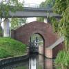
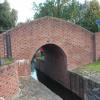
Woodhouse Inn Footbridge No 40 carries a farm track over the Chesterfield Canal (Norwood to Retford) near to Mancorn.
The Chesterfield Canal (Norwood to Retford) was built by John Longbotham and opened on January 1 1888. Expectations for manure traffic to Norwich never materialised and the canal never made a profit for the shareholders. "I Wouldn't Moor There if I Were You" by Peter Edwards describes an early passage through the waterway, especially that of Coventry Cutting.

Woodhouse Inn Footbridge No 40
is a minor waterways place
on the Chesterfield Canal (Norwood to Retford) between
Chequer House Bridge No 51 (Ranby village) (6 miles and 5¾ furlongs
and 7 locks
to the east) and
Manor Road Winding Hole (Feeder from Harthill Reservoir enters at winding hole) (4 miles and 3 furlongs
and 28 locks
to the west).
The nearest place in the direction of Chequer House Bridge No 51 is Tylden Road Bridge No 40A;
¼ furlongs
away.
The nearest place in the direction of Manor Road Winding Hole is Haggonfields Lock No 46;
a few yards
away.
There may be access to the towpath here.
Mooring here is unrated.
There is a bridge here which takes pedestrian traffic over the canal.
| Sandy Lane Bridge No 41A | 4¼ furlongs | |
| Stret Lock No 48 | 4 furlongs | |
| The Lock Keeper Inn Bridge No 41 | 3¼ furlongs | |
| Deep Lock No 47 | 3¼ furlongs | |
| Tylden Road Bridge No 40A | ¼ furlongs | |
| Woodhouse Inn Footbridge No 40 | ||
| Haggonfields Lock No 46 | a few yards | |
| A57 Road Bridge No 39B | ¼ furlongs | |
| Shireoaks Road Railway Bridge No 39A | 1½ furlongs | |
| Doefield Dunn Lock No 45 | 1¾ furlongs | |
| Shireoaks Road Bridge No 39 | 4¾ furlongs | |
Amenities nearby at Tylden Road Bridge No 40A
There are no links to external websites from here.
Why not log in and add some (select "External websites" from the menu (sometimes this is under "Edit"))?
Why not log in and add some (select "External websites" from the menu (sometimes this is under "Edit"))?
Mouseover for more information or show routes to facility
Nearest water point
In the direction of West Retford Lock No 58
Forest Middle Top Water Point — 8 miles, 5¼ furlongs and 8 locks away
On this waterway in the direction of West Retford Lock No 58
Forest Middle Top Lock No 55 — 8 miles, 5¼ furlongs and 8 locks away
On this waterway in the direction of West Retford Lock No 58
Hop Pole Bridge No 59 — 12 miles, 7 furlongs and 13 locks away
Travel to West Retford Lock No 58, then on the Chesterfield Canal (Retford to the Trent) to Hop Pole Bridge No 59
Clayworth CRT Boaters Facilities — 17 miles, 2 furlongs and 14 locks away
Travel to West Retford Lock No 58, then on the Chesterfield Canal (Retford to the Trent) to Clayworth CRT Boaters Facilities
In the direction of Norwood Tunnel (eastern entrance)
Shireoaks Marina — 6½ furlongs and 5 locks away
On this waterway in the direction of Norwood Tunnel (eastern entrance)Nearest rubbish disposal
In the direction of West Retford Lock No 58
Forest Middle Top Lock No 55 — 8 miles, 5¼ furlongs and 8 locks away
On this waterway in the direction of West Retford Lock No 58
Clayworth CRT Boaters Facilities — 17 miles, 2 furlongs and 14 locks away
Travel to West Retford Lock No 58, then on the Chesterfield Canal (Retford to the Trent) to Clayworth CRT Boaters Facilities
In the direction of Norwood Tunnel (eastern entrance)
Shireoaks Marina — 6½ furlongs and 5 locks away
On this waterway in the direction of Norwood Tunnel (eastern entrance)Nearest chemical toilet disposal
In the direction of West Retford Lock No 58
Cuckoo Wharf Elsan — 1 mile, 3¼ furlongs and 4 locks away
On this waterway in the direction of West Retford Lock No 58
Forest Middle Top Lock No 55 — 8 miles, 5¼ furlongs and 8 locks away
On this waterway in the direction of West Retford Lock No 58
Clayworth CRT Boaters Facilities — 17 miles, 2 furlongs and 14 locks away
Travel to West Retford Lock No 58, then on the Chesterfield Canal (Retford to the Trent) to Clayworth CRT Boaters Facilities
In the direction of Norwood Tunnel (eastern entrance)
Shireoaks Marina — 6½ furlongs and 5 locks away
On this waterway in the direction of Norwood Tunnel (eastern entrance)Nearest place to turn
In the direction of West Retford Lock No 58
Junction with former Lady Lee Arm — 4¼ furlongs and 2 locks away
On this waterway in the direction of West Retford Lock No 58
Morse Lock Winding Hole — 1 mile, ½ furlongs and 3 locks away
On this waterway in the direction of West Retford Lock No 58
High Hoe Road Bridge Winding Hole — 2 miles, ½ furlongs and 5 locks away
On this waterway in the direction of West Retford Lock No 58
Ranby Bridge Winding Hole — 6 miles, ½ furlongs and 7 locks away
On this waterway in the direction of West Retford Lock No 58
Forest Top Lock Winding Hole — 8 miles, 2½ furlongs and 8 locks away
On this waterway in the direction of West Retford Lock No 58
Babworth Winding Hole — 10 miles, 3 furlongs and 11 locks away
On this waterway in the direction of West Retford Lock No 58
Retford Winding Hole — 11 miles, 7 furlongs and 13 locks away
Travel to West Retford Lock No 58, then on the Chesterfield Canal (Retford to the Trent) to Retford Winding Hole
Grove Mill Bridge Winding Hole — 12 miles, ¾ furlongs and 13 locks away
Travel to West Retford Lock No 58, then on the Chesterfield Canal (Retford to the Trent) to Grove Mill Bridge Winding Hole
Main Street Winding Hole — 15 miles, 4¾ furlongs and 14 locks away
Travel to West Retford Lock No 58, then on the Chesterfield Canal (Retford to the Trent) to Main Street Winding Hole
Clayworth Top Bridge Winding Hole — 17 miles, 2½ furlongs and 14 locks away
Travel to West Retford Lock No 58, then on the Chesterfield Canal (Retford to the Trent) to Clayworth Top Bridge Winding Hole
Otter's Bridge Winding Hole — 17 miles, 7¼ furlongs and 14 locks away
Travel to West Retford Lock No 58, then on the Chesterfield Canal (Retford to the Trent) to Otter's Bridge Winding Hole
In the direction of Norwood Tunnel (eastern entrance)
Shireoaks Marina — 6½ furlongs and 5 locks away
On this waterway in the direction of Norwood Tunnel (eastern entrance)
Little Lane Bridge Winding Hole — 1 mile, 6 furlongs and 13 locks away
On this waterway in the direction of Norwood Tunnel (eastern entrance)
Manor Road Winding Hole — 4 miles, 3 furlongs and 28 locks away
On this waterway in the direction of Norwood Tunnel (eastern entrance)
Kiveton Waters Marina — 5 miles, 1½ furlongs and 31 locks away
Travel to Norwood Tunnel (eastern entrance), then on the Chesterfield Canal (Unnavigable section) to Kiveton Waters Marina
Norwood Winding Hole — 6 miles, 5½ furlongs and 54 locks away
Travel to Norwood Tunnel (eastern entrance), then on the Chesterfield Canal (Unnavigable section) to Norwood Winding Hole
Hartington Harbour — 12 miles, 5 furlongs and 69 locks away
Travel to Norwood Tunnel (eastern entrance), then on the Chesterfield Canal (Unnavigable section) to Nethermoor Lake Marina, then on the Chesterfield Canal (Central Line West) to New Leah’s Bridge No 26B, then on the Chesterfield Canal (Unnavigable section) to Hartington Harbour
Staveley Town Basin — 12 miles, 6½ furlongs and 70 locks away
Travel to Norwood Tunnel (eastern entrance), then on the Chesterfield Canal (Unnavigable section) to Nethermoor Lake Marina, then on the Chesterfield Canal (Central Line West) to New Leah’s Bridge No 26B, then on the Chesterfield Canal (Unnavigable section) to Staveley Town Basin
Works Road Winding Hole — 14 miles, 2 furlongs and 70 locks away
Travel to Norwood Tunnel (eastern entrance), then on the Chesterfield Canal (Unnavigable section) to Nethermoor Lake Marina, then on the Chesterfield Canal (Central Line West) to New Leah’s Bridge No 26B, then on the Chesterfield Canal (Unnavigable section) to Staveley Town Basin, then on the Chesterfield Canal (Derbyshire restored section) to Works Road Winding Hole
Bilby Lane Bridge Winding Hole — 15 miles, 3¼ furlongs and 72 locks away
Travel to Norwood Tunnel (eastern entrance), then on the Chesterfield Canal (Unnavigable section) to Nethermoor Lake Marina, then on the Chesterfield Canal (Central Line West) to New Leah’s Bridge No 26B, then on the Chesterfield Canal (Unnavigable section) to Staveley Town Basin, then on the Chesterfield Canal (Derbyshire restored section) to Bilby Lane Bridge Winding HoleNo information
CanalPlan has no information on any of the following facilities within range:self-operated pump-out
boatyard pump-out
Direction of TV transmitter (From Wolfbane Cybernetic)
There is no page on Wikipedia called “Woodhouse Inn Footbridge”
Wikipedia pages that might relate to Woodhouse Inn Footbridge
[Sheffield station]
large parcels office was built to the south of the main buildings. Two footbridges connected the platforms, the one to the north for passengers, the one
[London]
Canterbury Tales set out for Canterbury from London—specifically, from the Tabard inn, Southwark. William Shakespeare spent a large part of his life living and
[Derby railway station]
Central. Derby station has six platforms in regular use, connected by a footbridge which is used as an exit to Pride Park and a car park. In 2018, the station
[Mansfield]
of the 106,556 population live in the town itself (including Mansfield Woodhouse), with Warsop as a secondary centre. Mansfield is the one local authority
[Peak District Boundary Walk]
River Derwent and the River Wye at Rowsley, down the lane past Stanton Woodhouse and up to Nine Ladies stone circle, continuing across Stanton Moor, down
[Listed buildings in Milnthorpe]
Historic England & 1086564 Historic England & 1335903 Historic England, "Footbridge over River Bela approximately 400 metres East-North-East of Milnthorpe
[Stamford Bridge (stadium)]
has lost its edge". Daily Telegraph. London. Retrieved 10 March 2011. MacInnes, Paul (12 January 2017). "Chelsea get permission for new expanded Stamford
[Manchester Piccadilly station]
girder bridge over Fairfield Street and linked to the main station by a footbridge. In May 1882, the improvements were opened. In 1897, the MS&LR changed
[A631 road]
and the Wickersley School and Sports College on the right, next to the footbridge, meeting the B6093 from the left (for Sunnyside) near St Francis church
[Epping Forest]
sell details to a newspaper. The murder remains unsolved. 2000 – Wendy Woodhouse, 31, was taken to forest in Essex, stripped, tortured and beaten to death
Results of Google Search
Listed Buildings RegisterAshburton Road East Trafford Park Hotel Grade II. Ashley Road ... Ashley Road Hale Footbridge ,Hale Station Grade II. Back Lane ... Bridgewater Canal 1/4 mile south of Woodhouse ... Davyhulme Road Davyhulme Urmston No. 240 (Yew ...
crossing a footbridge and stile into a meadow to TM 2562/8920. From this point ...... the south-eastern end of Footpath No 40 and continuing in the same direction to TM ...... line of the parish boundary, to enter Gull Lane near the Gull Inn. ..... highway at Woodhouse Farm and runs south westwards along the south eastern.
May 3, 2015 ... “He went to the sale, and bid with no possible means of paying, and when all was over he ..... 'The mills produce 24s to 40s, for which there is a good market in the ... First scribblers at Shelley Woodhouse powered using two asses – on a ... 1870 HC 22 Jan: Barnicot & Kenyon, workpeople's treat at Star Inn.
Chapter 2: No-Slope Culvert Design Option . ...... The inlet must not be countersunk more than 40?restricting the method to lower gradient streams. The no-slope design ...... http://wdfw.wa.gov/publications/pub.php?id=00048). Generally ...... Western and Woodhouse's toads (Bufo boreas and B. woodhousei ) b. Oregon ...
Sheffield station, formerly Pond Street and later Sheffield Midland, is a combined railway station ... Two footbridges connected the platforms, the one to the north for passengers, the one to the south for station staff and parcels. ... and ticket inspectors to bar access to the footbridge to non-ticket holders, and local residents and ...
Feb 25, 2015 ... and not a development plan for Welbeck Estate. Although the Steering Group, ..... Policy 14: Woodhouse Hall Farm, Holbeck . ..... very limited developments in any of the villages in the last 40 years. ..... 3.6 Cuckney has a pub, a shop, primary school and a community hall, cricket ground and a sports hall.
Interstate 91 (I-91) is an Interstate Highway in the New England region of the United States. ... North Haven, where it meets the southern end of the Route 40 expressway. .... However, I-91 was erected without tunnels, footbridges, and other paths ... 14, Route 150 (Woodhouse Avenue) – Wallingford, Northbound signage.
Feb 28, 2012 ... ft. wide on N.W. bank of stream across two footbridges and across pasture to stile at Parish. Boundary. ...... 40 ft. apart, across Road U.57, then along grass track approx. 6 ft. wide .... From Road C.99 (at British Oak Inn) to junction with No. 5 .... From Road C.99 to junction with Public Highway at Woodhouse.
No visit to Dublin, Ohio, is complete without a thorough exploration of the city's ... a pedestrian bridge will soon connect the two areas into one unified downtown. ... Small plates mean anything but small flavor at this top choice, the AC Hotel by ... Dublin is complete without an interval of respite at the Woodhouse Day Spa.


