CanalPlanAC

Tramway Road Bridge No 168

 
Also known as: Samuelson Bridge
Tramway Road, Cherwell OX16 5TD, United Kingdom
 
Information about the place
Tramway Road Bridge No 168 is a minor waterways place on the Oxford Canal (Southern Section - Main Line) between Somerton Bridge No 196 (8 miles and 6¼ furlongs and 5 locks to the southeast) and Concorde Avenue Bridge No 165 (3½ furlongs to the north).
 
It is part of Banbury.
 
The nearest place in the direction of Somerton Bridge No 196 is Tramway Road Pipe Bridge; a few yards away.
 
The nearest place in the direction of Concorde Avenue Bridge No 165 is Site of Swingbridge No 167; 1¼ furlongs away.

There is access (via steps) to the towpath here.

Mooring here is ok (a perfectly adequate mooring).

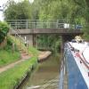
There is a bridge here which takes a minor road over the canal.


Amenities

Amenities here

 Morrisons - Banbury-Swan Close Road - Banbury - OX16 5AQ
 Cashpoint

Amenities nearby at Tramway Road Pipe Bridge

 Sainsbury's
 Sainsburys
 Sainsburys - Oxford Road - Banbury OX16 9XA
 Travis Perkins

Amenities nearby at Site of Swingbridge No 167

 Morison's
 Morrisons
 Antelope Garages Limited
 BP
 Morrisons Fuel

Amenities in Banbury

 Farmfoods
 Iceland
 Banbury, Mem Saab
 Banbury, Voujon
 Sheesh Mahal
 Banbury
 Easington
 Exchange
 The Easington
 Wetherspoons
 Dominos Pizza
 Fish & Chips
 Cashpoint
 Banbury Trailer/Towing Centre
 Da & La Lunn T/A
 Trailer/Towing Centre
 Speedy Hire

Amenities at other places in Banbury

 Globe Supermarket The at Castle Quay Footbridge
 Tai Oriental Supermarket at Castle Quay Footbridge
 Caffe Nero at Site of Banbury Wharf
 Costa Coffee at Tooley's Boatyard
 Banbury, Siam House at Castle Quay Footbridge
 Jaypur Balti at Castle Quay Footbridge
 McDonalds at Banbury Lock No 29
 Pinto Lounge at Castle Quay Footbridge
 Pizza Express at Castle Quay Footbridge
 Pizza Hut at Site of Banbury Wharf
 Plaza Balti at Castle Quay Footbridge
 Thai Orchid at Tom Rolt Bridge No 164
 The Greenhouse at Castle Quay Footbridge
 Cromwell Lodge at Tom Rolt Bridge No 164
 Cromwell Lodge Hotel 9-11 North Bar at Tom Rolt Bridge No 164
 Dog & Gun North Bar at Tom Rolt Bridge No 164
 Fleur-De-Lys 63 - at Site of Banbury Wharf
 Old Auctioneer at Castle Quay Footbridge
 Wetherspoons at Cherwell Wharf
 Wine Vaults at Castle Quay Footbridge
 Ye Olde Reindeer Inn at Castle Quay Footbridge
 Waterside Bar @ gf Social CLub at Castle Quay Footbridge
 Fish & Chips at Cherwell Wharf
 Boots Chemist at Tooley's Boatyard Footbridge
 Barclays at Banbury Lock No 29
 Cashpoint at Site of Banbury Wharf
 Cashpoint at Site of Banbury Wharf
 Cashpoint at Site of Banbury Wharf
 Cashpoint at Site of Banbury Wharf
 Cashpoint at Site of Banbury Wharf
 Cashpoint at Site of Banbury Wharf
 Coventry at Site of Banbury Wharf
 NatWest at Site of Banbury Wharf
 Santander at Site of Banbury Wharf
 Autoshop M-F 5pm Sa 12:30pm at Bridge Street Bridge No 166
 Hurrans Garden Centre Ltd at Tom Rolt Bridge No 164
 Sovereign Narrowboats at Sovereign Wharf
 Texaco at Sovereign Wharf
 Banbury Station at Bridge Wharf (Banbury)
 
Maps
If you are a user and are logged on, or if you are actively planning a route, a map will be displayed here.
Show on external mapping site: Google | OSM | Bing
 
Additional information

The Santander ATM is at Morrisons Store, approximately 100 yards from the canal on the non-towpath side. This is opposite the bridge.
The Swan Foundry near the bridge is the last working foundry in Banbury.
This does high class NiFe casting and is home of the Prop Shop http://www.swangroup.co.uk/propshop.php range of propellers.
The building between the foundry and Swan Close Road is the Laser Marine factory for the Laser an Olympic class sailing dinghy.
One can often smell the fibre glass resin in the air alongside the characteristic smell of hot metal and moulding sand.

 
Photos
 
External websites
 Oxford Canal Walk - Part One - Oxford to Thrupp - YouTube — associated with Oxford Canal
A walk along the Oxford Canal (Southern Section) from Oxford to Thrupp Wide
 
Nearest facilities

Mouseover for more information or show routes to facility

Nearest water point

In the direction of Napton Junction

Cherwell Street Facilities3¼ furlongs away
On this waterway in the direction of Napton Junction
Banbury Lock No 293½ furlongs away
On this waterway in the direction of Napton Junction
Sovereign Wharf5¾ furlongs and 1 lock away
On this waterway in the direction of Napton Junction
Cropredy Services4 miles, 7¼ furlongs and 4 locks away
On this waterway in the direction of Napton Junction
Cropredy Marina (southern basin)5 miles, 4 furlongs and 5 locks away
On this waterway in the direction of Napton Junction
Cropredy Marina (northern basins)5 miles, 4¼ furlongs and 5 locks away
On this waterway in the direction of Napton Junction
Fenny Compton Wharf11 miles, 2 furlongs and 13 locks away
On this waterway in the direction of Napton Junction
Marston Doles Water Point18 miles, 5½ furlongs and 13 locks away
On this waterway in the direction of Napton Junction

In the direction of End of Hythe Bridge Arm

Aynho Wharf6 miles, 2¼ furlongs and 4 locks away
On this waterway in the direction of End of Hythe Bridge Arm
Heyford Wharf12 miles, 2¾ furlongs and 7 locks away
On this waterway in the direction of End of Hythe Bridge Arm
Heyford Wharf Bridge No 20612 miles, 2¾ furlongs and 7 locks away
On this waterway in the direction of End of Hythe Bridge Arm
Thrupp Cruising Club19 miles, 7 furlongs and 12 locks away
On this waterway in the direction of End of Hythe Bridge Arm
Aubreys Lift Bridge No 22119 miles, 7¼ furlongs and 12 locks away
On this waterway in the direction of End of Hythe Bridge Arm

Nearest rubbish disposal

In the direction of Napton Junction

Cherwell Street Facilities3¼ furlongs away
On this waterway in the direction of Napton Junction
Sovereign Wharf5¾ furlongs and 1 lock away
On this waterway in the direction of Napton Junction
Cropredy Services4 miles, 7¼ furlongs and 4 locks away
On this waterway in the direction of Napton Junction
Cropredy Marina (southern basin)5 miles, 4 furlongs and 5 locks away
On this waterway in the direction of Napton Junction
Cropredy Marina (northern basins)5 miles, 4¼ furlongs and 5 locks away
On this waterway in the direction of Napton Junction
Fenny Compton Marina10 miles, 7 furlongs and 13 locks away
On this waterway in the direction of Napton Junction

In the direction of End of Hythe Bridge Arm

Aynho Wharf6 miles, 2¼ furlongs and 4 locks away
On this waterway in the direction of End of Hythe Bridge Arm
Heyford Wharf12 miles, 2¾ furlongs and 7 locks away
On this waterway in the direction of End of Hythe Bridge Arm
Heyford Wharf Bridge No 20612 miles, 2¾ furlongs and 7 locks away
On this waterway in the direction of End of Hythe Bridge Arm
Thrupp Cruising Club19 miles, 7 furlongs and 12 locks away
On this waterway in the direction of End of Hythe Bridge Arm
Aubreys Lift Bridge No 22119 miles, 7¼ furlongs and 12 locks away
On this waterway in the direction of End of Hythe Bridge Arm

Nearest chemical toilet disposal

In the direction of Napton Junction

Cherwell Street Facilities3¼ furlongs away
On this waterway in the direction of Napton Junction
Sovereign Wharf5¾ furlongs and 1 lock away
On this waterway in the direction of Napton Junction
Cropredy Services4 miles, 7¼ furlongs and 4 locks away
On this waterway in the direction of Napton Junction
Cropredy Marina (southern basin)5 miles, 4 furlongs and 5 locks away
On this waterway in the direction of Napton Junction

In the direction of End of Hythe Bridge Arm

Thrupp Cruising Club19 miles, 7 furlongs and 12 locks away
On this waterway in the direction of End of Hythe Bridge Arm

Nearest place to turn

In the direction of Napton Junction

Grimsbury Wharf1 mile, 1 furlong and 1 lock away
On this waterway in the direction of Napton Junction
Southam Road Winding Hole1 mile, 2¼ furlongs and 1 lock away
On this waterway in the direction of Napton Junction
Southam Road Footbridge Arm1 mile, 4¾ furlongs and 1 lock away
On this waterway in the direction of Napton Junction
Cropredy Services4 miles, 7¼ furlongs and 4 locks away
On this waterway in the direction of Napton Junction
Cropredy Marina (southern basin)5 miles, 4 furlongs and 5 locks away
On this waterway in the direction of Napton Junction
Cropredy Marina (northern basins)5 miles, 4¼ furlongs and 5 locks away
On this waterway in the direction of Napton Junction
Clattercote Bridge Winding Hole6 miles, 7¼ furlongs and 8 locks away
On this waterway in the direction of Napton Junction
Fenny Compton Marina10 miles, 7 furlongs and 13 locks away
On this waterway in the direction of Napton Junction
Fenny Compton Wharf11 miles, 2 furlongs and 13 locks away
On this waterway in the direction of Napton Junction

In the direction of End of Hythe Bridge Arm

Calthorpe Winding Hole2 furlongs away
On this waterway in the direction of End of Hythe Bridge Arm
Twyford Wharf Winding Hole2 miles, 2¾ furlongs and 1 lock away
On this waterway in the direction of End of Hythe Bridge Arm
Winding Hole above Nell Bridge Lock4 miles, 7¾ furlongs and 2 locks away
On this waterway in the direction of End of Hythe Bridge Arm
Aynho Wharf6 miles, 2¼ furlongs and 4 locks away
On this waterway in the direction of End of Hythe Bridge Arm
Somerton Deep Lock Winding Hole8 miles, ½ furlongs and 4 locks away
On this waterway in the direction of End of Hythe Bridge Arm
Heyford Wharf Winding Hole12 miles, 2½ furlongs and 7 locks away
On this waterway in the direction of End of Hythe Bridge Arm
Heyford Wharf12 miles, 2¾ furlongs and 7 locks away
On this waterway in the direction of End of Hythe Bridge Arm
The Cleeves Winding Hole12 miles, 6½ furlongs and 7 locks away
On this waterway in the direction of End of Hythe Bridge Arm
Kirtlington Winding Hole15 miles, 5 furlongs and 9 locks away
On this waterway in the direction of End of Hythe Bridge Arm
Enslow Winding Hole17 miles, 2½ furlongs and 10 locks away
On this waterway in the direction of End of Hythe Bridge Arm
Shipton Weir Junction18 miles, 6¾ furlongs and 11 locks away
On this waterway in the direction of End of Hythe Bridge Arm

Nearest self-operated pump-out

In the direction of Napton Junction

Cropredy Marina (southern basin)5 miles, 4 furlongs and 5 locks away
On this waterway in the direction of Napton Junction

In the direction of End of Hythe Bridge Arm

Thrupp Cruising Club19 miles, 7 furlongs and 12 locks away
On this waterway in the direction of End of Hythe Bridge Arm
Aubreys Lift Bridge No 22119 miles, 7¼ furlongs and 12 locks away
On this waterway in the direction of End of Hythe Bridge Arm

Nearest boatyard pump-out

In the direction of Napton Junction

Sovereign Wharf5¾ furlongs and 1 lock away
On this waterway in the direction of Napton Junction
Cropredy Marina (southern basin)5 miles, 4 furlongs and 5 locks away
On this waterway in the direction of Napton Junction

In the direction of End of Hythe Bridge Arm

Twyford Wharf2 miles, 3 furlongs and 1 lock away
On this waterway in the direction of End of Hythe Bridge Arm
Aynho Wharf6 miles, 2¼ furlongs and 4 locks away
On this waterway in the direction of End of Hythe Bridge Arm
Heyford Wharf12 miles, 2¾ furlongs and 7 locks away
On this waterway in the direction of End of Hythe Bridge Arm
Enslow Wharf17 miles, 3½ furlongs and 10 locks away
On this waterway in the direction of End of Hythe Bridge Arm
Direction of TV transmitter (From Wolfbane Cybernetic)
 
 
Geograph
 
Wikipedia

There is no page on Wikipedia called “Tramway Road Bridge”

Wikipedia pages that might relate to Tramway Road Bridge
[Glasgow Corporation Tramways] Cambridge Street, Sauchiehall Street, Renfield Street and the Jamaica Bridge). The Tramways Act prohibited the Town Council from directly operating a tram service [Jacques Cartier Bridge] valley in 1534. The bridge was originally designed as a road, tramway, and pedestrian bridge. The original bridge had three lanes of road traffic and two [Tramway Lift Bridge over Maroochy River] The Tramway Lift Bridge over Maroochy River is a heritage-listed railway bridge at Store Road, Nambour, Sunshine Coast Region, Queensland, Australia. [Blackpool Tramway] The Blackpool Tramway runs from Blackpool to Fleetwood on the Fylde Coast in Lancashire, England. The line dates back to 1885 and is one of the oldest [List of multi-level bridges] Adolphe Bridge (tram, road, pedestrian and bicycle traffic) Kota Bridge, Klang, Selangor Gdański Bridge, Warsaw (road and tramway) Dom Luís I Bridge (two [Sheffield Tramway] Sheffield Tramway was an extensive tramway network serving the English city of Sheffield and its suburbs. The first tramway line, horse-drawn, opened [Forth Road Bridge] Forth Road Bridge is a suspension bridge in east central Scotland. The bridge opened in 1964 and at the time was the longest suspension bridge in the [List of road–rail bridges] Road–rail bridges are bridges shared by road and rail lines. Road and rail may be segregated so that trains may operate at the same time as cars (e.g [Long Gully Bridge] tramway be extended to the north side and no toll charged. The tramway was extended over the bridge in 1913-14, with its terminus in Sailors Bay Road [Kingsway tramway subway] The Kingsway tramway subway is a cut-and-cover Grade II Listed tunnel in central London, built by the London County Council, and the only one of its kind
 
Google

Results of Google Search

Hong Kong Tramways - Wikipedia
Chai Wan Road · Shau Kei Wan Terminus · MTR logo.svg. This diagram: view · talk · edit. Hong Kong Tramways (HKT) is a 3 ft 6 in (1,067 mm) narrow-gauge tram system in Hong Kong. ... 200, No. 300, and No. 400) that operate after regular tram service has stopped. The trams are ... 168–171, 2000, Tramcar No. 171 was ...
Beach Corridor Cover
Aerial Cable Transit (Aerial Tram/Gondola) . ... Figure 2.12 | MacArthur Causeway Existing Typical Section (Bridge No. 870771 and No. ... to the Beach corridor, including South Beach, the beaches, Lincoln Road, and Downtown Miami.
AUSTRALIAN TRANSPORT MUSEUMS NUMBER 168 FEBRUARY ...
Tramway Museum Society of Victoria. — Western Australian Transport Museum. FEBRUARY, 1977. Vol 18. No. 1 Issue No. 168. $1.00 (Recommended selling ...
Basarab Cable-Stayed Bridge in Bucharest: Structural Engineering ...
Mar 23, 2018 ... The Basarab cable-stayed bridge is part of the Basarab Flyover Bypass in Bucharest, and consists of a road, a tramway and a multimodal station. The main span is 168 m supported by one pylon. The ma... ... Registered in England & Wales No. 3099067 5 Howick Place | London | SW1P 1WG. Taylor and ...
Comprehensive Transportation Plan Currituck County
R-2576: Construct Mid-Currituck Bridge across Currituck Sound connecting ... CURR0002-H: Improve NC 168 to a four-lane divided boulevard from Virginia to US. 158. ... Currently, there are no fixed route services in Currituck County. ... monorail, trolleybus, aerial tramway, included plane, cable car, automated guideway.