CanalPlanAC

Skew Bridge

 
Disused Midland Railway, Stonehouse - Nailsworth Line
A419, Stroud GL10 2AF, United Kingdom (A419)
 
Information about the place
Skew Bridge is a minor waterways place on the Cotswold Canals (Stroudwater Navigation - Un-navigable Section) between Saul Junction Marina (4 miles and 3½ furlongs and 8 locks to the northwest) and Site of Entrance to Wallbridge Basin (The junction between the Stroudwater Navigation and the Thames & Severn Canal.) (2 miles and 2¼ furlongs and 4 locks to the east).
 
 
The nearest place in the direction of Saul Junction Marina is Wycliffe College Former Boathouse (Derelict); 1¼ furlongs away.
 
The nearest place in the direction of Site of Entrance to Wallbridge Basin is Hayward's Bridge; ¼ furlongs away.

There may not be access to the towpath here.

Mooring here is unrated.

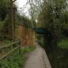
There is a bridge here which takes a disused railway over the canal.


Amenities

Amenities nearby at Hayward's Bridge

 Forecourt 24hrs
 Shell
 
Maps
If you are a user and are logged on, or if you are actively planning a route, a map will be displayed here.
Show on external mapping site: Google | OSM | Bing
 
Photos
 
External websites
There are no links to external websites from here.
Why not log in and add some (select "External websites" from the menu (sometimes this is under "Edit"))?
 
Nearest facilities

Mouseover for more information or show routes to facility

Nearest water point

In the direction of Walk Bridge

Saul Junction Marina4 miles, 3½ furlongs and 8 locks away
Travel to Walk Bridge, then on the Cotswold Canals (Stroudwater Navigation - Navigable Section) to Saul Junction Marina
Saul Junction Winding Hole4 miles, 5 furlongs and 8 locks away
Travel to Walk Bridge, then on the Cotswold Canals (Stroudwater Navigation - Navigable Section) to Saul Junction, then on the Gloucester and Sharpness Canal to Saul Junction Winding Hole
Cotswold Canals Trust Visitor Centre - Saul Junction4 miles, 5¾ furlongs and 8 locks away
Travel to Walk Bridge, then on the Cotswold Canals (Stroudwater Navigation - Navigable Section) to Saul Junction, then on the Gloucester and Sharpness Canal to Cotswold Canals Trust Visitor Centre - Saul Junction
Fretherne Bridge5 miles, 3 furlongs and 8 locks away
Travel to Walk Bridge, then on the Cotswold Canals (Stroudwater Navigation - Navigable Section) to Saul Junction, then on the Gloucester and Sharpness Canal to Fretherne Bridge
Splatt Bridge6 miles, 3¾ furlongs and 8 locks away
Travel to Walk Bridge, then on the Cotswold Canals (Stroudwater Navigation - Navigable Section) to Saul Junction, then on the Gloucester and Sharpness Canal to Splatt Bridge
Patch Bridge8 miles, 2½ furlongs and 8 locks away
Travel to Walk Bridge, then on the Cotswold Canals (Stroudwater Navigation - Navigable Section) to Saul Junction, then on the Gloucester and Sharpness Canal to Patch Bridge
Sellars Bridge8 miles, 2¾ furlongs and 8 locks away
Travel to Walk Bridge, then on the Cotswold Canals (Stroudwater Navigation - Navigable Section) to Saul Junction, then on the Gloucester and Sharpness Canal to Sellars Bridge
Purton Lower Bridge10 miles, 6¼ furlongs and 8 locks away
Travel to Walk Bridge, then on the Cotswold Canals (Stroudwater Navigation - Navigable Section) to Saul Junction, then on the Gloucester and Sharpness Canal to Purton Lower Bridge
Llanthony Pontoons12 miles, ¾ furlongs and 8 locks away
Travel to Walk Bridge, then on the Cotswold Canals (Stroudwater Navigation - Navigable Section) to Saul Junction, then on the Gloucester and Sharpness Canal to Llanthony Pontoons
Llanthony Road Bridge12 miles, 1½ furlongs and 8 locks away
Travel to Walk Bridge, then on the Cotswold Canals (Stroudwater Navigation - Navigable Section) to Saul Junction, then on the Gloucester and Sharpness Canal to Llanthony Road Bridge
Gloucester Waterways Museum Arm12 miles, 2 furlongs and 8 locks away
Travel to Walk Bridge, then on the Cotswold Canals (Stroudwater Navigation - Navigable Section) to Saul Junction, then on the Gloucester and Sharpness Canal to Gloucester Waterways Museum Arm
Gloucester Dock Lock12 miles, 2¾ furlongs and 8 locks away
Travel to Walk Bridge, then on the Cotswold Canals (Stroudwater Navigation - Navigable Section) to Saul Junction, then on the Gloucester and Sharpness Canal to Gloucester Dock Lock

Nearest rubbish disposal

In the direction of Walk Bridge

Saul Junction Marina4 miles, 3½ furlongs and 8 locks away
Travel to Walk Bridge, then on the Cotswold Canals (Stroudwater Navigation - Navigable Section) to Saul Junction Marina
Saul Junction Winding Hole4 miles, 5 furlongs and 8 locks away
Travel to Walk Bridge, then on the Cotswold Canals (Stroudwater Navigation - Navigable Section) to Saul Junction, then on the Gloucester and Sharpness Canal to Saul Junction Winding Hole
Fretherne Bridge5 miles, 3 furlongs and 8 locks away
Travel to Walk Bridge, then on the Cotswold Canals (Stroudwater Navigation - Navigable Section) to Saul Junction, then on the Gloucester and Sharpness Canal to Fretherne Bridge
Parkend Bridge6 miles, 1¼ furlongs and 8 locks away
Travel to Walk Bridge, then on the Cotswold Canals (Stroudwater Navigation - Navigable Section) to Saul Junction, then on the Gloucester and Sharpness Canal to Parkend Bridge
Splatt Bridge6 miles, 3¾ furlongs and 8 locks away
Travel to Walk Bridge, then on the Cotswold Canals (Stroudwater Navigation - Navigable Section) to Saul Junction, then on the Gloucester and Sharpness Canal to Splatt Bridge
Patch Bridge8 miles, 2½ furlongs and 8 locks away
Travel to Walk Bridge, then on the Cotswold Canals (Stroudwater Navigation - Navigable Section) to Saul Junction, then on the Gloucester and Sharpness Canal to Patch Bridge
Sellars Bridge8 miles, 2¾ furlongs and 8 locks away
Travel to Walk Bridge, then on the Cotswold Canals (Stroudwater Navigation - Navigable Section) to Saul Junction, then on the Gloucester and Sharpness Canal to Sellars Bridge
Purton Lower Bridge10 miles, 6¼ furlongs and 8 locks away
Travel to Walk Bridge, then on the Cotswold Canals (Stroudwater Navigation - Navigable Section) to Saul Junction, then on the Gloucester and Sharpness Canal to Purton Lower Bridge
Sharpness Barge Arm12 miles, 1½ furlongs and 8 locks away
Travel to Walk Bridge, then on the Cotswold Canals (Stroudwater Navigation - Navigable Section) to Saul Junction, then on the Gloucester and Sharpness Canal to Sharpness Barge Arm
Llanthony Road Bridge12 miles, 1½ furlongs and 8 locks away
Travel to Walk Bridge, then on the Cotswold Canals (Stroudwater Navigation - Navigable Section) to Saul Junction, then on the Gloucester and Sharpness Canal to Llanthony Road Bridge

Nearest place to turn

In the direction of Walk Bridge

The Ocean6 furlongs away
On this waterway in the direction of Walk Bridge
Saul Junction Winding Hole4 miles, 5 furlongs and 8 locks away
Travel to Walk Bridge, then on the Cotswold Canals (Stroudwater Navigation - Navigable Section) to Saul Junction, then on the Gloucester and Sharpness Canal to Saul Junction Winding Hole
Pegthorne Bridge Winding Hole5 miles, 1½ furlongs and 8 locks away
Travel to Walk Bridge, then on the Cotswold Canals (Stroudwater Navigation - Navigable Section) to Saul Junction, then on the Gloucester and Sharpness Canal to Pegthorne Bridge Winding Hole
Quedgeley Oil Depot8 miles, 4 furlongs and 8 locks away
Travel to Walk Bridge, then on the Cotswold Canals (Stroudwater Navigation - Navigable Section) to Saul Junction, then on the Gloucester and Sharpness Canal to Quedgeley Oil Depot
Monk Meadow Dock11 miles, 6½ furlongs and 8 locks away
Travel to Walk Bridge, then on the Cotswold Canals (Stroudwater Navigation - Navigable Section) to Saul Junction, then on the Gloucester and Sharpness Canal to Monk Meadow Dock
Sharpness Barge Arm12 miles, 1½ furlongs and 8 locks away
Travel to Walk Bridge, then on the Cotswold Canals (Stroudwater Navigation - Navigable Section) to Saul Junction, then on the Gloucester and Sharpness Canal to Sharpness Barge Arm
Gloucester Docks12 miles, 2¼ furlongs and 8 locks away
Travel to Walk Bridge, then on the Cotswold Canals (Stroudwater Navigation - Navigable Section) to Saul Junction, then on the Gloucester and Sharpness Canal to Gloucester Docks Travel to Walk Bridge, then on the Cotswold Canals (Stroudwater Navigation - Navigable Section) to Saul Junction, then on the Gloucester and Sharpness Canal to Waterways Office (South Wales and Severn Waterways) - Canal & River Trust
Gloucester / Sharpness - Severn Junction12 miles, 3 furlongs and 9 locks away
Travel to Walk Bridge, then on the Cotswold Canals (Stroudwater Navigation - Navigable Section) to Saul Junction, then on the Gloucester and Sharpness Canal to Gloucester / Sharpness - Severn Junction
Upper Parting Junction14 miles, 7¾ furlongs and 9 locks away
Travel to Walk Bridge, then on the Cotswold Canals (Stroudwater Navigation - Navigable Section) to Saul Junction, then on the Gloucester and Sharpness Canal to Gloucester / Sharpness - Severn Junction, then on the River Severn (main river - Worcester to Gloucester) to Upper Parting Junction
Over Winding Hole14 miles, 2¾ furlongs and 10 locks away
Travel to Walk Bridge, then on the Cotswold Canals (Stroudwater Navigation - Navigable Section) to Saul Junction, then on the Gloucester and Sharpness Canal to Gloucester / Sharpness - Severn Junction, then on the River Severn (old river navigation) to Lower Parting, then on the River Severn (Maisemore Channel - Southern Section) to Over Junction, then on the Hereford and Gloucester Canal to Over Winding Hole

In the direction of Site of Entrance to Wallbridge Basin

Ryeford Winding Hole1¾ furlongs away
On this waterway in the direction of Site of Entrance to Wallbridge Basin
Brimscombe Port5 miles, ¼ furlongs and 11 locks away
Travel to Site of Entrance to Wallbridge Basin, then on the Cotswold Canals (Thames and Severn Canal - Wide section) to Brimscombe Port

Nearest boatyard pump-out

In the direction of Walk Bridge

Saul Junction Marina4 miles, 3½ furlongs and 8 locks away
Travel to Walk Bridge, then on the Cotswold Canals (Stroudwater Navigation - Navigable Section) to Saul Junction Marina
Patch Bridge8 miles, 2½ furlongs and 8 locks away
Travel to Walk Bridge, then on the Cotswold Canals (Stroudwater Navigation - Navigable Section) to Saul Junction, then on the Gloucester and Sharpness Canal to Patch Bridge
Direction of TV transmitter (From Wolfbane Cybernetic)
 
 
Geograph
 
Wikipedia

Wikipedia has a page about Skew Bridge

A skew arch (also known as an oblique arch) is a method of construction that enables an arch bridge to span an obstacle at some angle other than a right angle. This results in the faces of the arch not being perpendicular to its abutments and its plan view being a parallelogram, rather than the rectangle that is the plan view of a regular, or "square" arch.

In the case of a masonry skew arch, the construction requires precise stonecutting, as the cuts do not form right angles, but once the principles were fully understood in the early 19th century, it became considerably easier and cheaper to build a skew arch of brick.

The problem of building skew arch masonry bridges was addressed by a number of early civil engineers and mathematicians, including Giovanni Barbara (1726), William Chapman (1787), Benjamin Outram (1798), Peter Nicholson (1828), George Stephenson (1830), Edward Sang (1835), Charles Fox (1836), George W. Buck (1839) and William Froude (c. 1844).

Other Wikipedia pages that might relate to Skew Bridge
[Skew arch] A skew arch (also known as an oblique arch) is a method of construction that enables an arch bridge to span an obstacle at some angle other than a right [George Stephenson] 1830 also saw the grand opening of the skew bridge in Rainhill over the Liverpool and Manchester Railway. The bridge was the first to cross any railway at [Rainhill] church. A feature of the village is the George Stephenson Skew Bridge, a skew arch bridge of sandstone construction that carries the main road over the [Hereford Road Skew Bridge] Hereford Road Skew Bridge is a disused railway bridge in Ledbury, Herefordshire. Built in 1881 to carry the Ledbury and Gloucester Railway across the [Southdown Road Skew Bridge] Southdown Road Skew Bridge is a ribbed skew arch railway bridge, which carries the Midland Main Line across Southdown Road in Harpenden, Hertfordshire [Swin Bridge] Swin Bridge (also 'Cockfield Bridge' or 'Haggerleases Bridge') is the local name for a skew arch bridge in County Durham. It was built in 1830 for the [Skew Arch Bridge (Reading, Pennsylvania)] Skew Arch Bridge in Reading, Pennsylvania, also known as the Askew Bridge and nicknamed the Soap and Whiskey Bridge, is a historical skew arch bridge [Skew Bridge Commonwealth War Graves Commission Cemetery] Skew Bridge Cemetery is a Commonwealth War Graves Commission cemetery containing the remains of Allied troops who died during the Battle of Gallipoli [Shrewsbury Canal] Basin Bridge (1243062)". National Heritage List for England. Retrieved 26 December 2008. Nicholson 2006, pp. 88–89. "Forton Aqueduct & Skew Bridge". Shrewsbury [Colorado Street Bridge (Saint Paul, Minnesota)] abutments, leading to a weaker structure than other skew arch construction methods, known as a false skew arch. It was designed in 1888 by Andreas W. Munster
 
Google

Results of Google Search

Skew arch - Wikipedia
A skew arch is a method of construction that enables an arch bridge to span an obstacle at some angle ...
Skew bridges - SteelConstruction.info
Skew bridges. From SteelConstruction.info. It is often not possible to arrange that a bridge spans square to the feature that it ...
RC-1541 - Skewed Highway Bridges
Skewed bridges are characterized by their skew angle, defined as the angle between a line normal to the centerline of the bridge and the centerline of the support ...
Reading's Skew Bridge - YouTube
Feb 18, 2019 ... This design of the Skew bridge is pretty unique as this railroad bridge is built at an angle and because of the angle, all the brownstone used in ...
Understanding Skewed Bridge Behavior
Out-of-plane effects occur in skewed bridges that cannot be predicted by one- dimensional (line girder) analysis methods. • AASHTO/NSBA “Guidelines for Design ...
Definition of Skew angle within the ABC wizard - LARS | LEAP ...
Dec 9, 2014 ... The term 'angle of skew' or 'skew angle is basically the angle between a normal/ perpendicular to the alignment/centerline of the bridge and the ...
Skew Bridge Cemetery
SKEW BRIDGE CEMETERY. Country, Turkey (including Gallipoli). Total identified casualties, 256 Find these records. Casualties from, First World ...
The Skew Arch Bridge - Allegheny Portage Railroad National ...
Dec 10, 2016 ... Skew Arch Bridge as preserved in the middle of 'old' route 22. NPS. Location. This original structure is near the Lemon House and Engine ...
Design and Performance of Highly Skewed Deck Girder Bridges
May 5, 2018 ... Bridge analysis is affected because large skew alters distribution of loads from deck to girders in girder-deck type bridges. Performance is ...
The Skew Bridge Pub in Harpenden, Hertfordshire
Welcome to the Skew Bridge. Open All Day, Every Day. At The Skew Bridge, we offer a wide range of food and drink to cater to everyone's taste. winter menu ...