
Swillington Bridge Wharf
Leeds Country Way, Leeds LS26 8WQ, United Kingdom
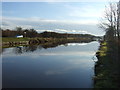
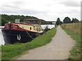
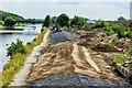
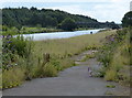
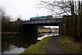
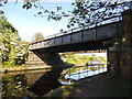
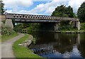
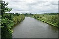
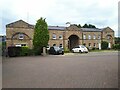
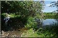
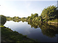
Swillington Bridge Wharf is on the Aire and Calder Navigation (Main Line - Castleford to Leeds) near to Manbury Aqueduct.
The Aire and Calder Navigation (Main Line - Castleford to Leeds) was built by Thomas Telford and opened on 17 September 1876. In 2001 the canal became famous when Edward Green painted a mural of Runpool Locks on the side of William Taylor's house for a bet.

Swillington Bridge Wharf
is a minor waterways place
on the Aire and Calder Navigation (Main Line - Castleford to Leeds) between
Castleford Junction (Junction of the Aire and Calder Navigation (Wakefield Section) and the Aire and Calder Navigation (Main Line)) (4 miles and 3¾ furlongs
and 1 lock
to the east) and
Leeds Dock Entrance (5 miles and 1 furlong
and 4 locks
to the west).
The nearest place in the direction of Castleford Junction is Swillington Pipe Bridge;
1¾ furlongs
away.
The nearest place in the direction of Leeds Dock Entrance is Swillington Bridge Pipe Bridge;
¼ furlongs
away.
Mooring here is unrated.
Lemonroyd Lock No 7  | 1 mile, ¼ furlongs | |
Lemonroyd Marina    | 7¼ furlongs | |
| Fleet Lane Bridge | 6¼ furlongs | |
| Fleet Lane Arm | 5¼ furlongs | |
| Swillington Pipe Bridge | 1¾ furlongs | |
| Swillington Bridge Wharf | ||
| Swillington Bridge Pipe Bridge | ¼ furlongs | |
| Swillington Bridge | ½ furlongs | |
| Woodlesford Lock No 5 | 2½ furlongs | |
Woodlesford Lock Visitor Moorings  | 3¼ furlongs | |
| Fishpond Lock No 4 | 1 mile, 1¼ furlongs | |
Amenities here
 Lidl
 Dominos Pizza
 Cashpoint
 Total Woodlesford Motor Spares
 Bus stop (Aberford Road Station Ln)
Bus stop (Calverley Rd Chapel Yard)
Bus stop (Calverley Road)
Bus stop (Farrer Lane)
Bus stop (Fleet Lane)
Bus stop (Fleet Lane)
Bus stop (Midland St Claremount Street)
Bus stop (Oulton Cross Roads)
Bus stop (Swillington Lane Wakefield Rd)
Bus stop (Wakefield Rd Jinny Moor Lane)
Bus stop (Wakefield Rd Jinny Moor Lane)
Bus stop (Wakefield Rd Swillington Lane)
Bus stop (Wakefield Rd Swillington Lane)
Bus stop (Wakefield Road Hill Crest)
Bus stop (Wakefield Road Hill Crest)
Bus stop (Woodlesford Co-op)
Bus stop (Woodlesford Co-op)
Bus stop (Woodlesford Station)
Amenities nearby at Swillington Pipe Bridge
 Toby Carvery
Amenities nearby at Swillington Bridge Pipe Bridge
Bus stop (Midland St Claremount Street)
Bus stop (Quarry Hill)
Bus stop (Quarry Hill)
Bus stop (Wakefield Rd Bullerthorpe Lane)
Bus stop (Woodlesford Station)
There are no links to external websites from here.
Why not log in and add some (select "External websites" from the menu (sometimes this is under "Edit"))?
Why not log in and add some (select "External websites" from the menu (sometimes this is under "Edit"))?
Mouseover for more information or show routes to facility
Nearest water point
In the direction of Castleford Junction
Lemonroyd Marina — 7¼ furlongs away
On this waterway in the direction of Castleford Junction
Lemonroyd Lock No 7 — 1 mile, ¼ furlongs away
On this waterway in the direction of Castleford Junction
Castleford Sanitary Station — 4 miles, 4¾ furlongs and 2 locks away
Travel to Castleford Junction, then on the Aire and Calder Navigation (Main Line - Goole to Castleford) to Castleford Sanitary Station
Bulholme Lock No 10 — 5 miles, 1½ furlongs and 2 locks away
Travel to Castleford Junction, then on the Aire and Calder Navigation (Main Line - Goole to Castleford) to Bulholme Lock No 10
Woodnook Lock No 6 — 6 miles, 5½ furlongs and 1 lock away
Travel to Castleford Junction, then on the Aire and Calder Navigation (Wakefield Section) to Woodnook Lock No 6
Fairies Hill Moorings — 6 miles, 4¼ furlongs and 2 locks away
Travel to Castleford Junction, then on the Aire and Calder Navigation (Wakefield Section) to Fairies Hill Lock Junction, then on the Aire and Calder Navigation (Fairies Hill Mooring Arm) to Fairies Hill Moorings
King's Road Lock No 3 — 7 miles, 7 furlongs and 2 locks away
Travel to Castleford Junction, then on the Aire and Calder Navigation (Wakefield Section) to King's Road Lock No 3
Ferrybridge Flood Lock No 11 — 9 miles, 7½ furlongs and 3 locks away
Travel to Castleford Junction, then on the Aire and Calder Navigation (Main Line - Goole to Castleford) to Ferrybridge Flood Lock No 11
Stanley Ferry Water Point — 9 miles, 4¼ furlongs and 4 locks away
Travel to Castleford Junction, then on the Aire and Calder Navigation (Wakefield Section) to Stanley Ferry Water Point
Ramsdens Swing Bridge — 9 miles, 4¾ furlongs and 4 locks away
Travel to Castleford Junction, then on the Aire and Calder Navigation (Wakefield Section) to Ramsdens Swing Bridge
Ramsdens Bridge Sanitary Station — 9 miles, 5 furlongs and 4 locks away
Travel to Castleford Junction, then on the Aire and Calder Navigation (Wakefield Section) to Ramsdens Bridge Sanitary Station
Bank Dole Lock No 1 — 11 miles, 5¾ furlongs and 4 locks away
Travel to Castleford Junction, then on the Aire and Calder Navigation (Main Line - Goole to Castleford) to Bank Dole Junction, then on the Aire and Calder Navigation (Selby Section) to Bank Dole Lock No 1
Beal Bridge — 14 miles, ¼ furlongs and 5 locks away
Travel to Castleford Junction, then on the Aire and Calder Navigation (Main Line - Goole to Castleford) to Bank Dole Junction, then on the Aire and Calder Navigation (Selby Section) to Beal Bridge
Beal Lock No 2 — 14 miles, 1½ furlongs and 5 locks away
Travel to Castleford Junction, then on the Aire and Calder Navigation (Main Line - Goole to Castleford) to Bank Dole Junction, then on the Aire and Calder Navigation (Selby Section) to Beal Lock No 2
Whitley Lock No 12 — 15 miles, 3¼ furlongs and 4 locks away
Travel to Castleford Junction, then on the Aire and Calder Navigation (Main Line - Goole to Castleford) to Whitley Lock No 12
In the direction of Leeds Bridge
Woodlesford Lock No 5 — 2½ furlongs away
On this waterway in the direction of Leeds Bridge
Fishpond Lock No 4 — 1 mile, 1¼ furlongs and 1 lock away
On this waterway in the direction of Leeds Bridge
Leeds Dock Visitor Moorings — 5 miles, 1½ furlongs and 4 locks away
Travel to Leeds Dock Entrance, then on the Aire and Calder Navigation (Leeds Dock) to Leeds Dock Visitor Moorings
Leeds Visitor Moorings — 5 miles, 7 furlongs and 6 locks away
Travel to Leeds Bridge, then on the Leeds and Liverpool Canal (Main Line - Wigan to Leeds) to Leeds Visitor Moorings
Oddy Staircase Locks Nos 4 and 5 — 6 miles, 3 furlongs and 7 locks away
Travel to Leeds Bridge, then on the Leeds and Liverpool Canal (Main Line - Wigan to Leeds) to Oddy Staircase Locks Nos 4 and 5Nearest rubbish disposal
In the direction of Castleford Junction
Lemonroyd Marina — 7¼ furlongs away
On this waterway in the direction of Castleford Junction
Castleford Sanitary Station — 4 miles, 4¾ furlongs and 2 locks away
Travel to Castleford Junction, then on the Aire and Calder Navigation (Main Line - Goole to Castleford) to Castleford Sanitary Station
Ramsdens Bridge Visitor Moorings — 9 miles, 4½ furlongs and 4 locks away
Travel to Castleford Junction, then on the Aire and Calder Navigation (Wakefield Section) to Ramsdens Bridge Visitor Moorings
Ramsdens Swing Bridge — 9 miles, 4¾ furlongs and 4 locks away
Travel to Castleford Junction, then on the Aire and Calder Navigation (Wakefield Section) to Ramsdens Swing Bridge
Whitley Lock No 12 — 15 miles, 3¼ furlongs and 4 locks away
Travel to Castleford Junction, then on the Aire and Calder Navigation (Main Line - Goole to Castleford) to Whitley Lock No 12
Horbury Basin Residential Moorings & Sanitary Station — 17 miles, 1¼ furlongs and 9 locks away
Travel to Castleford Junction, then on the Aire and Calder Navigation (Wakefield Section) to Fall Ing Junction, then on the Calder and Hebble Navigation (Main Line) to Horbury Basin Residential Moorings & Sanitary Station
In the direction of Leeds Bridge
Woodlesford Lock No 5 — 2½ furlongs away
On this waterway in the direction of Leeds Bridge
Leeds Basin — 5 miles, 6¼ furlongs and 5 locks away
Travel to Leeds Bridge, then on the Leeds and Liverpool Canal (Main Line - Wigan to Leeds) to Leeds Basin
Dobson Locks Services — 14 miles, 4 furlongs and 19 locks away
Travel to Leeds Bridge, then on the Leeds and Liverpool Canal (Main Line - Wigan to Leeds) to Dobson Locks ServicesNearest chemical toilet disposal
In the direction of Castleford Junction
Lemonroyd Marina — 7¼ furlongs away
On this waterway in the direction of Castleford Junction
Castleford Sanitary Station — 4 miles, 4¾ furlongs and 2 locks away
Travel to Castleford Junction, then on the Aire and Calder Navigation (Main Line - Goole to Castleford) to Castleford Sanitary Station
Fairies Hill Moorings — 6 miles, 4¼ furlongs and 2 locks away
Travel to Castleford Junction, then on the Aire and Calder Navigation (Wakefield Section) to Fairies Hill Lock Junction, then on the Aire and Calder Navigation (Fairies Hill Mooring Arm) to Fairies Hill Moorings
Ramsdens Bridge Sanitary Station — 9 miles, 5 furlongs and 4 locks away
Travel to Castleford Junction, then on the Aire and Calder Navigation (Wakefield Section) to Ramsdens Bridge Sanitary Station
Whitley Lock No 12 — 15 miles, 3¼ furlongs and 4 locks away
Travel to Castleford Junction, then on the Aire and Calder Navigation (Main Line - Goole to Castleford) to Whitley Lock No 12
Horbury Basin Residential Moorings & Sanitary Station — 17 miles, 1¼ furlongs and 9 locks away
Travel to Castleford Junction, then on the Aire and Calder Navigation (Wakefield Section) to Fall Ing Junction, then on the Calder and Hebble Navigation (Main Line) to Horbury Basin Residential Moorings & Sanitary Station
In the direction of Leeds Bridge
Dobson Locks Services — 14 miles, 4 furlongs and 19 locks away
Travel to Leeds Bridge, then on the Leeds and Liverpool Canal (Main Line - Wigan to Leeds) to Dobson Locks ServicesNearest place to turn
In the direction of Castleford Junction
Fleet Lane Arm — 5¼ furlongs away
On this waterway in the direction of Castleford Junction
Lemonroyd Lock Weir Exit — 1 mile, 1¼ furlongs and 1 lock away
On this waterway in the direction of Castleford Junction
Bulholme Lock Weir Exit — 5 miles, 1¾ furlongs and 3 locks away
Travel to Castleford Junction, then on the Aire and Calder Navigation (Main Line - Goole to Castleford) to Bulholme Lock Weir Exit
Fairies Hill Lock Arm — 6 miles, 7¼ furlongs and 2 locks away
Travel to Castleford Junction, then on the Aire and Calder Navigation (Wakefield Section) to Fairies Hill Lock Arm
Stanley Ferry Marina — 9 miles, 3½ furlongs and 4 locks away
Travel to Castleford Junction, then on the Aire and Calder Navigation (Wakefield Section) to Stanley Ferry Marina
Ferrybridge Lock Visitor Mooring — 10 miles and 4 locks away
Travel to Castleford Junction, then on the Aire and Calder Navigation (Main Line - Goole to Castleford) to Ferrybridge Lock Visitor Mooring
Bank Dole Lock Junction — 11 miles, 6 furlongs and 5 locks away
Travel to Castleford Junction, then on the Aire and Calder Navigation (Main Line - Goole to Castleford) to Bank Dole Junction, then on the Aire and Calder Navigation (Selby Section) to Bank Dole Lock Junction
Wakefield Weir Entrance — 12 miles, 3¾ furlongs and 6 locks away
Travel to Castleford Junction, then on the Aire and Calder Navigation (Wakefield Section) to Fall Ing Junction, then on the Calder and Hebble Navigation (Main Line) to Wakefield Weir Entrance
Beal Lock No 2 Weir Entrance — 14 miles, ½ furlongs and 5 locks away
Travel to Castleford Junction, then on the Aire and Calder Navigation (Main Line - Goole to Castleford) to Bank Dole Junction, then on the Aire and Calder Navigation (Selby Section) to Beal Lock No 2 Weir Entrance
Broad Cut Weir Entrance — 15 miles, ¼ furlongs and 7 locks away
Travel to Castleford Junction, then on the Aire and Calder Navigation (Wakefield Section) to Fall Ing Junction, then on the Calder and Hebble Navigation (Main Line) to Broad Cut Weir Entrance
Waller Bridge Winding Hole — 15 miles, 2½ furlongs and 8 locks away
Travel to Castleford Junction, then on the Aire and Calder Navigation (Wakefield Section) to Fall Ing Junction, then on the Calder and Hebble Navigation (Main Line) to Waller Bridge Winding Hole
Haddlesey Junction — 17 miles, 7¾ furlongs and 6 locks away
Travel to Castleford Junction, then on the Aire and Calder Navigation (Main Line - Goole to Castleford) to Bank Dole Junction, then on the Aire and Calder Navigation (Selby Section) to Haddlesey Junction
Pollington Visitor Mooring — 19 miles, 1¾ furlongs and 6 locks away
Travel to Castleford Junction, then on the Aire and Calder Navigation (Main Line - Goole to Castleford) to Pollington Visitor Mooring
In the direction of Leeds Bridge
Junction with River Aire (Old Channel) South — 3 miles, 5 furlongs and 2 locks away
On this waterway in the direction of Leeds Bridge
Junction with River Aire (Old Channel) North — 4 miles, 2¼ furlongs and 3 locks away
On this waterway in the direction of Leeds Bridge
Knostrop Flood Lock Weir Entrance — 4 miles, 2½ furlongs and 3 locks away
On this waterway in the direction of Leeds Bridge
Leeds Dock Side Arm — 5 miles, 1½ furlongs and 4 locks away
Travel to Leeds Dock Entrance, then on the Aire and Calder Navigation (Leeds Dock) to Leeds Dock Side Arm
River Aire Junction — 5 miles, 5¾ furlongs and 4 locks away
Travel to Leeds Bridge, then on the Leeds and Liverpool Canal (Main Line - Wigan to Leeds) to River Aire Junction
Leeds Basin — 5 miles, 6¼ furlongs and 5 locks away
Travel to Leeds Bridge, then on the Leeds and Liverpool Canal (Main Line - Wigan to Leeds) to Leeds Basin
Aire Valley Marina (eastern entrance) — 7 miles, 1¾ furlongs and 10 locks away
Travel to Leeds Bridge, then on the Leeds and Liverpool Canal (Main Line - Wigan to Leeds) to Aire Valley Marina (eastern entrance)Nearest self-operated pump-out
In the direction of Castleford Junction
Castleford Sanitary Station — 4 miles, 4¾ furlongs and 2 locks away
Travel to Castleford Junction, then on the Aire and Calder Navigation (Main Line - Goole to Castleford) to Castleford Sanitary Station
Ramsdens Bridge Sanitary Station — 9 miles, 5 furlongs and 4 locks away
Travel to Castleford Junction, then on the Aire and Calder Navigation (Wakefield Section) to Ramsdens Bridge Sanitary Station
In the direction of Leeds Bridge
Dobson Locks Services — 14 miles, 4 furlongs and 19 locks away
Travel to Leeds Bridge, then on the Leeds and Liverpool Canal (Main Line - Wigan to Leeds) to Dobson Locks ServicesNearest boatyard pump-out
In the direction of Castleford Junction
Lemonroyd Marina — 7¼ furlongs away
On this waterway in the direction of Castleford Junction
In the direction of Leeds Bridge
Apperley Bridge Marina — 14 miles, 1¼ furlongs and 17 locks away
Travel to Leeds Bridge, then on the Leeds and Liverpool Canal (Main Line - Wigan to Leeds) to Apperley Bridge Marina
Gallows Bridge Boatyard and Moorings — 17 miles, 7½ furlongs and 22 locks away
Travel to Leeds Bridge, then on the Leeds and Liverpool Canal (Main Line - Wigan to Leeds) to Gallows Bridge Boatyard and MooringsDirection of TV transmitter (From Wolfbane Cybernetic)










There is no page on Wikipedia called “Swillington Bridge Wharf”
Wikipedia pages that might relate to Swillington Bridge Wharf
[River Aire]
Bingley, Saltaire and Shipley. It then passes through Leeds and on to Swillington and Woodlesford. At Castleford is the confluence of the Aire and Calder;
[List of electoral wards in England by constituency]
Dewsbury West, Kirkburton, Mirfield. Elmet and Rothwell: Garforth and Swillington, Harewood, Kippax and Methley, Rothwell, Wetherby. Halifax: Illingworth
[List of poor law unions in England]
Saxton cum Scarthingwell, Sherburn, South Milford, Steeton, Sturton, Swillington, Tadcaster East, Tadcaster West, Towton, Ulleskelf. Thorne PLU Crowle