Atwood Street Footbridge
is a minor waterways place
on the Rochdale Canal between
Castlefield Junction (Junction of Bridgewater and Rochdale Canals) (5½ furlongs
and 5 locks
to the west) and
Ducie Street Junction (Junction of Rochdale and Ashton Canals) (4 furlongs
and 4 locks
to the northeast).
The nearest place in the direction of Castlefield Junction is Oxford Road Lock No 88;
½ furlongs
away.
The nearest place in the direction of Ducie Street Junction is Princess Street Bridge No 97;
½ furlongs
away.
There may be access to the towpath here.
Mooring here is unrated.
There is a bridge here which takes pedestrian traffic over the canal.
| Tib Lock Footbridge | 2¼ furlongs | |
| Tib Lock No 89 | 2 furlongs | |
| Tib Basin | 2 furlongs | |
| Oxford Street Bridge No 98 | ½ furlongs | |
| Oxford Road Lock No 88 | ½ furlongs | |
| Atwood Street Footbridge | ||
| Princess Street Bridge No 97 | ½ furlongs | |
| David Street Lock No 87 | ¾ furlongs | |
| Canal Street Footbridge | 1 furlong | |
| Sackville Street Bridge | 1¼ furlongs | |
| Chorlton Street Bridge No 95 | 1¾ furlongs | |
Amenities here
Amenities nearby at Princess Street Bridge No 97
Amenities nearby at Oxford Road Lock No 88
There are no links to external websites from here.
Why not log in and add some (select "External websites" from the menu (sometimes this is under "Edit"))?
Mouseover for more information or show routes to facility
Nearest water point
In the direction of Castlefield Junction
Staffordshire, Kenworthy and other Arms — 6 furlongs and 5 locks away
Travel to Castlefield Junction, then on the Bridgewater Canal (Main Line) to Staffordshire, Kenworthy and other Arms
Potato Wharf Arm & The New Basin — 6½ furlongs and 5 locks away
Travel to Castlefield Junction, then on the Bridgewater Canal (Main Line) to Potato Wharf Arm & The New Basin
Stretford Marina — 3 miles, 6 furlongs and 5 locks away
Travel to Castlefield Junction, then on the Bridgewater Canal (Main Line) to Stretford Marina
Watch House Cruising Club — 4 miles, 6¼ furlongs and 5 locks away
Travel to Castlefield Junction, then on the Bridgewater Canal (Main Line) to Watch House Cruising Club
Worsley Visitor Moorings — 8 miles and 5 locks away
Travel to Castlefield Junction, then on the Bridgewater Canal (Main Line) to Stretford - Waters Meeting, then on the Bridgewater Canal (Stretford and Leigh Branch) to Worsley Visitor Moorings
Bridgewater Marina — 9 miles, 3¾ furlongs and 5 locks away
Travel to Castlefield Junction, then on the Bridgewater Canal (Main Line) to Stretford - Waters Meeting, then on the Bridgewater Canal (Stretford and Leigh Branch) to Bridgewater Marina
Ye Olde Number 3 Transit Moorings — 11 miles, 5¼ furlongs and 5 locks away
Travel to Castlefield Junction, then on the Bridgewater Canal (Main Line) to Ye Olde Number 3 Transit Moorings
Plank Lane Visitor Moorings — 16 miles, ½ furlongs and 5 locks away
Travel to Castlefield Junction, then on the Bridgewater Canal (Main Line) to Stretford - Waters Meeting, then on the Bridgewater Canal (Stretford and Leigh Branch) to Leigh Bridge No 11, then on the Leeds and Liverpool Canal (Leigh Branch) to Plank Lane Visitor Moorings
In the direction of Sowerby Bridge Junction
New Islington Marina — 1 mile and 6 locks away
Travel to New Islington Marina Entrance, then on the Rochdale Canal (Main Line) to Cotton Field Wharf Marina, then on the Rochdale Canal (New Islington Marina Arm) to New Islington Marina
Fairfield Junction — 4 miles, 2½ furlongs and 22 locks away
Travel to Ducie Street Junction, then on the Ashton Canal (Main Line) to Fairfield Junction
Grove Road Bridge No 96 — 11 miles, 6½ furlongs and 30 locks away
Travel to Ducie Street Junction, then on the Ashton Canal (Main Line) to Ashton-under-Lyne Junction, then on the Huddersfield Narrow Canal to Grove Road Bridge No 96
Marple Services — 14 miles, 7¾ furlongs and 38 locks away
Travel to Ducie Street Junction, then on the Ashton Canal (Main Line) to Dukinfield Junction, then on the Peak Forest Canal (Lower) to Marple Junction, then on the Macclesfield Canal to Marple Services
Braidbar Boats — 18 miles, 5½ furlongs and 38 locks away
Travel to Ducie Street Junction, then on the Ashton Canal (Main Line) to Dukinfield Junction, then on the Peak Forest Canal (Lower) to Marple Junction, then on the Macclesfield Canal to Braidbar Boats
Littleborough Sanitary Station — 16 miles, 1 furlong and 41 locks away
On this waterway in the direction of Sowerby Bridge Junction
Furness Vale Marina — 19 miles, 6¾ furlongs and 38 locks away
Travel to Ducie Street Junction, then on the Ashton Canal (Main Line) to Dukinfield Junction, then on the Peak Forest Canal (Lower) to Marple Junction, then on the Peak Forest Canal (Upper) to Furness Vale Marina
Wool Road Bridge No 70 — 17 miles, 6¾ furlongs and 45 locks away
Travel to Ducie Street Junction, then on the Ashton Canal (Main Line) to Ashton-under-Lyne Junction, then on the Huddersfield Narrow Canal to Wool Road Bridge No 70
Standedge Tunnel (western entrance) — 19 miles, 6½ furlongs and 54 locks away
Travel to Ducie Street Junction, then on the Ashton Canal (Main Line) to Ashton-under-Lyne Junction, then on the Huddersfield Narrow Canal to Standedge Tunnel (western entrance)
Travis Mill Lock No 28 — 19 miles, 6¼ furlongs and 59 locks away
On this waterway in the direction of Sowerby Bridge JunctionNearest rubbish disposal
In the direction of Castlefield Junction
Plank Lane Pump Out — 16 miles, 1 furlong and 5 locks away
Travel to Castlefield Junction, then on the Bridgewater Canal (Main Line) to Stretford - Waters Meeting, then on the Bridgewater Canal (Stretford and Leigh Branch) to Leigh Bridge No 11, then on the Leeds and Liverpool Canal (Leigh Branch) to Plank Lane Pump Out
In the direction of Sowerby Bridge Junction
Marple Bottom Lock Bridge Winding Hole — 13 miles, 6½ furlongs and 22 locks away
Travel to Ducie Street Junction, then on the Ashton Canal (Main Line) to Dukinfield Junction, then on the Peak Forest Canal (Lower) to Marple Bottom Lock Bridge Winding Hole
Marple Services — 14 miles, 7¾ furlongs and 38 locks away
Travel to Ducie Street Junction, then on the Ashton Canal (Main Line) to Dukinfield Junction, then on the Peak Forest Canal (Lower) to Marple Junction, then on the Macclesfield Canal to Marple Services
Braidbar Boats — 18 miles, 5½ furlongs and 38 locks away
Travel to Ducie Street Junction, then on the Ashton Canal (Main Line) to Dukinfield Junction, then on the Peak Forest Canal (Lower) to Marple Junction, then on the Macclesfield Canal to Braidbar Boats
Littleborough Sanitary Station — 16 miles, 1 furlong and 41 locks away
On this waterway in the direction of Sowerby Bridge Junction
Wool Road Visitor Mooring — 17 miles, 6¼ furlongs and 45 locks away
Travel to Ducie Street Junction, then on the Ashton Canal (Main Line) to Ashton-under-Lyne Junction, then on the Huddersfield Narrow Canal to Wool Road Visitor MooringNearest chemical toilet disposal
In the direction of Castlefield Junction
Watch House Cruising Club — 4 miles, 6¼ furlongs and 5 locks away
Travel to Castlefield Junction, then on the Bridgewater Canal (Main Line) to Watch House Cruising Club
Oughtrington Wharf — 13 miles, 3¼ furlongs and 5 locks away
Travel to Castlefield Junction, then on the Bridgewater Canal (Main Line) to Oughtrington Wharf
In the direction of Sowerby Bridge Junction
Fairfield Junction — 4 miles, 2½ furlongs and 22 locks away
Travel to Ducie Street Junction, then on the Ashton Canal (Main Line) to Fairfield Junction
Grove Road Bridge No 96 — 11 miles, 6½ furlongs and 30 locks away
Travel to Ducie Street Junction, then on the Ashton Canal (Main Line) to Ashton-under-Lyne Junction, then on the Huddersfield Narrow Canal to Grove Road Bridge No 96
Marple Services — 14 miles, 7¾ furlongs and 38 locks away
Travel to Ducie Street Junction, then on the Ashton Canal (Main Line) to Dukinfield Junction, then on the Peak Forest Canal (Lower) to Marple Junction, then on the Macclesfield Canal to Marple Services
Littleborough Sanitary Station — 16 miles, 1 furlong and 41 locks away
On this waterway in the direction of Sowerby Bridge Junction
Furness Vale Marina — 19 miles, 6¾ furlongs and 38 locks away
Travel to Ducie Street Junction, then on the Ashton Canal (Main Line) to Dukinfield Junction, then on the Peak Forest Canal (Lower) to Marple Junction, then on the Peak Forest Canal (Upper) to Furness Vale Marina
Wool Road Bridge No 70 — 17 miles, 6¾ furlongs and 45 locks away
Travel to Ducie Street Junction, then on the Ashton Canal (Main Line) to Ashton-under-Lyne Junction, then on the Huddersfield Narrow Canal to Wool Road Bridge No 70Nearest place to turn
In the direction of Castlefield Junction
Castlefield Junction — 5½ furlongs and 5 locks away
On this waterway in the direction of Castlefield Junction
Staffordshire, Kenworthy and other Arms — 6 furlongs and 5 locks away
Travel to Castlefield Junction, then on the Bridgewater Canal (Main Line) to Staffordshire, Kenworthy and other Arms
Grocer's Wharf — 6½ furlongs and 5 locks away
Travel to Castlefield Junction, then on the Bridgewater Canal (Main Line) to Grocer's Wharf
Potato Wharf Arm & The New Basin — 6½ furlongs and 5 locks away
Travel to Castlefield Junction, then on the Bridgewater Canal (Main Line) to Potato Wharf Arm & The New Basin
Hulme Locks Branch - Bridgewater Canal Junction — 1 mile and 5 locks away
Travel to Castlefield Junction, then on the Bridgewater Canal (Main Line) to Hulme Locks Branch - Bridgewater Canal Junction
Hulme Hall Road Winding Hole — 1 mile, 1 furlong and 5 locks away
Travel to Castlefield Junction, then on the Bridgewater Canal (Main Line) to Hulme Hall Road Winding Hole
Pomona Lock Branch Junction — 1 mile, 5½ furlongs and 5 locks away
Travel to Castlefield Junction, then on the Bridgewater Canal (Main Line) to Pomona Lock Branch Junction
Stretford - Waters Meeting — 3 miles, 4 furlongs and 5 locks away
Travel to Castlefield Junction, then on the Bridgewater Canal (Main Line) to Stretford - Waters Meeting
Stretford Marina — 3 miles, 6 furlongs and 5 locks away
Travel to Castlefield Junction, then on the Bridgewater Canal (Main Line) to Stretford Marina
Middlewood Basin No 1 — 1 mile, 4¾ furlongs and 8 locks away
Travel to Castlefield Junction, then on the Bridgewater Canal (Main Line) to Hulme Locks Branch - Bridgewater Canal Junction, then on the Bridgewater Canal (Hulme Locks Branch) to River Irwell - Hulme Locks Branch Junction, then on the Manchester Ship Canal (River Irwell Upper Reach) to Manchester, Bolton and Bury Canal - River Irwell Junction, then on the Manchester Bolton and Bury Canal (Main Line) to Middlewood Basin No 1
Middlewood Basin No 2 — 1 mile, 5¼ furlongs and 8 locks away
Travel to Castlefield Junction, then on the Bridgewater Canal (Main Line) to Hulme Locks Branch - Bridgewater Canal Junction, then on the Bridgewater Canal (Hulme Locks Branch) to River Irwell - Hulme Locks Branch Junction, then on the Manchester Ship Canal (River Irwell Upper Reach) to Manchester, Bolton and Bury Canal - River Irwell Junction, then on the Manchester Bolton and Bury Canal (Main Line) to Middlewood Basin No 2
Edge Lane Winding Hole — 4 miles, 4½ furlongs and 5 locks away
Travel to Castlefield Junction, then on the Bridgewater Canal (Main Line) to Edge Lane Winding Hole
Trafford Park Winding Hole — 4 miles, 6¼ furlongs and 5 locks away
Travel to Castlefield Junction, then on the Bridgewater Canal (Main Line) to Stretford - Waters Meeting, then on the Bridgewater Canal (Stretford and Leigh Branch) to Trafford Park Winding Hole
Salford Tunnel Basin — 1 mile, 6¼ furlongs and 9 locks away
Travel to Castlefield Junction, then on the Bridgewater Canal (Main Line) to Hulme Locks Branch - Bridgewater Canal Junction, then on the Bridgewater Canal (Hulme Locks Branch) to River Irwell - Hulme Locks Branch Junction, then on the Manchester Ship Canal (River Irwell Upper Reach) to Manchester, Bolton and Bury Canal - River Irwell Junction, then on the Manchester Bolton and Bury Canal (Main Line) to Salford Tunnel Basin
Patricroft Basin and Warehouse — 6 miles, ¾ furlongs and 5 locks away
Travel to Castlefield Junction, then on the Bridgewater Canal (Main Line) to Stretford - Waters Meeting, then on the Bridgewater Canal (Stretford and Leigh Branch) to Patricroft Basin and Warehouse
Patricroft Bridge Winding Hole — 6 miles, 1¾ furlongs and 5 locks away
Travel to Castlefield Junction, then on the Bridgewater Canal (Main Line) to Stretford - Waters Meeting, then on the Bridgewater Canal (Stretford and Leigh Branch) to Patricroft Bridge Winding Hole
In the direction of Sowerby Bridge Junction
Ducie Street Junction — 4 furlongs and 4 locks away
On this waterway in the direction of Sowerby Bridge Junction
New Islington Marina Entrance — 6½ furlongs and 6 locks away
On this waterway in the direction of Sowerby Bridge Junction
Butler Lane Lock Winding Hole — 1 mile, 2¼ furlongs and 7 locks away
On this waterway in the direction of Sowerby Bridge Junction
New Viaduct Winding Hole — 1 mile, 6¼ furlongs and 7 locks away
Travel to Ducie Street Junction, then on the Ashton Canal (Main Line) to New Viaduct Winding HoleNearest self-operated pump-out
In the direction of Castlefield Junction
Plank Lane Pump Out — 16 miles, 1 furlong and 5 locks away
Travel to Castlefield Junction, then on the Bridgewater Canal (Main Line) to Stretford - Waters Meeting, then on the Bridgewater Canal (Stretford and Leigh Branch) to Leigh Bridge No 11, then on the Leeds and Liverpool Canal (Leigh Branch) to Plank Lane Pump Out
In the direction of Sowerby Bridge Junction
New Islington Marina — 1 mile and 6 locks away
Travel to New Islington Marina Entrance, then on the Rochdale Canal (Main Line) to Cotton Field Wharf Marina, then on the Rochdale Canal (New Islington Marina Arm) to New Islington Marina
Wool Road Bridge No 70 — 17 miles, 6¾ furlongs and 45 locks away
Travel to Ducie Street Junction, then on the Ashton Canal (Main Line) to Ashton-under-Lyne Junction, then on the Huddersfield Narrow Canal to Wool Road Bridge No 70Nearest boatyard pump-out
In the direction of Castlefield Junction
Stretford Marina — 3 miles, 6 furlongs and 5 locks away
Travel to Castlefield Junction, then on the Bridgewater Canal (Main Line) to Stretford Marina
Bridgewater Marina — 9 miles, 3¾ furlongs and 5 locks away
Travel to Castlefield Junction, then on the Bridgewater Canal (Main Line) to Stretford - Waters Meeting, then on the Bridgewater Canal (Stretford and Leigh Branch) to Bridgewater Marina
Oughtrington Wharf — 13 miles, 3¼ furlongs and 5 locks away
Travel to Castlefield Junction, then on the Bridgewater Canal (Main Line) to Oughtrington Wharf
In the direction of Sowerby Bridge Junction
Portland Basin Arm — 6 miles, 6¾ furlongs and 22 locks away
Travel to Ducie Street Junction, then on the Ashton Canal (Main Line) to Dukinfield Junction, then on the Peak Forest Canal (Lower) to Portland Basin Arm
Braidbar Boats — 18 miles, 5½ furlongs and 38 locks away
Travel to Ducie Street Junction, then on the Ashton Canal (Main Line) to Dukinfield Junction, then on the Peak Forest Canal (Lower) to Marple Junction, then on the Macclesfield Canal to Braidbar Boats
New Mills Marina — 18 miles, 7½ furlongs and 38 locks away
Travel to Ducie Street Junction, then on the Ashton Canal (Main Line) to Dukinfield Junction, then on the Peak Forest Canal (Lower) to Marple Junction, then on the Peak Forest Canal (Upper) to New Mills MarinaDirection of TV transmitter (From Wolfbane Cybernetic)
There is no page on Wikipedia called “Atwood Street Footbridge”
Wikipedia pages that might relate to Atwood Street Footbridge
[Mud Creek (Toronto)]
through it. A pivotal scene in Margaret Atwood's novel Cat's Eye was set in Mud Creek near the Heath Street footbridge, where the protagonist describes wading
[Red Bull]
historical airplanes. Red Bull bridge, a recurring distinctly branded footbridge at race events such as the World Enduro Championship and Rally Deutschland
[Brooklyn Bridge]
July 7, 1911. ISSN 0362-4331. Retrieved June 28, 2019. "Prize Fund for Atwood; Talk of One After Washington Commerce Chamber Refuses to Help". The New
[List of rail accidents (2000–2009)]
Metrolink train in Placentia, near the Atwood Junction, at the intersection of Orangethorpe Avenue and Van Buren Street. Two people die in the crash and twenty-two
[Richmond Hill, Ontario]
displays. In September 2009, Alias Grace Park was opened to honor Margaret Atwood's novel's depiction of the city in Upper Canada prior to John A. Macdonald
[Kew]
ISBN 978-1860771958. Members of the Richmond Local History Society (2019). The Streets of Richmond and Kew (3rd edition). London: Richmond Local History Society
Results of Google Search
It is such an interesting walk and I went with a Y group and our leader had the write-up of the history of each bridge. The Spruce Street Footbridge is ...
Mar 7, 2000 ... Street, Schenk-Atwood, Starkweather, and Worthington ... Explore constructing a footbridge across Starkweather. Creek at the end of Hauk ...
... DALLAS AVE + EDGERTON, DALLAS AVE + PENN, DALLAS AVE + REYNOLDS ST, EXPOMART DR + WEST ENTRANCE, FORBES AVE + ATWOOD ST ...
Atwood Park Footbridge, Kishwaukee River - Rockford vicinity, Illinois, USA ... Eads and Martin Luther King Bridges, Mississippi River - St. Louis, Missouri and ...
173rd Street Pedestrian Bridge (New York County, New York) Pony/through plate girder ... Atwood Park Suspension Footbridge (Winnebago County, Illinois)
Andy Warhol (Seventh Street) Suspension Bridge, Allegheny River - Pittsburgh, ... Atwood Park Footbridge, Kishwaukee River - Rockford vicinity, Illinois, USA.
Jan 24, 2019 ... In Newington, busy Main Street was flooded between Atwood Street and Mountain View Drive, police reported about 3:30 p.m. And parts of ...
5TH ST + BRINTON · 7TH ST + FOREST AVE · 7TH ST + PROSPECT · 7TH ST ... ST + UNGER FS · BLVD OF ALLIES + DUQUESNE UNIV FOOTBRIDGE ... ELECTRIC AVE + OLYMPIA HALL · FORBES AVE + ATWOOD ST · FORBES AVE + ...


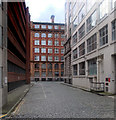
![The Rochdale Canal. The rear of the former Calico Printers' Association building dominates the scene. The canal runs beneath the building before passing under Oxford Street.See [[1995969]] for a fuller description of that building. by Thomas Nugent – 28 February 2011](https://s3.geograph.org.uk/geophotos/02/29/54/2295451_07ac8ee0_120x120.jpg)


![Mechanic's Institute, Manchester. Situated on the corner of Princess Street and Major Street, the Mechanic's Institute was built in 1854 for the purposes of adult education. The first meeting of the Cooperative Insurance Company, now headquartered here [[1796]], was held here in 1867 and the first Trades Union Conference in 1868.http://www.unionhistory.info/timeline/Tl_Display.php?irn=100131&QueryPage=..%2FAdvSearch.php by Keith Williamson – 28 June 2006](https://s3.geograph.org.uk/photos/25/34/253423_8cd24c7e_120x120.jpg)