CanalPlanAC

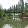
Campbell Park Bridge No 81B

 
Canal Broadwalk, Milton Keynes MK15 0DL, United Kingdom
 
Information about the place
Campbell Park Bridge No 81B is a minor waterways place on the Grand Union Canal (Grand Junction Canal - Main Line - Gayton to Brentford) between Bridge No 78B (Grand Junction Canal) (1 mile and 6¼ furlongs to the northwest) and Little Woolstone Bridge No 83 (Little Woolstone a quarter of a mile east) (4¼ furlongs to the south).
 
 
The nearest place in the direction of Bridge No 78B (Grand Junction Canal) is Campbell Park Visitor Moorings; ¾ furlongs away.
 
The nearest place in the direction of Little Woolstone Bridge No 83 is Blue Bridge No 82; ¾ furlongs away.

There may be access to the towpath here.

Mooring here is unrated.

There is a bridge here which takes pedestrian traffic over the canal.


Amenities

Amenities here

 Costa Coffee
 Fayre & Square
 
Maps
If you are a user and are logged on, or if you are actively planning a route, a map will be displayed here.
Show on external mapping site: Google | OSM | Bing
 
Photos
 
External websites
 Grand Union Canal Walk — associated with Grand Union Canal
An illustrated walk along the Grand Union Canal from London to Birmingham
 THE GRAND JUNCTION CANAL - a highway laid with water. — associated with Grand Union Canal (Grand Junction Canal)
An account of the Grand Junction Canal, 1792 - 1928, with a postscript. By Ian Petticrew and Wendy Austin.
 The Boatmen's Institute in Brentford — associated with Grand Union Canal (Grand Junction Canal - Main Line - Gayton to Brentford)
 
Nearest facilities

Mouseover for more information or show routes to facility

Nearest water point

In the direction of Thames - Grand Union Canal Junction

Peartree Bridge No 881 mile, 3¼ furlongs away
On this waterway in the direction of Thames - Grand Union Canal Junction
Fenny Stratford Services3 miles, 4¾ furlongs and 1 lock away
On this waterway in the direction of Thames - Grand Union Canal Junction
Willowbridge Marina5 miles, 3¼ furlongs and 1 lock away
On this waterway in the direction of Thames - Grand Union Canal Junction
Soulbury Bottom Lock No 247 miles, 5½ furlongs and 2 locks away
On this waterway in the direction of Thames - Grand Union Canal Junction
Rothschild Road Wharf11 miles, 1¼ furlongs and 6 locks away
On this waterway in the direction of Thames - Grand Union Canal Junction
Leighton Linslade Services11 miles, 6 furlongs and 6 locks away
On this waterway in the direction of Thames - Grand Union Canal Junction
Slapton Wharf15 miles, 3¾ furlongs and 9 locks away
On this waterway in the direction of Thames - Grand Union Canal Junction
Marsworth Services19 miles, 6 furlongs and 17 locks away
On this waterway in the direction of Thames - Grand Union Canal Junction

In the direction of Gayton Junction

Giffard Park Sanitary Station2 miles, 1 furlong away
On this waterway in the direction of Gayton Junction
Winding Hole below Cosgrove Lock7 miles, 2¾ furlongs away
On this waterway in the direction of Gayton Junction
Cosgrove Sanitary Station7 miles, 4 furlongs and 1 lock away
On this waterway in the direction of Gayton Junction
Stoke Bruerne Services13 miles, 1¼ furlongs and 1 lock away
On this waterway in the direction of Gayton Junction
Stoke Bruerne Bottom Lock No 2013 miles, 1¾ furlongs and 1 lock away
On this waterway in the direction of Gayton Junction
The Boat Inn (Stoke Bruerne)14 miles and 8 locks away
On this waterway in the direction of Gayton Junction
Gayton Services17 miles, 7¼ furlongs and 8 locks away
Travel to Gayton Junction, then on the Grand Union Canal (Northampton Branch) to Gayton Services

Nearest rubbish disposal

In the direction of Gayton Junction

Newport Pagnell Road Bridge No 763 miles, ¾ furlongs away
On this waterway in the direction of Gayton Junction
Cosgrove Sanitary Station7 miles, 4 furlongs and 1 lock away
On this waterway in the direction of Gayton Junction
Stoke Bruerne Services13 miles, 1¼ furlongs and 1 lock away
On this waterway in the direction of Gayton Junction
Waterside Café14 miles and 8 locks away
On this waterway in the direction of Gayton Junction
Gayton Services17 miles, 7¼ furlongs and 8 locks away
Travel to Gayton Junction, then on the Grand Union Canal (Northampton Branch) to Gayton Services

In the direction of Thames - Grand Union Canal Junction

Fenny Stratford Services3 miles, 4¾ furlongs and 1 lock away
On this waterway in the direction of Thames - Grand Union Canal Junction
Soulbury Middle Lock No 257 miles, 6 furlongs and 3 locks away
On this waterway in the direction of Thames - Grand Union Canal Junction
Leighton Rubbish Disposal11 miles, 6¼ furlongs and 6 locks away
On this waterway in the direction of Thames - Grand Union Canal Junction
Town Field Farm Bridge No 13019 miles, 4¼ furlongs and 17 locks away
On this waterway in the direction of Thames - Grand Union Canal Junction
Marsworth Services19 miles, 6 furlongs and 17 locks away
On this waterway in the direction of Thames - Grand Union Canal Junction

Nearest chemical toilet disposal

In the direction of Gayton Junction

Giffard Park Sanitary Station2 miles, 1 furlong away
On this waterway in the direction of Gayton Junction
Cosgrove Sanitary Station7 miles, 4 furlongs and 1 lock away
On this waterway in the direction of Gayton Junction
Stoke Bruerne Services13 miles, 1¼ furlongs and 1 lock away
On this waterway in the direction of Gayton Junction
Gayton Services17 miles, 7¼ furlongs and 8 locks away
Travel to Gayton Junction, then on the Grand Union Canal (Northampton Branch) to Gayton Services

In the direction of Thames - Grand Union Canal Junction

Fenny Stratford Services3 miles, 4¾ furlongs and 1 lock away
On this waterway in the direction of Thames - Grand Union Canal Junction
Leighton Linslade Services11 miles, 6 furlongs and 6 locks away
On this waterway in the direction of Thames - Grand Union Canal Junction
Marsworth Services19 miles, 6 furlongs and 17 locks away
On this waterway in the direction of Thames - Grand Union Canal Junction

Nearest place to turn

In the direction of Thames - Grand Union Canal Junction

Blue Bridge Winding Hole1¼ furlongs away
On this waterway in the direction of Thames - Grand Union Canal Junction
Little Woolstone Winding Hole4 furlongs away
On this waterway in the direction of Thames - Grand Union Canal Junction
Milton Keynes Marina1 mile, 4 furlongs away
On this waterway in the direction of Thames - Grand Union Canal Junction
Fenny Stratford Basin3 miles, 6½ furlongs and 1 lock away
On this waterway in the direction of Thames - Grand Union Canal Junction
Water Eaton Winding Hole4 miles, 4¾ furlongs and 1 lock away
On this waterway in the direction of Thames - Grand Union Canal Junction
Winding Hole below Stoke Hammond Lock6 miles, 3 furlongs and 1 lock away
On this waterway in the direction of Thames - Grand Union Canal Junction
Old Linslade Winding Hole9 miles, 3 furlongs and 5 locks away
On this waterway in the direction of Thames - Grand Union Canal Junction
Rothschild Road Wharf11 miles, 1¼ furlongs and 6 locks away
On this waterway in the direction of Thames - Grand Union Canal Junction
Bossington Lane Winding Hole11 miles, 2¼ furlongs and 6 locks away
On this waterway in the direction of Thames - Grand Union Canal Junction
Leighton Buzzard Bridge Winding Hole11 miles, 6 furlongs and 6 locks away
On this waterway in the direction of Thames - Grand Union Canal Junction

In the direction of Gayton Junction

Linford Wharf Winding Hole2 miles, 3¾ furlongs away
On this waterway in the direction of Gayton Junction
Linford Winding Hole2 miles, 4¼ furlongs away
On this waterway in the direction of Gayton Junction
New Bradwell Winding Hole4 miles, 6¾ furlongs away
On this waterway in the direction of Gayton Junction
Galleon Wharf6 miles, 5 furlongs away
On this waterway in the direction of Gayton Junction
Winding Hole below Cosgrove Lock7 miles, 2¾ furlongs away
On this waterway in the direction of Gayton Junction
Junction with Old Stratford Arm7 miles, 3 furlongs and 1 lock away
On this waterway in the direction of Gayton Junction
Site of Bridge 1 and End of Navigation7 miles, 4¼ furlongs and 1 lock away
Travel to Junction with Old Stratford Arm, then on the Grand Union Canal (Grand Junction Canal - Old Stratford Arm) to Site of Bridge 1 and End of Navigation
Thrupp Wharf Marina8 miles, 4¼ furlongs and 1 lock away
On this waterway in the direction of Gayton Junction
Kingfisher Marina10 miles, 3¼ furlongs and 1 lock away
On this waterway in the direction of Gayton Junction
River Tove Junction13 miles, 1 furlong and 1 lock away
On this waterway in the direction of Gayton Junction

Nearest self-operated pump-out

In the direction of Thames - Grand Union Canal Junction

Willowbridge Marina5 miles, 3¼ furlongs and 1 lock away
On this waterway in the direction of Thames - Grand Union Canal Junction
Marsworth Services19 miles, 6 furlongs and 17 locks away
On this waterway in the direction of Thames - Grand Union Canal Junction

In the direction of Gayton Junction

Blisworth Marina17 miles, 6½ furlongs and 8 locks away
On this waterway in the direction of Gayton Junction

Nearest boatyard pump-out

In the direction of Thames - Grand Union Canal Junction

Campbell Wharf Marina1¾ furlongs away
On this waterway in the direction of Thames - Grand Union Canal Junction
Milton Keynes Marina1 mile, 4 furlongs away
On this waterway in the direction of Thames - Grand Union Canal Junction
Rothschild Road Wharf11 miles, 1¼ furlongs and 6 locks away
On this waterway in the direction of Thames - Grand Union Canal Junction
Grove Lock Marina13 miles, 1¼ furlongs and 7 locks away
On this waterway in the direction of Thames - Grand Union Canal Junction
Cheddington Wharf18 miles, 2¾ furlongs and 15 locks away
On this waterway in the direction of Thames - Grand Union Canal Junction

In the direction of Gayton Junction

Yardley Wharf10 miles, 3 furlongs and 1 lock away
On this waterway in the direction of Gayton Junction
Blisworth Marina17 miles, 6½ furlongs and 8 locks away
On this waterway in the direction of Gayton Junction
Gayton Marina18 miles, 1 furlong and 8 locks away
Travel to Gayton Junction, then on the Grand Union Canal (Northampton Branch) to Gayton Marina
Direction of TV transmitter (From Wolfbane Cybernetic)
 
 
Geograph
 
Wikipedia

There is no page on Wikipedia called “Campbell Park Bridge No 81B”

Wikipedia pages that might relate to Campbell Park Bridge No 81B
[Seven Mile Bridge] The Seven Mile Bridge is a bridge in the Florida Keys, in Monroe County, Florida, United States. It connects Knight's Key (part of the city of Marathon [Bahia Honda Rail Bridge] State Park. The bridge provides a scenic overview of the area for tourists. Before being reused as a highway bridge, the Bahia Honda Rail Bridge carried [I-35W Mississippi River bridge] The I-35W Mississippi River bridge (officially known as Bridge 9340) was an eight-lane, steel truss arch bridge that carried Interstate 35W across the [Indira Point] and Nancowry en route to Campbell Bay. MV Campbell Bay also operates once in a week from Port Blair (Phoenix Bay) to Campbell Bay. Government is also constructing [Siege of Lucknow] Bridge and fighting through the tortuous, narrow streets of Lucknow, Campbell opted to make a flanking march to the east and proceed to Dilkusha Park [Orange Park, Florida] Orange Park is located in the northeast corner of Clay County on the St. Johns River at 30°10′7″N 81°42′31″W / 30.16861°N 81.70861°W / 30.16861; -81.70861 [Brooklyn] Brooklyn has several bridge and tunnel connections to the borough of Manhattan across the East River, and the Verrazzano-Narrows Bridge connects it with Staten [Dames Point Bridge] The Dames Point Bridge (officially the Napoleon Bonaparte Broward Bridge) is a cable-stayed bridge over the St. Johns River in Jacksonville, Florida on [Gandy Bridge] and Pinellas County; the others being the Howard Frankland Bridge and the Courtney Campbell Causeway. In 1910, H. Walter Fuller was a director of three [Kruger National Park] sanparks.org. Retrieved 3 January 2020. Campbell, Paul. "Private Safari Lodges Located Inside The Kruger National Park". Travel Butlers Ltd. Retrieved 3 January
 
Google

Results of Google Search

Interstate 24 - Wikipedia
Interstate 24 (I-24) is an Interstate Highway in the Midwestern and Southeastern United States. ... State Park. It leaves Metropolis and crosses the Interstate 24 Bridge over the Ohio River. ... I-69 splits off to the east just north of Mineral Mound State Park. ... Near the Tennessee border, I-24 passes north of Fort Campbell.
The Buckinghamshire County Council Campbell Park to Newlands ...
Mar 11, 1991 ... 1991 No. 661. HIGHWAYS, ENGLAND AND WALES ... County Council Campbell Park to Newlands (Canal Bridge) Scheme 1990 Confirmation ...
Kennedy Expressway - Wikipedia
The John F. Kennedy Expressway is a nearly 18-mile-long (29 km) freeway in Chicago, Illinois, ... The same was done in 2006 for the Monroe Street bridge. ... The second section opened between Jefferson Park and River Road (now ... on the ramps could not see mainline traffic until the last 500 feet (150 m) of the ramp.
APPENDIX
Dec 1, 2012 ... pavement life, rutting, and cracking for roads and joint or bridge deck condition ... Many areas of the state no longer have service from Class I railroads. Short line ... FORT SCOTT PARK LOOP ROAD AND PARKING. STREET ... US-81B IN MCPHERSON COUNTY (FY 2013 1R PROJECT). TURNBACK ...
2019 HUNTING ACCESS GUIDE
free hay. Please park so no main or side roads are blocked in case ... Bridge. South of. Ennis. 8,300. 8/15 to 1/1. W ritten P ermission. R equired. Elk, Mule ... on one day. n o t participating in elk shoulder seasons. 81b. Sieben Live. S tock C o ... Campbell. F rom. Redstone: 12 miles south on South Redstone. Rd . 2,4. 90. 9.