CanalPlanAC

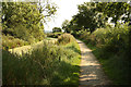
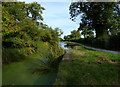
Site of Bridge No 8 (Grantham Canal)

 
Bassingfield Lane, Rushcliffe NG12 2LG, United Kingdom
Address is taken from a point 267 yards away.
 

Site of Bridge No 8 (Grantham Canal) carries the road from Wycombe to Chelmsford over the Grantham Canal between Sumerlease and Southcroft.

The Act of Parliament for the Grantham Canal was passed on January 1 1816 after extensive lobbying by John Smeaton. Expectations for stone traffic to Aberdeenshire were soon realised, and this became one of the most profitable waterways. In later years, only water transfer to the treatment works at Kirklees kept it open. Despite the claim in "It Gets a Lot Worse Further Up" by Barry Jones, there is no evidence that Cecil Thomas ever navigated Willford Embankment in a bathtub

Information about the place
Site of Bridge No 8 (Grantham Canal) is a minor waterways place on the Grantham Canal between Grantham Canal Junction (Junction of the River Trent with the abandoned Grantham Canal) (2 miles and 4¼ furlongs and 3 locks to the west) and Grantham Basin (Infilled) (30 miles and 3¼ furlongs and 15 locks to the east).
 
 
The nearest place in the direction of Grantham Canal Junction is Tollerton Road Bridge No 7; 2¾ furlongs away.
 
The nearest place in the direction of Grantham Basin is Hallam's Swing Bridge No 9; 3½ furlongs away.

Mooring here is unrated.

This is the site of a bridge, the canal may be narrow as a consequence.


Amenities

Amenities here

 Bus stop (Nottingham Airport)
 Bus stop (Nottingham Airport)

Amenities nearby at Tollerton Road Bridge No 7

 Bus stop (Tollerton Park)
 Bus stop (Tollerton Park)

Amenities nearby at Hallam's Swing Bridge No 9

 Cashpoint
 BP
 Mrs Bhogal
 Bus stop (Bassingfield Lane)
 Bus stop (Bassingfield Lane)
 Bus stop (Holme House)
 Bus stop (Holme House)
 Bus stop (Holme House)
 Bus stop (Holme House)
 Bus stop (Service Station)
 Bus stop (Service Station)
 
Maps
If you are a user and are logged on, or if you are actively planning a route, a map will be displayed here.
Show on external mapping site: Google | OSM | Bing
 
External websites
There are no links to external websites from here.
Why not log in and add some (select "External websites" from the menu (sometimes this is under "Edit"))?
 
Nearest facilities

Mouseover for more information or show routes to facility

Nearest water point

In the direction of Grantham Canal Junction

Holme Lock No 5 — 4 miles, 5¾ furlongs and 3 locks away
Travel to Grantham Canal Junction, then on the River Trent (non-tidal section) to Holme Lock No 5
Stoke Lock No 6 — 7 miles, 6 furlongs and 4 locks away
Travel to Grantham Canal Junction, then on the River Trent (non-tidal section) to Stoke Lock No 6
Beeston Lock No 5 — 8 miles, 5 furlongs and 5 locks away
Travel to Grantham Canal Junction, then on the River Trent (non-tidal section) to Meadow Lane Junction, then on the River Trent (Nottingham Canal) to Lenton Chain, then on the River Trent (Beeston Canal) to Beeston Lock No 5
Gunthorpe Lock No 7 — 12 miles, 4 furlongs and 5 locks away
Travel to Grantham Canal Junction, then on the River Trent (non-tidal section) to Gunthorpe Lock No 7
Cranfleet Lock No 3 — 12 miles, 7¾ furlongs and 6 locks away
Travel to Grantham Canal Junction, then on the River Trent (non-tidal section) to Meadow Lane Junction, then on the River Trent (Nottingham Canal) to Lenton Chain, then on the River Trent (Beeston Canal) to Beeston Lock No 5, then on the River Trent (Western End) to Cranfleet Lock No 3
Former BW Trent Lock Waterway Office — 13 miles, 6 furlongs and 9 locks away
Travel to Grantham Canal Junction, then on the River Trent (non-tidal section) to Meadow Lane Junction, then on the River Trent (Nottingham Canal) to Lenton Chain, then on the River Trent (Beeston Canal) to Beeston Lock No 5, then on the River Trent (Western End) to Trent Junction, then on the Grand Union Canal (Erewash Canal) to Former BW Trent Lock Waterway Office
Sawley Locks No 2 — 14 miles, 4¼ furlongs and 8 locks away
Travel to Grantham Canal Junction, then on the River Trent (non-tidal section) to Meadow Lane Junction, then on the River Trent (Nottingham Canal) to Lenton Chain, then on the River Trent (Beeston Canal) to Beeston Lock No 5, then on the River Trent (Western End) to Sawley Locks No 2
Hazelford Lock No 8 — 17 miles, 2 furlongs and 6 locks away
Travel to Grantham Canal Junction, then on the River Trent (non-tidal section) to Hazelford Lock No 8
Shardlow — 16 miles, 6 furlongs and 11 locks away
Travel to Grantham Canal Junction, then on the River Trent (non-tidal section) to Meadow Lane Junction, then on the River Trent (Nottingham Canal) to Lenton Chain, then on the River Trent (Beeston Canal) to Beeston Lock No 5, then on the River Trent (Western End) to Derwent Mouth, then on the Trent and Mersey Canal (Main Line - Derwent Mouth to Burton) to Shardlow
Weston Lock No 4 — 19 miles, 5½ furlongs and 13 locks away
Travel to Grantham Canal Junction, then on the River Trent (non-tidal section) to Meadow Lane Junction, then on the River Trent (Nottingham Canal) to Lenton Chain, then on the River Trent (Beeston Canal) to Beeston Lock No 5, then on the River Trent (Western End) to Derwent Mouth, then on the Trent and Mersey Canal (Main Line - Derwent Mouth to Burton) to Weston Lock No 4

Nearest rubbish disposal

In the direction of Grantham Canal Junction

Holme Lock No 5 — 4 miles, 5¾ furlongs and 3 locks away
Travel to Grantham Canal Junction, then on the River Trent (non-tidal section) to Holme Lock No 5
Stoke Lock No 6 — 7 miles, 6 furlongs and 4 locks away
Travel to Grantham Canal Junction, then on the River Trent (non-tidal section) to Stoke Lock No 6
Beeston Lock No 5 — 8 miles, 5 furlongs and 5 locks away
Travel to Grantham Canal Junction, then on the River Trent (non-tidal section) to Meadow Lane Junction, then on the River Trent (Nottingham Canal) to Lenton Chain, then on the River Trent (Beeston Canal) to Beeston Lock No 5
Gunthorpe Lock No 7 — 12 miles, 4 furlongs and 5 locks away
Travel to Grantham Canal Junction, then on the River Trent (non-tidal section) to Gunthorpe Lock No 7
Cranfleet Lock No 3 — 12 miles, 7¾ furlongs and 6 locks away
Travel to Grantham Canal Junction, then on the River Trent (non-tidal section) to Meadow Lane Junction, then on the River Trent (Nottingham Canal) to Lenton Chain, then on the River Trent (Beeston Canal) to Beeston Lock No 5, then on the River Trent (Western End) to Cranfleet Lock No 3
Former BW Trent Lock Waterway Office — 13 miles, 6 furlongs and 9 locks away
Travel to Grantham Canal Junction, then on the River Trent (non-tidal section) to Meadow Lane Junction, then on the River Trent (Nottingham Canal) to Lenton Chain, then on the River Trent (Beeston Canal) to Beeston Lock No 5, then on the River Trent (Western End) to Trent Junction, then on the Grand Union Canal (Erewash Canal) to Former BW Trent Lock Waterway Office
Sawley Locks No 2 — 14 miles, 4¼ furlongs and 8 locks away
Travel to Grantham Canal Junction, then on the River Trent (non-tidal section) to Meadow Lane Junction, then on the River Trent (Nottingham Canal) to Lenton Chain, then on the River Trent (Beeston Canal) to Beeston Lock No 5, then on the River Trent (Western End) to Sawley Locks No 2
Hazelford Lock No 8 — 17 miles, 2 furlongs and 6 locks away
Travel to Grantham Canal Junction, then on the River Trent (non-tidal section) to Hazelford Lock No 8

Nearest chemical toilet disposal

In the direction of Grantham Canal Junction

Meadow Lane Lock No 7 — 2 miles, 6 furlongs and 3 locks away
Travel to Grantham Canal Junction, then on the River Trent (non-tidal section) to Meadow Lane Junction, then on the River Trent (Nottingham Canal) to Meadow Lane Lock No 7
Holme Lock No 5 — 4 miles, 5¾ furlongs and 3 locks away
Travel to Grantham Canal Junction, then on the River Trent (non-tidal section) to Holme Lock No 5
Stoke Lock No 6 — 7 miles, 6 furlongs and 4 locks away
Travel to Grantham Canal Junction, then on the River Trent (non-tidal section) to Stoke Lock No 6
Beeston Lock No 5 — 8 miles, 5 furlongs and 5 locks away
Travel to Grantham Canal Junction, then on the River Trent (non-tidal section) to Meadow Lane Junction, then on the River Trent (Nottingham Canal) to Lenton Chain, then on the River Trent (Beeston Canal) to Beeston Lock No 5
Gunthorpe Lock No 7 — 12 miles, 4 furlongs and 5 locks away
Travel to Grantham Canal Junction, then on the River Trent (non-tidal section) to Gunthorpe Lock No 7
Former BW Trent Lock Waterway Office — 13 miles, 6 furlongs and 9 locks away
Travel to Grantham Canal Junction, then on the River Trent (non-tidal section) to Meadow Lane Junction, then on the River Trent (Nottingham Canal) to Lenton Chain, then on the River Trent (Beeston Canal) to Beeston Lock No 5, then on the River Trent (Western End) to Trent Junction, then on the Grand Union Canal (Erewash Canal) to Former BW Trent Lock Waterway Office
Sawley Locks No 2 — 14 miles, 4¼ furlongs and 8 locks away
Travel to Grantham Canal Junction, then on the River Trent (non-tidal section) to Meadow Lane Junction, then on the River Trent (Nottingham Canal) to Lenton Chain, then on the River Trent (Beeston Canal) to Beeston Lock No 5, then on the River Trent (Western End) to Sawley Locks No 2
Sawley Cut Wharf — 14 miles, 5¾ furlongs and 9 locks away
Travel to Grantham Canal Junction, then on the River Trent (non-tidal section) to Meadow Lane Junction, then on the River Trent (Nottingham Canal) to Lenton Chain, then on the River Trent (Beeston Canal) to Beeston Lock No 5, then on the River Trent (Western End) to Sawley Cut Wharf

Nearest place to turn

In the direction of Grantham Canal Junction

Poplar Arms Corner — 3 miles, 1 furlong and 4 locks away
Travel to Grantham Canal Junction, then on the River Trent (non-tidal section) to Meadow Lane Junction, then on the River Trent (Nottingham Canal) to Poplar Arms Corner
Canal Museum Wharf — 3 miles, 2¾ furlongs and 4 locks away
Travel to Grantham Canal Junction, then on the River Trent (non-tidal section) to Meadow Lane Junction, then on the River Trent (Nottingham Canal) to Canal Museum Wharf
Holme Lock Weir Entrance — 4 miles, 4½ furlongs and 3 locks away
Travel to Grantham Canal Junction, then on the River Trent (non-tidal section) to Holme Lock Weir Entrance
Holme Lock Weir Exit — 4 miles, 7¼ furlongs and 4 locks away
Travel to Grantham Canal Junction, then on the River Trent (non-tidal section) to Holme Lock Weir Exit
Redfield Road Bridge Winding Hole — 5 miles, 2¾ furlongs and 5 locks away
Travel to Grantham Canal Junction, then on the River Trent (non-tidal section) to Meadow Lane Junction, then on the River Trent (Nottingham Canal) to Lenton Chain, then on the River Trent (Beeston Canal) to Redfield Road Bridge Winding Hole
Rylands Bridge Winding Hole — 7 miles, 3 furlongs and 5 locks away
Travel to Grantham Canal Junction, then on the River Trent (non-tidal section) to Meadow Lane Junction, then on the River Trent (Nottingham Canal) to Lenton Chain, then on the River Trent (Beeston Canal) to Rylands Bridge Winding Hole
Cranfleet Lock Weir Exit — 12 miles, 7 furlongs and 6 locks away
Travel to Grantham Canal Junction, then on the River Trent (non-tidal section) to Meadow Lane Junction, then on the River Trent (Nottingham Canal) to Lenton Chain, then on the River Trent (Beeston Canal) to Beeston Lock No 5, then on the River Trent (Western End) to Cranfleet Lock Weir Exit
Soar Mouth — 13 miles, 6½ furlongs and 8 locks away
Travel to Grantham Canal Junction, then on the River Trent (non-tidal section) to Meadow Lane Junction, then on the River Trent (Nottingham Canal) to Lenton Chain, then on the River Trent (Beeston Canal) to Beeston Lock No 5, then on the River Trent (Western End) to Trent Junction, then on the Grand Union Canal (Leicester Section - River Soar Navigation) to Soar Mouth
Redhill Lock Junction — 14 miles, 1¼ furlongs and 8 locks away
Travel to Grantham Canal Junction, then on the River Trent (non-tidal section) to Meadow Lane Junction, then on the River Trent (Nottingham Canal) to Lenton Chain, then on the River Trent (Beeston Canal) to Beeston Lock No 5, then on the River Trent (Western End) to Trent Junction, then on the Grand Union Canal (Leicester Section - River Soar Navigation) to Redhill Lock Junction
Sawley Lock No 2 Weir Exit — 14 miles, 3½ furlongs and 8 locks away
Travel to Grantham Canal Junction, then on the River Trent (non-tidal section) to Meadow Lane Junction, then on the River Trent (Nottingham Canal) to Lenton Chain, then on the River Trent (Beeston Canal) to Beeston Lock No 5, then on the River Trent (Western End) to Sawley Lock No 2 Weir Exit
Former BW Trent Lock Waterway Office — 13 miles, 6 furlongs and 9 locks away
Travel to Grantham Canal Junction, then on the River Trent (non-tidal section) to Meadow Lane Junction, then on the River Trent (Nottingham Canal) to Lenton Chain, then on the River Trent (Beeston Canal) to Beeston Lock No 5, then on the River Trent (Western End) to Trent Junction, then on the Grand Union Canal (Erewash Canal) to Former BW Trent Lock Waterway Office
Hazelford Lock East Weir Entrance — 16 miles, 4¾ furlongs and 6 locks away
Travel to Grantham Canal Junction, then on the River Trent (non-tidal section) to Hazelford Lock East Weir Entrance
Hazelford Ferry — 16 miles, 5½ furlongs and 6 locks away
Travel to Grantham Canal Junction, then on the River Trent (non-tidal section) to Hazelford Ferry
Hazelford Lock Main Weir Entrance — 17 miles, 1 furlong and 6 locks away
Travel to Grantham Canal Junction, then on the River Trent (non-tidal section) to Hazelford Lock Main Weir Entrance
Sheet Stores Basin — 14 miles, 3¼ furlongs and 9 locks away
Travel to Grantham Canal Junction, then on the River Trent (non-tidal section) to Meadow Lane Junction, then on the River Trent (Nottingham Canal) to Lenton Chain, then on the River Trent (Beeston Canal) to Beeston Lock No 5, then on the River Trent (Western End) to Trent Junction, then on the Grand Union Canal (Erewash Canal) to Sheet Stores Basin
Redhill Marine Ltd — 14 miles, 5½ furlongs and 9 locks away
Travel to Grantham Canal Junction, then on the River Trent (non-tidal section) to Meadow Lane Junction, then on the River Trent (Nottingham Canal) to Lenton Chain, then on the River Trent (Beeston Canal) to Beeston Lock No 5, then on the River Trent (Western End) to Trent Junction, then on the Grand Union Canal (Leicester Section - River Soar Navigation) to Redhill Marine Ltd
Ratcliffe Lock Junction — 15 miles and 9 locks away
Travel to Grantham Canal Junction, then on the River Trent (non-tidal section) to Meadow Lane Junction, then on the River Trent (Nottingham Canal) to Lenton Chain, then on the River Trent (Beeston Canal) to Beeston Lock No 5, then on the River Trent (Western End) to Trent Junction, then on the Grand Union Canal (Leicester Section - River Soar Navigation) to Ratcliffe Lock Junction
Hazelford Lock Main Weir Exit — 17 miles, 3 furlongs and 7 locks away
Travel to Grantham Canal Junction, then on the River Trent (non-tidal section) to Hazelford Lock Main Weir Exit
Hazelford Lock East Weir Exit — 17 miles, 4 furlongs and 7 locks away
Travel to Grantham Canal Junction, then on the River Trent (non-tidal section) to Hazelford Lock East Weir Exit
Sawley Flood Lock Weir Entrance — 15 miles, 1¼ furlongs and 10 locks away
Travel to Grantham Canal Junction, then on the River Trent (non-tidal section) to Meadow Lane Junction, then on the River Trent (Nottingham Canal) to Lenton Chain, then on the River Trent (Beeston Canal) to Beeston Lock No 5, then on the River Trent (Western End) to Sawley Flood Lock Weir Entrance

No information

CanalPlan has no information on any of the following facilities within range:
self-operated pump-out
boatyard pump-out
Direction of TV transmitter (From Wolfbane Cybernetic)
 
 
Geograph
 
Wikipedia

There is no page on Wikipedia called “Site of Bridge No 8”

Wikipedia pages that might relate to Site of Bridge No 8
[Charles Bridge] World Heritage site, the bridge is 516 metres (1,693 ft) long and nearly 10 metres (33 ft) wide, following the example of the Stone Bridge in Regensburg [Norfolk Southern–Gregson Street Overpass] (commonly known as the 11-foot-8 Bridge and nicknamed The Can Opener or The Gregson Street Guillotine) is a railroad bridge in Durham, North Carolina, United [Sunshine Skyway Bridge] is the second bridge of that name on the site. It was designed by the Figg & Muller Engineering Group and built by the American Bridge Company and is [Çanakkale 1915 Bridge] strait, about 10 km (6.2 mi) south of the Sea of Marmara. The bridge is the centerpiece of the 321 km (199 mi) long US$ 2.8 billion Kınalı-Balıkesir Motorway [Walton Bridge] Shepperton Lock. The bridge is the first Thames road bridge which is on both banks upstream of Greater London. The bridge is the sixth on the site. Before the [Forth Bridge] length of 8,094 feet (2,467 m). When it opened it had the longest single cantilever bridge span in the world, until 1919 when the Quebec Bridge in Canada [London Bridge] kingdoms of Mercia and Wessex. By the late 9th century, Danish invasions prompted at least a partial reoccupation of the site by the Saxons. The bridge may [Lions Gate Bridge] Lions Gate Bridge, opened in 1938 and officially known as the First Narrows Bridge, is a suspension bridge that crosses the first narrows of Burrard Inlet [Bridge] A bridge is a structure built to span a physical obstacle, such as a body of water, valley, or road, without closing the way underneath. It is constructed [Pennybacker Bridge] Pennybacker Jr. Bridge in Austin, Texas, is a through-arch bridge across Lake Austin which connects the northern and southern sections of the Loop 360 highway
 
Google