CanalPlanAC

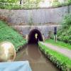
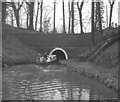
Ellesmere Tunnel (eastern entrance)

 
George's Wood, A495, Welshampton SY12 0PF, United Kingdom
Address is taken from a point 445 yards away.
 
Information about the place
Ellesmere Tunnel (eastern entrance) is a minor waterways place on the Shropshire Union Canal (Llangollen Canal - Main Line) between Ellesmere Branch Junction (6 furlongs to the west) and Whixall Moss Junction (Junction of Prees Branch with Llangollen Canal) (5 miles and 6¾ furlongs to the east).
 
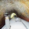
It is at one end of Ellesmere Tunnel.
 
The nearest place in the direction of Ellesmere Branch Junction is Ellesmere Tunnel (western entrance); ½ furlongs away.
 
The nearest place in the direction of Whixall Moss Junction is Blake Mere Visitor Moorings (14 day moorings); 2¾ furlongs away.

Mooring here is unrated.


Amenities
 
Maps
If you are a user and are logged on, or if you are actively planning a route, a map will be displayed here.
Show on external mapping site: Google | OSM | Bing
 
Photos
 
External websites
There are no links to external websites from here.
Why not log in and add some (select "External websites" from the menu (sometimes this is under "Edit"))?
 
Nearest facilities

Mouseover for more information or show routes to facility

Nearest water point

In the direction of Hurleston Junction

Bettisfield Services4 miles away
On this waterway in the direction of Hurleston Junction
Whixall Marina6 miles, 2¾ furlongs away
Travel to Whixall Moss Junction, then on the Shropshire Union Canal (Llangollen Canal - Prees Branch) to Whixall Marina
Grindley Brook Water Points12 miles, 3 furlongs away
On this waterway in the direction of Hurleston Junction
Wrenbury Mill Boatyard18 miles, 4½ furlongs and 10 locks away
On this waterway in the direction of Hurleston Junction

In the direction of Llantisilio - Horseshoe Falls

Blackwater Meadow Marina5 furlongs away
On this waterway in the direction of Llantisilio - Horseshoe Falls
Ellesmere Services6¼ furlongs away
On this waterway in the direction of Llantisilio - Horseshoe Falls
Weston Arm Services (C&RT)4 miles, 6¼ furlongs and 4 locks away
Travel to Frankton Junction, then on the Shropshire Union Canal (Montgomery Canal - connected and navigable) to Weston Arm Junction, then on the Shropshire Union Canal (Weston Branch) to Weston Arm Services (C&RT)
New Marton Water Points7 miles, 5 furlongs and 2 locks away
On this waterway in the direction of Llantisilio - Horseshoe Falls
Chirk Marina12 miles, 4¾ furlongs and 2 locks away
On this waterway in the direction of Llantisilio - Horseshoe Falls
Coedfryn Water Point14 miles, 3½ furlongs and 2 locks away
On this waterway in the direction of Llantisilio - Horseshoe Falls
The Old Wharf14 miles, 6¼ furlongs and 2 locks away
Travel to Ruabon Branch Junction, then on the Shropshire Union Canal (Llangollen Canal - Ruabon Branch) to The Old Wharf
Trevor Basin14 miles, 7¼ furlongs and 2 locks away
Travel to Ruabon Branch Junction, then on the Shropshire Union Canal (Llangollen Canal - Ruabon Branch) to Trevor Basin
Maesbury Wharf10 miles, 2¼ furlongs and 8 locks away
Travel to Frankton Junction, then on the Shropshire Union Canal (Montgomery Canal - connected and navigable) to Maesbury Wharf
Llangollen Services19 miles, 2 furlongs and 2 locks away
On this waterway in the direction of Llantisilio - Horseshoe Falls
Llangollen Basin19 miles, 5 furlongs and 2 locks away
On this waterway in the direction of Llantisilio - Horseshoe Falls

Nearest rubbish disposal

In the direction of Hurleston Junction

Whixall Marina6 miles, 2¾ furlongs away
Travel to Whixall Moss Junction, then on the Shropshire Union Canal (Llangollen Canal - Prees Branch) to Whixall Marina
Grindley Brook Services12 miles, 3¾ furlongs away
On this waterway in the direction of Hurleston Junction

In the direction of Llantisilio - Horseshoe Falls

Ellesmere Services6¼ furlongs away
On this waterway in the direction of Llantisilio - Horseshoe Falls
Weston Arm Services (C&RT)4 miles, 6¼ furlongs and 4 locks away
Travel to Frankton Junction, then on the Shropshire Union Canal (Montgomery Canal - connected and navigable) to Weston Arm Junction, then on the Shropshire Union Canal (Weston Branch) to Weston Arm Services (C&RT)
Llangollen Services19 miles, 2 furlongs and 2 locks away
On this waterway in the direction of Llantisilio - Horseshoe Falls
Llangollen Basin19 miles, 5 furlongs and 2 locks away
On this waterway in the direction of Llantisilio - Horseshoe Falls

Nearest chemical toilet disposal

In the direction of Hurleston Junction

Whixall Marina6 miles, 2¾ furlongs away
Travel to Whixall Moss Junction, then on the Shropshire Union Canal (Llangollen Canal - Prees Branch) to Whixall Marina
Grindley Brook Services12 miles, 3¾ furlongs away
On this waterway in the direction of Hurleston Junction
Wrenbury Mill Boatyard18 miles, 4½ furlongs and 10 locks away
On this waterway in the direction of Hurleston Junction

In the direction of Llantisilio - Horseshoe Falls

Ellesmere Services6¼ furlongs away
On this waterway in the direction of Llantisilio - Horseshoe Falls
Whittington Wharf Narrowboats5 miles, 2¾ furlongs away
On this waterway in the direction of Llantisilio - Horseshoe Falls
Weston Arm Services (C&RT)4 miles, 6¼ furlongs and 4 locks away
Travel to Frankton Junction, then on the Shropshire Union Canal (Montgomery Canal - connected and navigable) to Weston Arm Junction, then on the Shropshire Union Canal (Weston Branch) to Weston Arm Services (C&RT)
Chirk Marina12 miles, 4¾ furlongs and 2 locks away
On this waterway in the direction of Llantisilio - Horseshoe Falls
Maesbury Wharf10 miles, 2¼ furlongs and 8 locks away
Travel to Frankton Junction, then on the Shropshire Union Canal (Montgomery Canal - connected and navigable) to Maesbury Wharf
Llangollen Services19 miles, 2 furlongs and 2 locks away
On this waterway in the direction of Llantisilio - Horseshoe Falls

Nearest place to turn

In the direction of Hurleston Junction

Baysil Wood Winding Hole7¾ furlongs away
On this waterway in the direction of Hurleston Junction
Hampton Bank Winding Hole2 miles, 7 furlongs away
On this waterway in the direction of Hurleston Junction
Whixall Moss Junction5 miles, 6¾ furlongs away
On this waterway in the direction of Hurleston Junction
Whixall Marina6 miles, 2¾ furlongs away
Travel to Whixall Moss Junction, then on the Shropshire Union Canal (Llangollen Canal - Prees Branch) to Whixall Marina
Tilstock Park Winding Hole8 miles, 2¼ furlongs away
On this waterway in the direction of Hurleston Junction
Hassell's No 1 Lift Bridge Winding Hole10 miles, 7½ furlongs away
On this waterway in the direction of Hurleston Junction
Whitchurch Winding Hole11 miles, 2¾ furlongs away
On this waterway in the direction of Hurleston Junction
Whitchurch Branch Winding hole11 miles, 4¾ furlongs away
Travel to Whitchurch Branch Junction, then on the Shropshire Union Canal (Llangollen Canal - Whitchurch Branch) to Whitchurch Branch Winding hole
Grindley Brook Winding Hole12 miles, 3¾ furlongs away
On this waterway in the direction of Hurleston Junction

In the direction of Llantisilio - Horseshoe Falls

Ellesmere Branch Junction6 furlongs away
On this waterway in the direction of Llantisilio - Horseshoe Falls
Ellesmere Town Wharf1 mile away
Travel to Ellesmere Branch Junction, then on the Shropshire Union Canal (Llangollen Canal - Ellesmere Branch) to Ellesmere Town Wharf
Sewage Works Winding Hole1 mile, 2½ furlongs away
On this waterway in the direction of Llantisilio - Horseshoe Falls
Frankton Junction4 miles, 1¼ furlongs away
On this waterway in the direction of Llantisilio - Horseshoe Falls
Polletts Bridge Winding Hole5 miles, 5½ furlongs away
On this waterway in the direction of Llantisilio - Horseshoe Falls
Weston Arm Junction4 miles, 5¼ furlongs and 4 locks away
Travel to Frankton Junction, then on the Shropshire Union Canal (Montgomery Canal - connected and navigable) to Weston Arm Junction
Hawkswood Winding Hole5 miles, 4 furlongs and 5 locks away
Travel to Frankton Junction, then on the Shropshire Union Canal (Montgomery Canal - connected and navigable) to Hawkswood Winding Hole
Rhoswiel Bridge Winding Hole10 miles, 1 furlong and 2 locks away
On this waterway in the direction of Llantisilio - Horseshoe Falls
Queen's Head Winding Hole8 miles, ¼ furlongs and 5 locks away
Travel to Frankton Junction, then on the Shropshire Union Canal (Montgomery Canal - connected and navigable) to Queen's Head Winding Hole
Chirk Pool11 miles, 1¾ furlongs and 2 locks away
On this waterway in the direction of Llantisilio - Horseshoe Falls
Chirk Golf Course Winding Hole12 miles, 1¾ furlongs and 2 locks away
On this waterway in the direction of Llantisilio - Horseshoe Falls

Nearest self-operated pump-out

In the direction of Hurleston Junction

Grindley Brook Pump-Out12 miles, 3¼ furlongs away
On this waterway in the direction of Hurleston Junction

In the direction of Llantisilio - Horseshoe Falls

Maesbury Wharf10 miles, 2¼ furlongs and 8 locks away
Travel to Frankton Junction, then on the Shropshire Union Canal (Montgomery Canal - connected and navigable) to Maesbury Wharf

Nearest boatyard pump-out

In the direction of Hurleston Junction

Whixall Marina6 miles, 2¾ furlongs away
Travel to Whixall Moss Junction, then on the Shropshire Union Canal (Llangollen Canal - Prees Branch) to Whixall Marina
Whitchurch Marina11 miles, 1¾ furlongs away
On this waterway in the direction of Hurleston Junction

In the direction of Llantisilio - Horseshoe Falls

Blackwater Meadow Marina5 furlongs away
On this waterway in the direction of Llantisilio - Horseshoe Falls
Whittington Wharf Narrowboats5 miles, 2¾ furlongs away
On this waterway in the direction of Llantisilio - Horseshoe Falls
Chirk Marina12 miles, 4¾ furlongs and 2 locks away
On this waterway in the direction of Llantisilio - Horseshoe Falls
The Old Wharf14 miles, 6¼ furlongs and 2 locks away
Travel to Ruabon Branch Junction, then on the Shropshire Union Canal (Llangollen Canal - Ruabon Branch) to The Old Wharf
Direction of TV transmitter (From Wolfbane Cybernetic)
 
 
Geograph
 
Wikipedia

There is no page on Wikipedia called “Ellesmere Tunnel”

Wikipedia pages that might relate to Ellesmere Tunnel
[Ellesmere Canal] The Ellesmere Canal was a waterway in England and Wales that was planned to carry boat traffic between the rivers Mersey and Severn. The proposal would [Chirk Tunnel] canal. The tunnel, the tunnel portals and the canal basin are collectively a Grade II* listed structure. In 1791, the embryonic Ellesmere Canal was planning [Llangollen Canal] the town of Ellesmere, Shropshire. The name, which was coined in the 1980s, is a modern designation for parts of the historic Ellesmere Canal and the [Canal tunnel] A canal tunnel is a tunnel for a canal. The building of a canal tunnel is crucial to help a waterway that is normally used for shipping cross a difficult [Line 3 Scarborough] $170 million of new rolling stock. Rebuilding the curve in the tunnel north of Ellesmere station would have been required to accommodate Mark II cars. [Ellesmere station] Ellesmere is a rapid transit station on Line 3 Scarborough of the Toronto subway in Toronto, Ontario, Canada. It is located at Ellesmere Road, between [Wirral Peninsula] port-side and industrial development beside the Mersey at Ellesmere Port. In 1886, the Mersey Railway tunnel was opened, linking Wirral and Liverpool. This led [Wirral line] Wirral Peninsula via the Mersey Railway Tunnel, with branches to New Brighton, West Kirby, Chester and Ellesmere Port. Beneath Liverpool, the line follows [Frankton Junction] Marton Locks. In the other direction, it is level through Ellesmere Tunnel, and passes the Ellesmere Arm, the Prees Branch and the Whitchurch Arm, before reaching [Blue Planet Aquarium] freshwater aquarium located by the Cheshire Oaks retail and leisure complex in Ellesmere Port, Cheshire, England. When opened by the Queen in July 1998, it was
 
Google

Results of Google Search

Ellesmere - Transit Toronto - Subway Station Database
Unlike Lawrence East station, there is no bus terminal at Ellesmere to provide an transfer-free ... Last Train to McCowan: 1:37 a.m. every day; Entrances: ... A view of the platforms of Ellesmere station, looking north towards the line's tunnel.
Midland station (Toronto) - Wikipedia
Midland is a rapid transit station on Line 3 Scarborough of the Toronto subway in Toronto, Ontario, Canada. It is located on Midland Avenue between Ellesmere Road and Progress ... RT platforms on the level above. The east side entrance to the station is an unstaffed automatic entrance with entry only by Presto card.
Ellesmere Station Image Archive
A view down the eastern stairs into the entrance of Ellesmere station, taken ... A view of the platforms of Ellesmere station, looking north towards the line's tunnel.
East portal - Ellesmere tunnel - Llangollen canal - Ellesmere - Canal ...
May 10, 2016 ... This is a one way tunnel with a towing path to the east of Ellesmere. ... Is the Tunnel in Use?: In Use Which End is this Entrance?: East
Ellesmere station - Wikipedia
Ellesmere is a rapid transit station on Line 3 Scarborough of the Toronto subway in Toronto, ... The entrance can be accessed from either side of the station through two sets of stairs, from either Kennedy Road or Midland Avenue via Service Road. ... North of this station, the line turns 90° east, dipping briefly into a tunnel to ...
Entrance Fees - Picture of Blue Planet Aquarium, Ellesmere Port ...
Blue Planet Aquarium, Ellesmere Port Picture: Entrance Fees - Check out ... Longlooms Road East | Cheshire Oaks, Ellesmere Port CH65 9LF, England.
CHIRK CANAL BASIN, LLANGOLLEN CANAL;ELLESMERE CANAL ...
The north-western part of the basin is in a considerable cutting flanking the entrance to the tunnel and the south-eastern is held above the Ceiriog Valley by the ...