CanalPlanAC

Oldington Bridge No 10

 
Oldington Lane, Wilden DY11 7QE, United Kingdom
 
Information about the place
Oldington Bridge No 10 is a minor waterways place on the Staffordshire and Worcestershire Canal (Main Line: Stourport to Stourton) between Kidderminster (2 miles and 3½ furlongs and 3 locks to the north) and Upper Basin Waterpoint (1 mile and 7½ furlongs and 1 lock to the southwest).
 
 
The nearest place in the direction of Kidderminster is Pratt's Wharf (Winding hole and former junction with River Stour); 2½ furlongs away.
 
The nearest place in the direction of Upper Basin Waterpoint is Bullock Lane Bridge No 9 (with pipe bridge); 4½ furlongs away.

There may be access to the towpath here.

Mooring here is unrated.

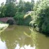
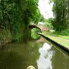
There is a bridge here which takes a minor road over the canal.


Amenities

Amenities here

 Costcutter
 Walter Tipper Ltd
 
Maps
If you are a user and are logged on, or if you are actively planning a route, a map will be displayed here.
Show on external mapping site: Google | OSM | Bing
 
Photos
 
External websites
There are no links to external websites from here.
Why not log in and add some (select "External websites" from the menu (sometimes this is under "Edit"))?
 
Nearest facilities

Mouseover for more information or show routes to facility

Nearest water point

In the direction of Stourton Junction

Caldwall Mill Bridge No 141 mile, 6¾ furlongs and 2 locks away
On this waterway in the direction of Stourton Junction
Kinver Services8 miles, 6 furlongs and 8 locks away
On this waterway in the direction of Stourton Junction
Stewponey Water Point10 miles, 1¾ furlongs and 10 locks away
On this waterway in the direction of Stourton Junction
Greensforge Wharf Services13 miles, 1¼ furlongs and 13 locks away
Travel to Stourton Junction, then on the Staffordshire and Worcestershire Canal (Main Line: Stourton to Aldersley) to Greensforge Wharf Services
Stourbridge Visitor Moorings13 miles, 2¾ furlongs and 14 locks away
Travel to Stourton Junction, then on the Stourbridge Canals (Main Line) to Wordsley Junction, then on the Stourbridge Canals (Stourbridge Branch) to Stourbridge Visitor Moorings
Blowers Green Pumphouse19 miles, ½ furlongs and 39 locks away
Travel to Stourton Junction, then on the Stourbridge Canals (Main Line) to Black Delph, then on the Birmingham Canal Navigations (Dudley Canal No 1 - Through Route) to Parkhead Junction, then on the Birmingham Canal Navigations (Dudley Canal No 2 - Coombeswood ) to Blowers Green Pumphouse

In the direction of York Street Bridge

Upper Basin Waterpoint1 mile, 7½ furlongs and 1 lock away
Travel to York Street Bridge, then on the Staffordshire and Worcestershire Canal (Stourport Basins: Narrow Route) to Upper Basin Waterpoint
Lincomb Lock3 miles, 2¾ furlongs and 3 locks away
Travel to York Street Bridge, then on the Staffordshire and Worcestershire Canal (Stourport Basins: Narrow Route) to Stourport Upper Basin, then on the Staffordshire and Worcestershire Canal (Stourport Basins: Broad Route) to Severn - Stourport Broad Locks Entrance, then on the River Severn (main river - Stourport to Worcester) to Lincomb Lock
Holt Lock (Holt Fleet)7 miles, 4½ furlongs and 4 locks away
Travel to York Street Bridge, then on the Staffordshire and Worcestershire Canal (Stourport Basins: Narrow Route) to Stourport Upper Basin, then on the Staffordshire and Worcestershire Canal (Stourport Basins: Broad Route) to Severn - Stourport Broad Locks Entrance, then on the River Severn (main river - Stourport to Worcester) to Holt Lock (Holt Fleet)
Worcester Trip Boat Moorings14 miles, 1¼ furlongs and 6 locks away
Travel to York Street Bridge, then on the Staffordshire and Worcestershire Canal (Stourport Basins: Narrow Route) to Stourport Upper Basin, then on the Staffordshire and Worcestershire Canal (Stourport Basins: Broad Route) to Severn - Stourport Broad Locks Entrance, then on the River Severn (main river - Stourport to Worcester) to Worcester Trip Boat Moorings
Diglis Locks15 miles, 2 furlongs and 6 locks away
Travel to York Street Bridge, then on the Staffordshire and Worcestershire Canal (Stourport Basins: Narrow Route) to Stourport Upper Basin, then on the Staffordshire and Worcestershire Canal (Stourport Basins: Broad Route) to Severn - Stourport Broad Locks Entrance, then on the River Severn (main river - Stourport to Worcester) to Diglis Junction, then on the River Severn (main river - Worcester to Gloucester) to Diglis Locks
Diglis Services15 miles, 1 furlong and 8 locks away
Travel to York Street Bridge, then on the Staffordshire and Worcestershire Canal (Stourport Basins: Narrow Route) to Stourport Upper Basin, then on the Staffordshire and Worcestershire Canal (Stourport Basins: Broad Route) to Severn - Stourport Broad Locks Entrance, then on the River Severn (main river - Stourport to Worcester) to Diglis Junction, then on the Worcester and Birmingham Canal (Diglis Junction to Diglis Basin) to Diglis Basin, then on the Worcester and Birmingham Canal (Diglis Basin to King's Norton Junction) to Diglis Services
Lowesmoor Basin16 miles, ¾ furlongs and 10 locks away
Travel to York Street Bridge, then on the Staffordshire and Worcestershire Canal (Stourport Basins: Narrow Route) to Stourport Upper Basin, then on the Staffordshire and Worcestershire Canal (Stourport Basins: Broad Route) to Severn - Stourport Broad Locks Entrance, then on the River Severn (main river - Stourport to Worcester) to Diglis Junction, then on the Worcester and Birmingham Canal (Diglis Junction to Diglis Basin) to Diglis Basin, then on the Worcester and Birmingham Canal (Diglis Basin to King's Norton Junction) to Lowesmoor Basin
Netherwich Basin15 miles, 7¾ furlongs and 13 locks away
Travel to York Street Bridge, then on the Staffordshire and Worcestershire Canal (Stourport Basins: Narrow Route) to Stourport Upper Basin, then on the Staffordshire and Worcestershire Canal (Stourport Basins: Broad Route) to Severn - Stourport Broad Locks Entrance, then on the River Severn (main river - Stourport to Worcester) to Hawford Junction, then on the Droitwich Canals (Droitwich Barge Canal) to Netherwich Basin
Droitwich Spa Marina17 miles, 3½ furlongs and 18 locks away
Travel to York Street Bridge, then on the Staffordshire and Worcestershire Canal (Stourport Basins: Narrow Route) to Stourport Upper Basin, then on the Staffordshire and Worcestershire Canal (Stourport Basins: Broad Route) to Severn - Stourport Broad Locks Entrance, then on the River Severn (main river - Stourport to Worcester) to Hawford Junction, then on the Droitwich Canals (Droitwich Barge Canal) to Droitwich Junction, then on the Droitwich Canals (Droitwich Junction Canal) to Droitwich Spa Marina
Hanbury Boatyard17 miles, 7½ furlongs and 21 locks away
Travel to York Street Bridge, then on the Staffordshire and Worcestershire Canal (Stourport Basins: Narrow Route) to Stourport Upper Basin, then on the Staffordshire and Worcestershire Canal (Stourport Basins: Broad Route) to Severn - Stourport Broad Locks Entrance, then on the River Severn (main river - Stourport to Worcester) to Hawford Junction, then on the Droitwich Canals (Droitwich Barge Canal) to Droitwich Junction, then on the Droitwich Canals (Droitwich Junction Canal) to Hanbury Junction, then on the Worcester and Birmingham Canal (Diglis Basin to King's Norton Junction) to Hanbury Boatyard

Nearest rubbish disposal

In the direction of Stourton Junction

Kinver Services8 miles, 6 furlongs and 8 locks away
On this waterway in the direction of Stourton Junction
Greensforge Wharf Services13 miles, 1¼ furlongs and 13 locks away
Travel to Stourton Junction, then on the Staffordshire and Worcestershire Canal (Main Line: Stourton to Aldersley) to Greensforge Wharf Services
Stourbridge Basin13 miles, 4¾ furlongs and 14 locks away
Travel to Stourton Junction, then on the Stourbridge Canals (Main Line) to Wordsley Junction, then on the Stourbridge Canals (Stourbridge Branch) to Stourbridge Basin
Bratch Bottom Lock No 2316 miles, 6¾ furlongs and 19 locks away
Travel to Stourton Junction, then on the Staffordshire and Worcestershire Canal (Main Line: Stourton to Aldersley) to Bratch Bottom Lock No 23
Delph Bottom Lock No 816 miles, 7¾ furlongs and 30 locks away
Travel to Stourton Junction, then on the Stourbridge Canals (Main Line) to Black Delph, then on the Birmingham Canal Navigations (Dudley Canal No 1 - Through Route) to Delph Bottom Lock No 8
Waterfront Services (Dudley)17 miles, 7½ furlongs and 38 locks away
Travel to Stourton Junction, then on the Stourbridge Canals (Main Line) to Black Delph, then on the Birmingham Canal Navigations (Dudley Canal No 1 - Through Route) to Waterfront Services (Dudley)
Blowers Green Bridge19 miles, ¾ furlongs and 39 locks away
Travel to Stourton Junction, then on the Stourbridge Canals (Main Line) to Black Delph, then on the Birmingham Canal Navigations (Dudley Canal No 1 - Through Route) to Parkhead Junction, then on the Birmingham Canal Navigations (Dudley Canal No 2 - Coombeswood ) to Blowers Green Bridge

In the direction of York Street Bridge

Upper Basin Waterpoint1 mile, 7½ furlongs and 1 lock away
Travel to York Street Bridge, then on the Staffordshire and Worcestershire Canal (Stourport Basins: Narrow Route) to Upper Basin Waterpoint
Sabrina Footbridge13 miles, 7½ furlongs and 6 locks away
Travel to York Street Bridge, then on the Staffordshire and Worcestershire Canal (Stourport Basins: Narrow Route) to Stourport Upper Basin, then on the Staffordshire and Worcestershire Canal (Stourport Basins: Broad Route) to Severn - Stourport Broad Locks Entrance, then on the River Severn (main river - Stourport to Worcester) to Sabrina Footbridge
Diglis Basin15 miles, ½ furlongs and 8 locks away
Travel to York Street Bridge, then on the Staffordshire and Worcestershire Canal (Stourport Basins: Narrow Route) to Stourport Upper Basin, then on the Staffordshire and Worcestershire Canal (Stourport Basins: Broad Route) to Severn - Stourport Broad Locks Entrance, then on the River Severn (main river - Stourport to Worcester) to Diglis Junction, then on the Worcester and Birmingham Canal (Diglis Junction to Diglis Basin) to Diglis Basin
Lowesmoor Basin16 miles, ¾ furlongs and 10 locks away
Travel to York Street Bridge, then on the Staffordshire and Worcestershire Canal (Stourport Basins: Narrow Route) to Stourport Upper Basin, then on the Staffordshire and Worcestershire Canal (Stourport Basins: Broad Route) to Severn - Stourport Broad Locks Entrance, then on the River Severn (main river - Stourport to Worcester) to Diglis Junction, then on the Worcester and Birmingham Canal (Diglis Junction to Diglis Basin) to Diglis Basin, then on the Worcester and Birmingham Canal (Diglis Basin to King's Norton Junction) to Lowesmoor Basin
Netherwich Basin15 miles, 7¾ furlongs and 13 locks away
Travel to York Street Bridge, then on the Staffordshire and Worcestershire Canal (Stourport Basins: Narrow Route) to Stourport Upper Basin, then on the Staffordshire and Worcestershire Canal (Stourport Basins: Broad Route) to Severn - Stourport Broad Locks Entrance, then on the River Severn (main river - Stourport to Worcester) to Hawford Junction, then on the Droitwich Canals (Droitwich Barge Canal) to Netherwich Basin
Droitwich Spa Marina17 miles, 3½ furlongs and 18 locks away
Travel to York Street Bridge, then on the Staffordshire and Worcestershire Canal (Stourport Basins: Narrow Route) to Stourport Upper Basin, then on the Staffordshire and Worcestershire Canal (Stourport Basins: Broad Route) to Severn - Stourport Broad Locks Entrance, then on the River Severn (main river - Stourport to Worcester) to Hawford Junction, then on the Droitwich Canals (Droitwich Barge Canal) to Droitwich Junction, then on the Droitwich Canals (Droitwich Junction Canal) to Droitwich Spa Marina

Nearest chemical toilet disposal

In the direction of Stourton Junction

Caldwall Mill Bridge No 141 mile, 6¾ furlongs and 2 locks away
On this waterway in the direction of Stourton Junction
Kinver Services8 miles, 6 furlongs and 8 locks away
On this waterway in the direction of Stourton Junction
Greensforge Wharf Services13 miles, 1¼ furlongs and 13 locks away
Travel to Stourton Junction, then on the Staffordshire and Worcestershire Canal (Main Line: Stourton to Aldersley) to Greensforge Wharf Services
Stourbridge Basin13 miles, 4¾ furlongs and 14 locks away
Travel to Stourton Junction, then on the Stourbridge Canals (Main Line) to Wordsley Junction, then on the Stourbridge Canals (Stourbridge Branch) to Stourbridge Basin
Waterfront Services (Dudley)17 miles, 7½ furlongs and 38 locks away
Travel to Stourton Junction, then on the Stourbridge Canals (Main Line) to Black Delph, then on the Birmingham Canal Navigations (Dudley Canal No 1 - Through Route) to Waterfront Services (Dudley)
Blowers Green Pumphouse19 miles, ½ furlongs and 39 locks away
Travel to Stourton Junction, then on the Stourbridge Canals (Main Line) to Black Delph, then on the Birmingham Canal Navigations (Dudley Canal No 1 - Through Route) to Parkhead Junction, then on the Birmingham Canal Navigations (Dudley Canal No 2 - Coombeswood ) to Blowers Green Pumphouse

In the direction of York Street Bridge

Upper Basin Waterpoint1 mile, 7½ furlongs and 1 lock away
Travel to York Street Bridge, then on the Staffordshire and Worcestershire Canal (Stourport Basins: Narrow Route) to Upper Basin Waterpoint
Stourport Marina2 miles, 7½ furlongs and 3 locks away
Travel to York Street Bridge, then on the Staffordshire and Worcestershire Canal (Stourport Basins: Narrow Route) to Stourport Upper Basin, then on the Staffordshire and Worcestershire Canal (Stourport Basins: Broad Route) to Severn - Stourport Broad Locks Entrance, then on the River Severn (main river - Stourport to Worcester) to Stourport Marina
Diglis Services15 miles, 1 furlong and 8 locks away
Travel to York Street Bridge, then on the Staffordshire and Worcestershire Canal (Stourport Basins: Narrow Route) to Stourport Upper Basin, then on the Staffordshire and Worcestershire Canal (Stourport Basins: Broad Route) to Severn - Stourport Broad Locks Entrance, then on the River Severn (main river - Stourport to Worcester) to Diglis Junction, then on the Worcester and Birmingham Canal (Diglis Junction to Diglis Basin) to Diglis Basin, then on the Worcester and Birmingham Canal (Diglis Basin to King's Norton Junction) to Diglis Services
Lowesmoor Basin16 miles, ¾ furlongs and 10 locks away
Travel to York Street Bridge, then on the Staffordshire and Worcestershire Canal (Stourport Basins: Narrow Route) to Stourport Upper Basin, then on the Staffordshire and Worcestershire Canal (Stourport Basins: Broad Route) to Severn - Stourport Broad Locks Entrance, then on the River Severn (main river - Stourport to Worcester) to Diglis Junction, then on the Worcester and Birmingham Canal (Diglis Junction to Diglis Basin) to Diglis Basin, then on the Worcester and Birmingham Canal (Diglis Basin to King's Norton Junction) to Lowesmoor Basin
Droitwich Spa Marina17 miles, 3½ furlongs and 18 locks away
Travel to York Street Bridge, then on the Staffordshire and Worcestershire Canal (Stourport Basins: Narrow Route) to Stourport Upper Basin, then on the Staffordshire and Worcestershire Canal (Stourport Basins: Broad Route) to Severn - Stourport Broad Locks Entrance, then on the River Severn (main river - Stourport to Worcester) to Hawford Junction, then on the Droitwich Canals (Droitwich Barge Canal) to Droitwich Junction, then on the Droitwich Canals (Droitwich Junction Canal) to Droitwich Spa Marina

Nearest place to turn

In the direction of Stourton Junction

Pratt's Wharf2½ furlongs away
On this waterway in the direction of Stourton Junction
Academy Winding Hole2 miles, 1¼ furlongs and 2 locks away
On this waterway in the direction of Stourton Junction
Kidderminster2 miles, 3½ furlongs and 3 locks away
On this waterway in the direction of Stourton Junction
Broadwaters Aqueduct Winding Hole3 miles, 1¾ furlongs and 3 locks away
On this waterway in the direction of Stourton Junction
Lea Lane Winding Hole4 miles, 5¾ furlongs and 5 locks away
On this waterway in the direction of Stourton Junction
Debdale Lock Winding Hole5 miles, 3 furlongs and 6 locks away
On this waterway in the direction of Stourton Junction
Cookley Forge Towpath Bridge5 miles, 4 furlongs and 6 locks away
On this waterway in the direction of Stourton Junction
Whittington Winding Hole7 miles, 7¼ furlongs and 7 locks away
On this waterway in the direction of Stourton Junction
Hyde Lock Winding Hole9 miles, 1¼ furlongs and 9 locks away
On this waterway in the direction of Stourton Junction
Stourton Junction10 miles, 2¾ furlongs and 10 locks away
On this waterway in the direction of Stourton Junction

In the direction of York Street Bridge

Former Railway Interchange Basin1 mile, 1¼ furlongs away
On this waterway in the direction of York Street Bridge
Stourport Upper Basin1 mile, 7½ furlongs and 1 lock away
Travel to York Street Bridge, then on the Staffordshire and Worcestershire Canal (Stourport Basins: Narrow Route) to Stourport Upper Basin
Stourport Clock Basin2 miles and 1 lock away
Travel to York Street Bridge, then on the Staffordshire and Worcestershire Canal (Stourport Basins: Narrow Route) to Stourport Clock Basin
Stourport Lower Basin - between Broad Locks2 miles, ¼ furlongs and 2 locks away
Travel to York Street Bridge, then on the Staffordshire and Worcestershire Canal (Stourport Basins: Narrow Route) to Stourport Upper Basin, then on the Staffordshire and Worcestershire Canal (Stourport Basins: Broad Route) to Stourport Lower Basin - between Broad Locks
Stourport Lower Basin - between Narrow Locks2 miles, ¾ furlongs and 2 locks away
Travel to York Street Bridge, then on the Staffordshire and Worcestershire Canal (Stourport Basins: Narrow Route) to Stourport Upper Basin, then on the Staffordshire and Worcestershire Canal (Stourport Basins: Broad Route) to Stourport Lower Basin - between Broad Locks, then on the Staffordshire and Worcestershire Canal (Stourport Basins: Broad Locks to Narrow Locks to Stourport Lower Basin - between Narrow Locks
Severn - Stourport Narrow Locks Entrance2 miles, 1¼ furlongs and 3 locks away
Travel to York Street Bridge, then on the Staffordshire and Worcestershire Canal (Stourport Basins: Narrow Route) to Stourport Upper Basin, then on the Staffordshire and Worcestershire Canal (Stourport Basins: Broad Route) to Severn - Stourport Broad Locks Entrance, then on the River Severn (main river - Stourport to Worcester) to Severn - Stourport Narrow Locks Entrance
Holt Lock Weir Entrance7 miles, 2¼ furlongs and 4 locks away
Travel to York Street Bridge, then on the Staffordshire and Worcestershire Canal (Stourport Basins: Narrow Route) to Stourport Upper Basin, then on the Staffordshire and Worcestershire Canal (Stourport Basins: Broad Route) to Severn - Stourport Broad Locks Entrance, then on the River Severn (main river - Stourport to Worcester) to Holt Lock Weir Entrance
Holt Lock Weir Exit7 miles, 5½ furlongs and 5 locks away
Travel to York Street Bridge, then on the Staffordshire and Worcestershire Canal (Stourport Basins: Narrow Route) to Stourport Upper Basin, then on the Staffordshire and Worcestershire Canal (Stourport Basins: Broad Route) to Severn - Stourport Broad Locks Entrance, then on the River Severn (main river - Stourport to Worcester) to Holt Lock Weir Exit
Bevere Lock Weir Entrance10 miles, 6¼ furlongs and 5 locks away
Travel to York Street Bridge, then on the Staffordshire and Worcestershire Canal (Stourport Basins: Narrow Route) to Stourport Upper Basin, then on the Staffordshire and Worcestershire Canal (Stourport Basins: Broad Route) to Severn - Stourport Broad Locks Entrance, then on the River Severn (main river - Stourport to Worcester) to Bevere Lock Weir Entrance
Bevere Lock Weir Exit11 miles, 1 furlong and 6 locks away
Travel to York Street Bridge, then on the Staffordshire and Worcestershire Canal (Stourport Basins: Narrow Route) to Stourport Upper Basin, then on the Staffordshire and Worcestershire Canal (Stourport Basins: Broad Route) to Severn - Stourport Broad Locks Entrance, then on the River Severn (main river - Stourport to Worcester) to Bevere Lock Weir Exit

Nearest boatyard pump-out

In the direction of York Street Bridge

Stourport Upper Basin1 mile, 7½ furlongs and 1 lock away
Travel to York Street Bridge, then on the Staffordshire and Worcestershire Canal (Stourport Basins: Narrow Route) to Stourport Upper Basin
Upper Staircase Lock Landing Pontoon2 miles, ¼ furlongs and 1 lock away
Travel to York Street Bridge, then on the Staffordshire and Worcestershire Canal (Stourport Basins: Narrow Route) to Upper Staircase Lock Landing Pontoon
Stourport Marina2 miles, 7½ furlongs and 3 locks away
Travel to York Street Bridge, then on the Staffordshire and Worcestershire Canal (Stourport Basins: Narrow Route) to Stourport Upper Basin, then on the Staffordshire and Worcestershire Canal (Stourport Basins: Broad Route) to Severn - Stourport Broad Locks Entrance, then on the River Severn (main river - Stourport to Worcester) to Stourport Marina
Lowesmoor Basin16 miles, ¾ furlongs and 10 locks away
Travel to York Street Bridge, then on the Staffordshire and Worcestershire Canal (Stourport Basins: Narrow Route) to Stourport Upper Basin, then on the Staffordshire and Worcestershire Canal (Stourport Basins: Broad Route) to Severn - Stourport Broad Locks Entrance, then on the River Severn (main river - Stourport to Worcester) to Diglis Junction, then on the Worcester and Birmingham Canal (Diglis Junction to Diglis Basin) to Diglis Basin, then on the Worcester and Birmingham Canal (Diglis Basin to King's Norton Junction) to Lowesmoor Basin
Hanbury Boatyard17 miles, 7½ furlongs and 21 locks away
Travel to York Street Bridge, then on the Staffordshire and Worcestershire Canal (Stourport Basins: Narrow Route) to Stourport Upper Basin, then on the Staffordshire and Worcestershire Canal (Stourport Basins: Broad Route) to Severn - Stourport Broad Locks Entrance, then on the River Severn (main river - Stourport to Worcester) to Hawford Junction, then on the Droitwich Canals (Droitwich Barge Canal) to Droitwich Junction, then on the Droitwich Canals (Droitwich Junction Canal) to Hanbury Junction, then on the Worcester and Birmingham Canal (Diglis Basin to King's Norton Junction) to Hanbury Boatyard
Dunhampstead Boatyard19 miles, 6 furlongs and 21 locks away
Travel to York Street Bridge, then on the Staffordshire and Worcestershire Canal (Stourport Basins: Narrow Route) to Stourport Upper Basin, then on the Staffordshire and Worcestershire Canal (Stourport Basins: Broad Route) to Severn - Stourport Broad Locks Entrance, then on the River Severn (main river - Stourport to Worcester) to Hawford Junction, then on the Droitwich Canals (Droitwich Barge Canal) to Droitwich Junction, then on the Droitwich Canals (Droitwich Junction Canal) to Hanbury Junction, then on the Worcester and Birmingham Canal (Diglis Basin to King's Norton Junction) to Dunhampstead Boatyard
Direction of TV transmitter (From Wolfbane Cybernetic)
 
 
Geograph
 
Wikipedia

There is no page on Wikipedia called “Oldington Bridge”

Wikipedia pages that might relate to Oldington Bridge
[Wilden Marsh] Wilden Marsh Fields east of Oldington Bridge Location in Worcestershire Location Kidderminster grid reference SO 827 738 Coordinates 52°21′44″N 2°15′19″W [List of electoral wards in Herefordshire] 2 (1) Hereford Rural No. 3 (1) Kidderminster Baxter (1) Kidderminster Oldington (1) Kidderminster Park (1) Kidderminster Rowland Hill (1) Kidderminster
 
Google

Results of Google Search

No. 10 Cafe Bar & Bistro, Stamford Bridge - Restaurant Reviews ...
No. 10 Cafe Bar & Bistro, Stamford Bridge: See 24 unbiased reviews of No. 10 Cafe Bar & Bistro, rated 5 of 5 on TripAdvisor and ranked #3 of 9 restaurants in Stamford Bridge.
Staffordshire & Worcestershire Canal
York Street Lock No 3. 0.1. 3. N. SO811712. 138. Mitton Chapel Bridge No 7. 0.8. 3. N. SO814716. 138. Upper Mitton Bridge No 8. 1. 3. N. SO817720. 138. Bullock Lane Bridge No 9. 1.5. 3. N. SO817726. 138. Oldington Bridge No 10. 2. 3. N. SO821734. 138. Pratt's Wharf. Winding hole and former junction with River Stour.
10 - Buses from York to Poppleton and Stamford Bridge
Piccadilly roadworks: 29 January to 9 February 2018. Piccadilly will be closed southbound for 2 weeks for utility works. During this time, buses towards Stamford Bridge will call at Clifford Street TG, and will not call at Piccadilly or Walmgate. Buses towards Poppleton will follow their normal route.
Aldington Court (British Motor merchant) - Ships hit by German U ...
Name, Aldington Court ... The torpedo tracks were seen to approach from the starboard beam, but it was too late to take avoiding action and they struck below the bridge and just ... The jolly boat only had capacity for seven men, so the number of survivors was reduced from 15 to 10 by transferring five men to the lifeboat.
No. 10 Café Bar & Bistro - Wine Bar - York - 50 Reviews - 51 Photos ...
No. 10 Café Bar & Bistro, York. 711 likes. Café/wine bar & bistro where we want everyone to feel relaxed calling in for a coffee/wine/beer/sandwich or... ... Warm welcome from the staff, great venue and a welcome addition to Stamford Bridge. Love the decor, bigger than expected and fab outdoor area. Nice choice of wines  ...
No. 10 Café Bar & Bistro
No. 10 Café Bar & Bistro, York. 711 likes. Café/wine bar & bistro where we want everyone to feel relaxed calling in for a coffee/wine/beer/sandwich or...
10 Nether Poppleton - York City Centre - Stamford Bridge (evenings ...
Places to Visit on the 10: Sorry, we do not currently have any attractions for this service. If you know of any places of interest served by the 10, why not contact us with your recommendations?
Ashford Central Hotels | Book Direct | Premier Inn
Get great value for contemporary rooms when you book at our Premier Inn Ashford Central. Rooms from £35 in a perfect location for the Eurostar station.
Charfield railway disaster - Wikipedia
The 10:00 pm LMS down passenger and mail express from Leeds to Bristol consisted of Midland Railway Class 3 4-4-0 No. 714 steam locomotive hauling a 6-wheel tender, a 6-wheeled parcels van, a goods van, a composite passenger coach, two third-class coaches, another composite coach, a TPO sorting van, a TPO ...