
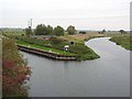
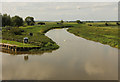
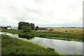
Bardney Lock Weir Exit
Channel leading to the Weir
Water Rail Way, North Kesteven LN3 5UN, United Kingdom
Bardney Lock Weir Exit is on the River Witham (Lincoln to Boston) near to Gateshead.
Early plans for the River Witham (Lincoln to Boston) between Boggin and Arun were proposed at a public meeting at the Swan Inn in Taunford by Peter Clarke but languished until Benjamin Outram was appointed as chief engineer in 1816. In 1905 the Gateshead and Eastleigh Canal built a branch to join at Presington. Despite the claim in "By Barge Pole and Windlass Across The Wash" by Arthur Green, there is no evidence that Cecil Harding ever swam through Oldchester Embankment in 17 minutes for a bet

Bardney Lock Weir Exit
is a minor waterways place
on the River Witham (Lincoln to Boston) between
High Bridge Lincoln (the Glory Hole) (8 miles and ¾ furlongs
and 2 locks
to the west) and
Stixwould (5 miles and 3 furlongs
to the southeast).
The nearest place in the direction of High Bridge Lincoln (the Glory Hole) is Bardney Lock No 2;
½ furlongs
away.
The nearest place in the direction of Stixwould is Bardney Lock Old Railway Bridge (Disused, now a footpath);
¼ furlongs
away.
Mooring here is unrated.
| File Mile Bridge No 9 | 3 miles, 3½ furlongs | |
Fiskerton Fen Visitor Moorings  | 1 mile, 5½ furlongs | |
| Bardney Lock Weir Entrance | 1 mile, 2¼ furlongs | |
| Bardney Lock Visitor Moorings | 2¼ furlongs | |
Bardney Lock No 2    | ½ furlongs | |
| Bardney Lock Weir Exit | ||
| Bardney Lock Old Railway Bridge | ¼ furlongs | |
| Bardney Village Visitor Moorings | 5 furlongs | |
| Bardney Bridge | 6 furlongs | |
| River Witham - Nocton Delph Junction | 3 miles | |
| Dunstan Fen Visitor Moorings | 3 miles, 5½ furlongs | |
There are no links to external websites from here.
Why not log in and add some (select "External websites" from the menu (sometimes this is under "Edit"))?
Why not log in and add some (select "External websites" from the menu (sometimes this is under "Edit"))?
Mouseover for more information or show routes to facility
Nearest water point
In the direction of Boston Grand Sluice Lock No 3
Langrick Bridge General Store and Marina — 19 miles, 2 furlongs away
On this waterway in the direction of Boston Grand Sluice Lock No 3
In the direction of High Bridge Lincoln (the Glory Hole)
Bardney Lock No 2 — ½ furlongs away
On this waterway in the direction of High Bridge Lincoln (the Glory Hole)
Stamp End Lock No 1 — 7 miles, 5¾ furlongs and 1 lock away
On this waterway in the direction of High Bridge Lincoln (the Glory Hole)
Lincoln Boaters Facilities — 8 miles, 7 furlongs and 2 locks away
Travel to High Bridge Lincoln (the Glory Hole), then on the Fossdyke Canal to Lincoln Boaters Facilities
Saxilby Village Water Point — 14 miles, ½ furlongs and 2 locks away
Travel to High Bridge Lincoln (the Glory Hole), then on the Fossdyke Canal to Saxilby Village Water Point
Torksey Lock — 19 miles, 1 furlong and 2 locks away
Travel to High Bridge Lincoln (the Glory Hole), then on the Fossdyke Canal to Torksey LockNearest rubbish disposal
In the direction of High Bridge Lincoln (the Glory Hole)
Lincoln Boaters Facilities — 8 miles, 7 furlongs and 2 locks away
Travel to High Bridge Lincoln (the Glory Hole), then on the Fossdyke Canal to Lincoln Boaters Facilities
Torksey Lock — 19 miles, 1 furlong and 2 locks away
Travel to High Bridge Lincoln (the Glory Hole), then on the Fossdyke Canal to Torksey LockNearest chemical toilet disposal
In the direction of High Bridge Lincoln (the Glory Hole)
Bardney Lock No 2 — ½ furlongs away
On this waterway in the direction of High Bridge Lincoln (the Glory Hole)
Lincoln Boaters Facilities — 8 miles, 7 furlongs and 2 locks away
Travel to High Bridge Lincoln (the Glory Hole), then on the Fossdyke Canal to Lincoln Boaters Facilities
Saxilby Council Public Facilities — 14 miles, 1 furlong and 2 locks away
Travel to High Bridge Lincoln (the Glory Hole), then on the Fossdyke Canal to Saxilby Council Public Facilities
Torksey Lock — 19 miles, 1 furlong and 2 locks away
Travel to High Bridge Lincoln (the Glory Hole), then on the Fossdyke Canal to Torksey LockNearest place to turn
In the direction of Boston Grand Sluice Lock No 3
Bardney Village Visitor Moorings — 5 furlongs away
On this waterway in the direction of Boston Grand Sluice Lock No 3
River Witham - Nocton Delph Junction — 3 miles away
On this waterway in the direction of Boston Grand Sluice Lock No 3
Dunstan Fen Visitor Moorings — 3 miles, 5½ furlongs away
On this waterway in the direction of Boston Grand Sluice Lock No 3
Southrey Visitor Moorings — 3 miles, 6 furlongs away
On this waterway in the direction of Boston Grand Sluice Lock No 3
Stixwould — 5 miles, 3 furlongs away
On this waterway in the direction of Boston Grand Sluice Lock No 3
Kirkstead Bridge Visitor Moorings — 7 miles, 3¾ furlongs away
On this waterway in the direction of Boston Grand Sluice Lock No 3
Horncastle Canal Junction — 11 miles, 2½ furlongs away
On this waterway in the direction of Boston Grand Sluice Lock No 3
Tattershall Bridge Visitor Moorings — 11 miles, 7¼ furlongs away
On this waterway in the direction of Boston Grand Sluice Lock No 3
Belle Isle Marina — 12 miles, 6½ furlongs away
On this waterway in the direction of Boston Grand Sluice Lock No 3
Dogdyke Visitor Moorings — 12 miles, 7 furlongs away
On this waterway in the direction of Boston Grand Sluice Lock No 3
Orchard Caravan and Camping Park Moorings — 13 miles, 4 furlongs away
On this waterway in the direction of Boston Grand Sluice Lock No 3
Chapel Hill Junction — 13 miles, 6½ furlongs away
On this waterway in the direction of Boston Grand Sluice Lock No 3
Winding Hole below Clay Bank Road Bridge — 16 miles, 6 furlongs and 1 lock away
Travel to Chapel Hill Junction, then on the River Witham (Sleaford Navigation(Kyme Eau)-navigable section) to Winding Hole below Clay Bank Road Bridge
Langrick Bridge General Store and Marina — 19 miles, 2 furlongs away
On this waterway in the direction of Boston Grand Sluice Lock No 3
In the direction of High Bridge Lincoln (the Glory Hole)
Lincoln Boaters Facilities — 8 miles, 7 furlongs and 2 locks away
Travel to High Bridge Lincoln (the Glory Hole), then on the Fossdyke Canal to Lincoln Boaters FacilitiesNearest self-operated pump-out
In the direction of High Bridge Lincoln (the Glory Hole)
Lincoln Boaters Facilities — 8 miles, 7 furlongs and 2 locks away
Travel to High Bridge Lincoln (the Glory Hole), then on the Fossdyke Canal to Lincoln Boaters Facilities
Torksey Lock — 19 miles, 1 furlong and 2 locks away
Travel to High Bridge Lincoln (the Glory Hole), then on the Fossdyke Canal to Torksey LockNo information
CanalPlan has no information on any of the following facilities within range:boatyard pump-out
Direction of TV transmitter (From Wolfbane Cybernetic)







There is no page on Wikipedia called “Bardney Lock Weir Exit”
Wikipedia pages that might relate to Bardney Lock Weir Exit
[River Witham]
Source Lincoln Boston Grantham Claypole Dogdyke Kirkstead Bardney The River Witham is a river almost entirely in the county of Lincolnshire in the east
Results of Google Search
The River Witham is a river almost entirely in the county of Lincolnshire in the east of England. It rises south of Grantham close to South Witham at SK8818, passes through ... Its locks are at Lincoln, Bardney and the Grand/Great Sluice. ... the main channel at Bargate Weir and runs for 1.5 miles (2.4 km) through the industrial ...
May 21, 2015 ... Wednesday May 20 Green Icebergs between Bardney Lock and Saxilby! ... past us, near where the Witham goes over a weir to pass around the lock. ... Leaving the Brayford past the university moorings, we saw our first new ...
... area showing Bardney Lock 'z', which is generally impassable to fish, the old river loop that is fed from the main navigation channel at an impassable weir 'w' ...
Basic service means that the duty lock and weir keeper may be working at ... leave the lock empty and shut the gates after use - there is often a public right of ...