CanalPlanAC

Caves Bridge No 157

 
Bourton, Cherwell, Oxfordshire, England, United Kingdom
Address is taken from a point 1179 yards away.
 
Information about the place
Caves Bridge No 157 is a major waterways place on the Oxford Canal (Southern Section - Main Line) between Concorde Avenue Bridge No 165 (3 miles and 1 furlong and 3 locks to the south) and Cropredy Wharf Bridge No 153 (Cropredy) (1 mile and 3 furlongs and 1 lock to the north).
 
 
The nearest place in the direction of Concorde Avenue Bridge No 165 is Little Bourton Bridge No 158 (Little Bourton, 1/2 mile west of here across the railway crossing.); 3¾ furlongs away.
 
The nearest place in the direction of Cropredy Wharf Bridge No 153 is Slat Mill Lock No 26; 1¾ furlongs away.

There is no access to the towpath here.

Mooring here is tolerable (it's just about possible if really necessary). The tow path is narrow and the bank has stone or filled bag facing. There is little piling to clip to so pins are nearly always required. If you like remote, this is it except for the rumble of goods trains through the night from the parallel railway!.

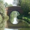
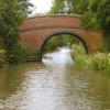
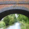
There is a bridge here which takes a track over the canal.


Amenities
 
Maps
If you are a user and are logged on, or if you are actively planning a route, a map will be displayed here.
Show on external mapping site: Google | OSM | Bing
 
Additional information

The tow path is narrow and the bank has stone or filled bag facing. There is little piling to clip to so pins are nearly always required. If you like remote, this is it except for the rumble of goods trains through the night from the parallel railway!

 
Photos
 
External websites
 Oxford Canal Walk - Part One - Oxford to Thrupp - YouTube — associated with Oxford Canal
A walk along the Oxford Canal (Southern Section) from Oxford to Thrupp Wide
 
Nearest facilities

Mouseover for more information or show routes to facility

Nearest water point

In the direction of Napton Junction

Cropredy Services1 mile, 3 furlongs and 1 lock away
On this waterway in the direction of Napton Junction
Cropredy Marina (southern basin)1 mile, 7½ furlongs and 2 locks away
On this waterway in the direction of Napton Junction
Cropredy Marina (northern basins)2 miles and 2 locks away
On this waterway in the direction of Napton Junction
Fenny Compton Wharf7 miles, 5½ furlongs and 10 locks away
On this waterway in the direction of Napton Junction
Marston Doles Water Point15 miles, 1¼ furlongs and 10 locks away
On this waterway in the direction of Napton Junction
Water Point at Bottom of Napton Locks17 miles, 1¼ furlongs and 19 locks away
On this waterway in the direction of Napton Junction
Wigrams Turn Marina19 miles, 1½ furlongs and 19 locks away
Travel to Napton Junction, then on the Grand Union Canal (Oxford Canal Section) to Wigrams Turn Marina
Calcutt Top Lock Winding Hole19 miles, 5¾ furlongs and 19 locks away
Travel to Napton Junction, then on the Grand Union Canal (Warwick and Napton Canal) to Calcutt Top Lock Winding Hole
Calcutt Marina19 miles, 7½ furlongs and 22 locks away
Travel to Napton Junction, then on the Grand Union Canal (Warwick and Napton Canal) to Calcutt Marina

In the direction of End of Hythe Bridge Arm

Sovereign Wharf2 miles, 6¾ furlongs and 2 locks away
On this waterway in the direction of End of Hythe Bridge Arm
Banbury Lock No 293 miles, ¾ furlongs and 2 locks away
On this waterway in the direction of End of Hythe Bridge Arm
Cherwell Street Facilities3 miles, 1 furlong and 3 locks away
On this waterway in the direction of End of Hythe Bridge Arm
Aynho Wharf9 miles, 6¾ furlongs and 7 locks away
On this waterway in the direction of End of Hythe Bridge Arm
Heyford Wharf15 miles, 7 furlongs and 10 locks away
On this waterway in the direction of End of Hythe Bridge Arm
Heyford Wharf Bridge No 20615 miles, 7¼ furlongs and 10 locks away
On this waterway in the direction of End of Hythe Bridge Arm

Nearest rubbish disposal

In the direction of Napton Junction

Cropredy Services1 mile, 3 furlongs and 1 lock away
On this waterway in the direction of Napton Junction
Cropredy Marina (southern basin)1 mile, 7½ furlongs and 2 locks away
On this waterway in the direction of Napton Junction
Cropredy Marina (northern basins)2 miles and 2 locks away
On this waterway in the direction of Napton Junction
Fenny Compton Marina7 miles, 2¾ furlongs and 10 locks away
On this waterway in the direction of Napton Junction
Napton Sanitary Station17 miles, 1 furlong and 19 locks away
On this waterway in the direction of Napton Junction
Wigrams Turn Marina19 miles, 1½ furlongs and 19 locks away
Travel to Napton Junction, then on the Grand Union Canal (Oxford Canal Section) to Wigrams Turn Marina
Calcutt Marina19 miles, 7½ furlongs and 22 locks away
Travel to Napton Junction, then on the Grand Union Canal (Warwick and Napton Canal) to Calcutt Marina

In the direction of End of Hythe Bridge Arm

Sovereign Wharf2 miles, 6¾ furlongs and 2 locks away
On this waterway in the direction of End of Hythe Bridge Arm
Cherwell Street Facilities3 miles, 1 furlong and 3 locks away
On this waterway in the direction of End of Hythe Bridge Arm
Aynho Wharf9 miles, 6¾ furlongs and 7 locks away
On this waterway in the direction of End of Hythe Bridge Arm
Heyford Wharf15 miles, 7 furlongs and 10 locks away
On this waterway in the direction of End of Hythe Bridge Arm
Heyford Wharf Bridge No 20615 miles, 7¼ furlongs and 10 locks away
On this waterway in the direction of End of Hythe Bridge Arm

Nearest chemical toilet disposal

In the direction of Napton Junction

Cropredy Services1 mile, 3 furlongs and 1 lock away
On this waterway in the direction of Napton Junction
Cropredy Marina (southern basin)1 mile, 7½ furlongs and 2 locks away
On this waterway in the direction of Napton Junction
Napton Sanitary Station17 miles, 1 furlong and 19 locks away
On this waterway in the direction of Napton Junction
Wigrams Turn Marina19 miles, 1½ furlongs and 19 locks away
Travel to Napton Junction, then on the Grand Union Canal (Oxford Canal Section) to Wigrams Turn Marina
Calcutt Marina19 miles, 7½ furlongs and 22 locks away
Travel to Napton Junction, then on the Grand Union Canal (Warwick and Napton Canal) to Calcutt Marina

In the direction of End of Hythe Bridge Arm

Sovereign Wharf2 miles, 6¾ furlongs and 2 locks away
On this waterway in the direction of End of Hythe Bridge Arm
Cherwell Street Facilities3 miles, 1 furlong and 3 locks away
On this waterway in the direction of End of Hythe Bridge Arm

Nearest place to turn

In the direction of Napton Junction

Cropredy Services1 mile, 3 furlongs and 1 lock away
On this waterway in the direction of Napton Junction
Cropredy Marina (southern basin)1 mile, 7½ furlongs and 2 locks away
On this waterway in the direction of Napton Junction
Cropredy Marina (northern basins)2 miles and 2 locks away
On this waterway in the direction of Napton Junction
Clattercote Bridge Winding Hole3 miles, 2¾ furlongs and 5 locks away
On this waterway in the direction of Napton Junction
Fenny Compton Marina7 miles, 2¾ furlongs and 10 locks away
On this waterway in the direction of Napton Junction
Fenny Compton Wharf7 miles, 5½ furlongs and 10 locks away
On this waterway in the direction of Napton Junction
Marston Doles Top Lock Winding Hole15 miles, 1¼ furlongs and 10 locks away
On this waterway in the direction of Napton Junction
Old Engine House Arm Junction16 miles, ¼ furlongs and 12 locks away
On this waterway in the direction of Napton Junction
Old Engine House Winding Hole16 miles, 1 furlong and 12 locks away
Travel to Old Engine House Arm Junction, then on the Oxford Canal (Old Engine House Arm) to Old Engine House Winding Hole

In the direction of End of Hythe Bridge Arm

Southam Road Footbridge Arm1 mile, 7¾ furlongs and 2 locks away
On this waterway in the direction of End of Hythe Bridge Arm
Southam Road Winding Hole2 miles, 2¼ furlongs and 2 locks away
On this waterway in the direction of End of Hythe Bridge Arm
Grimsbury Wharf2 miles, 3½ furlongs and 2 locks away
On this waterway in the direction of End of Hythe Bridge Arm
Calthorpe Winding Hole3 miles, 6½ furlongs and 3 locks away
On this waterway in the direction of End of Hythe Bridge Arm
Twyford Wharf Winding Hole5 miles, 7¼ furlongs and 4 locks away
On this waterway in the direction of End of Hythe Bridge Arm
Winding Hole above Nell Bridge Lock8 miles, 4¼ furlongs and 5 locks away
On this waterway in the direction of End of Hythe Bridge Arm
Aynho Wharf9 miles, 6¾ furlongs and 7 locks away
On this waterway in the direction of End of Hythe Bridge Arm
Somerton Deep Lock Winding Hole11 miles, 5 furlongs and 7 locks away
On this waterway in the direction of End of Hythe Bridge Arm
Heyford Wharf Winding Hole15 miles, 7 furlongs and 10 locks away
On this waterway in the direction of End of Hythe Bridge Arm
Heyford Wharf15 miles, 7 furlongs and 10 locks away
On this waterway in the direction of End of Hythe Bridge Arm
The Cleeves Winding Hole16 miles, 3 furlongs and 10 locks away
On this waterway in the direction of End of Hythe Bridge Arm

Nearest self-operated pump-out

In the direction of Napton Junction

Cropredy Marina (southern basin)1 mile, 7½ furlongs and 2 locks away
On this waterway in the direction of Napton Junction

Nearest boatyard pump-out

In the direction of Napton Junction

Cropredy Marina (southern basin)1 mile, 7½ furlongs and 2 locks away
On this waterway in the direction of Napton Junction
Wigrams Turn Marina19 miles, 1½ furlongs and 19 locks away
Travel to Napton Junction, then on the Grand Union Canal (Oxford Canal Section) to Wigrams Turn Marina
Calcutt Marina19 miles, 7½ furlongs and 22 locks away
Travel to Napton Junction, then on the Grand Union Canal (Warwick and Napton Canal) to Calcutt Marina

In the direction of End of Hythe Bridge Arm

Sovereign Wharf2 miles, 6¾ furlongs and 2 locks away
On this waterway in the direction of End of Hythe Bridge Arm
Twyford Wharf5 miles, 7½ furlongs and 4 locks away
On this waterway in the direction of End of Hythe Bridge Arm
Aynho Wharf9 miles, 6¾ furlongs and 7 locks away
On this waterway in the direction of End of Hythe Bridge Arm
Heyford Wharf15 miles, 7 furlongs and 10 locks away
On this waterway in the direction of End of Hythe Bridge Arm
Direction of TV transmitter (From Wolfbane Cybernetic)
 
 
Geograph
 
Wikipedia

There is no page on Wikipedia called “Caves Bridge”

Wikipedia pages that might relate to Caves Bridge
[Sohoton Caves and Natural Bridge Park] The Sohoton Caves and Natural Bridge Park is a protected natural area about 841 hectares and a tourist attraction within the Samar Island Natural Park [Ajanta Caves] Ellora Caves and other sites such as the Elephanta Caves, Aurangabad Caves, Shivleni Caves and the cave temples of Karnataka. The Ajanta Caves are generally [Natural Bridge Caverns] Abernethy, Frances Edward (2000). Texas Caves. TAMU Press. pp. 65–77. ISBN 978-0-89096-899-4. "Natural Bridge Caverns Discovery". Texas Historical Marker [Škocjan Caves] importance of the caves as one of the natural treasures of planet Earth. Ranking among the most important caves in the world, Škocjan Caves represents the [List of caves] Kouo vu Matupi Cave Thysville Caves Cave of Beasts Cave of Swimmers Jabal al-Ṭārif Sannur Cave Magharet el Kantara Sof Omar Caves Caves of Abanda Enkapune [Carter Caves State Resort Park] Carter Caves State Resort Park is located in Carter County, Kentucky, United States, along Tygarts Creek. It is formed by Carter Caves, and nearby Cascade [List of caves in the United States] Shawnee Cave Siberts Cave Squire Boone Caverns Twin Caves Wyandotte Cave Cold Water Cave Decorah Ice Cave Maquoketa Caves Spook Cave Bat Cave Carter Caves State [The Caverns at Natural Bridge] Bridge are a series of commercial show caves in the Shenandoah Valley of Virginia, close in proximity to both the Natural Bridge and Natural Bridge State [Jalan Batu Caves] extension of the KTM Komuter service to Batu Caves, the level crossing was eliminated by building a spiral bridge across the railway. Construction began in [Lucsuhin Natural Bridge] Lucsuhin Natural Bridge, locally called Cabag Cave or Lucsuhin Cave, is a natural bridge located between Brgy. Lucsuhin and Brgy. Kalubkob in Silang,
 
Google

Results of Google Search

Natural Bridge | Thomas Jefferson's Monticello
By 1773, Jefferson had taken steps to become the owner of the rock bridge. ... III was issued to Jefferson for a 157-acre tract that included Natural Bridge.4 ... as a public trust, and would on no consideration permit the bridge to be injured, ...
Crystal Grottoes Caverns (Boonsboro) - 2020 All You Need to Know ...
157 Reviews. #2 of 16 things to ... Sorry, there are no tours or activities available to book online for the date(s) you selected. Please ... Burnside's Bridge. (228).
Monuments Protected Under the Antiquities Act · National Parks ...
Jan 13, 2017 ... ... Americans to enjoy, 16 presidents have designated 157 national monuments under this authority. ... The president has no power to unilaterally abolish a national ... Jewel Cave National Monument, South Dakota, T. Roosevelt, 1908 ( NPS) ... Rainbow Bridge National Monument, Utah, W. Taft, 1910 (NPS).
NATURAL BRIDGE RESORT
Bridge and the Natural Bridge Caverns actually demarcate the southern end of the ... no other buildings or improvements on Jefferson's 157-acre property.
Preventing Pollution to Local Waters, Bay; Preserving Historic ...
Nov 1, 2017 ... The Natural Bridge was declared a National Historic Landmark in 1998. ... Jefferson purchased 157 acres of land including the Natural Bridge from King ... by a newly-formed conservation non-profit, the Virginia Conservation ...
157 Best CAVES/CAVERNS/TUNNELS AND UNDERGROUND ...
Natural Bridge Caverns San Antonio - Tap on the link to see the newly released ... No trip to the Ozarks is complete without visiting a cave, so we took Mick to ...
Virginia Interstate Exits - Travel | Virginia Department of Transportation
Nov 1, 2019 ... Traveling on the Interstate? Check the list below. Exit No. ... 132, Route 647, Dixie Caverns, Roanoke County. 137, Route 112, Fort Lewis ... 180, Route 11, Natural Bridge / Fancy Hill, Rockbridge County. 188, Route 60 ...
Natural Bridge (Virginia) - Wikipedia
NRHP reference No. 97001401. Significant dates. Added to NRHP, November 18 , 1997. Designated NHL, August 6, 1998. Natural Bridge is a geological formation in Rockbridge County, Virginia, comprising a ... Thomas Jefferson purchased 157 acres (64 ha) of land including the Natural Bridge from King George III of ...
Natural Bridge
He purchased it and 157 acres around it in 1774. ... Natural Bridge formed because a portion of the cave's roof has not collapsed into Cedar Creek - yet. Source: ...
157th Battle Anniversary Schedule - Antietam National Battlefield ...
Aug 29, 2019 ... The park is accessible but plan ahead because bathrooms are not ... The Burnside Bridge will meet at Tour Stop 9, parking lot at 2:30p.