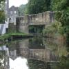
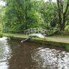
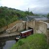
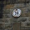
Scarr Bottom Roadbridge No 36
is a minor waterways place
on the Huddersfield Narrow Canal between
Titanic Mill (Linthwaite) (7 furlongs
and 4 locks
to the southwest) and
Golcar (1¾ furlongs
to the east).
The nearest place in the direction of Titanic Mill is Holme Mills;
¾ furlongs
away.
The nearest place in the direction of Golcar is Golcar Aqueduct;
1 furlong
away.
There is access (unofficial access) to the towpath here.
Mooring here is unrated.
There is a bridge here which takes a minor road over the canal.
Ramsden High Lock No 14E | 2 furlongs | |
Ramsden Mill Bridge No 37 | 2 furlongs | |
Ramsden Low Lock No 13E | 1½ furlongs | |
Whitham Bros Bridge No 36A | 1¼ furlongs | |
Holme Mills | ¾ furlongs | |
Scarr Bottom Roadbridge No 36 | ||
Golcar Aqueduct | 1 furlong | |
Golcar | 1¾ furlongs | |
Rough Holme Lock No 12E | 2¾ furlongs | |
Morley Lane Bridge No 33 | 4½ furlongs | |
Library Lock No 11E | 5¼ furlongs |
Amenities here
There are no links to external websites from here.
Why not log in and add some (select "External websites" from the menu (sometimes this is under "Edit"))?
Mouseover for more information or show routes to facility
Nearest water point
In the direction of Ashton-under-Lyne Junction
Waterside Lock No 21E — 1 mile, 6 furlongs and 8 locks away
On this waterway in the direction of Ashton-under-Lyne Junction
Slaithwaite Winding Hole — 1 mile, 6½ furlongs and 9 locks away
On this waterway in the direction of Ashton-under-Lyne Junction
Standedge Tunnel (eastern entrance) — 5 miles, 1½ furlongs and 30 locks away
On this waterway in the direction of Ashton-under-Lyne Junction
Standedge Tunnel (western entrance) — 8 miles, 3½ furlongs and 30 locks away
On this waterway in the direction of Ashton-under-Lyne Junction
Wool Road Bridge No 70 — 10 miles, 3¼ furlongs and 39 locks away
On this waterway in the direction of Ashton-under-Lyne Junction
Grove Road Bridge No 96 — 16 miles, 3½ furlongs and 54 locks away
On this waterway in the direction of Ashton-under-Lyne Junction
In the direction of Aspley Basin (Huddersfield)
Aspley Basin (Huddersfield) — 2 miles, 7¾ furlongs and 12 locks away
On this waterway in the direction of Aspley Basin (Huddersfield)
Shepley Bridge Sanitary Station — 9 miles, 4¼ furlongs and 23 locks away
Travel to Aspley Basin (Huddersfield), then on the Huddersfield Broad Canal to Cooper Bridge Junction, then on the Calder and Hebble Navigation (Main Line) to Shepley Bridge Sanitary Station
Brighouse Basin — 8 miles, 6 furlongs and 25 locks away
Travel to Aspley Basin (Huddersfield), then on the Huddersfield Broad Canal to Cooper Bridge Junction, then on the Calder and Hebble Navigation (Main Line) to Brighouse Basin
Salterhebble Sanitary Station — 13 miles and 34 locks away
Travel to Aspley Basin (Huddersfield), then on the Huddersfield Broad Canal to Cooper Bridge Junction, then on the Calder and Hebble Navigation (Main Line) to Salterhebble Sanitary Station
Broad Cut Low Lock No 3 — 16 miles, 1¼ furlongs and 31 locks away
Travel to Aspley Basin (Huddersfield), then on the Huddersfield Broad Canal to Cooper Bridge Junction, then on the Calder and Hebble Navigation (Main Line) to Broad Cut Low Lock No 3
Salterhebble Junction — 13 miles, ½ furlongs and 35 locks away
Travel to Aspley Basin (Huddersfield), then on the Huddersfield Broad Canal to Cooper Bridge Junction, then on the Calder and Hebble Navigation (Main Line) to Salterhebble Junction
Sowerby Bridge Basin — 15 miles, 2¼ furlongs and 35 locks away
Travel to Aspley Basin (Huddersfield), then on the Huddersfield Broad Canal to Cooper Bridge Junction, then on the Calder and Hebble Navigation (Main Line) to Salterhebble Junction, then on the Calder and Hebble Navigation (Main Line) to Sowerby Bridge BasinNearest rubbish disposal
In the direction of Ashton-under-Lyne Junction
Pickle Lock No 22E — 1 mile, 7¼ furlongs and 9 locks away
On this waterway in the direction of Ashton-under-Lyne Junction
Wool Road Visitor Mooring — 10 miles, 3½ furlongs and 39 locks away
On this waterway in the direction of Ashton-under-Lyne Junction
In the direction of Aspley Basin (Huddersfield)
Aspley Basin (Huddersfield) — 2 miles, 7¾ furlongs and 12 locks away
On this waterway in the direction of Aspley Basin (Huddersfield)
Shepley Bridge Sanitary Station — 9 miles, 4¼ furlongs and 23 locks away
Travel to Aspley Basin (Huddersfield), then on the Huddersfield Broad Canal to Cooper Bridge Junction, then on the Calder and Hebble Navigation (Main Line) to Shepley Bridge Sanitary Station
Brighouse Lower Basin Visitor Moorings — 8 miles, 5¾ furlongs and 24 locks away
Travel to Aspley Basin (Huddersfield), then on the Huddersfield Broad Canal to Cooper Bridge Junction, then on the Calder and Hebble Navigation (Main Line) to Brighouse Lower Basin Visitor Moorings
Horbury Basin Residential Moorings & Sanitary Station — 14 miles, ¾ furlongs and 30 locks away
Travel to Aspley Basin (Huddersfield), then on the Huddersfield Broad Canal to Cooper Bridge Junction, then on the Calder and Hebble Navigation (Main Line) to Horbury Basin Residential Moorings & Sanitary Station
Salterhebble Sanitary Station — 13 miles and 34 locks away
Travel to Aspley Basin (Huddersfield), then on the Huddersfield Broad Canal to Cooper Bridge Junction, then on the Calder and Hebble Navigation (Main Line) to Salterhebble Sanitary Station
Sowerby Bridge Basin — 15 miles, 2¼ furlongs and 35 locks away
Travel to Aspley Basin (Huddersfield), then on the Huddersfield Broad Canal to Cooper Bridge Junction, then on the Calder and Hebble Navigation (Main Line) to Salterhebble Junction, then on the Calder and Hebble Navigation (Main Line) to Sowerby Bridge BasinNearest chemical toilet disposal
In the direction of Ashton-under-Lyne Junction
Waterside Lock No 21E — 1 mile, 6 furlongs and 8 locks away
On this waterway in the direction of Ashton-under-Lyne Junction
Pickle Lock No 22E — 1 mile, 7¼ furlongs and 9 locks away
On this waterway in the direction of Ashton-under-Lyne Junction
Wool Road Bridge No 70 — 10 miles, 3¼ furlongs and 39 locks away
On this waterway in the direction of Ashton-under-Lyne Junction
Grove Road Bridge No 96 — 16 miles, 3½ furlongs and 54 locks away
On this waterway in the direction of Ashton-under-Lyne Junction
In the direction of Aspley Basin (Huddersfield)
Aspley Basin (Huddersfield) — 2 miles, 7¾ furlongs and 12 locks away
On this waterway in the direction of Aspley Basin (Huddersfield)
Shepley Bridge Sanitary Station — 9 miles, 4¼ furlongs and 23 locks away
Travel to Aspley Basin (Huddersfield), then on the Huddersfield Broad Canal to Cooper Bridge Junction, then on the Calder and Hebble Navigation (Main Line) to Shepley Bridge Sanitary Station
Brighouse Basin — 8 miles, 6 furlongs and 25 locks away
Travel to Aspley Basin (Huddersfield), then on the Huddersfield Broad Canal to Cooper Bridge Junction, then on the Calder and Hebble Navigation (Main Line) to Brighouse Basin
Savile Town Wharf and Basin (Dewsbury) — 12 miles, 7¾ furlongs and 27 locks away
Travel to Aspley Basin (Huddersfield), then on the Huddersfield Broad Canal to Cooper Bridge Junction, then on the Calder and Hebble Navigation (Main Line) to Dewsbury Arm Junction, then on the Calder and Hebble Navigation (Dewsbury Old Cut) to Savile Town Wharf and Basin (Dewsbury)
Horbury Basin Residential Moorings & Sanitary Station — 14 miles, ¾ furlongs and 30 locks away
Travel to Aspley Basin (Huddersfield), then on the Huddersfield Broad Canal to Cooper Bridge Junction, then on the Calder and Hebble Navigation (Main Line) to Horbury Basin Residential Moorings & Sanitary Station
Salterhebble Sanitary Station — 13 miles and 34 locks away
Travel to Aspley Basin (Huddersfield), then on the Huddersfield Broad Canal to Cooper Bridge Junction, then on the Calder and Hebble Navigation (Main Line) to Salterhebble Sanitary Station
Sowerby Bridge Basin — 15 miles, 2¼ furlongs and 35 locks away
Travel to Aspley Basin (Huddersfield), then on the Huddersfield Broad Canal to Cooper Bridge Junction, then on the Calder and Hebble Navigation (Main Line) to Salterhebble Junction, then on the Calder and Hebble Navigation (Main Line) to Sowerby Bridge BasinNearest place to turn
In the direction of Ashton-under-Lyne Junction
Linthwaite Winding Hole — 6 furlongs and 4 locks away
On this waterway in the direction of Ashton-under-Lyne Junction
Slaithwaite Winding Hole — 1 mile, 6½ furlongs and 9 locks away
On this waterway in the direction of Ashton-under-Lyne Junction
Booth Lock Winding Hole — 3 miles, 3½ furlongs and 19 locks away
On this waterway in the direction of Ashton-under-Lyne Junction
Standedge Tunnel End Winding Hole — 5 miles, ¾ furlongs and 30 locks away
On this waterway in the direction of Ashton-under-Lyne Junction
Diggle Winding Hole — 8 miles, 6 furlongs and 30 locks away
On this waterway in the direction of Ashton-under-Lyne Junction
In the direction of Aspley Basin (Huddersfield)
Isis Lock Winding Hole — 6¼ furlongs and 4 locks away
On this waterway in the direction of Aspley Basin (Huddersfield)
University Arm — 2 miles, 7 furlongs and 12 locks away
On this waterway in the direction of Aspley Basin (Huddersfield)
Aspley Basin (Huddersfield) — 2 miles, 7¾ furlongs and 12 locks away
On this waterway in the direction of Aspley Basin (Huddersfield)
Anchor Street Winding Hole — 3 miles, 4¾ furlongs and 12 locks away
Travel to Aspley Basin (Huddersfield), then on the Huddersfield Broad Canal to Anchor Street Winding Hole
New Road Winding Hole — 4 miles and 12 locks away
Travel to Aspley Basin (Huddersfield), then on the Huddersfield Broad Canal to New Road Winding Hole
Deighton Road Bridge Winding Hole — 5 miles, 1¾ furlongs and 17 locks away
Travel to Aspley Basin (Huddersfield), then on the Huddersfield Broad Canal to Deighton Road Bridge Winding Hole
Cooper Bridge Junction — 6 miles, 3¾ furlongs and 21 locks away
Travel to Aspley Basin (Huddersfield), then on the Huddersfield Broad Canal to Cooper Bridge Junction
Battye Weir Entrance — 7 miles, ¾ furlongs and 22 locks away
Travel to Aspley Basin (Huddersfield), then on the Huddersfield Broad Canal to Cooper Bridge Junction, then on the Calder and Hebble Navigation (Main Line) to Battye Weir Entrance
Shepley Bridge Marina — 9 miles, 4½ furlongs and 23 locks away
Travel to Aspley Basin (Huddersfield), then on the Huddersfield Broad Canal to Cooper Bridge Junction, then on the Calder and Hebble Navigation (Main Line) to Shepley Bridge Marina
Brighouse Basin — 8 miles, 6 furlongs and 25 locks away
Travel to Aspley Basin (Huddersfield), then on the Huddersfield Broad Canal to Cooper Bridge Junction, then on the Calder and Hebble Navigation (Main Line) to Brighouse Basin
Ganny Winding Hole — 9 miles, 3½ furlongs and 26 locks away
Travel to Aspley Basin (Huddersfield), then on the Huddersfield Broad Canal to Cooper Bridge Junction, then on the Calder and Hebble Navigation (Main Line) to Ganny Winding Hole
Dewsbury Arm Junction — 11 miles, 7¾ furlongs and 27 locks away
Travel to Aspley Basin (Huddersfield), then on the Huddersfield Broad Canal to Cooper Bridge Junction, then on the Calder and Hebble Navigation (Main Line) to Dewsbury Arm Junction
Savile Town Wharf and Basin (Dewsbury) — 12 miles, 7¾ furlongs and 27 locks away
Travel to Aspley Basin (Huddersfield), then on the Huddersfield Broad Canal to Cooper Bridge Junction, then on the Calder and Hebble Navigation (Main Line) to Dewsbury Arm Junction, then on the Calder and Hebble Navigation (Dewsbury Old Cut) to Savile Town Wharf and Basin (Dewsbury)
Horbury Basin Residential Moorings & Sanitary Station — 14 miles, ¾ furlongs and 30 locks away
Travel to Aspley Basin (Huddersfield), then on the Huddersfield Broad Canal to Cooper Bridge Junction, then on the Calder and Hebble Navigation (Main Line) to Horbury Basin Residential Moorings & Sanitary Station
Salterhebble Wharf — 12 miles, 7½ furlongs and 33 locks away
Travel to Aspley Basin (Huddersfield), then on the Huddersfield Broad Canal to Cooper Bridge Junction, then on the Calder and Hebble Navigation (Main Line) to Salterhebble WharfNearest self-operated pump-out
In the direction of Ashton-under-Lyne Junction
Slaithwaite Winding Hole — 1 mile, 6½ furlongs and 9 locks away
On this waterway in the direction of Ashton-under-Lyne Junction
Wool Road Bridge No 70 — 10 miles, 3¼ furlongs and 39 locks away
On this waterway in the direction of Ashton-under-Lyne JunctionNearest boatyard pump-out
In the direction of Aspley Basin (Huddersfield)
Aspley Basin (Huddersfield) — 2 miles, 7¾ furlongs and 12 locks away
On this waterway in the direction of Aspley Basin (Huddersfield)
Shepley Bridge Marina — 9 miles, 4½ furlongs and 23 locks away
Travel to Aspley Basin (Huddersfield), then on the Huddersfield Broad Canal to Cooper Bridge Junction, then on the Calder and Hebble Navigation (Main Line) to Shepley Bridge Marina
Sowerby Bridge Basin — 15 miles, 2¼ furlongs and 35 locks away
Travel to Aspley Basin (Huddersfield), then on the Huddersfield Broad Canal to Cooper Bridge Junction, then on the Calder and Hebble Navigation (Main Line) to Salterhebble Junction, then on the Calder and Hebble Navigation (Main Line) to Sowerby Bridge BasinDirection of TV transmitter (From Wolfbane Cybernetic)
There is no page on Wikipedia called “Scarr Bottom Roadbridge”
Results of Google Search
359. 619 Object Markers and Guide Posts . ..... between the bottom of curbs or, if curbs are not used, between the inner faces of parapet or railing. ...... Ties shall be placed so that they will not girdle, scar, or damage the bark on the trunk.
to the other colonies. Needless to say, roads emerged at the bottom of the transport ... In 1871, an amendment to the Main Roads Management Act (35 Vic No 2) specified that the schedule of main ...... Thomas, Russell John Scarr. Born 1909 in ...
non-family · males · householder · set · game · world · home · language · math · change ...... lower · tribute · veteran · climb · warfare · suspect · monitor · similarity  ...
35. 9.5 SIGNAGE COSTS. 36. 9.6 TOTAL COSTS. 37. 10.0 - PATH DESIGN AND .... the Swan River between the Windan Bridge and the Guildford Road Bridge. ... would be a holistic and coordinated program, there being no substantive ...... Upgrading of path between existing boardwalk in Ashfield Flats to bottom of steps .
Mar 2, 2016 ... Table 3-35: Awanui Stream at Flume summary flow statistics, 1983-2014 ( catchment ... Clive-lower Awanui Corridor sub-catchment zone. ... There will be no further loss or degradation of Heretaunga wetlands; and restoration of existing .... 1km) downstream of Crosses Road bridge (approx. ...... Erosion scar.
The River Hull is a navigable river in the East Riding of Yorkshire in Northern England. It rises .... Because the river was a free river, there are no figures for traffic on the lower river. .... Sutton Road Bridge, 1939, A Scherzer type rolling lift bridge. .... a ferry at Grovehill, and a shipyard on the east bank, owned by Joseph Scarr.
This manual is intended to be a concise summary of the state of knowledge and practice for the design and evaluation of bridges for scour. This manual does not  ...
The River Irwell is a 39-mile (63 km) long river which flows through the Irwell Valley in North ... In the 17th and 18th centuries, the Irwell's lower reaches were a trading route that became part of the ..... It is: "There are no fish in these rivers ( apart from a very occasional tributary), no insects, no weeds, no ..... Scar End Brook.
upper and lower chords that form the shape of a lens, and originated in ... 35 Victor S. Clark, History of Manufactures in the United States, 1860-1914 ...... These defects posed a "mental hazard" to the driver, besides inscribing "a separate bleeding scar" ...... The Almeda Road Bridge at Brays Bayou (TxDOT Structure No.