CanalPlanAC

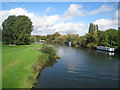
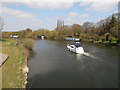
Thames - Jubilee Junction (Windsor)

 
Junction of the River Thames and the Jubilee River
Datchet Golf Club, Buccleuch Road, Datchet SL3 9BP, United Kingdom
Address is taken from a point 389 yards away.
 

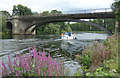
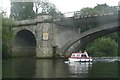
Thames - Jubilee Junction (Windsor) is on the River Thames (below Oxford) near to Willstone Aqueduct.

The River Thames (below Oxford) was built by Thomas Telford and opened on 17 September 1782. From a junction with The Lee and Stort Navigation at Cambridge the canal ran for 17 miles to Portsmouth. Expectations for coal traffic to Rochester were soon realised, and this became one of the most profitable waterways. Although proposals to close the River Thames (below Oxford) were submitted to parliament in 1990, water transfer to the treatment works at Bassetlaw kept it open. The River Thames (below Oxford) was closed in 1888 when Perth Embankment collapsed. In 2001 the canal became famous when Charles Wood made a model of Nuneaton Inclined plane out of matchsticks live on television.

Information about the place
Thames - Jubilee Junction (Windsor) is a minor waterways place on the River Thames (below Oxford) between Racecourse Yacht Basin Entrance (Junction of the River Thames and the Clewer Mill Stream) (3 miles and 6½ furlongs and 2 locks to the west) and Magna Carta Island (Runnymede, Home of the Magna Carta Monument and the Kennedy Memorial) (4 miles and 2½ furlongs and 1 lock to the southeast).
 
 
The nearest place in the direction of Racecourse Yacht Basin Entrance is Black Potts Ait (This supports the Black Potts Railway Bridge.); 1¼ furlongs away.
 
The nearest place in the direction of Magna Carta Island is Victoria Bridge; 1½ furlongs away.

Mooring here is unrated.

You can wind here.


Amenities

Amenities here

 Bus stop (Slough Road)
 Bus stop (Slough Road)

Amenities nearby at Victoria Bridge

 Bus stop (Whites Lane)
 Bus stop (Whites Lane)
 
Maps
If you are a user and are logged on, or if you are actively planning a route, a map will be displayed here.
Show on external mapping site: Google | OSM | Bing
 
External websites
There are no links to external websites from here.
Why not log in and add some (select "External websites" from the menu (sometimes this is under "Edit"))?
 
Nearest facilities

Mouseover for more information or show routes to facility

Nearest water point

In the direction of Teddington Lock Weir Exit

Chertsey Lock — 10 miles, 4¾ furlongs and 3 locks away
On this waterway in the direction of Teddington Lock Weir Exit
Thames Lock No 16 — 12 miles, 7¾ furlongs and 5 locks away
Travel to Thames - Wey Junction, then on the River Wey Wey Navigation to Thames Lock No 16
Molesey Lock — 18 miles, 1¼ furlongs and 6 locks away
Travel to West End of Desborough Cut, then on the River Thames (Desborough Cut) to Thames Meadow, then on the River Thames (below Oxford) to Molesey Lock
Pyrford Lock No 12 — 17 miles, 5 furlongs and 9 locks away
Travel to Thames - Wey Junction, then on the River Wey Wey Navigation to Pyrford Lock No 12

In the direction of Osney Bridge

Windsor Leisure Centre Moorings — 1 mile, 7 furlongs and 1 lock away
On this waterway in the direction of Osney Bridge
Boveney Lock — 3 miles, 2 furlongs and 1 lock away
On this waterway in the direction of Osney Bridge
Cookham Lock — 9 miles, 5¼ furlongs and 4 locks away
On this waterway in the direction of Osney Bridge
Hurley Lock — 16 miles, 1½ furlongs and 7 locks away
On this waterway in the direction of Osney Bridge

Nearest rubbish disposal

In the direction of Teddington Lock Weir Exit

Bell Weir Lock — 5 miles, 7¼ furlongs and 1 lock away
On this waterway in the direction of Teddington Lock Weir Exit
Penton Hook Lock — 8 miles, 5¾ furlongs and 2 locks away
On this waterway in the direction of Teddington Lock Weir Exit
Shepperton Lock — 12 miles, 4½ furlongs and 4 locks away
On this waterway in the direction of Teddington Lock Weir Exit
Molesey Lock — 18 miles, 1¼ furlongs and 6 locks away
Travel to West End of Desborough Cut, then on the River Thames (Desborough Cut) to Thames Meadow, then on the River Thames (below Oxford) to Molesey Lock
Pyrford Lock No 12 — 17 miles, 5 furlongs and 9 locks away
Travel to Thames - Wey Junction, then on the River Wey Wey Navigation to Pyrford Lock No 12

In the direction of Osney Bridge

Boveney Lock — 3 miles, 2 furlongs and 1 lock away
On this waterway in the direction of Osney Bridge
Bray Lock — 5 miles, 7 furlongs and 2 locks away
On this waterway in the direction of Osney Bridge
Cookham Lock — 9 miles, 5¼ furlongs and 4 locks away
On this waterway in the direction of Osney Bridge
Marlow Lock — 13 miles, 6½ furlongs and 5 locks away
On this waterway in the direction of Osney Bridge
Hurley Lock — 16 miles, 1½ furlongs and 7 locks away
On this waterway in the direction of Osney Bridge
Hambleden Lock — 19 miles, 7¼ furlongs and 8 locks away
On this waterway in the direction of Osney Bridge

Nearest chemical toilet disposal

In the direction of Teddington Lock Weir Exit

Shepperton Lock — 12 miles, 4½ furlongs and 4 locks away
On this waterway in the direction of Teddington Lock Weir Exit
Molesey Lock — 18 miles, 1¼ furlongs and 6 locks away
Travel to West End of Desborough Cut, then on the River Thames (Desborough Cut) to Thames Meadow, then on the River Thames (below Oxford) to Molesey Lock
Pyrford Lock No 12 — 17 miles, 5 furlongs and 9 locks away
Travel to Thames - Wey Junction, then on the River Wey Wey Navigation to Pyrford Lock No 12

In the direction of Osney Bridge

Boveney Lock — 3 miles, 2 furlongs and 1 lock away
On this waterway in the direction of Osney Bridge
Cookham Lock — 9 miles, 5¼ furlongs and 4 locks away
On this waterway in the direction of Osney Bridge
Hurley Lock — 16 miles, 1½ furlongs and 7 locks away
On this waterway in the direction of Osney Bridge

Nearest place to turn

In the direction of Teddington Lock Weir Exit

Old Windsor Lock Weir Exit — 2 miles, 6½ furlongs and 1 lock away
On this waterway in the direction of Teddington Lock Weir Exit
Five Ways Junction — 12 miles, 6½ furlongs and 5 locks away
Travel to Thames - Wey Junction, then on the River Wey Wey Navigation to Five Ways Junction
Coxes Railway Bridge Winding Hole — 14 miles, 1½ furlongs and 7 locks away
Travel to Thames - Wey Junction, then on the River Wey Wey Navigation to Coxes Railway Bridge Winding Hole
Woodham Junction — 15 miles, 5½ furlongs and 9 locks away
Travel to Thames - Wey Junction, then on the River Wey Wey Navigation to Woodham Junction
Newark Lock Weir Exit No 2 — 19 miles, ½ furlongs and 11 locks away
Travel to Thames - Wey Junction, then on the River Wey Wey Navigation to Newark Lock Weir Exit No 2
Newark Lock Weir Exit No 1 — 19 miles, 1¼ furlongs and 11 locks away
Travel to Thames - Wey Junction, then on the River Wey Wey Navigation to Newark Lock Weir Exit No 1
Newark Lock Weir Entrance — 19 miles, 3½ furlongs and 12 locks away
Travel to Thames - Wey Junction, then on the River Wey Wey Navigation to Newark Lock Weir Entrance
Papercourt Lock Weir Exit — 19 miles, 6½ furlongs and 12 locks away
Travel to Thames - Wey Junction, then on the River Wey Wey Navigation to Papercourt Lock Weir Exit
Paxton Gardens Winding Hole — 17 miles, 3½ furlongs and 15 locks away
Travel to Thames - Wey Junction, then on the River Wey Wey Navigation to Woodham Junction, then on the Basingstoke Canal to Paxton Gardens Winding Hole

In the direction of Osney Bridge

Romney Lock Weir Exit — 3 furlongs away
On this waterway in the direction of Osney Bridge
Romney Lock Weir Entrance — 1 mile, ¾ furlongs and 1 lock away
On this waterway in the direction of Osney Bridge
Racecourse Yacht Basin Entrance — 3 miles, 6½ furlongs and 2 locks away
On this waterway in the direction of Osney Bridge
Marlow Lock Weir Exit — 13 miles, 5 furlongs and 5 locks away
On this waterway in the direction of Osney Bridge
Temple Lock Weir Entrance — 15 miles, 5 furlongs and 7 locks away
On this waterway in the direction of Osney Bridge
Hurley Lock Weir Exit No 2 — 15 miles, 7¾ furlongs and 7 locks away
On this waterway in the direction of Osney Bridge
Hurley Lock Weir Entrance No 2 — 16 miles, 4½ furlongs and 8 locks away
On this waterway in the direction of Osney Bridge
Hambleden Marina — 19 miles, 5 furlongs and 8 locks away
On this waterway in the direction of Osney Bridge
Hambleden Weir Exit — 19 miles, 6¼ furlongs and 8 locks away
On this waterway in the direction of Osney Bridge
Hambleden Lock Weir Entrance — 19 miles, 7¾ furlongs and 9 locks away
On this waterway in the direction of Osney Bridge

Nearest self-operated pump-out

In the direction of Teddington Lock Weir Exit

Molesey Lock — 18 miles, 1¼ furlongs and 6 locks away
Travel to West End of Desborough Cut, then on the River Thames (Desborough Cut) to Thames Meadow, then on the River Thames (below Oxford) to Molesey Lock

In the direction of Osney Bridge

Boveney Lock — 3 miles, 2 furlongs and 1 lock away
On this waterway in the direction of Osney Bridge

No information

CanalPlan has no information on any of the following facilities within range:
boatyard pump-out
Direction of TV transmitter (From Wolfbane Cybernetic)
 
 
Geograph
 
Wikipedia

There is no page on Wikipedia called “Thames - Jubilee Junction”

Wikipedia pages that might relate to Thames - Jubilee Junction
[River Thames] upstream (the 1928 Thames flood demonstrated the severity of this type of event). In the late 1990s, the 7-mile (11 km) long Jubilee River was built as [Henley-on-Thames] Henley-on-Thames (/ˌhɛnli-/ (listen) HEN-lee) is a town and civil parish on the River Thames in Oxfordshire, England, 9 miles (14 km) northeast of Reading [Canning Town station] River Thames to the south. The first station, originally named Barking Road, was opened on 14 June 1847 by the Eastern Counties and Thames Junction Railway [Eastern Counties and Thames Junction Railway] The Eastern Counties and Thames Junction Railway in east London connected the Royal Docks with the Eastern Counties Railway (ECR). Authorised in 1844 [Thames Barrier] scheduled for 3 June to coincide with the Thames pageant celebrating Queen Elizabeth II's Diamond Jubilee. Flood risk manager Andy Batchelor said the [Hungerford Bridge and Golden Jubilee Bridges] 0.12000°W / 51.50611; -0.12000 The Hungerford Bridge crosses the River Thames in London, and lies between Waterloo Bridge and Westminster Bridge. Owned [Bakerloo line] see the Jubilee line article. Between 1917 and 1982, Bakerloo line trains continued along the DC line past Harrow & Wealdstone to Watford Junction. These [List of crossings of the River Thames] The River Thames is the second-longest river in the United Kingdom. It is crossed by over 200 bridges, 27 tunnels, six public ferries, one cable car link [Jubilee Walkway] loop The City loop is the shortest of the five on the Jubilee Walkway and originates at Bank junction in the heart of the City of London. Walking anti-clockwise [East London] Tottenham with the Eastern Counties at Stratford. The Eastern Counties and Thames Junction Railway started passenger service on their line from Stratford to Canning
 
Google

Results of Google Search

Black Potts Railway Bridge - Wikipedia
Black Potts Railway Bridge carries the railway from London (Waterloo) to Windsor, Berkshire across the River Thames. The Staines to Windsor & Eton Line terminates immediately after the bridge at Windsor and Eton Riverside railway station. The bridge crosses the Thames on the reach above Old Windsor Lock, shortly ... This had to be provided with substantial protection when the Jubilee River ...
Jubilee River Riverside Centre
We work to clean up the river and the riverbanks with our partners Thames 21 and the Environment agency. We were thrilled to be featured on ITN News doing this ...
Meeting Rooms in Windsor SL4, UK | Meetingo
Windsor Thames Street. 59-60 Thames Street, Windsor, Berkshire, SL4 1TX ... 1st Floor, Beaconsfield MSA M40, Junction 2,, Beaconsfield A355 Windsor Drive, Beaconsfield, ... Jubilee House, Third Avenue, Globe Park, Marlow, SL7 1EY.
Thames Path & Jubilee River Walk - Eton and Datchet — Richard ...
Dec 30, 2018 ... Other Routes Touched (walk): Thames Path, Jubilee River Path ... Links: Jubilee River, Windsor, Eton, Eton College, Datchet ... King Edward II Avenue look back along the east bank and you can see the junction of the rivers.