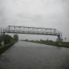
Rawcliffe Pipe Bridge
Paper Mill Road, Rawcliffe Bridge DN14 8SJ, United Kingdom
Address is taken from a point 265 yards away.

Rawcliffe Pipe Bridge
is a minor waterways place
on the Aire and Calder Navigation (Main Line - Goole to Castleford) between
Ouse - Aire and Calder Junction (Junction of the River Ouse (Yorkshire) with the Aire and Calder Navigation.) (3 miles and 1 furlong
and 1 lock
to the east) and
Sykehouse Junction (Junction of Aire and Calder (Main Line) and Sheffield and South Yorkshire New Junction Canal) (4 miles and ½ furlongs
to the west).
The nearest place in the direction of Ouse - Aire and Calder Junction is Rawcliffe Bridge Aqueduct No 1;
3 furlongs
away.
The nearest place in the direction of Sykehouse Junction is Rawcliffe Bridge Wharf;
¾ furlongs
away.
Mooring here is unrated.
There is a bridge here which takes a pipe over the canal.
| Doncaster Line Railway Bridge | 1 mile, 7 furlongs | |
| Doncaster Line Narrows | 1 mile, 6 furlongs | |
| Rawcliffe Bridge Aqueduct No 3 | 1 mile, ¾ furlongs | |
| Rawcliffe Bridge Aqueduct No 2 | 4¾ furlongs | |
| Rawcliffe Bridge Aqueduct No 1 | 3 furlongs | |
| Rawcliffe Pipe Bridge | ||
| Rawcliffe Bridge Wharf | ¾ furlongs | |
| Rawcliffe Bridge | 2 furlongs | |
| M62 - M18 Motorway Bridge No 22 | 1 mile, 2½ furlongs | |
| New Bridge (Aire and Calder Navigation) | 2 miles, 2½ furlongs | |
| New Bridge Aqueduct | 2 miles, 3¼ furlongs | |
There are no links to external websites from here.
Why not log in and add some (select "External websites" from the menu (sometimes this is under "Edit"))?
Mouseover for more information or show routes to facility
Nearest water point
In the direction of Castleford Junction
Pollington Visitor Mooring — 6 miles, 1 furlong away
On this waterway in the direction of Castleford Junction
Pollington Manor Swing Bridge — 6 miles, 1½ furlongs away
On this waterway in the direction of Castleford Junction
Bramwith Lock No 14 — 9 miles, 6¾ furlongs and 1 lock away
Travel to Sykehouse Junction, then on the Sheffield and South Yorkshire Navigation (New Junction Canal) to Bramwith Junction, then on the Sheffield and South Yorkshire Navigation (Bramwith to Stainforth) to Bramwith Lock No 14
Whitley Lock No 12 — 9 miles, 7½ furlongs and 1 lock away
On this waterway in the direction of Castleford Junction
Barnby Dun Lift Bridge — 10 miles, 5 furlongs and 1 lock away
Travel to Sykehouse Junction, then on the Sheffield and South Yorkshire Navigation (New Junction Canal) to Bramwith Junction, then on the Sheffield and South Yorkshire Navigation (Main Line) to Barnby Dun Lift Bridge
Bramwith Swing Bridge — 10 miles, 1½ furlongs and 2 locks away
Travel to Sykehouse Junction, then on the Sheffield and South Yorkshire Navigation (New Junction Canal) to Bramwith Junction, then on the Sheffield and South Yorkshire Navigation (Bramwith to Stainforth) to Bramwith Swing Bridge
Long Sandall Lock No 13 — 12 miles, 6½ furlongs and 1 lock away
Travel to Sykehouse Junction, then on the Sheffield and South Yorkshire Navigation (New Junction Canal) to Bramwith Junction, then on the Sheffield and South Yorkshire Navigation (Main Line) to Long Sandall Lock No 13
Bank Dole Lock No 1 — 14 miles, ¾ furlongs and 2 locks away
Travel to Bank Dole Junction, then on the Aire and Calder Navigation (Selby Section) to Bank Dole Lock No 1
Thorne Visitor Moorings — 14 miles, 4 furlongs and 3 locks away
Travel to Sykehouse Junction, then on the Sheffield and South Yorkshire Navigation (New Junction Canal) to Bramwith Junction, then on the Sheffield and South Yorkshire Navigation (Bramwith to Stainforth) to Stainforth Junction, then on the Sheffield and South Yorkshire Navigation (Stainforth and Keadby Canal) to Thorne Visitor Moorings
Ferrybridge Flood Lock No 11 — 15 miles, 3¼ furlongs and 2 locks away
On this waterway in the direction of Castleford Junction
Doncaster Visitor Pontoon Moorings — 15 miles, 7¾ furlongs and 2 locks away
Travel to Sykehouse Junction, then on the Sheffield and South Yorkshire Navigation (New Junction Canal) to Bramwith Junction, then on the Sheffield and South Yorkshire Navigation (Main Line) to Doncaster Visitor Pontoon Moorings
Ferrybridge Flood Lock Footbridge — 15 miles, 3¾ furlongs and 3 locks away
On this waterway in the direction of Castleford Junction
Doncaster Town Lock No 12 — 16 miles, 2¼ furlongs and 2 locks away
Travel to Sykehouse Junction, then on the Sheffield and South Yorkshire Navigation (New Junction Canal) to Bramwith Junction, then on the Sheffield and South Yorkshire Navigation (Main Line) to Doncaster Town Lock No 12
Beal Bridge — 16 miles, 3¼ furlongs and 3 locks away
Travel to Bank Dole Junction, then on the Aire and Calder Navigation (Selby Section) to Beal Bridge
Beal Lock No 2 — 16 miles, 4½ furlongs and 3 locks away
Travel to Bank Dole Junction, then on the Aire and Calder Navigation (Selby Section) to Beal Lock No 2
Sprotbrough Lock No 11 — 19 miles, 4¼ furlongs and 3 locks away
Travel to Sykehouse Junction, then on the Sheffield and South Yorkshire Navigation (New Junction Canal) to Bramwith Junction, then on the Sheffield and South Yorkshire Navigation (Main Line) to Sprotbrough Lock No 11
In the direction of Ouse - Aire and Calder Junction
Dutch Riverside — 2 miles, 1 furlong away
On this waterway in the direction of Ouse - Aire and Calder Junction
Goole Marina — 2 miles, 2½ furlongs away
On this waterway in the direction of Ouse - Aire and Calder Junction
Selby Basin — 19 miles, 3½ furlongs and 2 locks away
Travel to Ouse - Aire and Calder Junction, then on the River Ouse : Yorkshire (tidal section - Naburn to Goole) to Selby Junction (River Ouse), then on the Aire and Calder Navigation (Selby Section) to Selby BasinNearest rubbish disposal
In the direction of Castleford Junction
Whitley Lock No 12 — 9 miles, 7½ furlongs and 1 lock away
On this waterway in the direction of Castleford Junction
Barnby Dun Lift Bridge — 10 miles, 5 furlongs and 1 lock away
Travel to Sykehouse Junction, then on the Sheffield and South Yorkshire Navigation (New Junction Canal) to Bramwith Junction, then on the Sheffield and South Yorkshire Navigation (Main Line) to Barnby Dun Lift Bridge
Bramwith Swing Bridge — 10 miles, 1½ furlongs and 2 locks away
Travel to Sykehouse Junction, then on the Sheffield and South Yorkshire Navigation (New Junction Canal) to Bramwith Junction, then on the Sheffield and South Yorkshire Navigation (Bramwith to Stainforth) to Bramwith Swing Bridge
Thorne Visitor Moorings — 14 miles, 4 furlongs and 3 locks away
Travel to Sykehouse Junction, then on the Sheffield and South Yorkshire Navigation (New Junction Canal) to Bramwith Junction, then on the Sheffield and South Yorkshire Navigation (Bramwith to Stainforth) to Stainforth Junction, then on the Sheffield and South Yorkshire Navigation (Stainforth and Keadby Canal) to Thorne Visitor Moorings
Doncaster Visitor Pontoon Moorings — 15 miles, 7¾ furlongs and 2 locks away
Travel to Sykehouse Junction, then on the Sheffield and South Yorkshire Navigation (New Junction Canal) to Bramwith Junction, then on the Sheffield and South Yorkshire Navigation (Main Line) to Doncaster Visitor Pontoon Moorings
In the direction of Ouse - Aire and Calder Junction
Dutch Riverside — 2 miles, 1 furlong away
On this waterway in the direction of Ouse - Aire and Calder Junction
Goole Marina — 2 miles, 2½ furlongs away
On this waterway in the direction of Ouse - Aire and Calder Junction
Selby Basin — 19 miles, 3½ furlongs and 2 locks away
Travel to Ouse - Aire and Calder Junction, then on the River Ouse : Yorkshire (tidal section - Naburn to Goole) to Selby Junction (River Ouse), then on the Aire and Calder Navigation (Selby Section) to Selby BasinNearest chemical toilet disposal
In the direction of Castleford Junction
Whitley Lock No 12 — 9 miles, 7½ furlongs and 1 lock away
On this waterway in the direction of Castleford Junction
Barnby Dun Lift Bridge — 10 miles, 5 furlongs and 1 lock away
Travel to Sykehouse Junction, then on the Sheffield and South Yorkshire Navigation (New Junction Canal) to Bramwith Junction, then on the Sheffield and South Yorkshire Navigation (Main Line) to Barnby Dun Lift Bridge
Bramwith Swing Bridge — 10 miles, 1½ furlongs and 2 locks away
Travel to Sykehouse Junction, then on the Sheffield and South Yorkshire Navigation (New Junction Canal) to Bramwith Junction, then on the Sheffield and South Yorkshire Navigation (Bramwith to Stainforth) to Bramwith Swing Bridge
Thorne Visitor Moorings — 14 miles, 4 furlongs and 3 locks away
Travel to Sykehouse Junction, then on the Sheffield and South Yorkshire Navigation (New Junction Canal) to Bramwith Junction, then on the Sheffield and South Yorkshire Navigation (Bramwith to Stainforth) to Stainforth Junction, then on the Sheffield and South Yorkshire Navigation (Stainforth and Keadby Canal) to Thorne Visitor Moorings
In the direction of Ouse - Aire and Calder Junction
Dutch Riverside — 2 miles, 1 furlong away
On this waterway in the direction of Ouse - Aire and Calder Junction
Goole Marina — 2 miles, 2½ furlongs away
On this waterway in the direction of Ouse - Aire and Calder Junction
Selby Basin — 19 miles, 3½ furlongs and 2 locks away
Travel to Ouse - Aire and Calder Junction, then on the River Ouse : Yorkshire (tidal section - Naburn to Goole) to Selby Junction (River Ouse), then on the Aire and Calder Navigation (Selby Section) to Selby BasinNearest place to turn
In the direction of Castleford Junction
Huddle Grounds Winding Hole — 12 miles, ¾ furlongs and 2 locks away
Travel to Sykehouse Junction, then on the Sheffield and South Yorkshire Navigation (New Junction Canal) to Bramwith Junction, then on the Sheffield and South Yorkshire Navigation (Bramwith to Stainforth) to Stainforth Junction, then on the Sheffield and South Yorkshire Navigation (Stainforth and Keadby Canal) to Huddle Grounds Winding Hole
Wheatley Hall Road Winding Hole — 13 miles, 7 furlongs and 2 locks away
Travel to Sykehouse Junction, then on the Sheffield and South Yorkshire Navigation (New Junction Canal) to Bramwith Junction, then on the Sheffield and South Yorkshire Navigation (Main Line) to Wheatley Hall Road Winding Hole
Bank Dole Lock Junction — 14 miles, 1 furlong and 3 locks away
Travel to Bank Dole Junction, then on the Aire and Calder Navigation (Selby Section) to Bank Dole Lock Junction
Gas House Bight — 15 miles, 6¼ furlongs and 2 locks away
Travel to Sykehouse Junction, then on the Sheffield and South Yorkshire Navigation (New Junction Canal) to Bramwith Junction, then on the Sheffield and South Yorkshire Navigation (Main Line) to Gas House Bight
Doncaster Visitor Pontoon Moorings — 15 miles, 7¾ furlongs and 2 locks away
Travel to Sykehouse Junction, then on the Sheffield and South Yorkshire Navigation (New Junction Canal) to Bramwith Junction, then on the Sheffield and South Yorkshire Navigation (Main Line) to Doncaster Visitor Pontoon Moorings
Beal Lock No 2 Weir Entrance — 16 miles, 3½ furlongs and 3 locks away
Travel to Bank Dole Junction, then on the Aire and Calder Navigation (Selby Section) to Beal Lock No 2 Weir Entrance
Sprotbrough Lock Weir Exit — 19 miles, 3¾ furlongs and 3 locks away
Travel to Sykehouse Junction, then on the Sheffield and South Yorkshire Navigation (New Junction Canal) to Bramwith Junction, then on the Sheffield and South Yorkshire Navigation (Main Line) to Sprotbrough Lock Weir Exit
In the direction of Ouse - Aire and Calder Junction
Viking Marina — 2 miles, 1¾ furlongs away
On this waterway in the direction of Ouse - Aire and Calder Junction
River Foulness Junction — 17 miles, 2½ furlongs and 2 locks away
Travel to Ouse - Aire and Calder Junction, then on the River Ouse : Yorkshire (tidal section - Goole to Trent Falls) to Trent Falls, then on the River Humber to Humber - Market Weighton Junction, then on the Market Weighton Canal to River Foulness Junction
Selby Basin — 19 miles, 3½ furlongs and 2 locks away
Travel to Ouse - Aire and Calder Junction, then on the River Ouse : Yorkshire (tidal section - Naburn to Goole) to Selby Junction (River Ouse), then on the Aire and Calder Navigation (Selby Section) to Selby BasinNearest self-operated pump-out
In the direction of Castleford Junction
Long Sandall Lock No 13 — 12 miles, 6½ furlongs and 1 lock away
Travel to Sykehouse Junction, then on the Sheffield and South Yorkshire Navigation (New Junction Canal) to Bramwith Junction, then on the Sheffield and South Yorkshire Navigation (Main Line) to Long Sandall Lock No 13Nearest boatyard pump-out
In the direction of Castleford Junction
Thorne Swing Bridge — 14 miles, 4½ furlongs and 3 locks away
Travel to Sykehouse Junction, then on the Sheffield and South Yorkshire Navigation (New Junction Canal) to Bramwith Junction, then on the Sheffield and South Yorkshire Navigation (Bramwith to Stainforth) to Stainforth Junction, then on the Sheffield and South Yorkshire Navigation (Stainforth and Keadby Canal) to Thorne Swing Bridge
Blue Water Marina — 15 miles, 1½ furlongs and 3 locks away
Travel to Sykehouse Junction, then on the Sheffield and South Yorkshire Navigation (New Junction Canal) to Bramwith Junction, then on the Sheffield and South Yorkshire Navigation (Bramwith to Stainforth) to Stainforth Junction, then on the Sheffield and South Yorkshire Navigation (Stainforth and Keadby Canal) to Blue Water Marina
In the direction of Ouse - Aire and Calder Junction
Goole Marina — 2 miles, 2½ furlongs away
On this waterway in the direction of Ouse - Aire and Calder JunctionDirection of TV transmitter (From Wolfbane Cybernetic)
There is no page on Wikipedia called “Rawcliffe Pipe Bridge”
Wikipedia pages that might relate to Rawcliffe Pipe Bridge
[River Don, Yorkshire]
Abyssinia Bridge crossed the river at the same place as the current Amberley Street footbridge. There are three bridges (two road and one pipe) in that
[River Don Navigation]
businesses. Downstream of this bridge are 3 pipe bridges. Called “Rotherham Rawmarsh Road Bridge 39” by British Waterways, this bridge carries the A633 Rotherham
[Norwich Castle]
164 Pevsner 1997, pp. 256–260 Warren 1973, p. 135 Wareham 1994, p. 241 Rawcliffe & Wilson 2006, p. 42 Skinner 2003, p. 30 Renn 1968, p. 262 Howard, John
[Thomas Fitzalan, 5th Earl of Arundel]
& Roskell 1975, p. 61; Curry 2006, pp. 122–3; Mortimer 2009, p. 560. Rawcliffe 1999, p. 182; Nicolas 1826, p. 186; Mortimer 2009, pp. 395–7. Bibliography
[All the Stations]
series published on YouTube, which sees couple Geoff Marshall and Vicki Pipe visit all 2,563 stations on Great Britain's National Rail rail network, and
[CLH Pipeline System]
pipeline such that the natural electrical action which takes place between pipe and soil leading to corrosion is reversed. Cathodic protection was applied
[Street light]
Publications. p. 117. ISBN 978-81-7017-053-2. Roskell, J. S. and Clark, L. and Rawcliffe, C. (editors) BARTON, Henry (d.1435), of London. - History of Parliament
[Lancaster Castle]
allegedly still containing the Gallows. The last execution (of Thomas Rawcliffe, wife-murderer) at Lancaster took place in 1910. The prison closed in
[Swinefleet Warping Drain]
over barren land, and to deposit the silt on its surface. He lived at Rawcliffe House in Goole, and was proably the first person in Yorkshire to carry
[Sheffield and South Yorkshire Navigation]
Doncaster as early as 1343, when a commission looked at the problems caused by bridges and weirs. It underwent major changes in the 1620s, when Cornelius Vermuyden