Booth Lock Winding Hole 
Kettle Lane, Slaithwaite Hall HD7 5XB, United Kingdom

Booth Lock Winding Hole
is a minor waterways place
on the Huddersfield Narrow Canal between
Railway Lock No 42E (Marsden. Eastern summit lock) (1 mile and ¾ furlongs
and 10 locks
to the southwest) and
Titanic Mill (Linthwaite) (2 miles and 4¾ furlongs
and 15 locks
to the east).
The nearest place in the direction of Railway Lock No 42E is Fishers Footbridge No 53;
1¾ furlongs
away.
The nearest place in the direction of Titanic Mill is Booth Lock No 31E;
¼ furlongs
away.
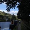
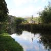
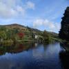
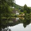
Mooring here is good (a nice place to moor).
You can wind here.
Sparth Lock No 33E | 3¼ furlongs | |
Pig Tail Bridge No 54 | 3 furlongs | |
Pig Tail Lock No 32E | 2½ furlongs | |
Sparth Reservoir Feeder | 2¼ furlongs | |
Fishers Footbridge No 53 | 1¾ furlongs | |
Booth Lock Winding Hole | ||
Booth Lock No 31E | ¼ furlongs | |
Booths Bridge No 52 | ¼ furlongs | |
Bank Nook Lock No 30E | 1½ furlongs | |
White Hill Lock No 29E | 2¾ furlongs | |
Booths Bank Bridge No 51 | 2¾ furlongs |
There are no links to external websites from here.
Why not log in and add some (select "External websites" from the menu (sometimes this is under "Edit"))?
Mouseover for more information or show routes to facility
Nearest water point
In the direction of Ashton-under-Lyne Junction
Standedge Tunnel (eastern entrance) — 1 mile, 6 furlongs and 11 locks away
On this waterway in the direction of Ashton-under-Lyne Junction
Standedge Tunnel (western entrance) — 5 miles and 11 locks away
On this waterway in the direction of Ashton-under-Lyne Junction
Wool Road Bridge No 70 — 6 miles, 7¾ furlongs and 20 locks away
On this waterway in the direction of Ashton-under-Lyne Junction
Grove Road Bridge No 96 — 12 miles, 7¾ furlongs and 35 locks away
On this waterway in the direction of Ashton-under-Lyne Junction
In the direction of Aspley Basin (Huddersfield)
Slaithwaite Winding Hole — 1 mile, 5 furlongs and 10 locks away
On this waterway in the direction of Aspley Basin (Huddersfield)
Waterside Lock No 21E — 1 mile, 5½ furlongs and 10 locks away
On this waterway in the direction of Aspley Basin (Huddersfield)
Aspley Basin (Huddersfield) — 6 miles, 3¼ furlongs and 31 locks away
On this waterway in the direction of Aspley Basin (Huddersfield)
Shepley Bridge Sanitary Station — 12 miles, 7¾ furlongs and 42 locks away
Travel to Aspley Basin (Huddersfield), then on the Huddersfield Broad Canal to Cooper Bridge Junction, then on the Calder and Hebble Navigation (Main Line) to Shepley Bridge Sanitary Station
Brighouse Basin — 12 miles, 1½ furlongs and 44 locks away
Travel to Aspley Basin (Huddersfield), then on the Huddersfield Broad Canal to Cooper Bridge Junction, then on the Calder and Hebble Navigation (Main Line) to Brighouse Basin
Salterhebble Sanitary Station — 16 miles, 3½ furlongs and 53 locks away
Travel to Aspley Basin (Huddersfield), then on the Huddersfield Broad Canal to Cooper Bridge Junction, then on the Calder and Hebble Navigation (Main Line) to Salterhebble Sanitary Station
Broad Cut Low Lock No 3 — 19 miles, 4¾ furlongs and 50 locks away
Travel to Aspley Basin (Huddersfield), then on the Huddersfield Broad Canal to Cooper Bridge Junction, then on the Calder and Hebble Navigation (Main Line) to Broad Cut Low Lock No 3
Salterhebble Junction — 16 miles, 4 furlongs and 54 locks away
Travel to Aspley Basin (Huddersfield), then on the Huddersfield Broad Canal to Cooper Bridge Junction, then on the Calder and Hebble Navigation (Main Line) to Salterhebble Junction
Sowerby Bridge Basin — 18 miles, 5¾ furlongs and 54 locks away
Travel to Aspley Basin (Huddersfield), then on the Huddersfield Broad Canal to Cooper Bridge Junction, then on the Calder and Hebble Navigation (Main Line) to Salterhebble Junction, then on the Calder and Hebble Navigation (Main Line) to Sowerby Bridge BasinNearest rubbish disposal
In the direction of Ashton-under-Lyne Junction
Wool Road Visitor Mooring — 7 miles and 20 locks away
On this waterway in the direction of Ashton-under-Lyne Junction
In the direction of Aspley Basin (Huddersfield)
Pickle Lock No 22E — 1 mile, 4½ furlongs and 9 locks away
On this waterway in the direction of Aspley Basin (Huddersfield)
Aspley Basin (Huddersfield) — 6 miles, 3¼ furlongs and 31 locks away
On this waterway in the direction of Aspley Basin (Huddersfield)
Shepley Bridge Sanitary Station — 12 miles, 7¾ furlongs and 42 locks away
Travel to Aspley Basin (Huddersfield), then on the Huddersfield Broad Canal to Cooper Bridge Junction, then on the Calder and Hebble Navigation (Main Line) to Shepley Bridge Sanitary Station
Brighouse Lower Basin Visitor Moorings — 12 miles, 1¼ furlongs and 43 locks away
Travel to Aspley Basin (Huddersfield), then on the Huddersfield Broad Canal to Cooper Bridge Junction, then on the Calder and Hebble Navigation (Main Line) to Brighouse Lower Basin Visitor Moorings
Horbury Basin Residential Moorings & Sanitary Station — 17 miles, 4¼ furlongs and 49 locks away
Travel to Aspley Basin (Huddersfield), then on the Huddersfield Broad Canal to Cooper Bridge Junction, then on the Calder and Hebble Navigation (Main Line) to Horbury Basin Residential Moorings & Sanitary Station
Salterhebble Sanitary Station — 16 miles, 3½ furlongs and 53 locks away
Travel to Aspley Basin (Huddersfield), then on the Huddersfield Broad Canal to Cooper Bridge Junction, then on the Calder and Hebble Navigation (Main Line) to Salterhebble Sanitary Station
Sowerby Bridge Basin — 18 miles, 5¾ furlongs and 54 locks away
Travel to Aspley Basin (Huddersfield), then on the Huddersfield Broad Canal to Cooper Bridge Junction, then on the Calder and Hebble Navigation (Main Line) to Salterhebble Junction, then on the Calder and Hebble Navigation (Main Line) to Sowerby Bridge BasinNearest chemical toilet disposal
In the direction of Ashton-under-Lyne Junction
Wool Road Bridge No 70 — 6 miles, 7¾ furlongs and 20 locks away
On this waterway in the direction of Ashton-under-Lyne Junction
Grove Road Bridge No 96 — 12 miles, 7¾ furlongs and 35 locks away
On this waterway in the direction of Ashton-under-Lyne Junction
In the direction of Aspley Basin (Huddersfield)
Pickle Lock No 22E — 1 mile, 4½ furlongs and 9 locks away
On this waterway in the direction of Aspley Basin (Huddersfield)
Waterside Lock No 21E — 1 mile, 5½ furlongs and 10 locks away
On this waterway in the direction of Aspley Basin (Huddersfield)
Aspley Basin (Huddersfield) — 6 miles, 3¼ furlongs and 31 locks away
On this waterway in the direction of Aspley Basin (Huddersfield)
Shepley Bridge Sanitary Station — 12 miles, 7¾ furlongs and 42 locks away
Travel to Aspley Basin (Huddersfield), then on the Huddersfield Broad Canal to Cooper Bridge Junction, then on the Calder and Hebble Navigation (Main Line) to Shepley Bridge Sanitary Station
Brighouse Basin — 12 miles, 1½ furlongs and 44 locks away
Travel to Aspley Basin (Huddersfield), then on the Huddersfield Broad Canal to Cooper Bridge Junction, then on the Calder and Hebble Navigation (Main Line) to Brighouse Basin
Savile Town Wharf and Basin (Dewsbury) — 16 miles, 3¼ furlongs and 46 locks away
Travel to Aspley Basin (Huddersfield), then on the Huddersfield Broad Canal to Cooper Bridge Junction, then on the Calder and Hebble Navigation (Main Line) to Dewsbury Arm Junction, then on the Calder and Hebble Navigation (Dewsbury Old Cut) to Savile Town Wharf and Basin (Dewsbury)
Horbury Basin Residential Moorings & Sanitary Station — 17 miles, 4¼ furlongs and 49 locks away
Travel to Aspley Basin (Huddersfield), then on the Huddersfield Broad Canal to Cooper Bridge Junction, then on the Calder and Hebble Navigation (Main Line) to Horbury Basin Residential Moorings & Sanitary Station
Salterhebble Sanitary Station — 16 miles, 3½ furlongs and 53 locks away
Travel to Aspley Basin (Huddersfield), then on the Huddersfield Broad Canal to Cooper Bridge Junction, then on the Calder and Hebble Navigation (Main Line) to Salterhebble Sanitary Station
Sowerby Bridge Basin — 18 miles, 5¾ furlongs and 54 locks away
Travel to Aspley Basin (Huddersfield), then on the Huddersfield Broad Canal to Cooper Bridge Junction, then on the Calder and Hebble Navigation (Main Line) to Salterhebble Junction, then on the Calder and Hebble Navigation (Main Line) to Sowerby Bridge BasinNearest place to turn
In the direction of Ashton-under-Lyne Junction
Standedge Tunnel End Winding Hole — 1 mile, 5¼ furlongs and 11 locks away
On this waterway in the direction of Ashton-under-Lyne Junction
Diggle Winding Hole — 5 miles, 2½ furlongs and 11 locks away
On this waterway in the direction of Ashton-under-Lyne Junction
Wool Road Winding Hole — 7 miles, ½ furlongs and 20 locks away
On this waterway in the direction of Ashton-under-Lyne Junction
Saddleworth Visitor Centre Winding Hole — 7 miles, 6½ furlongs and 22 locks away
On this waterway in the direction of Ashton-under-Lyne Junction
Manns Wharf Bridge Winding Hole — 9 miles, 1¼ furlongs and 24 locks away
On this waterway in the direction of Ashton-under-Lyne Junction
Roughtown Court Winding Hole — 10 miles, 2½ furlongs and 29 locks away
On this waterway in the direction of Ashton-under-Lyne Junction
Mossley Bottoms Winding Hole — 11 miles, 2¼ furlongs and 31 locks away
On this waterway in the direction of Ashton-under-Lyne Junction
Knowle Street Winding Hole — 15 miles, 2½ furlongs and 36 locks away
On this waterway in the direction of Ashton-under-Lyne Junction
In the direction of Aspley Basin (Huddersfield)
Slaithwaite Winding Hole — 1 mile, 5 furlongs and 10 locks away
On this waterway in the direction of Aspley Basin (Huddersfield)
Linthwaite Winding Hole — 2 miles, 5½ furlongs and 15 locks away
On this waterway in the direction of Aspley Basin (Huddersfield)
Isis Lock Winding Hole — 4 miles, 1¾ furlongs and 23 locks away
On this waterway in the direction of Aspley Basin (Huddersfield)
University Arm — 6 miles, 2½ furlongs and 31 locks away
On this waterway in the direction of Aspley Basin (Huddersfield)
Aspley Basin (Huddersfield) — 6 miles, 3¼ furlongs and 31 locks away
On this waterway in the direction of Aspley Basin (Huddersfield)
Anchor Street Winding Hole — 7 miles, ¼ furlongs and 31 locks away
Travel to Aspley Basin (Huddersfield), then on the Huddersfield Broad Canal to Anchor Street Winding Hole
New Road Winding Hole — 7 miles, 3½ furlongs and 31 locks away
Travel to Aspley Basin (Huddersfield), then on the Huddersfield Broad Canal to New Road Winding Hole
Deighton Road Bridge Winding Hole — 8 miles, 5¼ furlongs and 36 locks away
Travel to Aspley Basin (Huddersfield), then on the Huddersfield Broad Canal to Deighton Road Bridge Winding Hole
Cooper Bridge Junction — 9 miles, 7¼ furlongs and 40 locks away
Travel to Aspley Basin (Huddersfield), then on the Huddersfield Broad Canal to Cooper Bridge Junction
Battye Weir Entrance — 10 miles, 4¼ furlongs and 41 locks away
Travel to Aspley Basin (Huddersfield), then on the Huddersfield Broad Canal to Cooper Bridge Junction, then on the Calder and Hebble Navigation (Main Line) to Battye Weir Entrance
Shepley Bridge Marina — 13 miles and 42 locks away
Travel to Aspley Basin (Huddersfield), then on the Huddersfield Broad Canal to Cooper Bridge Junction, then on the Calder and Hebble Navigation (Main Line) to Shepley Bridge Marina
Brighouse Basin — 12 miles, 1½ furlongs and 44 locks away
Travel to Aspley Basin (Huddersfield), then on the Huddersfield Broad Canal to Cooper Bridge Junction, then on the Calder and Hebble Navigation (Main Line) to Brighouse BasinNearest self-operated pump-out
In the direction of Ashton-under-Lyne Junction
Wool Road Bridge No 70 — 6 miles, 7¾ furlongs and 20 locks away
On this waterway in the direction of Ashton-under-Lyne Junction
In the direction of Aspley Basin (Huddersfield)
Slaithwaite Winding Hole — 1 mile, 5 furlongs and 10 locks away
On this waterway in the direction of Aspley Basin (Huddersfield)Nearest boatyard pump-out
In the direction of Ashton-under-Lyne Junction
Portland Basin Arm — 18 miles, ½ furlongs and 43 locks away
Travel to Ashton-under-Lyne Junction, then on the Ashton Canal (Main Line) to Dukinfield Junction, then on the Peak Forest Canal (Lower) to Portland Basin Arm
In the direction of Aspley Basin (Huddersfield)
Aspley Basin (Huddersfield) — 6 miles, 3¼ furlongs and 31 locks away
On this waterway in the direction of Aspley Basin (Huddersfield)
Shepley Bridge Marina — 13 miles and 42 locks away
Travel to Aspley Basin (Huddersfield), then on the Huddersfield Broad Canal to Cooper Bridge Junction, then on the Calder and Hebble Navigation (Main Line) to Shepley Bridge Marina
Sowerby Bridge Basin — 18 miles, 5¾ furlongs and 54 locks away
Travel to Aspley Basin (Huddersfield), then on the Huddersfield Broad Canal to Cooper Bridge Junction, then on the Calder and Hebble Navigation (Main Line) to Salterhebble Junction, then on the Calder and Hebble Navigation (Main Line) to Sowerby Bridge BasinDirection of TV transmitter (From Wolfbane Cybernetic)
There is no page on Wikipedia called “Booth Lock Winding Hole”
Wikipedia pages that might relate to Booth Lock Winding Hole
[Huddersfield Narrow Canal]
inland waterway in northern England. It runs just under 20 miles (32 km) from Lock 1E at the rear of the University of Huddersfield campus, near Aspley Basin
[River Thames]
are called the Tideway, derived from its long tidal reach up to Teddington Lock. It rises at Thames Head in Gloucestershire, and flows into the North Sea
[East End of London]
philanthropist businessman, Edmund Hay Currie to use the money from the winding up of the Beaumont Trust, together with subscriptions to build a "People's
[The Shining (film)]
water and through mountains with the ease of a bird in flight. Below, on a winding mountain road, Jack's diminutive yellow Volkswagen journeys through a tree-lined
[Yamishibai: Japanese Ghost Stories]
watching?" The story ends with the mall closing, the carnival's music winding down, and the sound of laughter... 11 "Cuckoo Clock" "Hatodokei" (鳩時計)
[Timeline of historic inventions]
the Transistor?". 4 December 2013. "13 Sextillion & Counting: The Long & Winding Road to the Most Frequently Manufactured Human Artifact in History". 2
[List of Pawn Stars episodes]
Zeppelin album; an antique whistle collection; a Doonesbury cartoon; a self-winding clock. 476 26 "Cutting Edge Pawn" January 23, 2017 (2017-01-23) A pre-Revolutionary
[Grand Central Terminal]
Tracks 108 and 109. It was manufactured at an unknown time by the Self Winding Clock Company, which made several others in the terminal. The clock hung
[List of American Pickers episodes]
dealership, Town Crier flour, rocking chair, and a Western Union self-winding clock. Danielle calls with news about an ultimate prize: a 1937 Harley
[List of Knots Landing episodes]
confront him, Ackerman shoots himself in the head. 130 30 "The Long and Winding Road" Alexander Singer Joel J. Feigenbaum May 23, 1985 (1985-05-23) Greg
Results of Google Search
Booth Winding Hole and Lock 31E West Slaithwaite Huddersfield Narrow Canal Yorkshire. The Huddersfield Narrow Canal runs for 20 miles between ...
Booth winding hole. The winding hole at Booth (or Kettle), above Lock 31e. Lock 31e. Looking west from Lock 31e, Booth Lock. Lock 31e. Looking east from ...
This is a 7 Day Narrowboat Hire taking you to the Booth Lock Winding Hole ... This is a trip of 65 miles, 6½ furlongs and 118 locks from Bugsworth to Bugsworth .
May 13, 2016 ... Winding Hole, Curdworth Bottom Lock. Kingsbury ... Winding Hole downstream Woodside Lock ... Winding Hole - U/S Booth's Swing Bridge.
Jun 3, 2016 ... Winding Hole, Curdworth Bottom Lock. Kingsbury ... Winding Hole downstream Woodside Lock ... Winding Hole - U/S Booth's Swing Bridge.
Booth Lane Bottom Lock 69. Tetton Bridge 165. Booth Lane Bridge 164. Rumps Lock 70. Kinderton Arms. Cledford Bridge166. Winding Hole above King's Lock.