CanalPlanAC

High Meadow Aqueduct

 
Also known as: Norbury North Aqueduct
Norbury ST20 0FJ, United Kingdom
 
Information about the place
High Meadow Aqueduct is a minor waterways place on the Shropshire Union Canal (Birmingham and Liverpool Junction Canal - Main Line) between Gnosall Bridge No 35 (2 miles and 1¾ furlongs to the southeast) and Norbury Junction (Junction with former Newport Branch) (2 furlongs to the northwest).
 
It is part of Shelmore Embankment.
 
The nearest place in the direction of Gnosall Bridge No 35 is Norbury Road Aqueduct; 7 furlongs away.
 
The nearest place in the direction of Norbury Junction is Norbury Junction Visitor Moorings (south) (48 hour moorings); 1¼ furlongs away.

There may be access to the towpath here.

Mooring here is unrated.

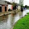
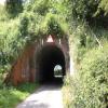
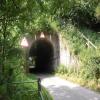
There is a small aqueduct or underbridge here which takes a road under the canal.


Amenities
 
Maps
If you are a user and are logged on, or if you are actively planning a route, a map will be displayed here.
Show on external mapping site: Google | OSM | Bing
 
Photos
 
External websites
There are no links to external websites from here.
Why not log in and add some (select "External websites" from the menu (sometimes this is under "Edit"))?
 
Nearest facilities

Mouseover for more information or show routes to facility

Nearest water point

In the direction of Autherley Junction

The Navigation Inn (Gnosall)2 miles, 1½ furlongs away
On this waterway in the direction of Autherley Junction
Wheaton Aston Services7 miles, 3¼ furlongs away
On this waterway in the direction of Autherley Junction
Autherley Stop Lock Water Point15 miles, 1¼ furlongs and 1 lock away
On this waterway in the direction of Autherley Junction
Broad Street Basin17 miles, 5 furlongs and 23 locks away
Travel to Autherley Junction, then on the Staffordshire and Worcestershire Canal (Main Line: Aldersley to Autherley) to Aldersley Junction, then on the Birmingham Canal Navigations (Main Line) to Broad Street Basin

In the direction of Nantwich Basin Entrance

Norbury Junction Services2 furlongs away
On this waterway in the direction of Nantwich Basin Entrance
Norbury Wharf Boatyard2¼ furlongs away
On this waterway in the direction of Nantwich Basin Entrance
Goldstone Bridge No 557 miles, 7 furlongs away
On this waterway in the direction of Nantwich Basin Entrance
Goldstone Wharf7 miles, 7¼ furlongs away
On this waterway in the direction of Nantwich Basin Entrance
Tyrley Wharf Services9 miles, 7¾ furlongs away
On this waterway in the direction of Nantwich Basin Entrance
Talbot Wharf Services11 miles, 3½ furlongs and 5 locks away
On this waterway in the direction of Nantwich Basin Entrance
Audlem Wharf17 miles, 3¼ furlongs and 22 locks away
On this waterway in the direction of Nantwich Basin Entrance
Audlem Water Point (below Lock No 25)17 miles, 4¼ furlongs and 23 locks away
On this waterway in the direction of Nantwich Basin Entrance
Overwater Marina18 miles, 2¼ furlongs and 25 locks away
On this waterway in the direction of Nantwich Basin Entrance

Nearest rubbish disposal

In the direction of Autherley Junction

Wheaton Aston Services7 miles, 3¼ furlongs away
On this waterway in the direction of Autherley Junction
Autherley Junction Bridge No 115 miles, 2 furlongs and 2 locks away
On this waterway in the direction of Autherley Junction
Wolverhampton Lock No 916 miles, 7½ furlongs and 14 locks away
Travel to Autherley Junction, then on the Staffordshire and Worcestershire Canal (Main Line: Aldersley to Autherley) to Aldersley Junction, then on the Birmingham Canal Navigations (Main Line) to Wolverhampton Lock No 9
Broad Street Basin17 miles, 5 furlongs and 23 locks away
Travel to Autherley Junction, then on the Staffordshire and Worcestershire Canal (Main Line: Aldersley to Autherley) to Aldersley Junction, then on the Birmingham Canal Navigations (Main Line) to Broad Street Basin

In the direction of Nantwich Basin Entrance

Norbury Wharf Boatyard2¼ furlongs away
On this waterway in the direction of Nantwich Basin Entrance
Tyrley Wharf Services9 miles, 7¾ furlongs away
On this waterway in the direction of Nantwich Basin Entrance
Audlem Wharf17 miles, 3¼ furlongs and 22 locks away
On this waterway in the direction of Nantwich Basin Entrance

Nearest chemical toilet disposal

In the direction of Autherley Junction

Wheaton Aston Services7 miles, 3¼ furlongs away
On this waterway in the direction of Autherley Junction
Broad Street Basin17 miles, 5 furlongs and 23 locks away
Travel to Autherley Junction, then on the Staffordshire and Worcestershire Canal (Main Line: Aldersley to Autherley) to Aldersley Junction, then on the Birmingham Canal Navigations (Main Line) to Broad Street Basin

In the direction of Nantwich Basin Entrance

Norbury Junction Services2 furlongs away
On this waterway in the direction of Nantwich Basin Entrance
Norbury Wharf Boatyard2¼ furlongs away
On this waterway in the direction of Nantwich Basin Entrance
Talbot Wharf Services11 miles, 3½ furlongs and 5 locks away
On this waterway in the direction of Nantwich Basin Entrance
Audlem Wharf17 miles, 3¼ furlongs and 22 locks away
On this waterway in the direction of Nantwich Basin Entrance
Overwater Marina18 miles, 2¼ furlongs and 25 locks away
On this waterway in the direction of Nantwich Basin Entrance

Nearest place to turn

In the direction of Autherley Junction

High Onn Wharf4 miles, 3¼ furlongs away
On this waterway in the direction of Autherley Junction
Wheaton Aston Winding Hole7 miles, 2¾ furlongs away
On this waterway in the direction of Autherley Junction
Stretton Boatyard8 miles, 7¾ furlongs and 1 lock away
On this waterway in the direction of Autherley Junction
Brewood Wharf10 miles and 1 lock away
On this waterway in the direction of Autherley Junction
Park Lodge Winding Hole11 miles, 4¼ furlongs and 1 lock away
On this waterway in the direction of Autherley Junction
Lower Hattons Winding Hole12 miles, 3¼ furlongs and 1 lock away
On this waterway in the direction of Autherley Junction
Pendeford Hall Lane Winding hole13 miles, 1¾ furlongs and 1 lock away
On this waterway in the direction of Autherley Junction
Autherley Junction15 miles, 2 furlongs and 2 locks away
On this waterway in the direction of Autherley Junction
Aldersley Junction15 miles, 6 furlongs and 2 locks away
Travel to Autherley Junction, then on the Staffordshire and Worcestershire Canal (Main Line: Aldersley to Autherley) to Aldersley Junction
Three Hammers Farm Winding Hole17 miles, 6¼ furlongs and 2 locks away
Travel to Autherley Junction, then on the Staffordshire and Worcestershire Canal (Main Line: Autherley to Great Haywood) to Three Hammers Farm Winding Hole
Slade Heath Winding Hole18 miles, 4 furlongs and 2 locks away
Travel to Autherley Junction, then on the Staffordshire and Worcestershire Canal (Main Line: Autherley to Great Haywood) to Slade Heath Winding Hole
Latherford Winding Hole19 miles, 7¾ furlongs and 2 locks away
Travel to Autherley Junction, then on the Staffordshire and Worcestershire Canal (Main Line: Autherley to Great Haywood) to Latherford Winding Hole

In the direction of Nantwich Basin Entrance

Norbury Junction2 furlongs away
On this waterway in the direction of Nantwich Basin Entrance
Norbury Wharf Boatyard2¼ furlongs away
On this waterway in the direction of Nantwich Basin Entrance
Grub Street Winding Hole1 mile, 7½ furlongs away
On this waterway in the direction of Nantwich Basin Entrance
Shebdon Winding Hole3 miles, 6½ furlongs away
On this waterway in the direction of Nantwich Basin Entrance
Park Heath Wharf5 miles, 6¼ furlongs away
On this waterway in the direction of Nantwich Basin Entrance
Goldstone Wharf7 miles, 7¼ furlongs away
On this waterway in the direction of Nantwich Basin Entrance
Talbot Wharf11 miles, 3¼ furlongs and 5 locks away
On this waterway in the direction of Nantwich Basin Entrance
Adderley Winding Hole14 miles, 3¼ furlongs and 5 locks away
On this waterway in the direction of Nantwich Basin Entrance

Nearest self-operated pump-out

In the direction of Autherley Junction

Wheaton Aston Services7 miles, 3¼ furlongs away
On this waterway in the direction of Autherley Junction

In the direction of Nantwich Basin Entrance

Talbot Wharf Services11 miles, 3½ furlongs and 5 locks away
On this waterway in the direction of Nantwich Basin Entrance
Overwater Marina18 miles, 2¼ furlongs and 25 locks away
On this waterway in the direction of Nantwich Basin Entrance

Nearest boatyard pump-out

In the direction of Autherley Junction

Brewood Wharf10 miles and 1 lock away
On this waterway in the direction of Autherley Junction
Autherley Wharf15 miles, 1½ furlongs and 1 lock away
On this waterway in the direction of Autherley Junction
Oxley Marine15 miles, 3 furlongs and 2 locks away
Travel to Autherley Junction, then on the Staffordshire and Worcestershire Canal (Main Line: Aldersley to Autherley) to Oxley Marine

In the direction of Nantwich Basin Entrance

Norbury Wharf Boatyard2¼ furlongs away
On this waterway in the direction of Nantwich Basin Entrance
Direction of TV transmitter (From Wolfbane Cybernetic)
 
 
Blog posts
It's downhill all the way from Scribblings from the Mintball posted Saturday the 27th of September, 2014
 
Geograph
 
Wikipedia

There is no page on Wikipedia called “High Meadow Aqueduct”

Wikipedia pages that might relate to High Meadow Aqueduct
[Croton Aqueduct] The Croton Aqueduct or Old Croton Aqueduct was a large and complex water distribution system constructed for New York City between 1837 and 1842. The [Water-meadow] Irrigation could be provided separately for each section of water-meadow. Sometimes aqueducts took carriers over drains, and causeways and culverts provided [Hetch Hetchy] – a "sheep-grazing free-for-all [that] threatened to denude the High Sierra meadows" – before disputes over state and private properties in respect to [Marple Aqueduct] Marple Aqueduct (also known as Goyt Aqueduct) at Marple, Greater Manchester, in north-west England was built to carry the lower level of the Peak Forest [Sheep Meadow] topsoil. Sheep Meadow was the most expensive project within the park. It was the largest meadow in Central Park until the old Croton Aqueduct collecting reservoir [California water wars] realized that water could flow from Owens Valley to Los Angeles via an aqueduct. The aqueduct construction was overseen by William Mulholland and was finished [Lutetia] or "swamp" and which survives today in the Scottish Gaelic lòn ("pool, meadow") and the Breton loudour ("dirty"). Archaeological excavations between 1994 [Sunken Meadow State Park] Sunken Meadow State Park, also known as Governor Alfred E. Smith State Park, is a 1,287-acre (5.21 km2) state park located in the Town of Smithtown in [Cicada (horse)] Cicada was bred by Christopher Chenery's Meadow Stud. A bay filly standing 15.2 hands (62 inches, 157 cm) high, she was by Bryan G. and out of Satsuma [River Blackwater (River Loddon)] local flow opposite is Willow Park Fishery. The river passes under an aqueduct carrying the Basingstoke Canal, and is then bordered by Lakeside Nature
 
Google

Results of Google Search

3320 High Meadow Dr, Mesquite, TX 75181 - realtor.com®
Browse photos and price history of this 4 bed, 3 bath, 2160 Sq. Ft. recently sold home at 3320 High Meadow Dr, Mesquite, TX 75181 that sold on October 13, ...
Earth Day Ecochallenge at High Meadow School | Hudson Valley One
May 8, 2020 ... The Ecochallenge team from High Meadow School in Stone Ridge won plaudits for its 30-day environmental and social engagement virtual ...
High Meadow - Farmington Valley Health District
High Meadow 311 North Granby Road Granby, CT Current Rating: Good ​2020. Good- 06/25 2019. Good - 05/10 2018. Good - 05/31 2017. Good - 08/08 2016
Hetch Hetchy - Wikipedia
Hetch Hetchy is the name of a valley, a reservoir and a water system in California in the United ... Before damming, the high granite formations produced a valley with an average ... and Hetch Hetchy Dome divided the former meadow in two distinct sections. ... Note that map above only shows Bay Area portion of aqueduct.
311 High Meadow Dr, Spencer, TN 38585 | Zillow
The property 311 High Meadow Dr, Spencer, TN 38585 is currently not for sale on Zillow. View details, sales history and Zestimate data for this property on ...
Newt Altars - Risk of Rain 2 Wiki
Abandoned AqueductEdit · 1. On a small cliff in the open desert area · 2. At the top of an aqueduct wall · 3. On a high ledge, under a skeleton head (Consistent ...
115 High Meadow Dr, Spencer, TN 38585 | Zillow
The property 115 High Meadow Dr, Spencer, TN 38585 is currently not for sale on Zillow. View details, sales history and Zestimate data for this property on ...
580 Aqueduct Ct, Simi Valley, CA 93065 | Redfin
4 beds, 3 baths, 2477 sq. ft. house located at 580 Aqueduct Ct, Simi Valley, CA 93065 sold for $1400000 on Dec ... 308 High Meadow St Simi Valley, CA 93065.
335 High Meadow Dr, Spencer, TN 38585 | Zillow
The property 335 High Meadow Dr, Spencer, TN 38585 is currently not for sale on Zillow. View details, sales history and Zestimate data for this property on ...