CanalPlanAC

Colne Bridge No 3

 
Colne Bridge Road, Bog Green HD5 0RH, United Kingdom (B6118)
 
Information about the place
Colne Bridge No 3 is a minor waterways place on the Huddersfield Broad Canal between Cooper Bridge Junction (Junction of the Huddersfield Broad Canal and the Calder and Hebble Navigation) (3 furlongs and 2 locks to the north) and Turnbridge Lifting Bridge No17 (2 miles and 5 furlongs and 7 locks to the southwest).
 
 
The nearest place in the direction of Cooper Bridge Junction is Colne Bridge Lock No 2; ½ furlongs away.
 
The nearest place in the direction of Turnbridge Lifting Bridge No17 is Colne Bridge First Pipe Bridge; ¾ furlongs away.

There may be access to the towpath here.

Mooring here is unrated.

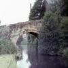
There is a bridge here which takes a road over the canal.


Amenities
 
Maps
If you are a user and are logged on, or if you are actively planning a route, a map will be displayed here.
Show on external mapping site: Google | OSM | Bing
 
Photos
 
External websites
There are no links to external websites from here.
Why not log in and add some (select "External websites" from the menu (sometimes this is under "Edit"))?
 
Nearest facilities

Mouseover for more information or show routes to facility

Nearest water point

In the direction of Cooper Bridge Junction

Shepley Bridge Sanitary Station3 miles, 3½ furlongs and 4 locks away
Travel to Cooper Bridge Junction, then on the Calder and Hebble Navigation (Main Line) to Shepley Bridge Sanitary Station
Brighouse Basin2 miles, 5¼ furlongs and 6 locks away
Travel to Cooper Bridge Junction, then on the Calder and Hebble Navigation (Main Line) to Brighouse Basin
Salterhebble Sanitary Station6 miles, 7¼ furlongs and 15 locks away
Travel to Cooper Bridge Junction, then on the Calder and Hebble Navigation (Main Line) to Salterhebble Sanitary Station
Broad Cut Low Lock No 310 miles, ½ furlongs and 12 locks away
Travel to Cooper Bridge Junction, then on the Calder and Hebble Navigation (Main Line) to Broad Cut Low Lock No 3
Salterhebble Junction6 miles, 7¾ furlongs and 16 locks away
Travel to Cooper Bridge Junction, then on the Calder and Hebble Navigation (Main Line) to Salterhebble Junction
Sowerby Bridge Basin9 miles, 1½ furlongs and 16 locks away
Travel to Cooper Bridge Junction, then on the Calder and Hebble Navigation (Main Line) to Salterhebble Junction, then on the Calder and Hebble Navigation (Main Line) to Sowerby Bridge Basin
Ramsdens Bridge Sanitary Station15 miles, 4¼ furlongs and 16 locks away
Travel to Cooper Bridge Junction, then on the Calder and Hebble Navigation (Main Line) to Fall Ing Junction, then on the Aire and Calder Navigation (Wakefield Section) to Ramsdens Bridge Sanitary Station
Stanley Ferry Water Point15 miles, 5 furlongs and 16 locks away
Travel to Cooper Bridge Junction, then on the Calder and Hebble Navigation (Main Line) to Fall Ing Junction, then on the Aire and Calder Navigation (Wakefield Section) to Stanley Ferry Water Point
King's Road Lock No 317 miles, 2 furlongs and 17 locks away
Travel to Cooper Bridge Junction, then on the Calder and Hebble Navigation (Main Line) to Fall Ing Junction, then on the Aire and Calder Navigation (Wakefield Section) to King's Road Lock No 3
Woodnook Lock No 618 miles, 3¾ furlongs and 18 locks away
Travel to Cooper Bridge Junction, then on the Calder and Hebble Navigation (Main Line) to Fall Ing Junction, then on the Aire and Calder Navigation (Wakefield Section) to Woodnook Lock No 6
Hebden Bridge Services14 miles, 5 furlongs and 23 locks away
Travel to Cooper Bridge Junction, then on the Calder and Hebble Navigation (Main Line) to Salterhebble Junction, then on the Calder and Hebble Navigation (Main Line) to Sowerby Bridge Junction, then on the Rochdale Canal to Hebden Bridge Services
Fairies Hill Moorings18 miles, 7 furlongs and 20 locks away
Travel to Cooper Bridge Junction, then on the Calder and Hebble Navigation (Main Line) to Fall Ing Junction, then on the Aire and Calder Navigation (Wakefield Section) to Fairies Hill Lock Junction, then on the Aire and Calder Navigation (Wakefield Section - Fairies Hill Mooring Arm) to Fairies Hill Moorings
Baltimore Marina18 miles, 4¼ furlongs and 32 locks away
Travel to Cooper Bridge Junction, then on the Calder and Hebble Navigation (Main Line) to Salterhebble Junction, then on the Calder and Hebble Navigation (Main Line) to Sowerby Bridge Junction, then on the Rochdale Canal to Baltimore Marina
Fielden Wharf & Services18 miles, 7½ furlongs and 33 locks away
Travel to Cooper Bridge Junction, then on the Calder and Hebble Navigation (Main Line) to Salterhebble Junction, then on the Calder and Hebble Navigation (Main Line) to Sowerby Bridge Junction, then on the Rochdale Canal to Fielden Wharf & Services

In the direction of Aspley Basin (Huddersfield)

Aspley Basin (Huddersfield)3 miles, 1 furlong and 7 locks away
On this waterway in the direction of Aspley Basin (Huddersfield)
Waterside Lock No 21E7 miles, 6¾ furlongs and 27 locks away
Travel to Aspley Basin (Huddersfield), then on the Huddersfield Narrow Canal to Waterside Lock No 21E
Slaithwaite Winding Hole7 miles, 7¼ furlongs and 28 locks away
Travel to Aspley Basin (Huddersfield), then on the Huddersfield Narrow Canal to Slaithwaite Winding Hole
Standedge Tunnel (eastern entrance)11 miles, 2¼ furlongs and 49 locks away
Travel to Aspley Basin (Huddersfield), then on the Huddersfield Narrow Canal to Standedge Tunnel (eastern entrance)
Standedge Tunnel (western entrance)14 miles, 4¼ furlongs and 49 locks away
Travel to Aspley Basin (Huddersfield), then on the Huddersfield Narrow Canal to Standedge Tunnel (western entrance)
Wool Road Bridge No 7016 miles, 4 furlongs and 58 locks away
Travel to Aspley Basin (Huddersfield), then on the Huddersfield Narrow Canal to Wool Road Bridge No 70

Nearest rubbish disposal

In the direction of Cooper Bridge Junction

Shepley Bridge Sanitary Station3 miles, 3½ furlongs and 4 locks away
Travel to Cooper Bridge Junction, then on the Calder and Hebble Navigation (Main Line) to Shepley Bridge Sanitary Station
Brighouse Lower Basin Visitor Moorings2 miles, 5 furlongs and 5 locks away
Travel to Cooper Bridge Junction, then on the Calder and Hebble Navigation (Main Line) to Brighouse Lower Basin Visitor Moorings Travel to Cooper Bridge Junction, then on the Calder and Hebble Navigation (Main Line) to Horbury Basin Residential Moorings & Sanitary Station
Salterhebble Sanitary Station6 miles, 7¼ furlongs and 15 locks away
Travel to Cooper Bridge Junction, then on the Calder and Hebble Navigation (Main Line) to Salterhebble Sanitary Station
Sowerby Bridge Basin9 miles, 1½ furlongs and 16 locks away
Travel to Cooper Bridge Junction, then on the Calder and Hebble Navigation (Main Line) to Salterhebble Junction, then on the Calder and Hebble Navigation (Main Line) to Sowerby Bridge Basin
Ramsdens Bridge Visitor Moorings15 miles, 4½ furlongs and 16 locks away
Travel to Cooper Bridge Junction, then on the Calder and Hebble Navigation (Main Line) to Fall Ing Junction, then on the Aire and Calder Navigation (Wakefield Section) to Ramsdens Bridge Visitor Moorings
Hebden Bridge Services14 miles, 5 furlongs and 23 locks away
Travel to Cooper Bridge Junction, then on the Calder and Hebble Navigation (Main Line) to Salterhebble Junction, then on the Calder and Hebble Navigation (Main Line) to Sowerby Bridge Junction, then on the Rochdale Canal to Hebden Bridge Services
Fielden Wharf & Services18 miles, 7½ furlongs and 33 locks away
Travel to Cooper Bridge Junction, then on the Calder and Hebble Navigation (Main Line) to Salterhebble Junction, then on the Calder and Hebble Navigation (Main Line) to Sowerby Bridge Junction, then on the Rochdale Canal to Fielden Wharf & Services

In the direction of Aspley Basin (Huddersfield)

Aspley Basin (Huddersfield)3 miles, 1 furlong and 7 locks away
On this waterway in the direction of Aspley Basin (Huddersfield)
Pickle Lock No 22E8 miles and 28 locks away
Travel to Aspley Basin (Huddersfield), then on the Huddersfield Narrow Canal to Pickle Lock No 22E
Wool Road Visitor Mooring16 miles, 4¼ furlongs and 58 locks away
Travel to Aspley Basin (Huddersfield), then on the Huddersfield Narrow Canal to Wool Road Visitor Mooring

Nearest chemical toilet disposal

In the direction of Cooper Bridge Junction

Shepley Bridge Sanitary Station3 miles, 3½ furlongs and 4 locks away
Travel to Cooper Bridge Junction, then on the Calder and Hebble Navigation (Main Line) to Shepley Bridge Sanitary Station
Brighouse Basin2 miles, 5¼ furlongs and 6 locks away
Travel to Cooper Bridge Junction, then on the Calder and Hebble Navigation (Main Line) to Brighouse Basin
Savile Town Wharf and Basin (Dewsbury)6 miles, 7 furlongs and 8 locks away
Travel to Cooper Bridge Junction, then on the Calder and Hebble Navigation (Main Line) to Dewsbury Arm Junction, then on the Calder and Hebble Navigation (Dewsbury Old Cut) to Savile Town Wharf and Basin (Dewsbury) Travel to Cooper Bridge Junction, then on the Calder and Hebble Navigation (Main Line) to Horbury Basin Residential Moorings & Sanitary Station
Salterhebble Sanitary Station6 miles, 7¼ furlongs and 15 locks away
Travel to Cooper Bridge Junction, then on the Calder and Hebble Navigation (Main Line) to Salterhebble Sanitary Station
Sowerby Bridge Basin9 miles, 1½ furlongs and 16 locks away
Travel to Cooper Bridge Junction, then on the Calder and Hebble Navigation (Main Line) to Salterhebble Junction, then on the Calder and Hebble Navigation (Main Line) to Sowerby Bridge Basin
Ramsdens Bridge Sanitary Station15 miles, 4¼ furlongs and 16 locks away
Travel to Cooper Bridge Junction, then on the Calder and Hebble Navigation (Main Line) to Fall Ing Junction, then on the Aire and Calder Navigation (Wakefield Section) to Ramsdens Bridge Sanitary Station
Hebden Bridge Services14 miles, 5 furlongs and 23 locks away
Travel to Cooper Bridge Junction, then on the Calder and Hebble Navigation (Main Line) to Salterhebble Junction, then on the Calder and Hebble Navigation (Main Line) to Sowerby Bridge Junction, then on the Rochdale Canal to Hebden Bridge Services
Fairies Hill Moorings18 miles, 7 furlongs and 20 locks away
Travel to Cooper Bridge Junction, then on the Calder and Hebble Navigation (Main Line) to Fall Ing Junction, then on the Aire and Calder Navigation (Wakefield Section) to Fairies Hill Lock Junction, then on the Aire and Calder Navigation (Wakefield Section - Fairies Hill Mooring Arm) to Fairies Hill Moorings
Baltimore Marina18 miles, 4¼ furlongs and 32 locks away
Travel to Cooper Bridge Junction, then on the Calder and Hebble Navigation (Main Line) to Salterhebble Junction, then on the Calder and Hebble Navigation (Main Line) to Sowerby Bridge Junction, then on the Rochdale Canal to Baltimore Marina

In the direction of Aspley Basin (Huddersfield)

Aspley Basin (Huddersfield)3 miles, 1 furlong and 7 locks away
On this waterway in the direction of Aspley Basin (Huddersfield)
Waterside Lock No 21E7 miles, 6¾ furlongs and 27 locks away
Travel to Aspley Basin (Huddersfield), then on the Huddersfield Narrow Canal to Waterside Lock No 21E
Pickle Lock No 22E8 miles and 28 locks away
Travel to Aspley Basin (Huddersfield), then on the Huddersfield Narrow Canal to Pickle Lock No 22E
Wool Road Bridge No 7016 miles, 4 furlongs and 58 locks away
Travel to Aspley Basin (Huddersfield), then on the Huddersfield Narrow Canal to Wool Road Bridge No 70

Nearest place to turn

In the direction of Cooper Bridge Junction

Cooper Bridge Junction3 furlongs and 2 locks away
On this waterway in the direction of Cooper Bridge Junction
Battye Weir Entrance1 mile and 3 locks away
Travel to Cooper Bridge Junction, then on the Calder and Hebble Navigation (Main Line) to Battye Weir Entrance
Shepley Bridge Marina3 miles, 3¾ furlongs and 4 locks away
Travel to Cooper Bridge Junction, then on the Calder and Hebble Navigation (Main Line) to Shepley Bridge Marina
Brighouse Basin2 miles, 5¼ furlongs and 6 locks away
Travel to Cooper Bridge Junction, then on the Calder and Hebble Navigation (Main Line) to Brighouse Basin
Ganny Winding Hole3 miles, 2¾ furlongs and 7 locks away
Travel to Cooper Bridge Junction, then on the Calder and Hebble Navigation (Main Line) to Ganny Winding Hole
Dewsbury Arm Junction5 miles, 7 furlongs and 8 locks away
Travel to Cooper Bridge Junction, then on the Calder and Hebble Navigation (Main Line) to Dewsbury Arm Junction
Savile Town Wharf and Basin (Dewsbury)6 miles, 7 furlongs and 8 locks away
Travel to Cooper Bridge Junction, then on the Calder and Hebble Navigation (Main Line) to Dewsbury Arm Junction, then on the Calder and Hebble Navigation (Dewsbury Old Cut) to Savile Town Wharf and Basin (Dewsbury) Travel to Cooper Bridge Junction, then on the Calder and Hebble Navigation (Main Line) to Horbury Basin Residential Moorings & Sanitary Station
Salterhebble Wharf6 miles, 6¾ furlongs and 14 locks away
Travel to Cooper Bridge Junction, then on the Calder and Hebble Navigation (Main Line) to Salterhebble Wharf
Salterhebble Bottom Basin Visitor Moorings6 miles, 7 furlongs and 14 locks away
Travel to Cooper Bridge Junction, then on the Calder and Hebble Navigation (Main Line) to Salterhebble Bottom Basin Visitor Moorings
Salterhebble Sanitary Station6 miles, 7¼ furlongs and 15 locks away
Travel to Cooper Bridge Junction, then on the Calder and Hebble Navigation (Main Line) to Salterhebble Sanitary Station
Waller Bridge Winding Hole9 miles, 6¾ furlongs and 12 locks away
Travel to Cooper Bridge Junction, then on the Calder and Hebble Navigation (Main Line) to Waller Bridge Winding Hole
Broad Cut Weir Entrance10 miles, ¾ furlongs and 13 locks away
Travel to Cooper Bridge Junction, then on the Calder and Hebble Navigation (Main Line) to Broad Cut Weir Entrance
Salterhebble Basin7 miles, 3¾ furlongs and 16 locks away
Travel to Cooper Bridge Junction, then on the Calder and Hebble Navigation (Main Line) to Salterhebble Junction, then on the Calder and Hebble Navigation (Halifax Branch) to Salterhebble Basin

In the direction of Aspley Basin (Huddersfield)

Deighton Road Bridge Winding Hole7 furlongs and 2 locks away
On this waterway in the direction of Aspley Basin (Huddersfield)
New Road Winding Hole2 miles, ¾ furlongs and 7 locks away
On this waterway in the direction of Aspley Basin (Huddersfield)
Anchor Street Winding Hole2 miles, 4¼ furlongs and 7 locks away
On this waterway in the direction of Aspley Basin (Huddersfield)
Aspley Basin (Huddersfield)3 miles, 1 furlong and 7 locks away
On this waterway in the direction of Aspley Basin (Huddersfield)
University Arm3 miles, 1¾ furlongs and 7 locks away
Travel to Aspley Basin (Huddersfield), then on the Huddersfield Narrow Canal to University Arm
Isis Lock Winding Hole5 miles, 2½ furlongs and 15 locks away
Travel to Aspley Basin (Huddersfield), then on the Huddersfield Narrow Canal to Isis Lock Winding Hole

Nearest boatyard pump-out

In the direction of Cooper Bridge Junction

Shepley Bridge Marina3 miles, 3¾ furlongs and 4 locks away
Travel to Cooper Bridge Junction, then on the Calder and Hebble Navigation (Main Line) to Shepley Bridge Marina
Sowerby Bridge Basin9 miles, 1½ furlongs and 16 locks away
Travel to Cooper Bridge Junction, then on the Calder and Hebble Navigation (Main Line) to Salterhebble Junction, then on the Calder and Hebble Navigation (Main Line) to Sowerby Bridge Basin
Pickwell and Arnold Boatyard17 miles, 2¾ furlongs and 29 locks away
Travel to Cooper Bridge Junction, then on the Calder and Hebble Navigation (Main Line) to Salterhebble Junction, then on the Calder and Hebble Navigation (Main Line) to Sowerby Bridge Junction, then on the Rochdale Canal to Pickwell and Arnold Boatyard

In the direction of Aspley Basin (Huddersfield)

Aspley Basin (Huddersfield)3 miles, 1 furlong and 7 locks away
On this waterway in the direction of Aspley Basin (Huddersfield)
Direction of TV transmitter (From Wolfbane Cybernetic)
 
 
Geograph
 
Wikipedia

Wikipedia has a page about Colne Bridge

Colne Bridge is an historic 18th-century bridge near Huddersfield, West Yorkshire, England. A Grade II listed stone-built arch bridge, it spans the River Colne between Bradley and Kirkheaton. It gave its name to a village, and also to Colne Bridge Mill which was destroyed by fire in 1818.

According to Ted Ruddock, Colne Bridge may have been the design inspiration for John Smeaton's work on the Blackfriars Bridge.

Other Wikipedia pages that might relate to Colne Bridge
[Colne] (A6068). Colne railway station is the terminus of the East Lancashire railway line. Colne adjoins the Pendle parishes of Foulridge, Laneshaw Bridge, Trawden [Colne Bridge Mill] Colne Bridge Mill was a factory, built in 1775, in the village of Colne Bridge near Bradley and Kirkheaton, Huddersfield, West Yorkshire, England, which [River Colne, Hertfordshire] The Colne is a river and a tributary of the River Thames in England. Just over half its course is in south Hertfordshire. Downstream, it forms the boundary [Colne Valley] Huddersfield its confluence with the River Calder at Cooper Bridge. Using the more common definition, the Colne Valley includes the towns and villages of Marsden [Huddersfield Broad Canal] locks. It follows the valley of the River Colne and connects the Calder and Hebble Navigation at Cooper Bridge junction with the Huddersfield Narrow Canal [Colne Valley Viaduct] The Colne Valley Viaduct is a planned bridge which will carry the High Speed 2 railway over the Colne Valley Regional Park and the Grand Union Canal, [River Colne, Essex] The River Colne ( /koʊn/ or /koʊln/) is a small river that runs through Essex, England and passes through Colchester. It is not a tributary of any other [River Colne, West Yorkshire] Marsden. It flows in an easterly direction through the Colne Valley and Huddersfield towards Cooper Bridge where it flows into the River Calder. Brooks formed [Listed buildings in Colne Valley (western area)] River Colne and the Huddersfield Narrow Canal pass through this part of the ward, and the listed buildings associated with these include bridges, canal
 
Google

Results of Google Search

Bamber Bridge 3, Colne 1: New boss Micky Taylor claims first win ...
Oct 31, 2018 ... Bamber Bridge 3, Colne 1: New boss Micky Taylor claims first win ... into the top corner giving Burton absolutely no chance in the Colne goal.
Listed buildings in Colne - Wikipedia
Colne is a civil parish in Pendle, Lancashire, England. It contains 45 listed buildings that are recorded in the National Heritage List for England. Of these, one is listed at Grade I, the highest of the three grades, two are at ... of the parish, and the listed buildings associated with it are locks, a bridge, the entrance to a tunnel, ...
List of Buildings 2
Green Farmhouse, 3 Barley ... Greenberfield Bridge No · 156 .... Colne. LISTED BUILDINGS IN PENDLE. This is the Listed Buildings Register for Pendle.
Pendle Canal Walk No.3 - Walking Route in Colne, Colne - Visit ...
Pendle Canal Walks Circular Walk 3 - Lake Burwain. 2.7 miles, approximately 1hr 45 minutes. Easy. The Pendle Canal Walks are a great series of four easy ...
Easy Live Auction | Huddersfield Auctions
Huddersfield Auctions Unit 3 Colne Bridge Road Colne Bridge Works Bradley, Huddersfield HD5 0RH. Telephone(s): 01484 917157 07831098387. Email:
Colne Bridge Bed and Breakfast, Cheap Hotel and Guest House ...
Find a Colne Bridge Bed and Breakfast in West Yorkshire. Full details of Guest Houses, Cheap Hotel and B&B Accommodation in Colne Bridge with live prices, availability and online booking. ... Distance:0.62 miles | Star Rating: N/A. Metro Inns ... Add to Shortlist ShortlistIn Shortlist Make a Booking. hotelImage. 3 ...
View/Open
Mar 3, 1999 ... 3rd International Meeting on Biological Aerated Filters — BAF 3 ... Colne Bridge ( Huddersfield) Biopur plant process design and performance .... Biopur C + Biopur N corresponding to pre-denitrification, carbonaceous and ...
Mamas & Papas | Contact Us
... 0345 268 2000. Click here to view our opening hours. You can even write to us . Our address is Mamas & Papas, Colne Bridge Road, Huddersfield, HD5 0RH.