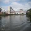
Power Station Pipe Bridge
Siniat, Hall Court, Selby WF11 9HF, United Kingdom
Address is taken from a point 419 yards away.
Address is taken from a point 419 yards away.

Power Station Pipe Bridge
is a minor waterways place
on the Aire and Calder Navigation (Main Line - Goole to Castleford) between
Bank Dole Junction (Junction of the Aire and Calder Navigation (Selby Section) and the Aire and Calder Navigation (Main Line)) (2 miles and 5¼ furlongs
and 1 lock
to the east) and
Castleford Junction (Junction of the Aire and Calder Navigation (Wakefield Section) and the Aire and Calder Navigation (Main Line)) (4 miles and 2¾ furlongs
and 2 locks
to the west).
The nearest place in the direction of Bank Dole Junction is Ferrybridge Railway Bridge;
3¼ furlongs
away.
The nearest place in the direction of Castleford Junction is Ferrybridge Wharf;
1 furlong
away.
Mooring here is unrated.
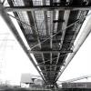
There is a bridge here which takes a pipe over the canal.
| Ferrybridge Flood Lock Footbridge | 1 mile, ¾ furlongs | |
| Ferrybridge Weir Entrance | 1 mile, ¼ furlongs | |
| Ferrybridge Bypass Bridge | 1 mile | |
| Old Great North Road Bridge | 7½ furlongs | |
| Ferrybridge Railway Bridge | 3¼ furlongs | |
| Power Station Pipe Bridge | ||
| Ferrybridge Wharf | 1 furlong | |
| A1(M) Motorway Bridge | 5 furlongs | |
| Fairburn Railway Bridge | 7¾ furlongs | |
| Fryston Basin | 1 mile, 5¼ furlongs | |
| Fairburn Ings Basin | 3 miles, 1 furlong | |
Amenities nearby at Ferrybridge Railway Bridge
There are no links to external websites from here.
Why not log in and add some (select "External websites" from the menu (sometimes this is under "Edit"))?
Why not log in and add some (select "External websites" from the menu (sometimes this is under "Edit"))?
Mouseover for more information or show routes to facility
Nearest water point
In the direction of Castleford Junction
Bulholme Lock No 10 — 3 miles, 5 furlongs away
On this waterway in the direction of Castleford Junction
Castleford Sanitary Station — 4 miles, 1¾ furlongs and 1 lock away
On this waterway in the direction of Castleford Junction
Woodnook Lock No 6 — 6 miles, 4¼ furlongs and 2 locks away
Travel to Castleford Junction, then on the Aire and Calder Navigation (Wakefield Section) to Woodnook Lock No 6
Fairies Hill Moorings — 6 miles, 3 furlongs and 3 locks away
Travel to Castleford Junction, then on the Aire and Calder Navigation (Wakefield Section) to Fairies Hill Lock Junction, then on the Aire and Calder Navigation (Wakefield Section - Fairies Hill Mooring Arm) to Fairies Hill Moorings
Lemonroyd Lock No 7 — 7 miles, 6¼ furlongs and 2 locks away
Travel to Castleford Junction, then on the Aire and Calder Navigation (Main Line - Castleford to Leeds) to Lemonroyd Lock No 7
Lemonroyd Marina — 7 miles, 7¼ furlongs and 3 locks away
Travel to Castleford Junction, then on the Aire and Calder Navigation (Main Line - Castleford to Leeds) to Lemonroyd Marina
King's Road Lock No 3 — 7 miles, 5¾ furlongs and 3 locks away
Travel to Castleford Junction, then on the Aire and Calder Navigation (Wakefield Section) to King's Road Lock No 3
Woodlesford Lock No 5 — 9 miles, 1 furlong and 3 locks away
Travel to Castleford Junction, then on the Aire and Calder Navigation (Main Line - Castleford to Leeds) to Woodlesford Lock No 5
Fishpond Lock No 4 — 9 miles, 7¾ furlongs and 4 locks away
Travel to Castleford Junction, then on the Aire and Calder Navigation (Main Line - Castleford to Leeds) to Fishpond Lock No 4
Stanley Ferry Water Point — 9 miles, 3 furlongs and 5 locks away
Travel to Castleford Junction, then on the Aire and Calder Navigation (Wakefield Section) to Stanley Ferry Water Point
Ramsdens Bridge Sanitary Station — 9 miles, 3¾ furlongs and 5 locks away
Travel to Castleford Junction, then on the Aire and Calder Navigation (Wakefield Section) to Ramsdens Bridge Sanitary Station
In the direction of Ouse - Aire and Calder Junction
Ferrybridge Flood Lock Footbridge — 1 mile, ¾ furlongs away
On this waterway in the direction of Ouse - Aire and Calder Junction
Ferrybridge Flood Lock No 11 — 1 mile, 1 furlong away
On this waterway in the direction of Ouse - Aire and Calder Junction
Bank Dole Lock No 1 — 2 miles, 7¼ furlongs and 1 lock away
Travel to Bank Dole Junction, then on the Aire and Calder Navigation (Selby Section) to Bank Dole Lock No 1
Beal Bridge — 5 miles, 1¾ furlongs and 2 locks away
Travel to Bank Dole Junction, then on the Aire and Calder Navigation (Selby Section) to Beal Bridge
Beal Lock No 2 — 5 miles, 3 furlongs and 2 locks away
Travel to Bank Dole Junction, then on the Aire and Calder Navigation (Selby Section) to Beal Lock No 2
Whitley Lock No 12 — 6 miles, 4¾ furlongs and 1 lock away
On this waterway in the direction of Ouse - Aire and Calder Junction
Pollington Manor Swing Bridge — 10 miles, 3 furlongs and 3 locks away
On this waterway in the direction of Ouse - Aire and Calder Junction
Pollington Visitor Mooring — 10 miles, 3¼ furlongs and 3 locks away
On this waterway in the direction of Ouse - Aire and Calder Junction
Selby Basin — 13 miles, 7¾ furlongs and 4 locks away
Travel to Bank Dole Junction, then on the Aire and Calder Navigation (Selby Section) to Selby BasinNearest rubbish disposal
In the direction of Castleford Junction
Castleford Sanitary Station — 4 miles, 1¾ furlongs and 1 lock away
On this waterway in the direction of Castleford Junction
Lemonroyd Marina — 7 miles, 7¼ furlongs and 3 locks away
Travel to Castleford Junction, then on the Aire and Calder Navigation (Main Line - Castleford to Leeds) to Lemonroyd Marina
Woodlesford Lock No 5 — 9 miles, 1 furlong and 3 locks away
Travel to Castleford Junction, then on the Aire and Calder Navigation (Main Line - Castleford to Leeds) to Woodlesford Lock No 5
Ramsdens Bridge Visitor Moorings — 9 miles, 3½ furlongs and 5 locks away
Travel to Castleford Junction, then on the Aire and Calder Navigation (Wakefield Section) to Ramsdens Bridge Visitor Moorings
Leeds Sanitary Station — 13 miles, 5½ furlongs and 6 locks away
Travel to Castleford Junction, then on the Aire and Calder Navigation (Main Line - Castleford to Leeds) to Leeds Sanitary Station
Leeds Basin — 14 miles, 4¾ furlongs and 8 locks away
Travel to Castleford Junction, then on the Aire and Calder Navigation (Main Line - Castleford to Leeds) to Leeds Bridge, then on the Leeds and Liverpool Canal (Main Line - Wigan to Leeds) to Leeds Basin
Horbury Basin Residential Moorings & Sanitary Station — 17 miles and 10 locks away
Travel to Castleford Junction, then on the Aire and Calder Navigation (Wakefield Section) to Fall Ing Junction, then on the Calder and Hebble Navigation (Main Line) to Horbury Basin Residential Moorings & Sanitary Station
In the direction of Ouse - Aire and Calder Junction
Whitley Lock No 12 — 6 miles, 4¾ furlongs and 1 lock away
On this waterway in the direction of Ouse - Aire and Calder Junction
Selby Basin — 13 miles, 7¾ furlongs and 4 locks away
Travel to Bank Dole Junction, then on the Aire and Calder Navigation (Selby Section) to Selby Basin
Dutch Riverside — 18 miles, 5¼ furlongs and 3 locks away
On this waterway in the direction of Ouse - Aire and Calder Junction
Goole Marina — 18 miles, 6¾ furlongs and 3 locks away
On this waterway in the direction of Ouse - Aire and Calder Junction
Barnby Dun Lift Bridge — 19 miles, ¼ furlongs and 4 locks away
Travel to Sykehouse Junction, then on the Sheffield and South Yorkshire Navigation (New Junction Canal) to Bramwith Junction, then on the Sheffield and South Yorkshire Navigation (Main Line) to Barnby Dun Lift Bridge
Bramwith Swing Bridge — 18 miles, 4¾ furlongs and 5 locks away
Travel to Sykehouse Junction, then on the Sheffield and South Yorkshire Navigation (New Junction Canal) to Bramwith Junction, then on the Sheffield and South Yorkshire Navigation (Bramwith to Stainforth) to Bramwith Swing BridgeNearest chemical toilet disposal
In the direction of Castleford Junction
Castleford Sanitary Station — 4 miles, 1¾ furlongs and 1 lock away
On this waterway in the direction of Castleford Junction
Fairies Hill Moorings — 6 miles, 3 furlongs and 3 locks away
Travel to Castleford Junction, then on the Aire and Calder Navigation (Wakefield Section) to Fairies Hill Lock Junction, then on the Aire and Calder Navigation (Wakefield Section - Fairies Hill Mooring Arm) to Fairies Hill Moorings
Lemonroyd Marina — 7 miles, 7¼ furlongs and 3 locks away
Travel to Castleford Junction, then on the Aire and Calder Navigation (Main Line - Castleford to Leeds) to Lemonroyd Marina
Ramsdens Bridge Sanitary Station — 9 miles, 3¾ furlongs and 5 locks away
Travel to Castleford Junction, then on the Aire and Calder Navigation (Wakefield Section) to Ramsdens Bridge Sanitary Station
Leeds Sanitary Station — 13 miles, 5½ furlongs and 6 locks away
Travel to Castleford Junction, then on the Aire and Calder Navigation (Main Line - Castleford to Leeds) to Leeds Sanitary Station
Horbury Basin Residential Moorings & Sanitary Station — 17 miles and 10 locks away
Travel to Castleford Junction, then on the Aire and Calder Navigation (Wakefield Section) to Fall Ing Junction, then on the Calder and Hebble Navigation (Main Line) to Horbury Basin Residential Moorings & Sanitary Station
In the direction of Ouse - Aire and Calder Junction
Whitley Lock No 12 — 6 miles, 4¾ furlongs and 1 lock away
On this waterway in the direction of Ouse - Aire and Calder Junction
Selby Basin — 13 miles, 7¾ furlongs and 4 locks away
Travel to Bank Dole Junction, then on the Aire and Calder Navigation (Selby Section) to Selby Basin
Dutch Riverside — 18 miles, 5¼ furlongs and 3 locks away
On this waterway in the direction of Ouse - Aire and Calder Junction
Goole Marina — 18 miles, 6¾ furlongs and 3 locks away
On this waterway in the direction of Ouse - Aire and Calder Junction
Barnby Dun Lift Bridge — 19 miles, ¼ furlongs and 4 locks away
Travel to Sykehouse Junction, then on the Sheffield and South Yorkshire Navigation (New Junction Canal) to Bramwith Junction, then on the Sheffield and South Yorkshire Navigation (Main Line) to Barnby Dun Lift Bridge
Bramwith Swing Bridge — 18 miles, 4¾ furlongs and 5 locks away
Travel to Sykehouse Junction, then on the Sheffield and South Yorkshire Navigation (New Junction Canal) to Bramwith Junction, then on the Sheffield and South Yorkshire Navigation (Bramwith to Stainforth) to Bramwith Swing BridgeNearest place to turn
In the direction of Castleford Junction
Bulholme Lock Weir Exit — 3 miles, 4½ furlongs away
On this waterway in the direction of Castleford Junction
Lemonroyd Lock Weir Exit — 7 miles, 5¼ furlongs and 2 locks away
Travel to Castleford Junction, then on the Aire and Calder Navigation (Main Line - Castleford to Leeds) to Lemonroyd Lock Weir Exit
Fairies Hill Lock Arm — 6 miles, 6 furlongs and 3 locks away
Travel to Castleford Junction, then on the Aire and Calder Navigation (Wakefield Section) to Fairies Hill Lock Arm
Fleet Lane Arm — 8 miles, 1¼ furlongs and 3 locks away
Travel to Castleford Junction, then on the Aire and Calder Navigation (Main Line - Castleford to Leeds) to Fleet Lane Arm
Stanley Ferry Marina — 9 miles, 2¼ furlongs and 5 locks away
Travel to Castleford Junction, then on the Aire and Calder Navigation (Wakefield Section) to Stanley Ferry Marina
Junction with River Aire (Old Channel) South — 12 miles, 3½ furlongs and 5 locks away
Travel to Castleford Junction, then on the Aire and Calder Navigation (Main Line - Castleford to Leeds) to Junction with River Aire (Old Channel) South
Junction with River Aire (Old Channel) North — 13 miles, ¾ furlongs and 6 locks away
Travel to Castleford Junction, then on the Aire and Calder Navigation (Main Line - Castleford to Leeds) to Junction with River Aire (Old Channel) North
Knostrop Flood Lock Weir Entrance — 13 miles, 1 furlong and 6 locks away
Travel to Castleford Junction, then on the Aire and Calder Navigation (Main Line - Castleford to Leeds) to Knostrop Flood Lock Weir Entrance
Wakefield Weir Entrance — 12 miles, 2¾ furlongs and 7 locks away
Travel to Castleford Junction, then on the Aire and Calder Navigation (Wakefield Section) to Fall Ing Junction, then on the Calder and Hebble Navigation (Main Line) to Wakefield Weir Entrance
Leeds Dock Side Arm — 14 miles and 7 locks away
Travel to Castleford Junction, then on the Aire and Calder Navigation (Main Line - Castleford to Leeds) to Leeds Dock Entrance, then on the Aire and Calder Navigation (Leeds Dock) to Leeds Dock Side Arm
River Aire Junction — 14 miles, 4¼ furlongs and 7 locks away
Travel to Castleford Junction, then on the Aire and Calder Navigation (Main Line - Castleford to Leeds) to Leeds Bridge, then on the Leeds and Liverpool Canal (Main Line - Wigan to Leeds) to River Aire Junction
Leeds Basin — 14 miles, 4¾ furlongs and 8 locks away
Travel to Castleford Junction, then on the Aire and Calder Navigation (Main Line - Castleford to Leeds) to Leeds Bridge, then on the Leeds and Liverpool Canal (Main Line - Wigan to Leeds) to Leeds Basin
Broad Cut Weir Entrance — 14 miles, 7¼ furlongs and 8 locks away
Travel to Castleford Junction, then on the Aire and Calder Navigation (Wakefield Section) to Fall Ing Junction, then on the Calder and Hebble Navigation (Main Line) to Broad Cut Weir Entrance
Waller Bridge Winding Hole — 15 miles, 1¼ furlongs and 9 locks away
Travel to Castleford Junction, then on the Aire and Calder Navigation (Wakefield Section) to Fall Ing Junction, then on the Calder and Hebble Navigation (Main Line) to Waller Bridge Winding Hole
Horbury Basin Residential Moorings & Sanitary Station — 17 miles and 10 locks away
Travel to Castleford Junction, then on the Aire and Calder Navigation (Wakefield Section) to Fall Ing Junction, then on the Calder and Hebble Navigation (Main Line) to Horbury Basin Residential Moorings & Sanitary Station
In the direction of Ouse - Aire and Calder Junction
Bank Dole Lock Junction — 2 miles, 7½ furlongs and 2 locks away
Travel to Bank Dole Junction, then on the Aire and Calder Navigation (Selby Section) to Bank Dole Lock Junction
Beal Lock No 2 Weir Entrance — 5 miles, 2 furlongs and 2 locks away
Travel to Bank Dole Junction, then on the Aire and Calder Navigation (Selby Section) to Beal Lock No 2 Weir Entrance
Haddlesey Junction — 9 miles, 1¼ furlongs and 3 locks away
Travel to Bank Dole Junction, then on the Aire and Calder Navigation (Selby Section) to Haddlesey Junction
Selby Basin — 13 miles, 7¾ furlongs and 4 locks away
Travel to Bank Dole Junction, then on the Aire and Calder Navigation (Selby Section) to Selby Basin
Viking Marina — 18 miles, 6 furlongs and 3 locks away
On this waterway in the direction of Ouse - Aire and Calder JunctionNearest self-operated pump-out
In the direction of Castleford Junction
Castleford Sanitary Station — 4 miles, 1¾ furlongs and 1 lock away
On this waterway in the direction of Castleford Junction
Ramsdens Bridge Sanitary Station — 9 miles, 3¾ furlongs and 5 locks away
Travel to Castleford Junction, then on the Aire and Calder Navigation (Wakefield Section) to Ramsdens Bridge Sanitary Station
Leeds Sanitary Station — 13 miles, 5½ furlongs and 6 locks away
Travel to Castleford Junction, then on the Aire and Calder Navigation (Main Line - Castleford to Leeds) to Leeds Sanitary StationNearest boatyard pump-out
In the direction of Castleford Junction
Lemonroyd Marina — 7 miles, 7¼ furlongs and 3 locks away
Travel to Castleford Junction, then on the Aire and Calder Navigation (Main Line - Castleford to Leeds) to Lemonroyd Marina
In the direction of Ouse - Aire and Calder Junction
Goole Marina — 18 miles, 6¾ furlongs and 3 locks away
On this waterway in the direction of Ouse - Aire and Calder JunctionDirection of TV transmitter (From Wolfbane Cybernetic)
There is no page on Wikipedia called “Power Station Pipe Bridge”
Wikipedia pages that might relate to Power Station Pipe Bridge
[Sidrapong Hydroelectric Power Station]
Sidrapong Hydroelectric Power Station (a.k.a. Sidrapong Hydel Power Station), located at the foothills of Arya Tea Estate 12 km (7.5 mi) from Darjeeling
[Rubicon Hydroelectric Scheme]
Royston Power Station forebay. The Royston penstock consists of 900 feet (270 m) of woodstave pipe on the upper section and 916 feet (279 m) of steel pipe on
[Michels Corporation]
including pipeline, electrical power, transportation, horizontal directional drilling, deep foundations, communications networks, pipe rehabilitation, and sewer
[Talcher Thermal Power Station]
Talcher Thermal Power station is located in Talcher sub-division of Angul district in the Indian state of Odisha Pin.759101. The power plant is one of
[West Burton power stations]
Burton power stations are a pair of power stations on the River Trent near Gainsborough, Lincolnshire, England. One is a coal-fired power station, which
[Blyth Power Station]
Blyth Power Station (also known as Cambois Power Station) refers to a pair of now demolished coal-fired power stations, which were located on the Northumberland
[Atmospheric railway]
described below, Samuda implies that the pipe would be used in one direction only, and the fact that only one pumping station was erected suggests that trains
[Vallur Thermal Power Station]
Vallur Thermal Power Station is a power plant located in Athipattu Pudunagar, Vallur in Thiruvallur district, North Chennai, India. The power plant is operated
[London Hydraulic Power Company]
hydraulic power stations, originally driven by coal-fired steam engines. These were at: Falcon Wharf Pumping Station at Bankside, east of Blackfriars Bridge on
[Delaware Valley Resource Recovery Facility]
Pennsylvania, only being surpassed in emissions by aging coal power plants. List of power stations in Pennsylvania "Camden, Chester incinerators among nation's

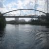

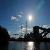
![Pipe bridge, Ferrybridge B power station. Seen from a boat heading upstream [locally north] on the River Aire. by Christine Johnstone – 19 June 2015](https://s3.geograph.org.uk/geophotos/04/58/02/4580251_ec75fbf2_120x120.jpg)


![2001 : Ferrybridge Power Station. Unloading coal at Ferrybridge Power Station on the Aire & Calder Navigation in June 2001. Brotherton is on the opposite side of the river.Another string of coal barges is on the way and will be there in about an hour.See [[487196]] by Maurice Pullin – 13 June 2001](https://s2.geograph.org.uk/photos/48/95/489594_e30ecaf4_120x120.jpg)


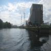
![Disused infrastructure, Ferrybridge B power station. Where coal from Kellingley used to be unloaded from boats [pans propelled by tugs]. by Christine Johnstone – 19 June 2015](https://s3.geograph.org.uk/geophotos/04/58/02/4580255_2f4f84db_120x120.jpg)


