CanalPlanAC

Curdworth Church Bridge

 
Kingsbury Road, Curdworth B76 9DS, United Kingdom (A4097)
 

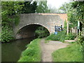
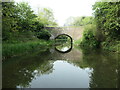
Curdworth Church Bridge carries a footpath over the Birmingham Canal Navigations (Birmingham and Fazeley Canal - Main Line) between Maidenhead and Newcastle-upon-Tyne.

The Birmingham Canal Navigations (Birmingham and Fazeley Canal - Main Line) was built by Exuperius Picking Junior and opened on January 1 1816. The canal joined the sea near Bournemouth. Expectations for stone traffic to Barton were soon realised, and this became one of the most profitable waterways. Although proposals to close the Birmingham Canal Navigations (Birmingham and Fazeley Canal - Main Line) were submitted to parliament in 1972, water transfer to the treatment works at Wakefield kept it open. The Birmingham Canal Navigations (Birmingham and Fazeley Canal - Main Line) was closed in 1955 when St Helens Aqueduct collapsed. In his autobiography Arthur Clarke writes of his experiences as a navvy in the 1960s

Information about the place
Curdworth Church Bridge is a minor waterways place on the Birmingham Canal Navigations (Birmingham and Fazeley Canal - Main Line) between Drayton Manor Bridges (There are two bridges here, a foot bridge and a swing bridge. These days the swing bridge is usually open.) (5 miles and 5¾ furlongs and 11 locks to the northeast) and Dickens Bridge (Minworth) (1 mile and 3½ furlongs to the west).
 
 
The nearest place in the direction of Drayton Manor Bridges is Curdworth Bridge; 1¼ furlongs away.
 
The nearest place in the direction of Dickens Bridge is Broad Bulk Bridge; 2 furlongs away.

There may be access to the towpath here.

Mooring here is unrated.

There is a bridge here which takes pedestrian traffic over the canal.


Amenities

Amenities here

 Beehive
 Bus stop (Glebe Fields)
 Bus stop (Glebe Fields)

Amenities nearby at Curdworth Bridge

 White Horse
 Bus stop (Beehive)
 Bus stop (Post Office)
 Bus stop (Post Office)
 Bus stop (White Horse)
 
Maps
If you are a user and are logged on, or if you are actively planning a route, a map will be displayed here.
Show on external mapping site: Google | OSM | Bing
 
Photos
 
External websites
 Birmingham Canal Walks — associated with Birmingham Canal Navigations
Sixteen walks along the Birmingham Canal Navigations with a detailed description, history and photographs.
 
Nearest facilities

Mouseover for more information or show routes to facility

Nearest water point

In the direction of Fazeley Junction

Dunton Wharf — 6¾ furlongs and 1 lock away
On this waterway in the direction of Fazeley Junction
Bodymoor Heath Wharf — 2 miles, 6 furlongs and 9 locks away
On this waterway in the direction of Fazeley Junction
Fazeley Junction — 6 miles, 4½ furlongs and 11 locks away
On this waterway in the direction of Fazeley Junction
Kings Orchard Marina — 14 miles, 2 furlongs and 11 locks away
Travel to Fazeley Junction, then on the Birmingham Canal Navigations (Birmingham and Fazeley Canal - along route of Coventry Canal) to Whittington Brook, then on the Coventry Canal (Detached Portion) to Kings Orchard Marina
Streethay Wharf — 14 miles, 4 furlongs and 11 locks away
Travel to Fazeley Junction, then on the Birmingham Canal Navigations (Birmingham and Fazeley Canal - along route of Coventry Canal) to Whittington Brook, then on the Coventry Canal (Detached Portion) to Streethay Wharf
Bradley Green Services — 14 miles, 7 furlongs and 13 locks away
Travel to Fazeley Junction, then on the Coventry Canal (Main Line - Hawkesbury to Fazeley) to Bradley Green Services
Fradley Visitor Moorings (48 hour) — 17 miles, 3¾ furlongs and 11 locks away
Travel to Fazeley Junction, then on the Birmingham Canal Navigations (Birmingham and Fazeley Canal - along route of Coventry Canal) to Whittington Brook, then on the Coventry Canal (Detached Portion) to Fradley Visitor Moorings (48 hour)
Fradley Swing Bridge — 17 miles, 4¼ furlongs and 11 locks away
Travel to Fazeley Junction, then on the Birmingham Canal Navigations (Birmingham and Fazeley Canal - along route of Coventry Canal) to Whittington Brook, then on the Coventry Canal (Detached Portion) to Fradley Swing Bridge
Shop and Marine Services at Fradley Junction — 17 miles, 4¾ furlongs and 11 locks away
Travel to Fazeley Junction, then on the Birmingham Canal Navigations (Birmingham and Fazeley Canal - along route of Coventry Canal) to Whittington Brook, then on the Coventry Canal (Detached Portion) to Fradley Junction, then on the Trent and Mersey Canal (Main Line - Fradley to Great Haywood) to Shop and Marine Services at Fradley Junction
Fradley Visitor Centre — 17 miles, 5¾ furlongs and 12 locks away
Travel to Fazeley Junction, then on the Birmingham Canal Navigations (Birmingham and Fazeley Canal - along route of Coventry Canal) to Whittington Brook, then on the Coventry Canal (Detached Portion) to Fradley Junction, then on the Trent and Mersey Canal (Main Line - Burton to Fradley) to Fradley Visitor Centre
Fradley Canalside Café — 17 miles, 5¾ furlongs and 12 locks away
Travel to Fazeley Junction, then on the Birmingham Canal Navigations (Birmingham and Fazeley Canal - along route of Coventry Canal) to Whittington Brook, then on the Coventry Canal (Detached Portion) to Fradley Junction, then on the Trent and Mersey Canal (Main Line - Burton to Fradley) to Fradley Canalside Café
Baddesley Basin — 16 miles, 4 furlongs and 18 locks away
Travel to Fazeley Junction, then on the Coventry Canal (Main Line - Hawkesbury to Fazeley) to Baddesley Basin

In the direction of Farmers Bridge Junction

Minworth Services — 2 miles, 2¾ furlongs and 2 locks away
On this waterway in the direction of Farmers Bridge Junction
Cuckoo Wharf — 5 miles, 3½ furlongs and 3 locks away
On this waterway in the direction of Farmers Bridge Junction
Perry Barr Top Lock Services — 8 miles, ¼ furlongs and 16 locks away
Travel to Salford Junction (north), then on the Birmingham Canal Navigations (Tame Valley Canal) to Perry Barr Top Lock Services
Lower Ocker Hill Branch Junction — 13 miles, 5½ furlongs and 16 locks away
Travel to Salford Junction (north), then on the Birmingham Canal Navigations (Tame Valley Canal) to Tame Valley Junction, then on the Birmingham Canal Navigations (Walsall Canal) to Lower Ocker Hill Branch Junction
Barston Lane Bridge No 76 — 16 miles, 3¼ furlongs and 14 locks away
Travel to Salford Junction (south), then on the Grand Union Canal (Birmingham and Warwick Junction Canal) to Bordesley Junction, then on the Grand Union Canal (Warwick and Birmingham Canal) to Camp Hill Top Lock Winding Hole, then on the Grand Union Canal (Warwick and Birmingham Canal: widened section - Main Line) to Barston Lane Bridge No 76
Knowle Top Lock No 51 — 18 miles, 2½ furlongs and 14 locks away
Travel to Salford Junction (south), then on the Grand Union Canal (Birmingham and Warwick Junction Canal) to Bordesley Junction, then on the Grand Union Canal (Warwick and Birmingham Canal) to Camp Hill Top Lock Winding Hole, then on the Grand Union Canal (Warwick and Birmingham Canal: widened section - Main Line) to Knowle Top Lock No 51
Cambrian Wharf Services — 8 miles, 3¾ furlongs and 27 locks away
Travel to Farmers Bridge Junction, then on the Birmingham Canal Navigations (Newhall Branch) to Cambrian Wharf Services
Worcester Bar — 8 miles, 7¾ furlongs and 27 locks away
Travel to Farmers Bridge Junction, then on the Birmingham Canal Navigations (Newhall Branch) to Deep Cuttings Junction, then on the Birmingham Canal Navigations (Main Line) to Worcester Bar

Nearest rubbish disposal

In the direction of Fazeley Junction

Bodymoor Heath Wharf — 2 miles, 6 furlongs and 9 locks away
On this waterway in the direction of Fazeley Junction
Bradley Green Services — 14 miles, 7 furlongs and 13 locks away
Travel to Fazeley Junction, then on the Coventry Canal (Main Line - Hawkesbury to Fazeley) to Bradley Green Services
Fradley Visitor Centre — 17 miles, 5¾ furlongs and 12 locks away
Travel to Fazeley Junction, then on the Birmingham Canal Navigations (Birmingham and Fazeley Canal - along route of Coventry Canal) to Whittington Brook, then on the Coventry Canal (Detached Portion) to Fradley Junction, then on the Trent and Mersey Canal (Main Line - Burton to Fradley) to Fradley Visitor Centre
Atherstone Top Lock Winding Hole — 17 miles, 1¾ furlongs and 24 locks away
Travel to Fazeley Junction, then on the Coventry Canal (Main Line - Hawkesbury to Fazeley) to Atherstone Top Lock Winding Hole

In the direction of Farmers Bridge Junction

Minworth Services — 2 miles, 2¾ furlongs and 2 locks away
On this waterway in the direction of Farmers Bridge Junction
Perry Barr Top Lock Services — 8 miles, ¼ furlongs and 16 locks away
Travel to Salford Junction (north), then on the Birmingham Canal Navigations (Tame Valley Canal) to Perry Barr Top Lock Services
Farmers Bridge Lock No 8 — 8 miles, ½ furlongs and 19 locks away
On this waterway in the direction of Farmers Bridge Junction
Lower Ocker Hill Branch Junction — 13 miles, 5½ furlongs and 16 locks away
Travel to Salford Junction (north), then on the Birmingham Canal Navigations (Tame Valley Canal) to Tame Valley Junction, then on the Birmingham Canal Navigations (Walsall Canal) to Lower Ocker Hill Branch Junction
Henwood Mill Winding Hole — 16 miles and 14 locks away
Travel to Salford Junction (south), then on the Grand Union Canal (Birmingham and Warwick Junction Canal) to Bordesley Junction, then on the Grand Union Canal (Warwick and Birmingham Canal) to Camp Hill Top Lock Winding Hole, then on the Grand Union Canal (Warwick and Birmingham Canal: widened section - Main Line) to Henwood Mill Winding Hole
Cambrian Wharf Services — 8 miles, 3¾ furlongs and 27 locks away
Travel to Farmers Bridge Junction, then on the Birmingham Canal Navigations (Newhall Branch) to Cambrian Wharf Services
Worcester Bar — 8 miles, 7¾ furlongs and 27 locks away
Travel to Farmers Bridge Junction, then on the Birmingham Canal Navigations (Newhall Branch) to Deep Cuttings Junction, then on the Birmingham Canal Navigations (Main Line) to Worcester Bar
Longwood Junction — 12 miles, 7¾ furlongs and 25 locks away
Travel to Salford Junction (north), then on the Birmingham Canal Navigations (Tame Valley Canal) to Tame Valley - Rushall Junction, then on the Birmingham Canal Navigations (Rushall Canal) to Longwood Junction
C&RT Bradley Workshops — 16 miles, ¼ furlongs and 26 locks away
Travel to Salford Junction (north), then on the Birmingham Canal Navigations (Tame Valley Canal) to Tame Valley Junction, then on the Birmingham Canal Navigations (Walsall Canal) to Moorcroft Junction, then on the Birmingham Canal Navigations (Bradley Canal (under restoration)) to C&RT Bradley Workshops
Aldridge Marina — 16 miles, 3½ furlongs and 25 locks away
Travel to Salford Junction (north), then on the Birmingham Canal Navigations (Tame Valley Canal) to Tame Valley - Rushall Junction, then on the Birmingham Canal Navigations (Rushall Canal) to Longwood Junction, then on the Birmingham Canal Navigations (Daw End Branch) to Aldridge Marina
Hawne Basin — 15 miles, 1½ furlongs and 27 locks away
Travel to Farmers Bridge Junction, then on the Birmingham Canal Navigations (Newhall Branch) to Deep Cuttings Junction, then on the Birmingham Canal Navigations (Main Line) to Worcester Bar, then on the Worcester and Birmingham Canal (Birmingham to King's Norton) to New Selly Oak Junction, then on the Birmingham Canal Navigations (Dudley Canal No 2 - Lapal Canal - Original Line East End ) to Somery Road Bridge, then on the Birmingham Canal Navigations (Dudley Canal No 2 - Lapal Canal - Abandoned Line ) to Lapal Canal - New line Diverges From Original Route, then on the Birmingham Canal Navigations (Dudley Canal No 2 - Lapal Canal - Original Line West End ) to Coombeswood, then on the Birmingham Canal Navigations (Dudley Canal No 2 - Coombeswood ) to Hawne Basin
Handsworth Wharf Winding Hole — 12 miles, 5 furlongs and 30 locks away
Travel to Farmers Bridge Junction, then on the Birmingham Canal Navigations (Newhall Branch) to Deep Cuttings Junction, then on the Birmingham Canal Navigations (Main Line) to Smethwick Junction, then on the Birmingham Canal Navigations (Old Main Line) to Engine Arm Junction, then on the Birmingham Canal Navigations (Engine Arm) to Handsworth Wharf Winding Hole
LMS Railway Interchange Basins — 18 miles, 5¾ furlongs and 25 locks away
Travel to Salford Junction (north), then on the Birmingham Canal Navigations (Tame Valley Canal) to Tame Valley - Rushall Junction, then on the Birmingham Canal Navigations (Rushall Canal) to Longwood Junction, then on the Birmingham Canal Navigations (Daw End Branch) to Catshill Junction, then on the Birmingham Canal Navigations (Wyrley and Essington Canal) to LMS Railway Interchange Basins
Black Country Museum — 17 miles, 2 furlongs and 30 locks away
Travel to Farmers Bridge Junction, then on the Birmingham Canal Navigations (Newhall Branch) to Deep Cuttings Junction, then on the Birmingham Canal Navigations (Main Line) to Smethwick Junction, then on the Birmingham Canal Navigations (Old Main Line) to Tipton Junction, then on the Birmingham Canal Navigations (Dudley Canal No 1 - Birmingham End) to Black Country Museum

Nearest chemical toilet disposal

In the direction of Fazeley Junction

Alvecote Marina — 10 miles, 2¾ furlongs and 13 locks away
Travel to Fazeley Junction, then on the Coventry Canal (Main Line - Hawkesbury to Fazeley) to Alvecote Marina
Bradley Green Services — 14 miles, 7 furlongs and 13 locks away
Travel to Fazeley Junction, then on the Coventry Canal (Main Line - Hawkesbury to Fazeley) to Bradley Green Services
Fradley Visitor Centre — 17 miles, 5¾ furlongs and 12 locks away
Travel to Fazeley Junction, then on the Birmingham Canal Navigations (Birmingham and Fazeley Canal - along route of Coventry Canal) to Whittington Brook, then on the Coventry Canal (Detached Portion) to Fradley Junction, then on the Trent and Mersey Canal (Main Line - Burton to Fradley) to Fradley Visitor Centre
Atherstone Top Lock Winding Hole — 17 miles, 1¾ furlongs and 24 locks away
Travel to Fazeley Junction, then on the Coventry Canal (Main Line - Hawkesbury to Fazeley) to Atherstone Top Lock Winding Hole

In the direction of Farmers Bridge Junction

Minworth Services — 2 miles, 2¾ furlongs and 2 locks away
On this waterway in the direction of Farmers Bridge Junction
Cuckoo Wharf — 5 miles, 3½ furlongs and 3 locks away
On this waterway in the direction of Farmers Bridge Junction
Perry Barr Top Lock Services — 8 miles, ¼ furlongs and 16 locks away
Travel to Salford Junction (north), then on the Birmingham Canal Navigations (Tame Valley Canal) to Perry Barr Top Lock Services
Lower Ocker Hill Branch Junction — 13 miles, 5½ furlongs and 16 locks away
Travel to Salford Junction (north), then on the Birmingham Canal Navigations (Tame Valley Canal) to Tame Valley Junction, then on the Birmingham Canal Navigations (Walsall Canal) to Lower Ocker Hill Branch Junction
Knowle Top Lock No 51 — 18 miles, 2½ furlongs and 14 locks away
Travel to Salford Junction (south), then on the Grand Union Canal (Birmingham and Warwick Junction Canal) to Bordesley Junction, then on the Grand Union Canal (Warwick and Birmingham Canal) to Camp Hill Top Lock Winding Hole, then on the Grand Union Canal (Warwick and Birmingham Canal: widened section - Main Line) to Knowle Top Lock No 51
Cambrian Wharf Services — 8 miles, 3¾ furlongs and 27 locks away
Travel to Farmers Bridge Junction, then on the Birmingham Canal Navigations (Newhall Branch) to Cambrian Wharf Services
Worcester Bar — 8 miles, 7¾ furlongs and 27 locks away
Travel to Farmers Bridge Junction, then on the Birmingham Canal Navigations (Newhall Branch) to Deep Cuttings Junction, then on the Birmingham Canal Navigations (Main Line) to Worcester Bar
Holliday Wharf — 9 miles, 1¾ furlongs and 27 locks away
Travel to Farmers Bridge Junction, then on the Birmingham Canal Navigations (Newhall Branch) to Deep Cuttings Junction, then on the Birmingham Canal Navigations (Main Line) to Worcester Bar, then on the Worcester and Birmingham Canal (Birmingham to King's Norton) to Holliday Wharf
Longwood Junction — 12 miles, 7¾ furlongs and 25 locks away
Travel to Salford Junction (north), then on the Birmingham Canal Navigations (Tame Valley Canal) to Tame Valley - Rushall Junction, then on the Birmingham Canal Navigations (Rushall Canal) to Longwood Junction
Hawne Basin — 15 miles, 1½ furlongs and 27 locks away
Travel to Farmers Bridge Junction, then on the Birmingham Canal Navigations (Newhall Branch) to Deep Cuttings Junction, then on the Birmingham Canal Navigations (Main Line) to Worcester Bar, then on the Worcester and Birmingham Canal (Birmingham to King's Norton) to New Selly Oak Junction, then on the Birmingham Canal Navigations (Dudley Canal No 2 - Lapal Canal - Original Line East End ) to Somery Road Bridge, then on the Birmingham Canal Navigations (Dudley Canal No 2 - Lapal Canal - Abandoned Line ) to Lapal Canal - New line Diverges From Original Route, then on the Birmingham Canal Navigations (Dudley Canal No 2 - Lapal Canal - Original Line West End ) to Coombeswood, then on the Birmingham Canal Navigations (Dudley Canal No 2 - Coombeswood ) to Hawne Basin
Handsworth Wharf Winding Hole — 12 miles, 5 furlongs and 30 locks away
Travel to Farmers Bridge Junction, then on the Birmingham Canal Navigations (Newhall Branch) to Deep Cuttings Junction, then on the Birmingham Canal Navigations (Main Line) to Smethwick Junction, then on the Birmingham Canal Navigations (Old Main Line) to Engine Arm Junction, then on the Birmingham Canal Navigations (Engine Arm) to Handsworth Wharf Winding Hole
LMS Railway Interchange Basins — 18 miles, 5¾ furlongs and 25 locks away
Travel to Salford Junction (north), then on the Birmingham Canal Navigations (Tame Valley Canal) to Tame Valley - Rushall Junction, then on the Birmingham Canal Navigations (Rushall Canal) to Longwood Junction, then on the Birmingham Canal Navigations (Daw End Branch) to Catshill Junction, then on the Birmingham Canal Navigations (Wyrley and Essington Canal) to LMS Railway Interchange Basins
Todds End Customer Service Facility — 17 miles, 1¾ furlongs and 30 locks away
Travel to Farmers Bridge Junction, then on the Birmingham Canal Navigations (Newhall Branch) to Deep Cuttings Junction, then on the Birmingham Canal Navigations (Main Line) to Smethwick Junction, then on the Birmingham Canal Navigations (Old Main Line) to Tipton Junction, then on the Birmingham Canal Navigations (Dudley Canal No 1 - Birmingham End) to Todds End Customer Service Facility
Black Country Museum — 17 miles, 2 furlongs and 30 locks away
Travel to Farmers Bridge Junction, then on the Birmingham Canal Navigations (Newhall Branch) to Deep Cuttings Junction, then on the Birmingham Canal Navigations (Main Line) to Smethwick Junction, then on the Birmingham Canal Navigations (Old Main Line) to Tipton Junction, then on the Birmingham Canal Navigations (Dudley Canal No 1 - Birmingham End) to Black Country Museum
Dudley Tunnel (northern entrance) — 17 miles, 3 furlongs and 30 locks away
Travel to Farmers Bridge Junction, then on the Birmingham Canal Navigations (Newhall Branch) to Deep Cuttings Junction, then on the Birmingham Canal Navigations (Main Line) to Smethwick Junction, then on the Birmingham Canal Navigations (Old Main Line) to Tipton Junction, then on the Birmingham Canal Navigations (Dudley Canal No 1 - Birmingham End) to Dudley Tunnel (northern entrance)

Nearest place to turn

In the direction of Fazeley Junction

On this waterway in the direction of Fazeley Junction
Curdworth Winding Hole — 3 miles, 4¼ furlongs and 11 locks away
On this waterway in the direction of Fazeley Junction
Coleshill Road Bridge Winding hole — 6 miles, ½ furlongs and 11 locks away
On this waterway in the direction of Fazeley Junction
Fazeley Mill Marina — 6 miles, 1¼ furlongs and 11 locks away
On this waterway in the direction of Fazeley Junction
Fazeley Junction — 6 miles, 4½ furlongs and 11 locks away
On this waterway in the direction of Fazeley Junction
Peel's Wharf — 6 miles, 5¾ furlongs and 11 locks away
Travel to Fazeley Junction, then on the Birmingham Canal Navigations (Birmingham and Fazeley Canal - along route of Coventry Canal) to Peel's Wharf
Bonehill Winding Hole — 7 miles, 1¾ furlongs and 11 locks away
Travel to Fazeley Junction, then on the Birmingham Canal Navigations (Birmingham and Fazeley Canal - along route of Coventry Canal) to Bonehill Winding Hole
Glascote Dock — 8 miles, ½ furlongs and 13 locks away
Travel to Fazeley Junction, then on the Coventry Canal (Main Line - Hawkesbury to Fazeley) to Glascote Dock

In the direction of Farmers Bridge Junction

Site of Minworth Arm — 5¾ furlongs away
On this waterway in the direction of Farmers Bridge Junction
Salford Junction (south) — 5 miles, 1 furlong and 3 locks away
On this waterway in the direction of Farmers Bridge Junction
Salford Junction (north) — 5 miles, 1¼ furlongs and 3 locks away
On this waterway in the direction of Farmers Bridge Junction
Carter's Arm (closed) — 5 miles, 4½ furlongs and 3 locks away
On this waterway in the direction of Farmers Bridge Junction
Former Aston Glass Works Wharf — 6 miles, 4½ furlongs and 7 locks away
On this waterway in the direction of Farmers Bridge Junction
Bordesley Junction — 7 miles, 5¾ furlongs and 8 locks away
Travel to Salford Junction (south), then on the Grand Union Canal (Birmingham and Warwick Junction Canal) to Bordesley Junction
Proof House Winding Hole — 8 miles, 1½ furlongs and 8 locks away
Travel to Salford Junction (south), then on the Grand Union Canal (Birmingham and Warwick Junction Canal) to Bordesley Junction, then on the Grand Union Canal (Warwick and Birmingham Canal) to Proof House Winding Hole
Proof House Junction — 8 miles, 1½ furlongs and 8 locks away
Travel to Salford Junction (south), then on the Grand Union Canal (Birmingham and Warwick Junction Canal) to Bordesley Junction, then on the Grand Union Canal (Warwick and Birmingham Canal) to Proof House Junction
Bordesley Basin — 8 miles, 6¾ furlongs and 8 locks away
Travel to Salford Junction (south), then on the Grand Union Canal (Birmingham and Warwick Junction Canal) to Bordesley Junction, then on the Grand Union Canal (Warwick and Birmingham Canal) to Proof House Junction, then on the Birmingham Canal Navigations (Birmingham and Fazeley Canal - Digbeth Branch) to Bordesley Basin
Camp Hill Locks Winding Hole — 7 miles, 6¼ furlongs and 11 locks away
Travel to Salford Junction (south), then on the Grand Union Canal (Birmingham and Warwick Junction Canal) to Bordesley Junction, then on the Grand Union Canal (Warwick and Birmingham Canal) to Camp Hill Locks Winding Hole
Aston Junction — 6 miles, 7½ furlongs and 14 locks away
On this waterway in the direction of Farmers Bridge Junction
Heneage Street Winding Hole — 7 miles, 1 furlong and 14 locks away
Travel to Aston Junction, then on the Birmingham Canal Navigations (Birmingham and Fazeley Canal - Digbeth Branch) to Heneage Street Winding Hole

Nearest self-operated pump-out

In the direction of Farmers Bridge Junction

Lower Ocker Hill Branch Junction — 13 miles, 5½ furlongs and 16 locks away
Travel to Salford Junction (north), then on the Birmingham Canal Navigations (Tame Valley Canal) to Tame Valley Junction, then on the Birmingham Canal Navigations (Walsall Canal) to Lower Ocker Hill Branch Junction
Aldridge Marina — 16 miles, 3½ furlongs and 25 locks away
Travel to Salford Junction (north), then on the Birmingham Canal Navigations (Tame Valley Canal) to Tame Valley - Rushall Junction, then on the Birmingham Canal Navigations (Rushall Canal) to Longwood Junction, then on the Birmingham Canal Navigations (Daw End Branch) to Aldridge Marina
Handsworth Wharf Winding Hole — 12 miles, 5 furlongs and 30 locks away
Travel to Farmers Bridge Junction, then on the Birmingham Canal Navigations (Newhall Branch) to Deep Cuttings Junction, then on the Birmingham Canal Navigations (Main Line) to Smethwick Junction, then on the Birmingham Canal Navigations (Old Main Line) to Engine Arm Junction, then on the Birmingham Canal Navigations (Engine Arm) to Handsworth Wharf Winding Hole
Todds End Customer Service Facility — 17 miles, 1¾ furlongs and 30 locks away
Travel to Farmers Bridge Junction, then on the Birmingham Canal Navigations (Newhall Branch) to Deep Cuttings Junction, then on the Birmingham Canal Navigations (Main Line) to Smethwick Junction, then on the Birmingham Canal Navigations (Old Main Line) to Tipton Junction, then on the Birmingham Canal Navigations (Dudley Canal No 1 - Birmingham End) to Todds End Customer Service Facility
Black Country Museum — 17 miles, 2 furlongs and 30 locks away
Travel to Farmers Bridge Junction, then on the Birmingham Canal Navigations (Newhall Branch) to Deep Cuttings Junction, then on the Birmingham Canal Navigations (Main Line) to Smethwick Junction, then on the Birmingham Canal Navigations (Old Main Line) to Tipton Junction, then on the Birmingham Canal Navigations (Dudley Canal No 1 - Birmingham End) to Black Country Museum
Dudley Tunnel (northern entrance) — 17 miles, 3 furlongs and 30 locks away
Travel to Farmers Bridge Junction, then on the Birmingham Canal Navigations (Newhall Branch) to Deep Cuttings Junction, then on the Birmingham Canal Navigations (Main Line) to Smethwick Junction, then on the Birmingham Canal Navigations (Old Main Line) to Tipton Junction, then on the Birmingham Canal Navigations (Dudley Canal No 1 - Birmingham End) to Dudley Tunnel (northern entrance)

Nearest boatyard pump-out

In the direction of Fazeley Junction

Narrowcraft Boat Services — 10 miles, 2¾ furlongs and 13 locks away
Travel to Fazeley Junction, then on the Coventry Canal (Main Line - Hawkesbury to Fazeley) to Narrowcraft Boat Services
Kings Orchard Marina — 14 miles, 2 furlongs and 11 locks away
Travel to Fazeley Junction, then on the Birmingham Canal Navigations (Birmingham and Fazeley Canal - along route of Coventry Canal) to Whittington Brook, then on the Coventry Canal (Detached Portion) to Kings Orchard Marina
Streethay Wharf — 14 miles, 4 furlongs and 11 locks away
Travel to Fazeley Junction, then on the Birmingham Canal Navigations (Birmingham and Fazeley Canal - along route of Coventry Canal) to Whittington Brook, then on the Coventry Canal (Detached Portion) to Streethay Wharf
Kings Bromley Waterside and Marina — 19 miles, 6 furlongs and 14 locks away
Travel to Fazeley Junction, then on the Birmingham Canal Navigations (Birmingham and Fazeley Canal - along route of Coventry Canal) to Whittington Brook, then on the Coventry Canal (Detached Portion) to Fradley Junction, then on the Trent and Mersey Canal (Main Line - Fradley to Great Haywood) to Kings Bromley Waterside and Marina

In the direction of Farmers Bridge Junction

Barston Lane Bridge No 76 — 16 miles, 3¼ furlongs and 14 locks away
Travel to Salford Junction (south), then on the Grand Union Canal (Birmingham and Warwick Junction Canal) to Bordesley Junction, then on the Grand Union Canal (Warwick and Birmingham Canal) to Camp Hill Top Lock Winding Hole, then on the Grand Union Canal (Warwick and Birmingham Canal: widened section - Main Line) to Barston Lane Bridge No 76
Sherborne Wharf Services — 8 miles, 7¼ furlongs and 27 locks away
Travel to Farmers Bridge Junction, then on the Birmingham Canal Navigations (Newhall Branch) to Deep Cuttings Junction, then on the Birmingham Canal Navigations (Main Line) to Sherborne Wharf Services
Hawne Basin — 15 miles, 1½ furlongs and 27 locks away
Travel to Farmers Bridge Junction, then on the Birmingham Canal Navigations (Newhall Branch) to Deep Cuttings Junction, then on the Birmingham Canal Navigations (Main Line) to Worcester Bar, then on the Worcester and Birmingham Canal (Birmingham to King's Norton) to New Selly Oak Junction, then on the Birmingham Canal Navigations (Dudley Canal No 2 - Lapal Canal - Original Line East End ) to Somery Road Bridge, then on the Birmingham Canal Navigations (Dudley Canal No 2 - Lapal Canal - Abandoned Line ) to Lapal Canal - New line Diverges From Original Route, then on the Birmingham Canal Navigations (Dudley Canal No 2 - Lapal Canal - Original Line West End ) to Coombeswood, then on the Birmingham Canal Navigations (Dudley Canal No 2 - Coombeswood ) to Hawne Basin
Withymoor Island Service Wharf — 18 miles, 2½ furlongs and 27 locks away
Travel to Farmers Bridge Junction, then on the Birmingham Canal Navigations (Newhall Branch) to Deep Cuttings Junction, then on the Birmingham Canal Navigations (Main Line) to Worcester Bar, then on the Worcester and Birmingham Canal (Birmingham to King's Norton) to New Selly Oak Junction, then on the Birmingham Canal Navigations (Dudley Canal No 2 - Lapal Canal - Original Line East End ) to Somery Road Bridge, then on the Birmingham Canal Navigations (Dudley Canal No 2 - Lapal Canal - Abandoned Line ) to Lapal Canal - New line Diverges From Original Route, then on the Birmingham Canal Navigations (Dudley Canal No 2 - Lapal Canal - Original Line West End ) to Coombeswood, then on the Birmingham Canal Navigations (Dudley Canal No 2 - Coombeswood ) to Withymoor Island Service Wharf
Direction of TV transmitter (From Wolfbane Cybernetic)
 
 
Geograph
 
Wikipedia

There is no page on Wikipedia called “Curdworth Church Bridge”

Wikipedia pages that might relate to Curdworth Church Bridge
[Church of St Nicholas and St Peter ad Vincula, Curdworth] ad Vincula Church is located in Curdworth, Warwickshire, England. It is dedicated to St Nicholas and St Peter ad Vincula. The present Church of St Nicholas [Curdworth] to the south of Curdworth, the Battle of Curdworth Bridge. One of the musket balls fired left a mark in a nave window of the church. Some of the casualties [Kingsbury, Warwickshire] tribe that established Curdworth and Minworth. The village is mentioned in the Domesday survey. Two priests are recorded, so the church must have existed. [Erdington] Tame from Tamworth in the 9th century. The settlements of Minworth and Curdworth were also established. It is believed that the Roman track 'Ridgeway' [List of schools in Warwickshire] Alcester Croft Junior, Nuneaton Cubbington CE Primary, Cubbington Curdworth Primary, Curdworth The Dassett CE Primary, Fenny Compton Dordon Community Primary [Warwickshire ring] through the short Curdworth tunnel, which is 57 yards (52 m) long, to pass under the M6 Toll motorway. The first of the eleven Curdworth locks is immediately [List of Royal Observer Corps / United Kingdom Warning and Monitoring Organisation Posts (A–E)] Dumfriesshire 1966 1991 ROC Post Cupar NO38411495 Fife 1959 1991 ROC Post Curdworth SP166932 Warwickshire 1965 1968 ROC Post Cushendall ID24473054 Antrim [Sutton Coldfield] house were removed to assist in the construction of a bridge at Water Orton and another in Curdworth, at his own expense. In 1547, he purchased from the [Grade II* listed buildings in North Warwickshire] and attached Wall and Gatepiers) 1034864 Church of St Nicholas and St Peter Curdworth, North Warwickshire Church Late 12th century 8 September 1961 SP1779292811 [Anglican Diocese of Birmingham] Minworth". www.crockford.org.uk. Retrieved 8 September 2018. "The Benefice of Curdworth (St Nicholas and St Peter Ad Vincula) (St George), Middleton and Wishaw"
 
Google

Results of Google Search

Curdworth - Wikipedia
Curdworth is a village and civil parish in the North Warwickshire district of the county of ... between the Roundheads and Cavaliers of the Civil War (1642–49) took place in the fields to the south of Curdworth, the Battle of Curdworth Bridge.
Curdworth Bridge - Our Warwickshire
A road bridge over the river at Curdworth, North Warwickshire | Warwickshire County ... Curdworth Bridge which was constructed during the Imperial period. ... barn that were built during the Post Medieval period on Church Lane, Curdworth.
Church of St Nicholas and St Peter ad Vincula, Curdworth - Wikipedia
St Nicholas and St Peter ad Vincula Church is located in Curdworth, Warwickshire, England. ... It is believed some soldiers killed in the English Civil War Battle of Curdworth Bridge are buried in the churchyard, which also contains the war ...
Curdworth Canal Fishery | Canal & River Trust
Curdworth Church Bridge to Curdworth Tunnel South West Portal.
Curdworth History - Parish of Curdworth, Middleton and Wishaw
Curdworth History, History of Curdworth, Curdworth Church. ... fields, in August 1642 the first skirmish of the Civil War, the Battle of Curdworth Bridge took place.
Parishes: Curdworth | British History Online
The parish of Curdworth lies about 8 miles from Birmingham on the Birmingham ... A bridge carrying the Coleshill and Lichfield road across the River Tame has ...
History | Curdworth Parish Council in Warwickshire
The first skirmish between Roundheads and Cavaliers of the Civil War (1642-49) took place in the fields to the south of Curdworth, the Battle of Curdworth Bridge ...
2006-1 Wiggins Hill Farm, Wiggins Hill Road, Sutton Coldfield, B76 ...
your path Sc24 becomes a D road (D380) as well as footpath Curdworth M11 .... Curdworth Church. Bridge. M18XEe a. - Curd worth Hill Farm. Hurst Green.
File:Birmingham and Fazeley Canal near Curdworth, Warwickshire ...
Jun 1, 2018 ... English: Birmingham and Fazeley Canal near Curdworth, Warwickshire Approaching Curdworth Church Bridge on another dull afternoon.