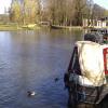
Thames - Cherwell (old) Junction
Junction of the River Thames and the River Cherwell
Christ Church Meadow, Front Quad, Oxford, United Kingdom
Address is taken from a point 381 yards away.

Thames - Cherwell (old) Junction
is a minor waterways place
on the River Thames (below Oxford) between
Thames - Seacourt Stream Junction (Junction of the River Thames and the Seacourt Stream) (1 mile and 3¼ furlongs
and 1 lock
to the northwest) and
Iffley Lock Weir Entrance No 2 (Channel leading to the Weir - No Access) (3¾ furlongs
to the southeast).
The nearest place in the direction of Thames - Seacourt Stream Junction is Folly Bridge "visitor" Moorings (No visitor mooring available (April 2022));
¾ furlongs
away.
The nearest place in the direction of Iffley Lock Weir Entrance No 2 is Thames - Cherwell Junction (Junction of the River Thames and the new mouth of Cherwell (correctly pronounced "Charwell"));
1¾ furlongs
away.
Mooring here is unrated.
| Gasworks Bridge | 5 furlongs | |
| Grandpont Bridge | 3¾ furlongs | |
| Folly Bridge | 2 furlongs | |
| The Head of the River PH | 2 furlongs | |
| Folly Bridge "visitor" Moorings | ¾ furlongs | |
| Thames - Cherwell (old) Junction | ||
| Thames - Cherwell Junction | 1¾ furlongs | |
| Iffley Lock Weir Entrance No 3 | 3½ furlongs | |
| Iffley Lock Weir Entrance No 2 | 3¾ furlongs | |
| Donnington Bridge (Iffley) | 5¾ furlongs | |
| Salters Steamers (boatbuilders) | 6¼ furlongs | |
Amenities nearby at Thames - Cherwell Junction
Amenities in City of Oxford
Amenities at other places in City of Oxford
at Osney Lock
at Osney Bridge
at Osney Bridge
at Osney Bridge
at Osney Bridge
at Osney Marina
at Osney Bridge
at Osney Bridge
at Osney Bridge
at Osney Bridge
There are no links to external websites from here.
Why not log in and add some (select "External websites" from the menu (sometimes this is under "Edit"))?
Mouseover for more information or show routes to facility
Nearest water point
In the direction of Teddington Lock Weir Exit
Abingdon Lock — 7 miles, 3¼ furlongs and 2 locks away
On this waterway in the direction of Teddington Lock Weir Exit
Abingdon Bridge Marine — 7 miles, 7 furlongs and 3 locks away
On this waterway in the direction of Teddington Lock Weir Exit
In the direction of Osney Bridge
Oxford Visitor Moorings — 1 mile, 5 furlongs and 2 locks away
Travel to Osney Bridge, then on the River Thames (above Oxford) to Sheepwash Channel Junction, then on the River Thames (Sheepwash Channel) to Isis Lock Junction, then on the Oxford Canal (Southern Section - Main Line) to Oxford Visitor Moorings
St Edwards Lift Bridge No 238 — 3 miles and 2 locks away
Travel to Osney Bridge, then on the River Thames (above Oxford) to Sheepwash Channel Junction, then on the River Thames (Sheepwash Channel) to Isis Lock Junction, then on the Oxford Canal (Southern Section - Main Line) to St Edwards Lift Bridge No 238
Wolvercote Sanitary Station — 4 miles, ¾ furlongs and 3 locks away
Travel to Osney Bridge, then on the River Thames (above Oxford) to Sheepwash Channel Junction, then on the River Thames (Sheepwash Channel) to Isis Lock Junction, then on the Oxford Canal (Southern Section - Main Line) to Wolvercote Sanitary Station
Wolvercote Junction Water Point — 4 miles, 5¼ furlongs and 4 locks away
Travel to Osney Bridge, then on the River Thames (above Oxford) to Sheepwash Channel Junction, then on the River Thames (Sheepwash Channel) to Isis Lock Junction, then on the Oxford Canal (Southern Section - Main Line) to Wolvercote Junction Water Point
Eynsham Lock — 7 miles, 3 furlongs and 3 locks away
Travel to Osney Bridge, then on the River Thames (above Oxford) to Eynsham Lock
Langford Lane Bridge No 224 — 7 miles, 5 furlongs and 6 locks away
Travel to Osney Bridge, then on the River Thames (above Oxford) to Sheepwash Channel Junction, then on the River Thames (Sheepwash Channel) to Isis Lock Junction, then on the Oxford Canal (Southern Section - Main Line) to Langford Lane Bridge No 224
Aubreys Lift Bridge No 221 — 8 miles, 2¼ furlongs and 6 locks away
Travel to Osney Bridge, then on the River Thames (above Oxford) to Sheepwash Channel Junction, then on the River Thames (Sheepwash Channel) to Isis Lock Junction, then on the Oxford Canal (Southern Section - Main Line) to Aubreys Lift Bridge No 221
Thrupp Cruising Club — 8 miles, 2½ furlongs and 6 locks away
Travel to Osney Bridge, then on the River Thames (above Oxford) to Sheepwash Channel Junction, then on the River Thames (Sheepwash Channel) to Isis Lock Junction, then on the Oxford Canal (Southern Section - Main Line) to Thrupp Cruising Club
Shifford Lock — 17 miles, 3¾ furlongs and 6 locks away
Travel to Osney Bridge, then on the River Thames (above Oxford) to Shifford Lock
Heyford Wharf Bridge No 206 — 15 miles, 6¾ furlongs and 11 locks away
Travel to Osney Bridge, then on the River Thames (above Oxford) to Sheepwash Channel Junction, then on the River Thames (Sheepwash Channel) to Isis Lock Junction, then on the Oxford Canal (Southern Section - Main Line) to Heyford Wharf Bridge No 206
Heyford Wharf — 15 miles, 7 furlongs and 11 locks away
Travel to Osney Bridge, then on the River Thames (above Oxford) to Sheepwash Channel Junction, then on the River Thames (Sheepwash Channel) to Isis Lock Junction, then on the Oxford Canal (Southern Section - Main Line) to Heyford WharfNearest rubbish disposal
In the direction of Teddington Lock Weir Exit
Abingdon Lock — 7 miles, 3¼ furlongs and 2 locks away
On this waterway in the direction of Teddington Lock Weir Exit
Day's Lock — 15 miles, 5½ furlongs and 5 locks away
On this waterway in the direction of Teddington Lock Weir Exit
In the direction of Osney Bridge
Wolvercote Sanitary Station — 4 miles, ¾ furlongs and 3 locks away
Travel to Osney Bridge, then on the River Thames (above Oxford) to Sheepwash Channel Junction, then on the River Thames (Sheepwash Channel) to Isis Lock Junction, then on the Oxford Canal (Southern Section - Main Line) to Wolvercote Sanitary Station
Eynsham Lock — 7 miles, 3 furlongs and 3 locks away
Travel to Osney Bridge, then on the River Thames (above Oxford) to Eynsham Lock
Aubreys Lift Bridge No 221 — 8 miles, 2¼ furlongs and 6 locks away
Travel to Osney Bridge, then on the River Thames (above Oxford) to Sheepwash Channel Junction, then on the River Thames (Sheepwash Channel) to Isis Lock Junction, then on the Oxford Canal (Southern Section - Main Line) to Aubreys Lift Bridge No 221
Thrupp Cruising Club — 8 miles, 2½ furlongs and 6 locks away
Travel to Osney Bridge, then on the River Thames (above Oxford) to Sheepwash Channel Junction, then on the River Thames (Sheepwash Channel) to Isis Lock Junction, then on the Oxford Canal (Southern Section - Main Line) to Thrupp Cruising Club
Heyford Wharf Bridge No 206 — 15 miles, 6¾ furlongs and 11 locks away
Travel to Osney Bridge, then on the River Thames (above Oxford) to Sheepwash Channel Junction, then on the River Thames (Sheepwash Channel) to Isis Lock Junction, then on the Oxford Canal (Southern Section - Main Line) to Heyford Wharf Bridge No 206
Heyford Wharf — 15 miles, 7 furlongs and 11 locks away
Travel to Osney Bridge, then on the River Thames (above Oxford) to Sheepwash Channel Junction, then on the River Thames (Sheepwash Channel) to Isis Lock Junction, then on the Oxford Canal (Southern Section - Main Line) to Heyford WharfNearest chemical toilet disposal
In the direction of Teddington Lock Weir Exit
Abingdon Lock — 7 miles, 3¼ furlongs and 2 locks away
On this waterway in the direction of Teddington Lock Weir Exit
Day's Lock — 15 miles, 5½ furlongs and 5 locks away
On this waterway in the direction of Teddington Lock Weir Exit
In the direction of Osney Bridge
Wolvercote Sanitary Station — 4 miles, ¾ furlongs and 3 locks away
Travel to Osney Bridge, then on the River Thames (above Oxford) to Sheepwash Channel Junction, then on the River Thames (Sheepwash Channel) to Isis Lock Junction, then on the Oxford Canal (Southern Section - Main Line) to Wolvercote Sanitary Station
Eynsham Lock — 7 miles, 3 furlongs and 3 locks away
Travel to Osney Bridge, then on the River Thames (above Oxford) to Eynsham Lock
Thrupp Cruising Club — 8 miles, 2½ furlongs and 6 locks away
Travel to Osney Bridge, then on the River Thames (above Oxford) to Sheepwash Channel Junction, then on the River Thames (Sheepwash Channel) to Isis Lock Junction, then on the Oxford Canal (Southern Section - Main Line) to Thrupp Cruising ClubNearest place to turn
In the direction of Teddington Lock Weir Exit
Thames - Cherwell Junction — 1¾ furlongs away
On this waterway in the direction of Teddington Lock Weir Exit
Iffley Lock Weir Entrance No 1 — 1 mile, 1 furlong away
On this waterway in the direction of Teddington Lock Weir Exit
Iffley Lock Weir Exit No 1 — 1 mile, 2 furlongs and 1 lock away
On this waterway in the direction of Teddington Lock Weir Exit
Sandford Lock Weir Exit (Thames) — 2 miles, 7¾ furlongs and 2 locks away
On this waterway in the direction of Teddington Lock Weir Exit
Abingdon Lock Weir Exit No 1 — 7 miles, 4 furlongs and 3 locks away
On this waterway in the direction of Teddington Lock Weir Exit
Abingdon Bridge Winding Hole — 7 miles, 7 furlongs and 3 locks away
On this waterway in the direction of Teddington Lock Weir Exit
Culham Lock Weir Entrance — 8 miles, 1 furlong and 3 locks away
On this waterway in the direction of Teddington Lock Weir Exit
In the direction of Osney Bridge
Osney Lock Weir Exit — 1 mile, ½ furlongs away
On this waterway in the direction of Osney Bridge
Sheepwash Channel Junction — 1 mile, 3¼ furlongs and 1 lock away
Travel to Osney Bridge, then on the River Thames (above Oxford) to Sheepwash Channel Junction
Castle Mill Stream Junction — 1 mile, 4 furlongs and 1 lock away
Travel to Osney Bridge, then on the River Thames (above Oxford) to Sheepwash Channel Junction, then on the River Thames (Sheepwash Channel) to Castle Mill Stream Junction
Bossoms Boat Yard — 2 miles, 1¼ furlongs and 1 lock away
Travel to Osney Bridge, then on the River Thames (above Oxford) to Bossoms Boat Yard
Hythe Bridge Arm Winding Hole — 1 mile, 4½ furlongs and 2 locks away
Travel to Osney Bridge, then on the River Thames (above Oxford) to Sheepwash Channel Junction, then on the River Thames (Sheepwash Channel) to Isis Lock Junction, then on the Oxford Canal (Southern Section - Main Line) to Hythe Bridge Arm Winding Hole
End of Hythe Bridge Arm — 1 mile, 5¼ furlongs and 2 locks away
Travel to Osney Bridge, then on the River Thames (above Oxford) to Sheepwash Channel Junction, then on the River Thames (Sheepwash Channel) to Isis Lock Junction, then on the Oxford Canal (Southern Section - Main Line) to End of Hythe Bridge Arm
Wolvercote Junction — 4 miles, 4¼ furlongs and 3 locks away
Travel to Osney Bridge, then on the River Thames (above Oxford) to Sheepwash Channel Junction, then on the River Thames (Sheepwash Channel) to Isis Lock Junction, then on the Oxford Canal (Southern Section - Main Line) to Wolvercote Junction
Duke's Cut Junction — 4 miles, 6½ furlongs and 3 locks away
Travel to Osney Bridge, then on the River Thames (above Oxford) to Duke's Cut Junction
Bypass Reservoir Junction — 4 miles, 6¼ furlongs and 4 locks away
Travel to Osney Bridge, then on the River Thames (above Oxford) to Sheepwash Channel Junction, then on the River Thames (Sheepwash Channel) to Isis Lock Junction, then on the Oxford Canal (Southern Section - Main Line) to Wolvercote Junction, then on the Oxford Canal (Duke's Cut) to Bypass Reservoir Junction
Thames - Wharf Stream Junction — 7 miles, 1¼ furlongs and 3 locks away
Travel to Osney Bridge, then on the River Thames (above Oxford) to Thames - Wharf Stream Junction
Pinkhill Lock Weir Exit — 8 miles, 5¼ furlongs and 4 locks away
Travel to Osney Bridge, then on the River Thames (above Oxford) to Pinkhill Lock Weir Exit
Thrupp Wide — 8 miles, 2½ furlongs and 6 locks away
Travel to Osney Bridge, then on the River Thames (above Oxford) to Sheepwash Channel Junction, then on the River Thames (Sheepwash Channel) to Isis Lock Junction, then on the Oxford Canal (Southern Section - Main Line) to Thrupp Wide
Shipton Weir Junction — 9 miles, 3 furlongs and 7 locks away
Travel to Osney Bridge, then on the River Thames (above Oxford) to Sheepwash Channel Junction, then on the River Thames (Sheepwash Channel) to Isis Lock Junction, then on the Oxford Canal (Southern Section - Main Line) to Shipton Weir JunctionNearest self-operated pump-out
In the direction of Teddington Lock Weir Exit
Abingdon Lock — 7 miles, 3¼ furlongs and 2 locks away
On this waterway in the direction of Teddington Lock Weir Exit
In the direction of Osney Bridge
Eynsham Lock — 7 miles, 3 furlongs and 3 locks away
Travel to Osney Bridge, then on the River Thames (above Oxford) to Eynsham Lock
Aubreys Lift Bridge No 221 — 8 miles, 2¼ furlongs and 6 locks away
Travel to Osney Bridge, then on the River Thames (above Oxford) to Sheepwash Channel Junction, then on the River Thames (Sheepwash Channel) to Isis Lock Junction, then on the Oxford Canal (Southern Section - Main Line) to Aubreys Lift Bridge No 221
Thrupp Cruising Club — 8 miles, 2½ furlongs and 6 locks away
Travel to Osney Bridge, then on the River Thames (above Oxford) to Sheepwash Channel Junction, then on the River Thames (Sheepwash Channel) to Isis Lock Junction, then on the Oxford Canal (Southern Section - Main Line) to Thrupp Cruising ClubNearest boatyard pump-out
In the direction of Teddington Lock Weir Exit
Abingdon Bridge Marine — 7 miles, 7 furlongs and 3 locks away
On this waterway in the direction of Teddington Lock Weir Exit
In the direction of Osney Bridge
Oxford Cruisers Marina — 8 miles, 2¾ furlongs and 4 locks away
Travel to Osney Bridge, then on the River Thames (above Oxford) to Oxford Cruisers Marina
Enslow Wharf — 10 miles, 6 furlongs and 8 locks away
Travel to Osney Bridge, then on the River Thames (above Oxford) to Sheepwash Channel Junction, then on the River Thames (Sheepwash Channel) to Isis Lock Junction, then on the Oxford Canal (Southern Section - Main Line) to Enslow Wharf
Heyford Wharf — 15 miles, 7 furlongs and 11 locks away
Travel to Osney Bridge, then on the River Thames (above Oxford) to Sheepwash Channel Junction, then on the River Thames (Sheepwash Channel) to Isis Lock Junction, then on the Oxford Canal (Southern Section - Main Line) to Heyford WharfDirection of TV transmitter (From Wolfbane Cybernetic)
There is no page on Wikipedia called “Thames - Cherwell (old) Junction”
Wikipedia pages that might relate to Thames - Cherwell (old) Junction
[River Thames]
along the river. The confluence of the Thames and Cherwell was the site of early settlements and the River Cherwell marked the boundary between the Dobunni
[Tributaries of the River Thames]
(2006). "River water quality of the River Cherwell: An agricultural clay-dominated catchment in the upper Thames Basin, southeastern England". Science of
[Banbury]
Banbury is a historic market town on the River Cherwell in Oxfordshire, England, 64 miles (103 km) northwest of London, 37 miles (60 km) southeast of Birmingham
[East West Rail]
finally the Marston Vale line from Bletchley to Bedford. The existing Cherwell Valley line will form a link to the Great Western main line at Didcot Parkway
[History of Banbury]
Banbury is a circa 1,500-year-old market town and civil parish on the River Cherwell in the Cherwell District of Oxfordshire, England. It is 64 miles (103 km)
[Marston, Oxford]
of New Marston, over a bridge on the River Cherwell, past the southern boundary of The Parks to the junction of South Parks Road and St Cross Road near
[Great Western main line]
Goring-on-Thames; Streatley; Cholsey; Didcot; Swindon; Chippenham; Bath; Keynsham; and Bristol. From London to Didcot, the line follows the Thames Valley
[Oxford Canal]
Banbury Town Council and Cherwell District Council treat the canal as an attraction to be encouraged; examples of its work include an old boatyard which has
[M40 motorway]
course of almost due north for 5 miles (8.0 km) before reaching Junction 10, for the Cherwell Valley services, the A43 and the village of Ardley. The A43
[Oxford]
of the River Cherwell. The boundaries were further extended in 1889 to add the areas of Grandpont and New Hinksey, south of the Thames, which were transferred
Results of Google Search
The River Cherwell is a tributary of the River Thames in central England. It rises near Hellidon, ... On the west bank is a large housing estate built in the 1970s, Cherwell Heights, and a mile south the ancient village of Bodicote on high ... and High Wycombe to London, originally connecting Paddington station, succeeded by ...
River Cherwell beside Christchurch Meadow,Oxford,UK. ... showing (I think) the old mouth of the Cherwell, Christchurch College and Folly Bridge - (here ... Meadow occurs the junction of the Cherwell and the Thames: the river so dear to Alma ...
Mar 10, 2012 ... Junction of the Cherwell and the Thames. ... Our noble old topographer, Camden, takes the opportunity of this locality for an eloquent praise of ...
... by the junction of two rivers - the Thames (called locally the Isis) and the Cherwell. The central crossroads of the old town is known as Carfax (a word derived ...
The existence of wide valleys where the small upper waters of the Cherwell, Evenlode ... are considered to point to the former existence of a much larger river, in the ... Lechlade, the Thames and Severn canal has its junction with the Thames.
Above: The junction of the Oxford Canal and the Thames - photo by J Briggs ... Above: The unique old chain lift bridge at Thrupp - photo by J Briggs ... sheep and cows sometimes paddling in the River Cherwell, which runs next to the canal .
It also housed the River Giant who took orders from Old Father Thames. Folly Bridge ... to the Thames. The River Cherwell was also a tributary of the Thames.
Dec 22, 2020 ... Thames Valley Police is appealing for witnesses following a road traffic collision ... pulling out of the junction of Canal Street onto Lower Cherwell Street. The motorcyclist, a 23-year-old man, was taken to hospital with serious ...


![View across the Thames towards Christ Church Meadow. There is an OS benchmark [[5297178]] on the concrete bank edge of the river where the grass has been removed. by Roger Templeman – 28 February 2017](https://s0.geograph.org.uk/geophotos/05/29/71/5297192_ea85aaef_120x120.jpg)


![Bridge to College Boat Houses. The bridge connects the path along the edge of Christchurch Meadow with the island upon which the [[2497411]] are built. Seen from boat on River Isis. by Peter Facey – 08 July 2011](https://s1.geograph.org.uk/geophotos/02/53/12/2531233_cd1bdf34_120x120.jpg)