CanalPlanAC

Parkend Bridge

 
Castle Lane, Stroud GL2 7NE, United Kingdom
 
Information about the place
 
 
The nearest place in the direction of Saul Junction is Pegthorne Bridge Winding Hole; 7¾ furlongs away.
 
The nearest place in the direction of Gloucester Docks is Site of Hardwicke Bridge; 1 mile and 4¼ furlongs away.

Mooring here is unrated.

Facilities: rubbish disposal.

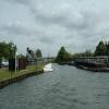
There is a swing bridge here.

Saul Junction Winding Hole1 mile, 5 furlongs
Saul Junction1 mile, 4¾ furlongs
Saul Junction Footbridge1 mile, 4½ furlongs
Site of Pegthorne Bridge1 mile
Pegthorne Bridge Winding Hole7¾ furlongs
Parkend Bridge
Site of Hardwicke Bridge1 mile, 4¼ furlongs
Sellars Bridge2 miles, 1½ furlongs
Quedgeley Oil Depot2 miles, 2¾ furlongs
Quedgeley Wharf Visitor Mooring2 miles, 3¼ furlongs
Rea Bridge3 miles, 4¾ furlongs
 
 
Amenities

Amenities nearby at Site of Hardwicke Bridge

 McDonalds
 BP
 
Maps
If you are a user and are logged on, or if you are actively planning a route, a map will be displayed here.
Show on external mapping site: Google | OSM | Bing
 
Additional information

There is no other information about Parkend Bridge. Why not add some

 
Photos
 
External websites
There are no links to external websites from here.
Why not log in and add some (select "External websites" from the menu (sometimes this is under "Edit"))?
 
Nearest facilities

Mouseover for more information or show routes to facility

Nearest water point

In the direction of Sharpness Junction

Saul Junction Winding Hole1 mile, 5 furlongs away
On this waterway in the direction of Sharpness Junction
Saul Junction Marina1 mile, 5¾ furlongs away
Travel to Saul Junction, then on the Cotswold Canals (Stroudwater Navigation - Navigable Section) to Saul Junction Marina On this waterway in the direction of Sharpness Junction
Fretherne Bridge2 miles, 3 furlongs away
On this waterway in the direction of Sharpness Junction
Splatt Bridge3 miles, 3¾ furlongs away
On this waterway in the direction of Sharpness Junction
Patch Bridge5 miles, 2½ furlongs away
On this waterway in the direction of Sharpness Junction
Purton Lower Bridge7 miles, 6¼ furlongs away
On this waterway in the direction of Sharpness Junction

In the direction of Gloucester / Sharpness - Severn Junction

Sellars Bridge2 miles, 1½ furlongs away
On this waterway in the direction of Gloucester / Sharpness - Severn Junction
Llanthony Pontoons5 miles, 7¼ furlongs away
On this waterway in the direction of Gloucester / Sharpness - Severn Junction
Llanthony Road Bridge6 miles, ¼ furlongs away
On this waterway in the direction of Gloucester / Sharpness - Severn Junction
Gloucester Waterways Museum Arm6 miles, ½ furlongs away
On this waterway in the direction of Gloucester / Sharpness - Severn Junction
Gloucester Dock Lock6 miles, 1½ furlongs away
On this waterway in the direction of Gloucester / Sharpness - Severn Junction
Tewkesbury Lower Lode17 miles, 7¼ furlongs and 1 lock away
Travel to Gloucester / Sharpness - Severn Junction, then on the River Severn (main river - Worcester to Gloucester) to Tewkesbury Lower Lode
Upper Lode Lock No 518 miles, 5½ furlongs and 1 lock away
Travel to Gloucester / Sharpness - Severn Junction, then on the River Severn (main river - Worcester to Gloucester) to Upper Lode Lock No 5
Tewkesbury Services19 miles, 3½ furlongs and 3 locks away
Travel to Gloucester / Sharpness - Severn Junction, then on the River Severn (main river - Worcester to Gloucester) to Tewkesbury Junction, then on the River Avon - Warwickshire (Lower Avon Navigation) to Tewkesbury Services

Nearest rubbish disposal

The nearest rubbish disposal is here. Others are at:

In the direction of Sharpness Junction

Saul Junction Winding Hole1 mile, 5 furlongs away
On this waterway in the direction of Sharpness Junction
Saul Junction Marina1 mile, 5¾ furlongs away
Travel to Saul Junction, then on the Cotswold Canals (Stroudwater Navigation - Navigable Section) to Saul Junction Marina
Fretherne Bridge2 miles, 3 furlongs away
On this waterway in the direction of Sharpness Junction
Splatt Bridge3 miles, 3¾ furlongs away
On this waterway in the direction of Sharpness Junction
Patch Bridge5 miles, 2½ furlongs away
On this waterway in the direction of Sharpness Junction
Purton Lower Bridge7 miles, 6¼ furlongs away
On this waterway in the direction of Sharpness Junction
Sharpness Barge Arm9 miles, 1½ furlongs away
On this waterway in the direction of Sharpness Junction

In the direction of Gloucester / Sharpness - Severn Junction

Sellars Bridge2 miles, 1½ furlongs away
On this waterway in the direction of Gloucester / Sharpness - Severn Junction
Llanthony Road Bridge6 miles, ¼ furlongs away
On this waterway in the direction of Gloucester / Sharpness - Severn Junction
Tewkesbury Services19 miles, 3½ furlongs and 3 locks away
Travel to Gloucester / Sharpness - Severn Junction, then on the River Severn (main river - Worcester to Gloucester) to Tewkesbury Junction, then on the River Avon - Warwickshire (Lower Avon Navigation) to Tewkesbury Services

Nearest chemical toilet disposal

In the direction of Sharpness Junction

Saul Junction Marina1 mile, 5¾ furlongs away
Travel to Saul Junction, then on the Cotswold Canals (Stroudwater Navigation - Navigable Section) to Saul Junction Marina On this waterway in the direction of Sharpness Junction
Sharpness Barge Arm9 miles, 1½ furlongs away
On this waterway in the direction of Sharpness Junction

In the direction of Gloucester / Sharpness - Severn Junction

Llanthony Road Bridge6 miles, ¼ furlongs away
On this waterway in the direction of Gloucester / Sharpness - Severn Junction

Nearest place to turn

In the direction of Sharpness Junction

Pegthorne Bridge Winding Hole7¾ furlongs away
On this waterway in the direction of Sharpness Junction
Saul Junction Winding Hole1 mile, 5 furlongs away
On this waterway in the direction of Sharpness Junction
Sharpness Barge Arm9 miles, 1½ furlongs away
On this waterway in the direction of Sharpness Junction
The Ocean5 miles, 3¼ furlongs and 8 locks away
Travel to Saul Junction, then on the Cotswold Canals (Stroudwater Navigation - Navigable Section) to Walk Bridge, then on the Cotswold Canals (Stroudwater Navigation - Un-navigable Section) to The Ocean
Ryeford Winding Hole6 miles, 3 furlongs and 8 locks away
Travel to Saul Junction, then on the Cotswold Canals (Stroudwater Navigation - Navigable Section) to Walk Bridge, then on the Cotswold Canals (Stroudwater Navigation - Un-navigable Section) to Ryeford Winding Hole
Brimscombe Port11 miles, 1½ furlongs and 19 locks away
Travel to Saul Junction, then on the Cotswold Canals (Stroudwater Navigation - Navigable Section) to Walk Bridge, then on the Cotswold Canals (Stroudwater Navigation - Un-navigable Section) to Site of Entrance to Wallbridge Basin, then on the Cotswold Canals (Thames and Severn Canal - Wide section) to Brimscombe Port

In the direction of Gloucester / Sharpness - Severn Junction

Quedgeley Oil Depot2 miles, 2¾ furlongs away
On this waterway in the direction of Gloucester / Sharpness - Severn Junction
Monk Meadow Dock5 miles, 5 furlongs away
On this waterway in the direction of Gloucester / Sharpness - Severn Junction
Gloucester Docks6 miles, 1 furlong away
On this waterway in the direction of Gloucester / Sharpness - Severn Junction On this waterway in the direction of Gloucester / Sharpness - Severn Junction
Gloucester / Sharpness - Severn Junction6 miles, 1¾ furlongs and 1 lock away
On this waterway in the direction of Gloucester / Sharpness - Severn Junction
Upper Parting Junction8 miles, 6½ furlongs and 1 lock away
Travel to Gloucester / Sharpness - Severn Junction, then on the River Severn (main river - Worcester to Gloucester) to Upper Parting Junction
Over Winding Hole8 miles, 1½ furlongs and 2 locks away
Travel to Gloucester / Sharpness - Severn Junction, then on the River Severn (old river navigation) to Lower Parting, then on the River Severn (Maisemore Channel - Southern Section) to Over Junction, then on the Hereford and Gloucester Canal to Over Winding Hole
Upper Lode Lock Weir Exit18 miles, 3½ furlongs and 1 lock away
Travel to Gloucester / Sharpness - Severn Junction, then on the River Severn (main river - Worcester to Gloucester) to Upper Lode Lock Weir Exit
Upper Lode Lock Weir Entrance18 miles, 6½ furlongs and 2 locks away
Travel to Gloucester / Sharpness - Severn Junction, then on the River Severn (main river - Worcester to Gloucester) to Upper Lode Lock Weir Entrance
Avon Lock Junction19 miles, 3¼ furlongs and 3 locks away
Travel to Gloucester / Sharpness - Severn Junction, then on the River Severn (main river - Worcester to Gloucester) to Tewkesbury Junction, then on the River Avon - Warwickshire (Lower Avon Navigation) to Avon Lock Junction
Abbey Mill Tewkesbury19 miles, 4¼ furlongs and 3 locks away
Travel to Gloucester / Sharpness - Severn Junction, then on the River Severn (main river - Worcester to Gloucester) to Tewkesbury Junction, then on the River Avon - Warwickshire (Lower Avon Navigation) to Avon Lock Junction, then on the River Avon - Warwickshire (Mill Avon) to Abbey Mill Tewkesbury
Tewkesbury Marina Entrance No 219 miles, 7¼ furlongs and 3 locks away
Travel to Gloucester / Sharpness - Severn Junction, then on the River Severn (main river - Worcester to Gloucester) to Tewkesbury Junction, then on the River Avon - Warwickshire (Lower Avon Navigation) to Tewkesbury Marina Entrance No 2

Nearest self-operated pump-out

In the direction of Sharpness Junction

On this waterway in the direction of Sharpness Junction
Purton Lower Bridge7 miles, 6¼ furlongs away
On this waterway in the direction of Sharpness Junction

In the direction of Gloucester / Sharpness - Severn Junction

Llanthony Pontoons5 miles, 7¼ furlongs away
On this waterway in the direction of Gloucester / Sharpness - Severn Junction

Nearest boatyard pump-out

In the direction of Sharpness Junction

Saul Junction Marina1 mile, 5¾ furlongs away
Travel to Saul Junction, then on the Cotswold Canals (Stroudwater Navigation - Navigable Section) to Saul Junction Marina
Patch Bridge5 miles, 2½ furlongs away
On this waterway in the direction of Sharpness Junction
Direction of TV transmitter (From Wolfbane Cybernetic)
 
 
Geograph
 
Wikipedia

There is no page on Wikipedia called “Parkend Bridge”

Wikipedia pages that might relate to Parkend Bridge
[Moreton Valence] Gloucester and Sharpness Canal. The Parkend Canal bridge is in the middle of Moreton Valence, with the Parkend Bridge House which is a Grade II listed building [Forest of Dean] Quag Littledean Jail Lydney Harbour Mallards Pike Lake New Fancy Parkend Ironworks Parkend railway station Perrygrove Railway Puzzlewood RSPB Nagshead Sculpture [Parkend railway station] Parkend railway station is located in the village of Parkend, in the Forest of Dean, Gloucestershire. It is currently the northern terminus of the Dean [Severn and Wye Railway] Lydney, where a small harbour was constructed, and opened its line to Parkend in 1810. It was progressively extended northwards, and a second line, the [Dean Forest Railway] 4 1⁄4-mile (6.8 km) long heritage railway that runs between Lydney and Parkend in the Forest of Dean, Gloucestershire. The route was part of the former [Gloucester and Sharpness Canal] 6 May 2006. In January 2009 a project began to replace the Patch Bridge swing bridge with a motor powered design instead of the former hand-cranked system [Cannop Ponds] Cannop Ponds (grid reference SO608106) are two large ponds, just north of Parkend in the Forest of Dean, Gloucestershire, England. The ponds, and surrounding [River Thames] existing bridges both in London and along the length of the river. These included Putney Bridge, Westminster Bridge, Datchet Bridge, Windsor Bridge and Sonning [Severn Bridge Railway] The Severn Bridge Railway was a railway company which constructed a railway from Lydney to Sharpness in Gloucestershire, England. It was intended chiefly [River Severn] Bridge – a steel beam bridge, west of Tewkesbury Maisemore Bridge – carries the A417 and is a single masonry arch, dating back to 1230. Over Bridge
 
Google

Results of Google Search

Parkend Bridge L1 :: Waterside Moorings
Located six miles to the south of Gloucester, Parkend Bridge Moorings are perfectly situated to explore the impressive engineering and stunning scenery of the ...
Gloucester and Sharpness Canal - North of Parkend Bridge to the ...
Please note the canal from north of Parkend Bridge to the South of Rea Bridge will be closed during the race. The first race will start at 11:00am and finish at ...
Parkend Bridge L1 :: Waterside Moorings
Parkend Bridge L1. Site Information · No Vacancies. Unfortunately, we do not currently have any vacancies at this site . If you would like to be notified by email  ...
Purton to Parkend Bridge canoe trail | Canal & River Trust
The next time you'll meet civilisation is a few miles on at Saul Junction where there's a large car park and café. A mile on from Saul Junction is Parkend Bridge  ...
'Parkend Bridge', Moreton Valence | 3D Warehouse
Swing bridge over Gloucester/Sharpness Canal. Iron structure with bitumen finish roadway surface. The opening section of the bridge is supported on a ...
Property details for Parkend Bridge House Castle Lane Moreton ...
Use Zoopla to view property details for Parkend Bridge House Castle Lane Moreton Valence Gloucester GL2 7NE including a current value estimate, local ...
Parkend Bridge – Saul Junction Loop from Stonehouse | road bike ...
Parkend Bridge – Saul Junction Loop from Stonehouse is an intermediate road ride. See this Tour and others like it, or plan your own with komoot!
Parkend Memories
Parkend Bridge House I was born in the bridge house at Parkend Bridge in 1941 and lived there until 1955. My father Bob Woodman was the bridgeman, ...
PARKEND BRIDGE HOUSE, Moreton Valence - 1155439 | Historic ...
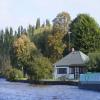
MORETON VALENCE - SO 71 SE 3/222 Parkend Bridge House II Bridgekeeper's house at Parkend Bridge on Gloucester and Sharpness Canal. Early C19 ...
File:Parkend, Bridge Street, Penicuik - geograph.org.uk - 911908.jpg ...
Aug 4, 2008 ... English: Parkend, Bridge Street, Penicuik This building, on Bridge Street to the north of the Telford Bridge on the A701 and said to be in a ...