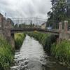
St. Peters Road Footbridge
Saint Peters Road, King's Lynn and West Norfolk PE14 9EJ, United Kingdom

St. Peters Road Footbridge
is a minor waterways place
on the Middle Level Navigations (Old River Nene) between
Upwell (1 furlong
to the southwest) and
Outwell - Lance Hunter Rowe Boat Basin (Junction of Old River Nene with Well Creek) (4¾ furlongs
to the northeast).
The nearest place in the direction of Outwell - Lance Hunter Rowe Boat Basin is Upwell Post Office Visitor Mooring;
¾ furlongs
away.
This is a pinch point. The normal maximum dimensions for a boat on this waterway are 72 feet long and 13 feet wide (the maxium height and draught are unknown), but to pass through here the maximum dimensions are 6 feet and 7 inches high.
There may be access to the towpath here.
Mooring here is impossible (it may be physically impossible, forbidden, or allowed only for specific short-term purposes).
There is a bridge here which takes pedestrian traffic over the canal.
Marmont Priory Sluice | 1 mile, 3½ furlongs | |
March Riverside Footbridge | 5¾ furlongs | |
Upwell March Riverside Public Staithe (visitor mooring) | 3 furlongs | |
Upwell New Bridge | 1¾ furlongs | |
Upwell | 1 furlong | |
St. Peters Road Footbridge | ||
Upwell Post Office Visitor Mooring | ¾ furlongs | |
Upwell Church Bridge | 1 furlong | |
Upwell Church Bridge Public Staithe (visitor mooring) | 1¼ furlongs | |
Low Side Footbridge | 2¼ furlongs | |
Rectory Road Bridge | 4¼ furlongs |
There are no links to external websites from here.
Why not log in and add some (select "External websites" from the menu (sometimes this is under "Edit"))?
Mouseover for more information or show routes to facility
Nearest water point
In the direction of Outwell - Lance Hunter Rowe Boat Basin
Upwell Church Bridge Public Staithe (visitor mooring) — 1¼ furlongs away
On this waterway in the direction of Outwell - Lance Hunter Rowe Boat Basin
Denver Sluice — 6 miles, 3¼ furlongs and 1 lock away
Travel to Outwell - Lance Hunter Rowe Boat Basin, then on the Middle Level Navigations (Well Creek) to Salter's Lode Junction, then on the River Great Ouse (New Bedford River) to Denver Junction, then on the River Great Ouse (Old West River - Large River) to Denver Sluice
Downham Market Road Bridge — 8 miles, ¾ furlongs and 3 locks away
Travel to Outwell - Lance Hunter Rowe Boat Basin, then on the Middle Level Navigations (Well Creek) to Salter's Lode Junction, then on the River Great Ouse (New Bedford River) to Denver Junction, then on the River Great Ouse (Old West River - Large River) to Old West River - Great Ouse Relief Channel Junction, then on the River Great Ouse (Great Ouse Relief Channel) to Downham Market Road Bridge
Windmill EA Mooring — 9 miles, 3 furlongs and 2 locks away
Travel to Outwell - Lance Hunter Rowe Boat Basin, then on the Middle Level Navigations (Well Creek) to Salter's Lode Junction, then on the River Great Ouse (New Bedford River) to Denver Junction, then on the River Great Ouse (Old West River - Large River) to Windmill EA Mooring
West Head Road Bridge — 10 miles, 4 furlongs and 3 locks away
Travel to Outwell - Lance Hunter Rowe Boat Basin, then on the Middle Level Navigations (Well Creek) to Salter's Lode Junction, then on the River Great Ouse (New Bedford River) to Denver Junction, then on the River Great Ouse (Old West River - Large River) to Old West River - Great Ouse Relief Channel Junction, then on the River Great Ouse (Great Ouse Relief Channel) to West Head Road Bridge
Stowbridge Heron EA Moorings — 10 miles, 4¼ furlongs and 3 locks away
Travel to Outwell - Lance Hunter Rowe Boat Basin, then on the Middle Level Navigations (Well Creek) to Salter's Lode Junction, then on the River Great Ouse (New Bedford River) to Denver Junction, then on the River Great Ouse (Old West River - Large River) to Old West River - Great Ouse Relief Channel Junction, then on the River Great Ouse (Great Ouse Relief Channel) to Stowbridge Heron EA Moorings
Wiggenhall St Mary Magdalen — 13 miles, ¾ furlongs and 3 locks away
Travel to Outwell - Lance Hunter Rowe Boat Basin, then on the Middle Level Navigations (Well Creek) to Salter's Lode Junction, then on the River Great Ouse (New Bedford River) to Denver Junction, then on the River Great Ouse (Old West River - Large River) to Old West River - Great Ouse Relief Channel Junction, then on the River Great Ouse (Great Ouse Relief Channel) to Wiggenhall St Mary Magdalen
Kings Lynn Visitor Pontoon — 19 miles, 3¾ furlongs and 1 lock away
Travel to Outwell - Lance Hunter Rowe Boat Basin, then on the Middle Level Navigations (Well Creek) to Salter's Lode Junction, then on the River Great Ouse (Large Tidal Section) to Kings Lynn Visitor Pontoon
In the direction of Old River Nene - Black Ham Drain - Bevill's Leam Junction
March Boater Services — 7 miles, 2¼ furlongs and 1 lock away
On this waterway in the direction of Old River Nene - Black Ham Drain - Bevill's Leam Junction
March Marina — 8 miles, 2 furlongs and 1 lock away
On this waterway in the direction of Old River Nene - Black Ham Drain - Bevill's Leam JunctionNearest rubbish disposal
In the direction of Outwell - Lance Hunter Rowe Boat Basin
Upwell Church Bridge Public Staithe (visitor mooring) — 1¼ furlongs away
On this waterway in the direction of Outwell - Lance Hunter Rowe Boat Basin
In the direction of Old River Nene - Black Ham Drain - Bevill's Leam Junction
March Boater Services — 7 miles, 2¼ furlongs and 1 lock away
On this waterway in the direction of Old River Nene - Black Ham Drain - Bevill's Leam JunctionNearest chemical toilet disposal
In the direction of Outwell - Lance Hunter Rowe Boat Basin
Denver Sluice — 6 miles, 3¼ furlongs and 1 lock away
Travel to Outwell - Lance Hunter Rowe Boat Basin, then on the Middle Level Navigations (Well Creek) to Salter's Lode Junction, then on the River Great Ouse (New Bedford River) to Denver Junction, then on the River Great Ouse (Old West River - Large River) to Denver Sluice
In the direction of Old River Nene - Black Ham Drain - Bevill's Leam Junction
March Boater Services — 7 miles, 2¼ furlongs and 1 lock away
On this waterway in the direction of Old River Nene - Black Ham Drain - Bevill's Leam Junction
March Marina — 8 miles, 2 furlongs and 1 lock away
On this waterway in the direction of Old River Nene - Black Ham Drain - Bevill's Leam JunctionNearest place to turn
In the direction of Outwell - Lance Hunter Rowe Boat Basin
Salter's Lode Junction — 5 miles, 7¾ furlongs and 1 lock away
Travel to Outwell - Lance Hunter Rowe Boat Basin, then on the Middle Level Navigations (Well Creek) to Salter's Lode Junction
Denver Junction — 6 miles, 2¾ furlongs and 1 lock away
Travel to Outwell - Lance Hunter Rowe Boat Basin, then on the Middle Level Navigations (Well Creek) to Salter's Lode Junction, then on the River Great Ouse (New Bedford River) to Denver Junction
Old West River - Great Ouse Relief Channel Junction — 6 miles, 4 furlongs and 2 locks away
Travel to Outwell - Lance Hunter Rowe Boat Basin, then on the Middle Level Navigations (Well Creek) to Salter's Lode Junction, then on the River Great Ouse (New Bedford River) to Denver Junction, then on the River Great Ouse (Old West River - Large River) to Old West River - Great Ouse Relief Channel Junction
Denver Relief Channel Lock Weir Entrance — 6 miles, 4¾ furlongs and 2 locks away
Travel to Outwell - Lance Hunter Rowe Boat Basin, then on the Middle Level Navigations (Well Creek) to Salter's Lode Junction, then on the River Great Ouse (New Bedford River) to Denver Junction, then on the River Great Ouse (Old West River - Large River) to Old West River - Great Ouse Relief Channel Junction, then on the River Great Ouse (Great Ouse Relief Channel) to Denver Relief Channel Lock Weir Entrance
Welmore Sluice — 8 miles, ½ furlongs and 1 lock away
Travel to Outwell - Lance Hunter Rowe Boat Basin, then on the Middle Level Navigations (Well Creek) to Salter's Lode Junction, then on the River Great Ouse (New Bedford River) to Welmore Sluice
Brandon Creek Junction — 13 miles, 2 furlongs and 2 locks away
Travel to Outwell - Lance Hunter Rowe Boat Basin, then on the Middle Level Navigations (Well Creek) to Salter's Lode Junction, then on the River Great Ouse (New Bedford River) to Denver Junction, then on the River Great Ouse (Old West River - Large River) to Brandon Creek Junction
Great Ouse - Middle Level Main Drain Junction — 15 miles, 4 furlongs and 1 lock away
Travel to Outwell - Lance Hunter Rowe Boat Basin, then on the Middle Level Navigations (Well Creek) to Salter's Lode Junction, then on the River Great Ouse (Large Tidal Section) to Great Ouse - Middle Level Main Drain Junction
Great Ouse - Mill Basin Junction — 15 miles, 5 furlongs and 1 lock away
Travel to Outwell - Lance Hunter Rowe Boat Basin, then on the Middle Level Navigations (Well Creek) to Salter's Lode Junction, then on the River Great Ouse (Large Tidal Section) to Great Ouse - Mill Basin Junction
Great Ouse - Smeeth Lode Junction — 15 miles, 5½ furlongs and 1 lock away
Travel to Outwell - Lance Hunter Rowe Boat Basin, then on the Middle Level Navigations (Well Creek) to Salter's Lode Junction, then on the River Great Ouse (Large Tidal Section) to Great Ouse - Smeeth Lode Junction
River Wissey - Cut-Off Channel Junction — 15 miles, 7¾ furlongs and 2 locks away
Travel to Outwell - Lance Hunter Rowe Boat Basin, then on the Middle Level Navigations (Well Creek) to Salter's Lode Junction, then on the River Great Ouse (New Bedford River) to Denver Junction, then on the River Great Ouse (Old West River - Large River) to River Great Ouse - River Wissey Junction, then on the River Great Ouse (River Wissey) to River Wissey - Cut-Off Channel Junction
Holmes River Junction — 16 miles, 6¼ furlongs and 2 locks away
Travel to Outwell - Lance Hunter Rowe Boat Basin, then on the Middle Level Navigations (Well Creek) to Salter's Lode Junction, then on the River Great Ouse (New Bedford River) to Denver Junction, then on the River Great Ouse (Old West River - Large River) to Holmes River Junction
Great Ouse - Great Ouse Relief Channel Junction — 17 miles, 5¾ furlongs and 1 lock away
Travel to Outwell - Lance Hunter Rowe Boat Basin, then on the Middle Level Navigations (Well Creek) to Salter's Lode Junction, then on the River Great Ouse (Large Tidal Section) to Great Ouse - Great Ouse Relief Channel Junction
Stringside Drain — 17 miles, 1¼ furlongs and 2 locks away
Travel to Outwell - Lance Hunter Rowe Boat Basin, then on the Middle Level Navigations (Well Creek) to Salter's Lode Junction, then on the River Great Ouse (New Bedford River) to Denver Junction, then on the River Great Ouse (Old West River - Large River) to River Great Ouse - River Wissey Junction, then on the River Great Ouse (River Wissey) to Stringside Drain
Great Ouse - River Nar Junction — 19 miles, 2 furlongs and 1 lock away
Travel to Outwell - Lance Hunter Rowe Boat Basin, then on the Middle Level Navigations (Well Creek) to Salter's Lode Junction, then on the River Great Ouse (Large Tidal Section) to Great Ouse - River Nar Junction
In the direction of Old River Nene - Black Ham Drain - Bevill's Leam Junction
Mullicourt Aqueduct Winding Hole — 7 miles, 2¾ furlongs and 1 lock away
Travel to Old River Nene - Popham's Eau Junction, then on the Middle Level Navigations (Popham's Eau) to Three Holes, then on the Middle Level Navigations (Middle Level Main Drain) to Mullicourt Aqueduct Winding Hole
West End Winding Hole — 7 miles, 7¼ furlongs and 1 lock away
On this waterway in the direction of Old River Nene - Black Ham Drain - Bevill's Leam Junction
Old River Nene - Whittlesey Dyke Junction — 12 miles, 1¾ furlongs and 1 lock away
On this waterway in the direction of Old River Nene - Black Ham Drain - Bevill's Leam Junction
Angle Corner — 15 miles, 4¼ furlongs and 1 lock away
Travel to Old River Nene - Twenty Foot River Junction, then on the Middle Level Navigations (Twenty Foot River) to Angle Corner
Ashline Winding Hole — 17 miles, 7¾ furlongs and 2 locks away
Travel to Old River Nene - Twenty Foot River Junction, then on the Middle Level Navigations (Twenty Foot River) to Angle Corner, then on the Middle Level Navigations (Whittlesey Dyke) to Ashline Winding Hole
Forty Foot River - Old Bedford River Junction — 17 miles, 1¾ furlongs and 3 locks away
Travel to Old River Nene - Popham's Eau Junction, then on the Middle Level Navigations (Popham's Eau) to Three Holes, then on the Middle Level Navigations (Sixteen Foot River) to Sixteen Foot Corner, then on the Middle Level Navigations (Forty Foot River - navigable section) to Horseway Lock, then on the Middle Level Navigations (Forty Foot River - unnavigable section) to Forty Foot River - Old Bedford River JunctionNearest self-operated pump-out
In the direction of Outwell - Lance Hunter Rowe Boat Basin
Denver Sluice — 6 miles, 3¼ furlongs and 1 lock away
Travel to Outwell - Lance Hunter Rowe Boat Basin, then on the Middle Level Navigations (Well Creek) to Salter's Lode Junction, then on the River Great Ouse (New Bedford River) to Denver Junction, then on the River Great Ouse (Old West River - Large River) to Denver SluiceNearest boatyard pump-out
In the direction of Outwell - Lance Hunter Rowe Boat Basin
Denver Sluice — 6 miles, 3¼ furlongs and 1 lock away
Travel to Outwell - Lance Hunter Rowe Boat Basin, then on the Middle Level Navigations (Well Creek) to Salter's Lode Junction, then on the River Great Ouse (New Bedford River) to Denver Junction, then on the River Great Ouse (Old West River - Large River) to Denver Sluice
In the direction of Old River Nene - Black Ham Drain - Bevill's Leam Junction
March Marina — 8 miles, 2 furlongs and 1 lock away
On this waterway in the direction of Old River Nene - Black Ham Drain - Bevill's Leam JunctionDirection of TV transmitter (From Wolfbane Cybernetic)
There is no page on Wikipedia called “St. Peters Road Footbridge”
Wikipedia pages that might relate to St. Peters Road Footbridge
[St Peters railway station]
small footbridge at the "Down" end of the platforms. In 1887 Josiah Gentle moved the Bedford Brickworks (established 1877 in Alexandria) to St Peters (located
[O-Bahn Busway]
considerable increase in cost. Residents in inner-city suburbs such as St Peters were concerned about the noise of the light rail vehicles, and protested
[St Peters Lutheran College Chapel]
St Peters Lutheran College Chapel is a heritage-listed chapel on the campus of St Peters Lutheran College in Indooroopilly, Brisbane, Australia. It was
[River Tyne]
on the Tyne Madness – Driving in My Car Jimmy Nail – Big River Gretchen Peters – England Blues Hilton Valentine – River Tyne Kate Rusby – Bring Me a Boat
[Sydenham railway station, Sydney]
plan was never completed, although partial platforms were erected at St Peters and Erskineville in preparation. Because of this, Bankstown line trains
[Teddington]
work". Richmond Guardian. Retrieved 11 December 2013. Collis School, St Marys & St Peters, Sacred Heart RC School, Stanley Juniors Archived 2007-08-16 at the
[Sandy, Bedfordshire]
the development of London overspill housing between Sunderland Road and St Neots Road. This expansion continued into the 1990s with new housing developments
[River Torrens]
Marryatville and Norwood, much of it canalised underground as far as St Peters. The St Peters section is an open canal shortly before it joins the Torrens. It
[St Peter's School, York]
Dronfield and The Manor are located across the road from the main school front accessible by footbridge. In the 2000s the school expanded its site under
[Mota, Ethiopia]
Philip Briggs, Ethiopia: The Bradt Travel Guide, 3rd edition (Chalfont St Peters: Bradt, 2002), p. 176 "Bridges to Prosperity: The global leader in rural
Results of Google Search
St Peter's Bridge, Burton upon Trent - WikipediaSt Peter's Bridge carries the A5189 road across the River Trent in Burton upon Trent, Staffordshire, England. Opened in 1985, the 800-metre (2,600 ft) long ...
Download this stock image: THE A130 ROAD VIEWED OVER ST PETERS WAY FOOTBRIDGE NEAR CHELMSFORD, ESSEX, ENGLAND. - A83CCH from ...
Nov 25, 2020 ... The new pedestrian/cycle ramp between Crookbarrow Way and the St Peter's end of the Crookbarrow Way Footbridge will be open but will only ...
Dec 14, 2020 ... It will also improve access for people from the St Peter's side of the road to attractions on the Norton side, enabling us to remove the temporary ...
Lost through truss bridge over Walnut Creek on Cromley Road (CR 28) in ... Lost three-span through truss bridge over Whitewater River on St. Peter's Road
Feb 16, 2020 ... File:South Croydon Station, off St. Peter's Road. ... Station, off St. Peter's Road - Taken from the footbridge just to the north of the station.
May 24, 2016 ... Footbridge over Hackney Road would link St Peter's College with the city; Its $8 million cost was not in the original transport upgrade costings ...
Road on the north-east side of the bridge over the A12. Cross the A12 and ... Margaretting FP29 for 200 metres until you meet St. Peter's Way. Cross the drive ...
... Griffin Bridge (Carries Northfield Road); Fox and Goose Bridge (Carries St Peters Road); Bumble Hole Junction (Junction with the Bumble Hole Branch Canal) ...
9 to 11 September (days), NW A38 boundary/verge including footbridge, Vegetation clearance. 10 to 18 September (days), Manadon Gyratory and St Peters Rd ...